


Dreieich, Germany
Dreieich is a town of 41,692 people in Hesse, Germany, founded in 1977.
Why visit Dreieich
Townapedia lists 134 museums and landmarks, 59 parks and trails, 221 places to eat, 18 places to stay and 11 attractions in and around town.
Highlights include Goethe Tower, Wingerthof Langen, Dreieich-Museum and Altes Rathaus.
Weather in Dreieich
Forecast from MET Norway (CC BY 4.0). Full forecast
About Dreieich
Dreieich (German pronunciation: [dʁaɪˈʔaɪç] ) is a town in the Offenbach district in the Regierungsbezirk of Darmstadt in Hessen, Germany. The town is part of the Frankfurt Rhein-Main urban area and is located roughly 10 km (6.2 mi) south of downtown Frankfurt am Main. With a population of more than 40,000 it is the district’s second largest town.
From the Wikipedia article Dreieich (this version), under CC BY-SA 4.0.
Travel tips from other travellers: Dreieich on Wikivoyage (CC BY-SA 4.0).
Photos of Dreieich


Things to do11

Goethe Tower
Monument and historic site · 7.8 km
Observation tower in Frankfurt, Germany

Wingerthof Langen
Farm and orchard · 2.9 km
Saft und Wein aus 100% Streuobstäpfeln.
87 Frankfurter Straße, Langen

Cineplace
Cinema and theater · 3.6 km
"bei Kinovorstellungen, idR dienstags 16:30 Uhr und 19:30 Uhr"
Museums and landmarks134


Liebieghaus
Museum · 9.3 km
Sculpture museum in Frankfurt/Main, Germany

Museum Giersch
Museum · 9.2 km
Art museum in Frankfurt am Main, Germany


Zeppelin Museum Zeppelinheim
Museum · 6.1 km
Airship museum in Neu-Isenburg at Frankfurt/Main

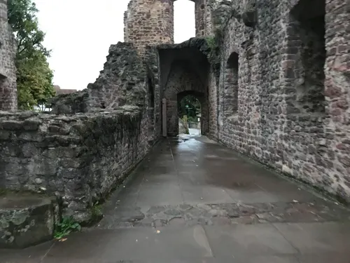
Burg Hayn in der Dreieich
Monument and historic site · 2.5 km
The castle was the seat of the Reichsvögte, who administered the Wildbann Dreieich from here on behalf of the emperor. Remains of the...



122 more on the map.
Parks, trails and playgrounds59

Frankfurt City Forest
Park · 6.3 km
Urban forest of Frankfurt, Germany

Herrnröther- und Bornwaldswiesen von Sprendlingen
Hiking and trails · 1.6 km



Dreieichhörnchen
Playground · 1.3 km
25 Reuterpfad, Dreieich
Apr-Sep: Tu-Sa 14:00-18:00; Oct-Mar: Tu-Fr 14:00-18:00



47 more on the map.
Restaurants and cafes221
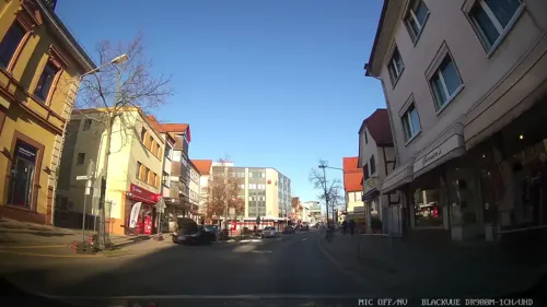
Herrnbrod & Ständecke
Restaurant · German
29 Hauptstraße, Dreieich
Mo-Fr 11:00-14:00,17:00-23:00; Sa off; Su 17:00-23:00; PH off
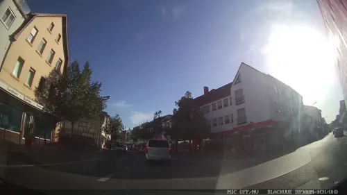
Anka
Cafe · Breakfast, Brunch, Coffee Shop
43 Hauptstraße, Dreieich
Mo-Th 09:30-19:00; Fr-Su 09:30-20:00
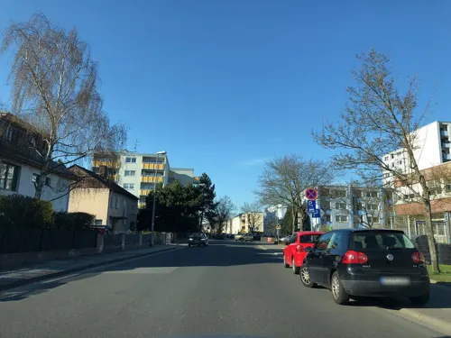
Casa Grande
Restaurant · International · 0.7 km
50 Fichtestraße, Dreieich
Mo-Fr 11:30-14:30, 17:00-23:00; Sa 17:00-23:00; Su 11:30-23:00
DesiLicious
Restaurant · Indian · 0.9 km
28 Hainer Chaussee, Dreieich
Mo-Fr 11:00-14:30,17:00-22:00; Sa 17:00-22:00; Su 11:00-22:00

Cafe Vielfalt
Cafe · Breakfast, Cake · 1.1 km
1 Freiherr-vom-Stein-Straße, Dreieich
Tu-Fr 10:00-17:00; Su 10:30-17:00

Endstation
Restaurant · Mexican, Thai · 2.5 km
2 Buchschlager Allee, Dreieich
Mo-Sa 17:00-22:00; Su 13:00-21:00
Eva - Restaurant, Pizzeria, Café
Restaurant · Pizza, Italian, Coffee Shop · 1.1 km
4 Dreieich Plaza, Dreieich
Mo-Fr 07:30-22:00, Sa 17:00-24:00
Goldstück
Cafe · Coffee Shop, Cake, Soup, Snack
29-33 Hauptstraße, Dreieich
Mo-Fr 09:30-18:00; Sa 10:00-17:00
209 more on the map.
History
The town’s name comes from a royal hunting forest – the Wildbann Dreieich – which had its first documentary mention as early as the 9th century. It was a forest whose hunting rights were exclusively the Emperor’s. This forest stretched along the lower Main from Aschaffenburg to Rüsselsheim and from Vilbel to the Neunkircher Höhe (heights) in the Odenwald. The oaktrees in many communities’ coats of arms in this area point to this origin. In the middle of this royal hunting forest in the 11th century rose Dreieichenhain, when the Lords of Hagen built a tower castle in 1075.
This community was founded in 1904 as a Villenkolonie ('villa colony', a form of town planning once popular among the well-to-do in Germany) by the Frankfurt salesman Jakob Latscha in the wooded Gemarkung (a cadastral unit) of Mitteldick. The first mayor was Rudolf Bindung. By 1909, Buchschlag had grown 343 inhabitants. By the time it was merged with the other communities in 1977, the population had risen to 2,984. Buchschlag has largely managed to keep its Villenkolonie character: many old Art Nouveau villas in the middle of the community are still preserved today and collectively are under heritage protection. The newer parts of Buchschlag likewise consist of fully detached houses. There are only scattered terraced houses and on the main street, Buchschlager Allee, a few blocks of flats.
Read more of the history
In the 11th century, a tower castle (Burg Hayn) was built from which the Lords of Hagen, later Hagen-Münzenberg (1075–1255), administered the Imperial hunting forest of Dreieich. The settlement beside the castle was first mentioned as a town on 23 September 1256 (cives in hagen in Latin, meaning 'citizens in Hagen'), allowing the town to celebrate 750 years of having town rights in 2006.
The Falkensteins, who inherited the land from the Hagen-Münzenberg family, died out in 1418, and the Counts of Isenburg managed in time to acquire the lordship over Dreieichenhain. In 1549, the Reformation was introduced into the town. In 1816, the Isenburg-Birstein Oberamt of Offenbach passed along with Dreieichenhain to Hesse. The placename Hain in der Dreieich was changed in 1840 to Dreieichenhain. In 1834 the town had 998 inhabitants, and at the time of the merger on 1 January 1977 about 8,000.
After the Falkenstein family had died out, Götzenhain found itself under the ownership of the County of Isenburg in 1418, and in the 16th century, the Reformation was introduced.
Count Johann Philipp of Isenburg-Birstein built the palatial castle Schloss Phillipseich in Götzenhain about 1715. The new estate was built as an archetypal Isenburg estate. Only in 1724 did Götzenhain become an independent parish.
In 1816, Götzenhain passed together with the Oberamt of Offenbach to Hesse. The Dreieichbahn railway was opened in 1905 with a railway station in Götzenhain. In 1834, the community had 705 inhabitants, and by 1977 this had grown to 4,696.
In a Langen boundary description, Ovemdan was mentioned about 834, making Offenthal the oldest settlement in the Dreieich area after Sprendlingen. The Counts of Isenburg owned Offenthal as of 1489. As an important building monument, the Gothic church of Offenthal has been preserved. It was endowed about 1400 and thereby belongs among the Offenbach district’s oldest churches. After the Reformation’s introduction in 1528, the parish became Lutheran. Beginning in 1596, attempts were made to introduce Calvinism. In 1816, Offenthal became Hessian. In 1834 the community had 441 inhabitants, and by 1977 this had grown to 5.142.
Offenthal lies on the Deutsche Fachwerkstraße (German Timber Framing Road) and on the Hessian Apple Wine and Orchard Route.
In the early 1990s arose the Borngarten and Tannenstumpf new development areas. The rural calm and the proximity to Frankfurt am Main saw to it that Offenthal grew quickly.
Offenthal hosts several local organizations and sport clubs, including Sport- und Spielvereinigung Offenthal (SUSGO), Fußball-Club Offenthal (FCO), Table Tennis Club Offenthal (TTCO), and the Offenthal Volunteer Fire Brigade. As of 31 December 2007, the volunteer fire brigade had 535 members.
In 880, Louis the Younger documented a donation by his father through the church in Sprendilingun to the Salvatorkapelle in Frankfurt ("with appurtenances"). The Counts of Isenburg acquired in 1486 from the Falkenstein inheritance the lordship over Sprendlingen. In 1528 the Reformation was introduced and in 1816 Sprendlingen passed to Hesse. In 1871, the Buchschlag-Sprendlingen station on the Main-Neckar-Bahn railway was opened, as was the Dreieichbahn to Ober-Roden in 1905. In 1834, Sprendlingen had 1,788 inhabitants, and by 1977 this had grown to 21,351.
From the History section of Dreieich on Wikipedia, under CC BY-SA 4.0.
More about Dreieich
Geography
Dreieich lies in the Offenbach district. Its northernmost constituent community of Sprendlingen lies some 10 km north of Darmstadt. Between Dreieich-Götzenhain and Dietzenbach rises the river Bieber.
Dreieich borders in the north on the town of Neu-Isenburg, in the northeast on the district-free city of Offenbach, in the east on the towns of Heusenstamm, Dietzenbach and Rödermark, in the south on the community of Messel (Darmstadt-Dieburg) and the district-free city of Darmstadt and in the southwest on the town of Langen. To the west lies Frankfurt Airport.
The town of Dreieich came into being on 1 January 1977 in the framework of municipal restructuring in the Offenbach district, bringing together five communities which until then had been self-administering. At the time of the merger, their population figures were as follows:
Today, 43.542 people live in Dreieich (main residences, 31 December 2019), including all five communities. Inhabitants here come from 117 different nations (as of 30 July 2007).
Economy
Dreieich lies within the area covered by the Rhein-Main-Verkehrsverbund. At Dreieich-Buchschlag station there are connections to S-Bahn line . The Dreieichbahn (RB 61): Dieburg – Rödermark-Ober Roden – Dreieich-Offenthal – Dreieich-Götzenhain – Dreieich-Dreieichenhain – Dreieich-Weibelfeld – Dreieich-Sprendlingen – Dreieich-Buchschlag – Frankfurt Central Station runs hourly through the entire town every day. From Monday to Friday there are additional trains between Rödermark-Ober Roden and Neu-Isenburg resulting in a half-hourly service on the common section.
Dreieich-Sprendlingen – Dreieich-Buchschlag – Frankfurt Airport Terminal 1 (OF-64)
Dreieich-Buchschlag – Langener Waldsee – seasonal only from May to September if the weather forecast is showing at least 24 °C (OF-65)
Langen – Dreieich-Sprendlingen – Neu-Isenburg – Offenbach Marktplatz (X83)
Dreieich-Offenthal – Dreieich-Sprendlingen – Neu-Isenburg (OF-92)
Langen – Dreieich-Offenthal – Dietzenbach – Heusenstamm (OF-96)
Langen – Dreieich – Dietzenbach – Rodgau – Seligenstadt (OF-99)
Nightbus: Frankfurt – Neu-Isenburg – Dreieich-Sprendlingen – Langen – Darmstadt (N71) (Runs every night)
Arts and culture
Dreieichenhain is above all known for the Haaner Kerb kermis at Whitsun, and it hosts a Christmas market, which thanks to Dreieichenhain’s Old Town is famous countrywide. The Haaner Kerb is Southern Hesse’s biggest kermis and yearly draws 80,000 visitors. The highlights are the fireworks on Saturday evening and the traditional Kerbborschemarsch on the Monday. Furthermore there are the yearly castle festival games and Jazz in der Burg (“Jazz at the Castle”).
The Burg Hayn is a castle ruin from the High Middle Ages. The oldest part of the castle complex – the dwelling tower – was built in Salian times. It is one of the few secular architectural witnesses to Salian times in Germany. Cultural events at the castle are the nationally known Burgfestspiele (castle festival games) and the jazz festival Jazz in der Burg.
Within the framework of the regional park initiative, a sculpture designed by the landscape architects Ipach and Dreisbusch was built north of Dreieichenhain and is part of the regional park route. This work, called the Stangenpyramide (Post Pyramid), is made up of 450 bonded round wooden posts, each 24 cm (9.4 in) in diameter. The sculpture is built in two sections and is accessible on foot. It forms a sightline with the Taunus and Frankfurt’s skyline.
From the Wikipedia article Dreieich, under CC BY-SA 4.0.
Notable people from Dreieich
 Anna ElendtGerman swimmerPhoto: Martin Rulsch , Wikimedia Commons, CC BY-SA 4.0
 Christoph HelvigGerman academicPhoto: Melchior Haffner II, Public domain
- Johannes ab Indagineastrologer, 1467-1537
- Angelika TrabertGerman doctor and para-equestrian rider
Born in Dreieich, according to Wikidata (CC0). Each name links to its Wikipedia article.
Where to stay18
Best Western Hotel Frankfurt Airport Neu-Isenburg
Motel and hotel · 3.4 km
61-63 Herzogstraße, Neu-Isenburg
Coffee Fellows Hotel Frankfurt Airport-Langen
Motel and hotel · 3.2 km
58 Robert-Bosch-Straße, Langen (Hessen)
Churches and places of worship23
Erasmus-Alberus-Kirche
Church · Protestant · 0.6 km
2 Tempelstraße, Dreieich
St. Laurentius
Church · Catholic · 0.7 km
57 Eisenbahnstraße, Dreieich
Shopping58
Gas and EV charging15
Schools, colleges and libraries32
Sankt Georgen Graduate School of Philosophy and Theology
School · 8.8 km
DFS Air Navigation Services Acamdey
School · 3.3 km
4 Am DFS-Campus, Langen (Hessen)
Healthcare17
Map of Dreieich
250 places. The map loads OpenStreetMap tiles when you open it.
Getting there and nearby towns
Frankfurt Airport (FRA) is the nearest airport with scheduled flights listed in OpenStreetMap, 11 km away.
- Neu-Isenburg 3 km north, about 3 min by car
- Langen 4 km southwest, about 4 min by car
- Dietzenbach 6 km east, about 6 min by car
- Egelsbach 6 km south, about 6 min by car
- Mörfelden-Walldorf 9 km west, about 9 min by car
- Heusenstamm 8 km northeast, about 8 min by car
- Erzhausen 8 km southwest, about 8 min by car
- Offenbach 10 km northeast, about 10 min by car
- Wixhausen 10 km south, about 10 min by car
- Frankfurt am Main 11 km north, about 11 min by car
Drive times are estimates from straight-line distance, not routes.
Towns near Dreieich


Keep exploring
Local news
Headlines from INDB.
Reviews, tips and questions
Loading what members have shared...
Sources and licences
- GeoNames (CC BY 4.0): population, coordinates, regions and time zone
- Mapillary (see each image): photos
- OpenStreetMap contributors (ODbL 1.0): places, airports, map data
- Wikidata (CC0 1.0): elevation, founding date, time zone, website, landmarks and historic places
- Wikimedia Commons (see each image): photos
- Wikipedia (CC BY-SA 4.0): overview and history text
Photo credits
- Rathaus Dreieich, Grimes2, CC0
- Euthanasiedenkmal vor dem Friedhof Sprendlingen (Dreieich) 01, Wikitarisch, CC BY 4.0
- Friedhof Sprendlingen (Dreieich) 03, Wikitarisch, CC BY 4.0
- Friedhof Sprendlingen (Dreieich) 07, Wikitarisch, CC BY 4.0
- Kriegerdenkmal 1870-71 Friedhof Sprendlingen (Dreieich) 03, Wikitarisch, CC BY 4.0
- Kriegerdenkmal 1870-71 Friedhof Sprendlingen (Dreieich) 04, Wikitarisch, CC BY 4.0
- Kriegerdenkmal 1870-71 Friedhof Sprendlingen (Dreieich) 01, Wikitarisch, CC BY 4.0
- Kriegerdenkmal 1870-71 Friedhof Sprendlingen (Dreieich) 02, Wikitarisch, CC BY 4.0
- Friedhof Sprendlingen (Dreieich) 04, Wikitarisch, CC BY 4.0
- Kriegerdenkmal Kriegsgräberstätte Erster Weltkrieg Sprendlingen (Dreieich) 19, Wikitarisch, CC BY 4.0
- Kriegerdenkmal Kriegsgräberstätte Erster Weltkrieg Sprendlingen (Dreieich) 21, Wikitarisch, CC BY 4.0
- Kriegerdenkmal Kriegsgräberstätte Erster Weltkrieg Sprendlingen (Dreieich) 20, Wikitarisch, CC BY 4.0
- Friedhof Sprendlingen (Dreieich) 02, Wikitarisch, CC BY 4.0
- Kriegerdenkmal 1870-71 Friedhof Sprendlingen (Dreieich) 07, Wikitarisch, CC BY 4.0
- Kriegerdenkmal Kriegsgräberstätte Erster Weltkrieg Sprendlingen (Dreieich) 06, Wikitarisch, CC BY 4.0
- Kriegerdenkmal Kriegsgräberstätte Erster Weltkrieg Sprendlingen (Dreieich) 05, Wikitarisch, CC BY 4.0
- Kriegerdenkmal Kriegsgräberstätte Erster Weltkrieg Sprendlingen (Dreieich) 04, Wikitarisch, CC BY 4.0
- Friedhof Sprendlingen (Dreieich) 08, Wikitarisch, CC BY 4.0
- Friedhof Sprendlingen (Dreieich) 09, Wikitarisch, CC BY 4.0
- Kriegerdenkmal Kriegsgräberstätte Erster Weltkrieg Sprendlingen (Dreieich) 16, Wikitarisch, CC BY 4.0
- Kriegerdenkmal Kriegsgräberstätte Erster Weltkrieg Sprendlingen (Dreieich) 14, Wikitarisch, CC BY 4.0
- Kriegerdenkmal Kriegsgräberstätte Erster Weltkrieg Sprendlingen (Dreieich) 13, Wikitarisch, CC BY 4.0
- Kriegerdenkmal Kriegsgräberstätte Erster Weltkrieg Sprendlingen (Dreieich) 17, Wikitarisch, CC BY 4.0
- Kriegerdenkmal Kriegsgräberstätte Erster Weltkrieg Sprendlingen (Dreieich) 18, Wikitarisch, CC BY 4.0
- Kriegerdenkmal Kriegsgräberstätte Erster Weltkrieg Sprendlingen (Dreieich) 15, Wikitarisch, CC BY 4.0
- Friedhof Sprendlingen (Dreieich) 05, Wikitarisch, CC BY 4.0
- Goetheturm, No machine-readable author provided. Popie~commonswiki assumed (based on copyright claims)., CC BY-SA 3.0
- Liebieghaus Galerieflügel Haupteingang, Photo: Andreas Praefcke, CC BY 3.0
- Museum-giersch-ffm001, dontworry, CC BY-SA 3.0
- Staedel-Frankfurt-2013-Ffm-862-867, Simsalabimbam, CC BY-SA 3.0
- Zeppelin museum Frankfurt, Andy Dingley, Public domain
- Skyline-sued-ffm001, dontworry, CC BY-SA 3.0
- Oberrad, Herz-Jesu-Kirche, Karsten Ratzke, CC0
- Mensa-im-park-pth-sankt-georgen-frankfurt-main, Ulla Schmitz, CC BY-SA 3.0
- Haupteingang Dürerstr, MarieEgger, CC BY-SA 4.0
- Dreieich Dreieichenhain Burg 20070823, Rudolf Stricker, Public domain
- DFS headquarters in Langen, Carlo Dani, CC BY-SA 4.0
- Isenburg Zentrum, Frank Murmann, CC BY 3.0
- NSG Luderbachaue von Dreieich01, KUGerhardt, CC BY-SA 4.0
- NSG Oberwiesen von Sprendlingen01, KUGerhardt, CC BY-SA 4.0
- Herrnröther- und Bornwaldswiesen von Sprendlingen03, KUGerhardt, CC BY-SA 4.0
- MaxEythSchuleDreieich, Lauterbach-Darmstadt, CC BY-SA 4.0
- Stadtbibliothek Neu-Isenburg, Forum für Medien- und Lesekultur, Grimes2, CC BY-SA 3.0
- Dreieich - Museum, Grimes2, CC BY-SA 3.0
- Sprendlingen - Lindenplatz (6), John Doe IX, CC BY-SA 4.0
- Dreieich Sprendlingen St. Laurentius2 20070822, Rudolf Stricker, Public domain
- Jüdischer Friedhof Dreieichenhain, grim, CC BY-SA 4.0
- Sprendlingen, Auferstehungskirche-01, Muck, CC BY-SA 4.0
- Burgkirche Dreieichenhain-01, Muck, CC BY-SA 4.0
- Buchschlag, Evangelische Kirche, Muck, CC BY-SA 4.0
- Buchenbuschkirche Neu-Isenburg Suedostansicht, C. M., CC BY-SA 4.0
- Heilig-Kreuz-Kirche Neu-Isenburg Suedostansicht, C. M., CC BY-SA 4.0
- 2021 07 kath Kirche Goetzenhain, Stefan Oemisch, CC BY-SA 4.0
- Neu-Isenburg, Johanneskirche (5), Subbass1, CC BY-SA 4.0
- Ricarda-Huch-Schule Dreieich Gymnasium, Helichrysius, CC BY-SA 4.0
- "Stumpfer Turm" Langen, Hesse143, CC BY-SA 3.0
- Dreieichenhain, Kriegerdenkmal, Muck, CC BY-SA 4.0
- DreyEichGrenzsteinNo15(Station12), Stefan Oemisch, CC BY-SA 4.0
- Langen Stadtkirche 20110310, Rudolf Stricker, Attribution
- Langen (Hessen) Aerial fg120, Fritz Geller-Grimm supported by Rüdiger Wandke, CC BY-SA 3.0
- Langen altes Rathaus 20110310, Rudolf Stricker, Attribution
- Street-level photo, chuck, CC BY-SA 4.0
- Street-level photo, chuck, CC BY-SA 4.0
- Street-level photo, chuck, CC BY-SA 4.0
- Street-level photo, chuck, CC BY-SA 4.0
- Street-level photo, xodes, CC BY-SA 4.0
- Street-level photo, chuck, CC BY-SA 4.0
- Street-level photo, xodes, CC BY-SA 4.0
- Street-level photo, chuck, CC BY-SA 4.0
- Street-level photo, quickness805, CC BY-SA 4.0
- Street-level photo, chuck, CC BY-SA 4.0
- Street-level photo, chuck, CC BY-SA 4.0
- Street-level photo, stancehelix2020, CC BY-SA 4.0
- Street-level photo, chuck, CC BY-SA 4.0
- Street-level photo, chuck, CC BY-SA 4.0
- Street-level photo, robffm, CC BY-SA 4.0
- Street-level photo, robffm, CC BY-SA 4.0
- Street-level photo, chuck, CC BY-SA 4.0
- Street-level photo, quickness805, CC BY-SA 4.0
- Street-level photo, DCBHQQZ5662nfacw, CC BY-SA 4.0
- Street-level photo, plexi32, CC BY-SA 4.0
- Street-level photo, robffm, CC BY-SA 4.0


Page built November 9, 2026. Spotted a mistake? Tell us or suggest a place.