


Why visit Langen
Townapedia lists 227 museums and landmarks, 48 parks and trails, 174 places to eat, 8 places to stay and 4 attractions in and around town.
Highlights include Neue Stadthalle Langen, Lichtburg Filmtheater, Dreieich-Museum and Petrus-Gemeindehaus.
Weather in Langen
Forecast from MET Norway (CC BY 4.0). Full forecast
About Langen
Langen (German pronunciation: [ˈlaŋən] ) is a town of roughly 39,000 in the Offenbach district in the Regierungsbezirk of Darmstadt in Hesse, Germany. The town is between Darmstadt and Frankfurt am Main and part of the Frankfurt Rhein-Main urban area. Langen is headquarters to Deutsche Flugsicherung (German air traffic control), and is also home to the Paul-Ehrlich-Institut, a federal institute for the evaluation and supervision of sera and vaccines in Germany.
From the Wikipedia article Langen, Hesse (this version), under CC BY-SA 4.0.
Travel tips from other travellers: Langen on Wikivoyage (CC BY-SA 4.0).
Photos of Langen


Things to do4



Wingerthof Langen
Farm and orchard · 1.1 km
Saft und Wein aus 100% Streuobstäpfeln.
87 Frankfurter Straße, Langen
Museums and landmarks227


Zeppelin Museum Zeppelinheim
Museum · 6.4 km
Airship museum in Neu-Isenburg at Frankfurt/Main

Burg Hayn in der Dreieich
Monument and historic site · 3.7 km
The castle was the seat of the Reichsvögte, who administered the Wildbann Dreieich from here on behalf of the emperor. Remains of the...


Wasserhochbehälter
Monument and historic site · 2.0 km
Wasserhochbehälter in Langen (Hessen)
18 An der Koberstadt, Langen (Hessen)


"Barockstraße"
Monument and historic site · 3.3 km
Die Bezeichnung "Barockstraße" rührt her von einer vermutlich in der Barockzeit angelegten befestigten Straße zum Schloss Philippseich....
215 more on the map.
Parks, trails and playgrounds48

Kammereckswiesen, Herchwiesen, Schmale Wiesen und Belzbornwiesen von Langen
Hiking and trails · 1.4 km


Gedenkstätte ehemalige Synagoge
Park · 1.0 km
23 Dieburger Straße, Langen (Hessen)
"auf Anfrage und zu besonderen Anlässen"

36 more on the map.
Restaurants and cafes174
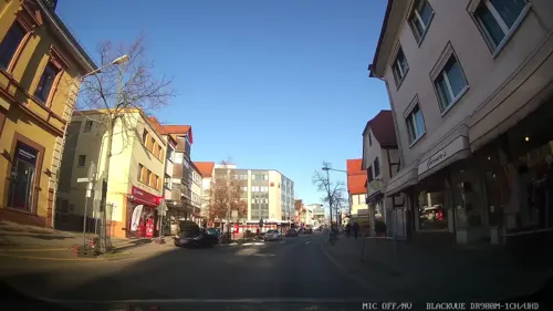
Herrnbrod & Ständecke
Restaurant · German · 3.6 km
29 Hauptstraße, Dreieich
Mo-Fr 11:00-14:00,17:00-23:00; Sa off; Su 17:00-23:00; PH off
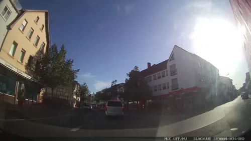
Anka
Cafe · Breakfast, Brunch, Coffee Shop · 3.7 km
43 Hauptstraße, Dreieich
Mo-Th 09:30-19:00; Fr-Su 09:30-20:00
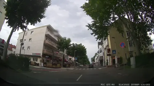
Asia-Kim
Restaurant · Asian · 0.6 km
1 Marienstraße, Langen (Hessen)
Tu-Sa 11:00-22:00; Su,PH 12:00-22:00
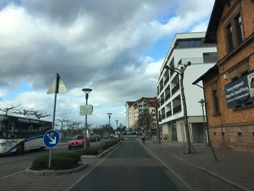
Bäumsche am Bahnhof
Restaurant · Regional · 0.9 km
3 Europaplatz, Langen (Hessen)
Mo-Sa 16:00-23:00; PH,Su 12:00-22:00
DesiLicious
Restaurant · Indian · 3.1 km
28 Hainer Chaussee, Dreieich
Mo-Fr 11:00-14:30,17:00-22:00; Sa 17:00-22:00; Su 11:00-22:00


Endstation
Restaurant · Mexican, Thai · 3.6 km
2 Buchschlager Allee, Dreieich
Mo-Sa 17:00-22:00; Su 13:00-21:00
Goldstück
Cafe · Coffee Shop, Cake, Soup, Snack · 3.6 km
29-33 Hauptstraße, Dreieich
Mo-Fr 09:30-18:00; Sa 10:00-17:00
Gute Landung
Restaurant · Regional · 3.2 km
75 Hans-Fleissner-Straße, Egelsbach
Mo-Th 15:00-22:30; Fr-Su 11:00-22:30
Haferkasten
Restaurant · German · 0.9 km
13 Wilhelm-Leuschner-Platz, Langen (Hessen)
Fr-We 11:30-14:00,18:00-22:00; Th off
162 more on the map.
History
The earliest community here may have arisen about AD 500 or 600, settled by Frankish migrants. Langen had its first documentary mention in 834 in a donation document from King Ludwig II to the Lorsch Abbey under the name Langungon. In 835, he had the extent of the Mark Langen (a communal area shared by a number of villages) delineated with Drieichlahha, today's Dreieich, as a neighbouring community to the north. To the Dreieich Royal Hunting Forest (Wildbann Dreieich), which in the king's name was governed by the Lords of Hagen (later of Münzenberg) as Vögte, also belonged in the Middle Ages the woodlands around Langen. Two of the Royal Hunting Forest's 30 Wildhuben (farming estates whose owners were charged with guarding the king's hunting rights) lay in Langen. Since the Lorsch Abbey hardly worried very much about their landholdings, the Lords of Hagen-Münzenberg came over the course of time to be the land's effective owners.
Read more of the history
When the Hagen-Münzenberg family died out in 1255, the place passed to the Lords of Falkenstein. In 1414, the village burnt down in the midst of a dispute between the city of Frankfurt and the then owners of Langen, the Archbishop of Trier, Werner von Falkenstein. When the Lords of Falkenstein, too, saw their male line come to an end in 1418, the County of Isenburg inherited the lordship over Langen. Surviving from the Middle Ages are, among other things remains of the fortifications with the spitzer Turm and the stumpfer Turm ("Sharp Tower" and "Blunt Tower") from Falkenstein times (1336), and from the Renaissance the Vierröhrenbrunnen ("Four-Pipe Spring") from 1553.
In 1600, Langen, along with the whole Amt of Kelsterbach was sold by the Counts of Isenburg to the Landgraviate of Hesse-Darmstadt. Langen has belonged to Hesse since then. With the partitioning of the Länger Mark in 1732, whose main estate Langen was, the community got two thirds of the land, and Egelsbach the other third.
In 1812, Langen was raised to market community. After the French period, in 1821, Langen was raised to seat of the Landratsbezirk, practically making Langen a district seat, although in 1832 it had to yield this function to Groß-Gerau and Offenbach. In 1834, Langen had 2,368 inhabitants. In 1846, the Main-Neckar Railway (88 km) was opened with a railway station in Langen.
In 1883, the community was granted town rights by Grand Duke Ludwig IV.
After the First World War, Langen was – as part of the Mainz bridgehead – occupied by French troops until 1930 (→ Occupation of the Rhineland).
Around 1959, a new urban district, Oberlinden, was built. The population rose from 9,077 in 1939 to 28,500 in 1983.
From the History section of Langen, Hesse on Wikipedia, under CC BY-SA 4.0.
More about Langen
Geography
Langen borders in the north and northeast on the town of Dreieich, in the south on the community of Egelsbach and in the west on the town of Mörfelden-Walldorf (Groß-Gerau district).
Altstadt ("Old Town") in the east. This lies within the former eastern town wall, parts of which may still be seen. There is an Altstadtordnung ("Old Town Order") in force for the Old Town, meant to preserve the many timber-frame houses’ character.
Zentrum ("Centre") in the middle of Langen. This is surrounded by the other Stadtteile.
Economy
Langen station is on the Rhine-Main S-Bahn network running on the Main-Neckar line and is served by S-Bahn line . The travel time to downtown Frankfurt is roughly 20 minutes with trains running every 15 minutes. Moreover, regional trains on the Frankfurt-Mannheim RE 60 and Frankfurt-Heidelberg RB 68 runs stop here.
Furthermore, Langen is linked to the north–south Autobahnen A 5 (Langen/Mörfelden interchange in the town's west) and A 661 (Langen interchange in the east). Both interchanges are linked by the east–west Bundesstraße 486, which at the same time also forms the Langen north bypass. This new link also connects the industrial area in the northwest, in which are found, among other things, Federal authorities. Along Bundesstraße 486 towards the west, after about 15 km, drivers reach the Rüsselsheimer Dreieck ("Rüsselsheim Triangle"), where the A 60 towards Mainz branches off the A 67 (Darmstadt-Mönchhof).
Running across the municipal area is also the former Bundesstraße 3 from Frankfurt am Main to Darmstadt.
Frankfurt Egelsbach Airport, Germany's busiest general airport, lies in the neighbouring community of Egelsbach some 3 km away, while Europe's third biggest airport, Frankfurt Airport, is found about 10 km from Langen.
Arts and culture
Well known outside the town is above all the Langen Ebbelwoi-Fest, to which tens of thousands of visitors come each year on the last weekend in June. Moreover, the Langener Waldsee, a favourite outing destination among dwellers of the nearby Main agglomeration, is within town limits. Since 2002, the swimming competition Ironman Germany (so called even in German) has been held there.
The town museum is found at the Old Town Hall in the Old Town. However, it opens only for special exhibitions, such as the one between May 2008 and March 2009 for the show Blick(e) zurück ("Looking Back") for the 125-year jubilee of town rights.
On the town's outskirts is found the former hunting palace of Schloß Wolfsgarten, which is owned by the House of Hesse.
Quite a few orchestras and musical groups frame Langen's cultural makeup. Among the most important are the Langen Orchestra Club and the TV 1862 Langen's (sport club) wind orchestra. Both groups furnish accompaniment to many of Langen's public events.
Langen's most successful sport team are the TV 1862 Langen's basketball players, who are represented in Pro A, Germany's second highest playing class. Home games are played at the Georg-Sehring-Halle.
From the Wikipedia article Langen, Hesse, under CC BY-SA 4.0.
Notable people from Langen
 Janine WisslerGerman politician (born 1981)Photo: DIE LINKE, CC BY 2.0
 Jan Costin WagnerGerman crime writerPhoto: Sven Teschke, CC BY-SA 3.0 de
 Carsten NulleGerman footballerPhoto: Günther Pöpperl-- BICYCLE 04.Juli..., CC BY-SA 3.0 de
 Frieder WeissmannGerman musician and conductor (1893–1984)Photo: Unknown Unknown, Public domain
 Tanja Börzelpolitical scientistPhoto: Wyoming Videos, CC BY 3.0
- Aaron SeydelGerman association football player
- Meike BabelGerman tennis player
- Ralf SchneiderGerman footballer
- Michael SerthGerman trampoline gymnast
- Thomas KnausGerman media education and university teacher
Born in Langen, according to Wikidata (CC0). Each name links to its Wikipedia article.
Where to stay8
Coffee Fellows Hotel Frankfurt Airport-Langen
Motel and hotel · 2.1 km
58 Robert-Bosch-Straße, Langen (Hessen)
Churches and places of worship17
Erasmus-Alberus-Kirche
Church · Protestant · 3.4 km
2 Tempelstraße, Dreieich
Evangelisch-methodistische Kirche
Church · Methodist · 3.6 km
27 Poststraße, Dreieich
Martin-Luther-Kirche
Church · Lutheran · 1.4 km
31 Berliner Allee, Langen (Hessen)
St. Laurentius
Church · Catholic · 3.3 km
57 Eisenbahnstraße, Dreieich
Kirche Jesu Christi der Heiligen der letzten Tage
Church · Mormon · 0.9 km
22 Birkenstraße, Langen (Hessen)
Shopping44
Gas and EV charging19
Schools, colleges and libraries24
DFS Air Navigation Services Acamdey
School · 2.3 km
4 Am DFS-Campus, Langen (Hessen)
Healthcare19
Münch'sche Apotheke zu Langen
Clinic and pharmacy · 0.8 km
1 Darmstädter Straße, Langen (Hessen)
Map of Langen
250 places. The map loads OpenStreetMap tiles when you open it.
Getting there and nearby towns
Frankfurt Airport (FRA) is the nearest airport with scheduled flights listed in OpenStreetMap, 10 km away.
- Egelsbach 2 km south, about 2 min by car
- Dreieich 4 km northeast, about 4 min by car
- Erzhausen 4 km south, about 4 min by car
- Mörfelden-Walldorf 6 km west, about 6 min by car
- Neu-Isenburg 7 km north, about 7 min by car
- Wixhausen 7 km south, about 7 min by car
- Dietzenbach 8 km east, about 8 min by car
- Gräfenhausen 8 km southwest, about 8 min by car
- Weiterstadt 11 km southwest, about 11 min by car
- Frankfurt am Main 14 km north, about 14 min by car
Drive times are estimates from straight-line distance, not routes.
Towns near Langen


Keep exploring
Local news
Headlines from INDB.
Reviews, tips and questions
Loading what members have shared...
Sources and licences
- GeoNames (CC BY 4.0): population, coordinates, regions and time zone
- Mapillary (see each image): photos
- OpenStreetMap contributors (ODbL 1.0): places, airports, map data
- Wikidata (CC0 1.0): elevation, founding date, time zone, website, landmarks and historic places
- Wikimedia Commons (see each image): photos
- Wikipedia (CC BY-SA 4.0): overview and history text
Photo credits
- Altstadtblick, Stadt Langen, CC BY-SA 4.0
- Bahnstraße 50, 1, Langen (Hessen), Landkreis Offenbach, GeorgDerReisende, CC BY-SA 4.0
- Umschlag des Abijahrbuch 1981 82 der Dreieichschule Langen 01, original: unknown; (publisher: Yearbook working group of the Dreieichschule Langen; photo/scan: Arthur Diebold ), Public domain
- 2026TaunusplatzLangen, Stefan Oemisch, CC BY-SA 4.0
- 2021 Lichtburg Langen, Stefan Oemisch, CC BY-SA 4.0
- 2021 NeuapostolischeKircheLangen, Stefan Oemisch, CC BY-SA 4.0
- Langen Neues Rathaus 20070816, Rudolf Stricker, Public domain
- Langen Rathaus 20110310, Rudolf Stricker, Attribution
- Amtsgericht Langen und Finanzamt, Hesse143, CC BY-SA 3.0
- Bahnstraße 17, 1, Langen (Hessen), Landkreis Offenbach, GeorgDerReisende, CC BY-SA 4.0
- Stolpersteinlage, 2, Bahnstraße 15, Langen, Landkreis Offenbach, GeorgDerReisende, CC BY-SA 4.0
- Stolpersteinlage, 1, Bahnstraße 15, Langen, Landkreis Offenbach, GeorgDerReisende, CC BY-SA 4.0
- Bahnstraße 11, 1, Langen (Hessen), Landkreis Offenbach, GeorgDerReisende, CC BY-SA 4.0
- Bahnstraße 15-11, 1, Langen, Landkreis Offenbach, GeorgDerReisende, CC BY-SA 4.0
- Bahnstraße 4, 1, Langen (Hessen), Landkreis Offenbach, GeorgDerReisende, CC BY-SA 4.0
- 2021 LutherdenkmalLangen, Stefan Oemisch, CC BY-SA 4.0
- Lutherplatz Langen (Hessen), Hesse143, CC BY-SA 3.0
- Lutherplatz 4 Langen (Hessen), C. M., CC BY-SA 4.0
- Rheinstraße 38, 1, Langen, Landkreis Offenbach, GeorgDerReisende, CC BY-SA 4.0
- Stolpersteinlage, 1, Rheinstraße 38, Langen, Landkreis Offenbach, GeorgDerReisende, CC BY-SA 4.0
- 2021 WallschuleLangen, Stefan Oemisch, CC BY-SA 4.0
- 2021 WallschuleLangen3, Stefan Oemisch, CC BY-SA 4.0
- 2021 WallschuleLangen4, Stefan Oemisch, CC BY-SA 4.0
- August-Bebel-Straße 12, 1, Langen (Hessen), Landkreis Offenbach, GeorgDerReisende, CC BY-SA 4.0
- Langen Wassergasse, E-W, CC BY-SA 3.0
- Lerchgasse 8, 1, Langen, Landkreis Offenbach, GeorgDerReisende, CC BY-SA 4.0
- Stolpersteinlage, 1, Lerchgasse 8, Langen, Landkreis Offenbach, GeorgDerReisende, CC BY-SA 4.0
- Stolpersteinlage, 1, Vierhäusergasse 1, Langen, Landkreis Offenbach, GeorgDerReisende, CC BY-SA 4.0
- Langen Fahrgasse, E-W, CC BY-SA 3.0
- Vierhäusergasse 1, 1, Langen, Landkreis Offenbach, GeorgDerReisende, CC BY-SA 4.0
- Altes Rathaus, 1, Wilhelm-Leuschner-Platz 3, Langen, Landkreis Offenbach, GeorgDerReisende, CC BY-SA 4.0
- Langen Rathaus 20070816, Rudolf Stricker, Public domain
- Mammutbaum Langen, Andreas Delp, CC BY-SA 3.0 de
- Zeppelin museum Frankfurt, Andy Dingley, Public domain
- DFS headquarters in Langen, Carlo Dani, CC BY-SA 4.0
- Schloss Wolfsgarten Aerial fg117, Fritz Geller-Grimm supported by Rüdiger Wandke, CC BY-SA 3.0
- Dreieich Dreieichenhain Burg 20070823, Rudolf Stricker, Public domain
- Egelsbach evangelische Kirche 20110520, Rudolf Stricker, Attribution
- NSG Kammereckswiesen und Herchwiesen von Langen01, KUGerhardt, CC BY-SA 4.0
- Neue Stadthalle Langen, Stadt Langen, CC BY-SA 4.0
- Dreieich - Museum, Grimes2, CC BY-SA 3.0
- Sprendlingen - Lindenplatz (6), John Doe IX, CC BY-SA 4.0
- Dreieich Sprendlingen St. Laurentius2 20070822, Rudolf Stricker, Public domain
- Jüdischer Friedhof Dreieichenhain, grim, CC BY-SA 4.0
- Sprendlingen, Auferstehungskirche-01, Muck, CC BY-SA 4.0
- 2020 Martin-Luther-Kirche Langen, Stefan Oemisch, CC BY-SA 4.0
- 2020 Thomas von Aquin Langen, Stefan Oemisch, CC BY-SA 4.0
- Burgkirche Dreieichenhain-01, Muck, CC BY-SA 4.0
- Petrusgemeindehaus Langen (Hessen) Nordansicht 2, C. M., CC BY-SA 4.0
- "Stumpfer Turm" Langen, Hesse143, CC BY-SA 3.0
- StJosefEgelsbach, Stefan Oemisch, CC BY-SA 4.0
- Langen Stadtkirche 20110310, Rudolf Stricker, Attribution
- Langen (Hessen) Aerial fg120, Fritz Geller-Grimm supported by Rüdiger Wandke, CC BY-SA 3.0
- Langen altes Rathaus 20110310, Rudolf Stricker, Attribution
- Langen Wasserhochbehälter, Oberlausitzerin64, CC BY-SA 4.0
- Street-level photo, chuck, CC BY-SA 4.0
- Street-level photo, xodes, CC BY-SA 4.0
- Street-level photo, robffm, CC BY-SA 4.0
- Street-level photo, robffm, CC BY-SA 4.0
- Street-level photo, robffm, CC BY-SA 4.0
- Street-level photo, xodes, CC BY-SA 4.0
- Street-level photo, chuck, CC BY-SA 4.0
- Street-level photo, chuck, CC BY-SA 4.0
- Street-level photo, xodes, CC BY-SA 4.0
- Street-level photo, chuck, CC BY-SA 4.0
- Street-level photo, chuck, CC BY-SA 4.0
- Street-level photo, chuck, CC BY-SA 4.0
- Street-level photo, robffm, CC BY-SA 4.0
- Street-level photo, xodes, CC BY-SA 4.0
- Street-level photo, xodes, CC BY-SA 4.0
- Street-level photo, chuck, CC BY-SA 4.0
- Street-level photo, DCBHQQZ5662nfacw, CC BY-SA 4.0
- Street-level photo, raymond, CC BY-SA 4.0
- Street-level photo, quickness805, CC BY-SA 4.0
- Street-level photo, plexi32, CC BY-SA 4.0
- Street-level photo, foxman, CC BY-SA 4.0
- Street-level photo, xodes, CC BY-SA 4.0
- Street-level photo, stancehelix2020, CC BY-SA 4.0
- Street-level photo, chuck, CC BY-SA 4.0
- Street-level photo, robffm, CC BY-SA 4.0
- Street-level photo, chuck, CC BY-SA 4.0


Page built November 9, 2026. Spotted a mistake? Tell us or suggest a place.