


Why visit Dietzenbach
Townapedia lists 56 museums and landmarks, 43 parks and trails, 120 places to eat, 19 places to stay and 16 attractions in and around town.
Highlights include Hofgut Patershausen, Neue Lichtspiele, Feuerwehrmuseum and Schloß Philippseich.
Weather in Dietzenbach
Forecast from MET Norway (CC BY 4.0). Full forecast
About Dietzenbach
Dietzenbach (German pronunciation: [ˈdiːtsn̩ˌbax] ) is the seat of Offenbach district in the Regierungsbezirk of Darmstadt in Hesse, Germany and lies roughly 12 km southeast of Frankfurt am Main on the waterstream Bieber. Before the Second World War, the current town was a farming village with not quite 4,000 inhabitants. However, after the war, there was a considerable upswing in the population due to refugees settling in the community. From the 1970s onwards, Dietzenbach's population rose rapidly, reaching some 33,000 by 2006.
From the Wikipedia article Dietzenbach (this version), under CC BY-SA 4.0.
Photos of Dietzenbach


Things to do16

Hofgut Patershausen
Farm and orchard · 3.3 km
1 Patershäuser Weg, Heusenstamm
Th 15:00-19:00; Fr,Sa 09:30-13:00



Hofladen Köppen
Farm and orchard · 4.0 km
24 Bahnhofstraße, Dreieich-Offenthal
Tu-Fr 10:00-13:00, We-Fr 15:00-18:30

Beeren-Knecht
Farm and orchard · 1.0 km
Diverse Beeren/Obst in Verkaufsstand, der da jedes Jahr im Sommer steht. Öffnungszeiten für Selbstpflücker auf Facebookseite.
Tu,Fr 10:00-17:00 "geschätzt, dass offen ist, da Saison"; Sa...
Spargelhof Mager
Farm and orchard · 1.2 km
16a Mühlstraße, Weiterstadt
09:45-18:00
4 more on the map.
Museums and landmarks56



SkulpTouren Park
Monument and historic site · 1.3 km
Ansammlung von vier Kunstwerken (Skulpturen) von vier Künstlern mit dem Motto "Kreativ das Leben leben - Kunst im Dialog mit den Generationen"
24/7

Wasserwerkspark
Monument and historic site · 1.8 km
Schaubrunnen/Kunst (gehört zu Wasser-Infopark)
50°00'59.8"N 8°48'00.1"E
"Barockstraße"
Monument and historic site · 4.4 km
Die Bezeichnung "Barockstraße" rührt her von einer vermutlich in der Barockzeit angelegten befestigten Straße zum Schloss Philippseich....
Altes Rathaus
Monument and historic site · 4.2 km
17 Am Alten Rathaus, Dreieich-Offenthal
Nachbau hist. Straßen
Monument and historic site · 2.9 km
1:1-Modell von Römerstraßen mit naher Infotafel
44 more on the map.
Parks, trails and playgrounds43





Spielplatz Am Stiergraben West
Playground · 1.7 km
Kinderspielplatz für Personen bis 14 Jahren
07:00-22:00

31 more on the map.
Restaurants and cafes120
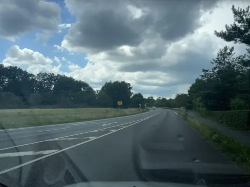
SG Dietzenbach
Restaurant · Regional · 1.0 km
51 Offenthaler Straße, Dietzenbach
Mo-Fr 00:00-01:00,11:00-14:00,16:00-24:00; Sa...
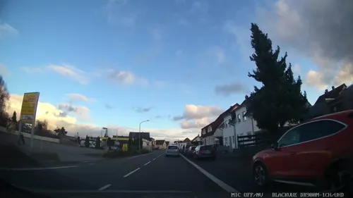
Urberacher Hof
Restaurant · Regional · 4.0 km
86 Konrad-Adenauer-Straße, Rödermark
Mo-Fr 11:00-14:00,17:00-00:00; Su 11:00-14:00
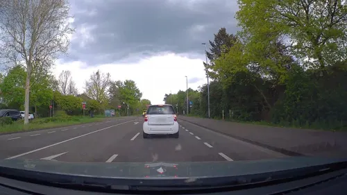
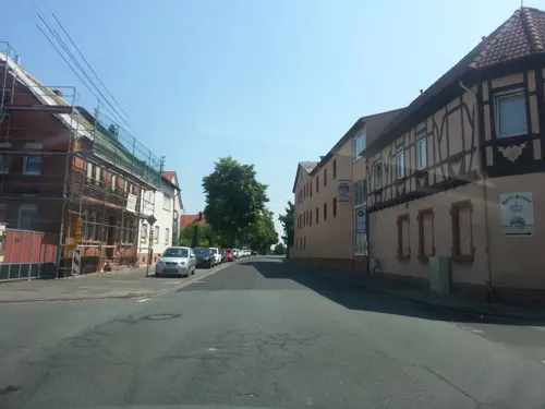
Hotelrestaurant Krone
Restaurant · German · 3.3 km
2 Wallstraße, Dreieich
Mo-Fr 17:00+; Sa off; Su 11:00-15:00, Su[1] 17:00+
La Lanterna
Restaurant · Italian · 1.3 km
26 Offenthaler Straße, Dietzenbach
Mo-Sa 00:00-01:00,11:30-15:00,17:30-24:00; Su 00:00-01:00,11:30-24:00
Porto Cervo
Restaurant · Italian · 2.7 km
70 Hauptstraße, Rödermark
Mo-Su 11:00-14:30,17:30-22:30; Sa 17:30-22:30; Tu, PH off
Stadtliebe
Restaurant · International
8 Am Stadtbrunnen, Dietzenbach
Mo-Sa 09:00-23:00, Su,PH 10:00-22:00

Gaststätte Harmonie
Restaurant · Greek
Warme Küche von 11:30-14:30 und 17:00-23:00
11:00-01:00; Mo off; PH 11:00-01:00
HSV-Restaurant
Restaurant · German · 4.2 km
69 Langener Straße, Dreieich
Mo-Fr 11:30-14:00,17:00-23:00; Sa-Su 11:00-14:30,17:30-23:00
Naturfreundehaus - Bulau
Restaurant · Regional · 3.3 km
20 Bulauweg, Rödermark
Mo-Fr 15:00-21:00; Sa 12:00-21:00; PH,Su 09:00-21:00
Ristorante Panorama
Restaurant · Italian
5 Jungfernwingertstraße, Dietzenbach
Mo-Sa 11:30-14:30,17:00-23:00; Su 11:30-22:00
108 more on the map.
History
Dietzenbach had its first documentary mention about 1210 in a donation document to the Patershausen monastery as Dicenbah. The later forsaken settlements of Ippingshausen and Richolshausen lay within what are now Dietzenbach's limits in the Early Middle Ages.
In 1545, the Counts of Hanau, who had been Dietzenbach's lords for a few centuries, introduced Protestantism. When the Counts of Hanau died out in 1736, the Landgraves Hesse-Darmstadt and of Hesse-Kassel fought over who had the right to be Dietzenbach's lords.
The Amt of Schaafheim, with Dietzenbach, which lay within it, passed in 1773 to Hesse-Darmstadt. With the partition of the Rödermark in 1818, the community acquired its forest. In 1821, the Amt of Schaafheim was dissolved and Dietzenbach passed to the Landratsbezirk of Langen. However, by 1832 Dietzenbach had already been assigned to the district of Offenbach.
In 1898, the railway through Offenbach, Bieber and Heusenstamm to Dietzenbach was dedicated and the railway station was built, which is now once again in use, after many years of seeing no passenger service at all, by the Rhine-Main S-Bahn. The line underwent an extensive modernization for S-Bahn operation.
A British air raid in 1941 caused great damage in the community.
Read more of the history
Dietzenbach was granted town rights in 1971. Since 2002, Dietzenbach has also been administrative seat of the district of Offenbach. However, it was only officially allowed to use the designation Kreisstadt (“District Seat”) beginning in March 2003 as the result of a dispute with the neighbouring town of Rodgau, which had demanded this status on the grounds that it had a greater population.
From the History section of Dietzenbach on Wikipedia, under CC BY-SA 4.0.
More about Dietzenbach
Geography
Lying in the Upper Rhine Plain, the climate of the Offenbach (district) is temperate and influenced through southwestern trade winds. The temperature differences during the year are less. In Dietzenbach, the average high temperature of the warmest month is 26 °C, in the central valleys they are three degrees Celsius higher.
Dietzenbach borders in the north on the town of Heusenstamm, in the east on the town of Rodgau, in the south on the town of Rödermark and in the west on the town of Dreieich.
The town of Dietzenbach is made up of a number of Stadtteile, although not all places listed here have this official designation.
Steinberg is a constituent community. Parts of the north industrial area are found here, as well as daycare centres (Kindertagesstätten) 3,5 and 11, the Siedlerstraße Seniors’ Centre and four schools: Astrid-Lindgren-Schule (primary school), Regenbogenschule (primary school), Helen-Keller-Schule (special school) and Heinrich-Mann-Schule (coöperative comprehensive school with Gymnasium upper level). Furthermore, there is a sporting ground on Limesstraße. In the centre is the Steinberg Shopping Centre. Just under 12,000 people live in Steinberg.
Arts and culture
Each year in Dietzenbach, the following festivals offer a chance to pursue social contacts:
Fest ohne Grenzen (“Festival Without Borders”), held at the Hessentagspark
Fest der Biere (“Festival of Beers”), held at the Harmonieplatz, lasts five days
Nacht der Lichter(“Night of the Lights”)with "Museumsnacht" and "Heimatfest" held in the Old Town Centre
Trinkbornfest in the Old Town on the first weekend in September
Dietzenbacher Kelterfest about the "Äbbelwoi" and the making of it
Kerb or Kirchweih, always held on the last weekend in October. It stretches along Landwehrstraße from Harmonieplatz to the Dietrich-Bonhoeffer-Schule (school). The revived tradition of the Kerbborsche – a group of young men who perform part of the ceremony – is an important part of the kermis.
Altstadtmarkt (Old City Centre Market) where the old, traditionell Art is shown together with the modern, young Artists
Kreativmarkt (creative Market) is a market for Creatives and Hobby Artists of the whole Rhein-Main-Area
Weihnachtsmarkt (Christmas Market) on the first weekend in Advent
Evangelical Free Church (Pentecostal parish) of “Jesus-Gemeinde”
Baitul Hadi (House of Leading to the Right Way, Ahmadiyya Muslim Jamaat Deutschland e.V.)
SG Dietzenbach (longtime team handball Bundesliga participant)
TG Dietzenbach (on the Wingertsberg: gymnastics, dancing, fitness, tennis, association football, team handball)
From the Wikipedia article Dietzenbach, under CC BY-SA 4.0.
Notable people from Dietzenbach
 Götz OttoGerman actorPhoto: Harald Bischoff, CC BY-SA 3.0
 Monika StaabGerman football managerPhoto: Heinrich-Böll-Stiftung, CC BY-SA 2.0
Born in Dietzenbach, according to Wikidata (CC0). Each name links to its Wikipedia article.
Where to stay19
Churches and places of worship17
Dreifaltigkeitskapelle
Church · Catholic · 3.0 km
40 Urberacher Straße, Rödermark
Katholische Pfarrkirche St. Martin
Church · Catholic
7 Offenbacher Straße, Dietzenbach
Shopping33
Gas and EV charging9
Schools, colleges and libraries22
Dezentrale Schule für Erziehungshilfe und Kranke
School · 1.1 km
1 Werner-Hilpert-Straße, Dietzenbach
Healthcare12
Dialysezentrum Heusenstamm - Seligenstadt
Clinic and pharmacy · 4.3 km
10 Ernst-Leitz-Straße, Heusenstamm
Vitos Kinder- und jugendpsychiatrische Tagesklinik Dietzenbach
Clinic and pharmacy · 1.3 km
Map of Dietzenbach
250 places. The map loads OpenStreetMap tiles when you open it.
Getting there and nearby towns
Frankfurt Airport (FRA) is the nearest airport with scheduled flights listed in OpenStreetMap, 17 km away.
- Heusenstamm 5 km north, about 5 min by car
- Dreieich 6 km west, about 6 min by car
- Neu-Isenburg 7 km northwest, about 7 min by car
- Rodgau 8 km east, about 8 min by car
- Langen 8 km west, about 8 min by car
- Obertshausen 9 km northeast, about 9 min by car
- Eppertshausen 9 km southeast, about 9 min by car
- Offenbach 10 km north, about 10 min by car
- Egelsbach 9 km southwest, about 9 min by car
- Frankfurt am Main 14 km northwest, about 14 min by car
Drive times are estimates from straight-line distance, not routes.
Towns near Dietzenbach


Keep exploring
Local news
Headlines from INDB.
Reviews, tips and questions
Loading what members have shared...
Sources and licences
- GeoNames (CC BY 4.0): population, coordinates, regions and time zone
- Mapillary (see each image): photos
- OpenStreetMap contributors (ODbL 1.0): places, airports, map data
- Wikidata (CC0 1.0): elevation, founding date, time zone, website
- Wikimedia Commons (see each image): photos
- Wikipedia (CC BY-SA 4.0): overview and history text
Photo credits
- Dietzenbach Aerial fg125, Fritz Geller-Grimm supported by Rüdiger Wandke, CC BY-SA 3.0
- Municipal library Dietzenbach, Grimes2, CC BY-SA 3.0
- St. Martin Dietzenbach Westansicht, C. M., CC BY-SA 4.0
- Altes Rathaus Dietzenbach, Luna Moonshine, CC BY-SA 4.0
- Dietzenbach, Darmstädter Straße 11, Der wilde bernd, CC BY-SA 4.0
- Historisches Museum Dietzenbach Eingang, Grimes2, CC BY-SA 4.0
- Dietzenbach, Darmstädter Straße 27, Der wilde bernd, CC BY-SA 4.0
- Dietzenbach, Darmstädter Straße 27 (2), Der wilde bernd, CC BY-SA 4.0
- Glocke Stadtbücherei Dietzenbach Innenhof, Grimes2, CC BY-SA 4.0
- Dietzenbach, Darmstädter Straße 31, Der wilde bernd, CC BY-SA 4.0
- Darmstädter Straße Dietzenbach, Grimes2, CC BY-SA 4.0
- Dietzenbach, Darmstädter Straße 31, Ansicht Borngasse, Der wilde bernd, CC BY-SA 4.0
- Dietzenbach, Schäfergasse 3, Der wilde bernd, CC BY-SA 4.0
- Haus Schäfergasse 3 Dietzenbach, Grimes2, CC BY-SA 4.0
- Dietzenbach, Borngasse 19, Der wilde bernd, CC BY-SA 4.0
- Dietzenbach, Wohnhaus Borngasse 19, Der wilde bernd, CC BY-SA 4.0
- Dietzenbach, Pfarrgasse 8, Der wilde bernd, CC BY-SA 4.0
- Schäfereck Dietzenbach, Luna Moonshine, CC BY-SA 4.0
- Schäfereck Dietzenbach 2, Grimes2, CC BY-SA 4.0
- Schäfereck Dietzenbach 3, Grimes2, CC BY-SA 4.0
- Dietzenbach, der Trinkborn in der Borngasse, Der wilde bernd, CC BY-SA 4.0
- Martinsfigur St. Martin Dietzenbach, C. M., CC BY-SA 4.0
- Dietzenbach St. Martin Innenraum, C. M., CC BY-SA 4.0
- Trinkborn Brunnen Dietzenbach, Grimes2, CC BY-SA 4.0
- Trinkborn Brunnen Dietzenbach 2, Grimes2, CC BY-SA 4.0
- Dietzenbach, Brunnengasse 5, Der wilde bernd, CC BY-SA 4.0
- Trinkborn Brunnen Dietzenbach 3, Grimes2, CC BY-SA 4.0
- Dietzenbach, Schäfergasse 16, Der wilde bernd, CC BY-SA 4.0
- Dietzenbach, Wohnhaus an der Ecke Brunnengasse 12 zur Borngasse 24 (2), Der wilde bernd, CC BY-SA 4.0
- Haus Schäfergasse 14 Dietzenbach, Grimes2, CC BY-SA 4.0
- Dietzenbach, Wohnhaus an der Ecke Brunnengasse 12 zur Borngasse 24, Der wilde bernd, CC BY-SA 4.0
- Haus Schäfergasse 16 Dietzenbach, Grimes2, CC BY-SA 4.0
- Dietzenbach St. Martin, C. M., CC BY-SA 4.0
- Dietzenbach, Schäfergasse 18 (Hofansicht), Der wilde bernd, CC BY-SA 4.0
- Dietzenbach, Schäfergasse 18, Der wilde bernd, CC BY-SA 4.0
- Haus Schäfergasse 18 Dietzenbach, Grimes2, CC BY-SA 4.0
- Schäfergasse Dietzenbach 3, Grimes2, CC BY-SA 4.0
- Eibe Christuskirche Dietzenbach, Fotografisis, CC BY-SA 4.0
- Dietzenbach Evangelische Christuskirche (Außenansicht), Dr. Thomas Liptak, CC BY-SA 4.0
- Schloss Philippseich01, Haselburg-müller, CC BY-SA 3.0
- Stadt Heusenstamm - Nachtweide von Patershausen (nördlich), GreylanderPhotography, CC BY-SA 4.0
- Ober-Roden Nell-Breuning-Schule, E-W, CC BY-SA 3.0
- Heusenstamm Patershausen Grabplatte der Elisabeth Brendel von Homburg, Agridecumantes, Public domain
- NSG Luderbachaue von Dreieich01, KUGerhardt, CC BY-SA 4.0
- NSG Willersinn´sche Grube bei Dietzenbach, KUGerhardt, CC BY-SA 4.0
- Neue Lichtspiele Urberach, Grimes2, CC BY-SA 3.0
- Goetzenhain evang Kirche, E-W, CC BY-SA 3.0
- Messenhausen Kapelle, E-W, CC BY-SA 3.0
- Hotel Odenwaldblick, Grimes2, CC BY-SA 3.0
- 2021 07 kath Kirche Goetzenhain, Stefan Oemisch, CC BY-SA 4.0
- Evangelische Kirche Offenthal 2, Grimes2, CC BY-SA 4.0
- Rathaus Center Dietzenbach, Ceyhan CAGLAK, CC BY-SA 4.0
- Dietzenbach Aussichtsturm, Dr. Thomas Liptak, CC BY-SA 4.0
- Dietzenbach Feuerwehrmuseum (Außenansicht), Dr. Thomas Liptak, CC BY-SA 4.0
- Street-level photo, robffm, CC BY-SA 4.0
- Street-level photo, chuck, CC BY-SA 4.0
- Street-level photo, wegavision, CC BY-SA 4.0
- Street-level photo, littlefool, CC BY-SA 4.0
- Street-level photo, robffm, CC BY-SA 4.0
- Street-level photo, poxonline, CC BY-SA 4.0
- Street-level photo, poxonline, CC BY-SA 4.0
- Street-level photo, wegavision, CC BY-SA 4.0
- Street-level photo, foxman, CC BY-SA 4.0
- Street-level photo, wegavision, CC BY-SA 4.0
- Street-level photo, wegavision, CC BY-SA 4.0
- Street-level photo, wegavision, CC BY-SA 4.0
- Street-level photo, wegavision, CC BY-SA 4.0
- Street-level photo, wegavision, CC BY-SA 4.0
- Street-level photo, wegavision, CC BY-SA 4.0
- Street-level photo, chuck, CC BY-SA 4.0
- Street-level photo, chuck, CC BY-SA 4.0
- Street-level photo, poxonline, CC BY-SA 4.0
- Street-level photo, flidolin, CC BY-SA 4.0
- Street-level photo, flidolin, CC BY-SA 4.0
- Street-level photo, wegavision, CC BY-SA 4.0
- Street-level photo, MediStudi, CC BY-SA 4.0
- Street-level photo, MediStudi, CC BY-SA 4.0
- Street-level photo, MediStudi, CC BY-SA 4.0


Page built November 9, 2026. Spotted a mistake? Tell us or suggest a place.