


Why visit Wixhausen
Townapedia lists 22 museums and landmarks, 29 parks and trails, 46 places to eat, 8 places to stay and 7 attractions in and around town.
Highlights include Bauernladen Benz, Merlau's Hofladen, Rückenmühle and Hofreite.
Weather in Wixhausen
Forecast from MET Norway (CC BY 4.0). Full forecast
About Wixhausen
Wixhausen is northernmost borough of the City of Darmstadt in southern Hesse, Germany. Covering an area of 23.247 km2, in 2006 it had 5,772 inhabitants and 1,310 houses. It is noted for the GSI heavy-ion research laboratory located there.
From the Wikipedia article Wixhausen (this version), under CC BY-SA 4.0.
Things to do7

Bauernladen Benz
Farm and orchard · 1.7 km
91 Obere Mühlstraße, Darmstadt
Sa 09:00-18:00; May-Oct Tu-Fr 08:00-19:00; Nov-Apr Tu-Fr...
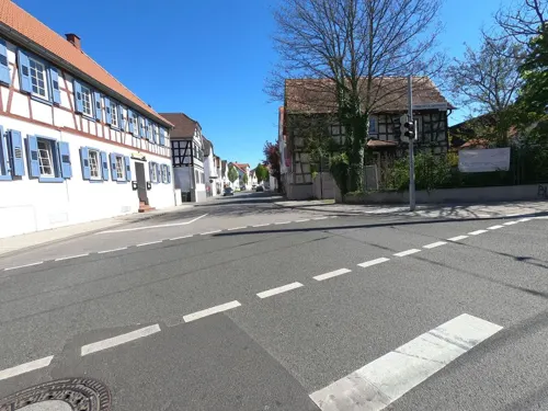

Spargel- und Erdbeerhof Rohmann
Farm and orchard · 2.2 km
Mo 09:00-12:00,16:00-18:00; Tu,We 09:00-12:00,15:00-18:00; Fr...

Museums and landmarks22


Hofreite
Monument and historic site · 2.0 km
5 Darmstädter Straße, Darmstadt

Schreiberpforte
Monument and historic site · 1.9 km
1 Messeler Straße, Darmstadt





Gedenkstätte für Kriegstote des Ersten und Zweiten Weltkriegs
Monument and historic site
10 more on the map.
Parks, trails and playgrounds29






Winterspielplatz
Playground · 1.6 km
Mo-Fr 10:00-12:00,15:00-18:00; Sa 11:00-16:00
17 more on the map.
Restaurants and cafes46
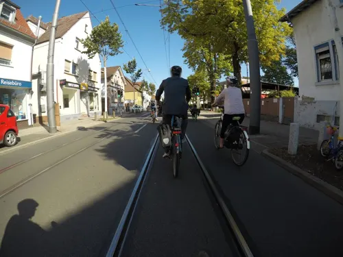
Gabi's Stübchen
Restaurant · Soup, Cake · 2.5 km
125 Frankfurter Landstraße, Darmstadt
Mo-Fr 12:00-17:00
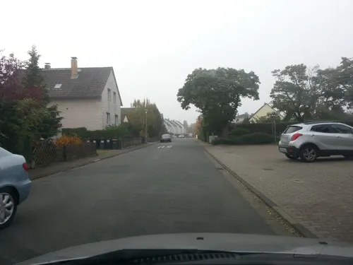
Gaststätte Bürgermeister-Pohl-Haus
Restaurant · German, Balkan
26 Im Appensee, Darmstadt
Mo-Sa 17:00-23:00; Tu off; Fr,Su 11:30-14:00,17:00-23:00
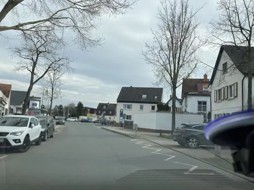

Matis' Waldlust
Restaurant · Regional · 2.2 km
173 Bahnstraße, Erzhausen
Tu-Sa 11:30-15:00, 17:30-23:00

Pizzeria Luca
Restaurant · Pizza · 2.4 km
140 Frankfurter Landstraße, Darmstadt
Mo-Su 16:30-21:30; We Off
Restaurant Bürgerhaus
Restaurant · Balkan · 2.4 km
7-9 Rodenseestraße, Erzhausen
Tu-Su 11:30-14:30,17:00-24:00

Bäckerei Keller
Bakery · 2.7 km
15 Bahnstraße, Erzhausen
Mo-Fr 06:00-12:30, 14:30-18:00; Sa 06:00-12:30; Su 08:00-11:00
Eisboutique Da Carlo
Ice cream · Ice Cream · 2.6 km
112 Frankfurter Landstraße, Darmstadt
We-Mo 10:00-22:00; Tu 10:30-22:00
Schäfer
Bakery · 2.2 km
162 Frankfurter Landstraße, Darmstadt
Mo-Fr 06:00-19:00; Sa 06:00-18:00; Su 07:00-17:00


Stettiner Garden
Restaurant · 2.3 km
Weiterstädter Landstraße, Darmstadt
Mo-Fr,Su,PH 12:00-22:00; Sa 14:00-22:00; Tu off
Thien Long
Restaurant · Asian · 2.7 km
99 Frankfurter Landstraße, Darmstadt
We-Sa 11:00-15:00,17:00-21:00; Su 12:00-15:00,17:00-21:00
34 more on the map.
History
Wixhausen was already inhabited in the Bronze Age. The first signs of settlement in the Wixhausen district can be found around 1400 BC. 750/780 Wixhausen was then incorporated into the Frankish Empire. Wixhausen was first mentioned by name in 1172 as "Wickenhusen", which means something like "settlement by the pond", since in the Middle Ages the area was traversed by several spring streams with small ponds. The baroque evangelical church built between 1774 and 1776 is worth seeing. It has a daily manually wound chime from 1517 in the Romanesque tower from 1150 (the oldest surviving structure in Darmstadt) and special windows (“Physikfenster” by Thomas Duttenhoefer, 1997).
As part of the local government reform in Hesse, the municipality of Wixhausen was incorporated into Darmstadt in 1977.
From the History section of Wixhausen on Wikipedia, under CC BY-SA 4.0.
Where to stay8
Vereinsgelände für Sport und Naturismus ORPLID-Darmstadt e. V.
Campground · 2.6 km
50 Weiterstädter Landstr, Darmstadt
Churches and places of worship11
ehemalige Neuapostolische Kirche
Church · New Apostolic · 2.7 km
25 Mainstraße, Erzhausen
Shopping13
Gas and EV charging1
Schools, colleges and libraries6
Healthcare5
Map of Wixhausen
148 places. The map loads OpenStreetMap tiles when you open it.
Getting there and nearby towns
Frankfurt Airport (FRA) is the nearest airport with scheduled flights listed in OpenStreetMap, 13 km away.
- Weiterstadt 5 km southwest, about 5 min by car
- Darmstadt 7 km south, about 7 min by car
- Langen 7 km north, about 7 min by car
- Mörfelden-Walldorf 9 km northwest, about 9 min by car
- Griesheim 10 km southwest, about 10 min by car
- Büttelborn 10 km west, about 10 min by car
- Dreieich 10 km north, about 10 min by car
- Roßdorf 11 km southeast, about 11 min by car
- Groß-Gerau 12 km west, about 12 min by car
- Dietzenbach 13 km northeast, about 13 min by car
Drive times are estimates from straight-line distance, not routes.
Local news
Headlines from INDB.
Reviews, tips and questions
Loading what members have shared...
Sources and licences
- GeoNames (CC BY 4.0): population, coordinates, regions and time zone
- Mapillary (see each image): photos
- OpenStreetMap contributors (ODbL 1.0): places, airports, map data
- Wikidata (CC0 1.0): elevation, founding date, time zone, website
- Wikimedia Commons (see each image): photos
- Wikipedia (CC BY-SA 4.0): overview and history text
Photo credits
- BrunnenWixhausen, Stefan Oemisch, CC BY-SA 4.0
- Bridge Over Little Creek Near Wixhausen, Ingolfson, Public domain
- Wixhausen evangelische Kirche 20110310, Rudolf Stricker, Attribution
- Wixhausen-Pfarrscheune, Hewiha, CC BY-SA 4.0
- S-Bahn Racing Out From Wixhausen, Ingolfson, Public domain
- DA-Wixhausen vilaĝa kirko ev. Kirche 4, Thomas Pusch, CC BY-SA 3.0
- Ev Auferstehungskirche Arheilgen, Wolfgang Arhelger, CC BY-SA 3.0
- Düne Stahlberg II, Andreas Delp, CC BY-SA 3.0 de
- Faulbruch3, Ratki, CC BY-SA 4.0
- Astrid Lindgren Schule Arheilgen, Andreas Delp, CC BY-SA 3.0 de
- Rückenmühle Arheilgen, Andreas Delp, CC BY-SA 3.0 de
- DA-Arheilgen domo Schreiberpforte 3, Thomas Pusch, CC BY-SA 3.0
- DA-Arheilgen historia domo Darmstädter Straße 5, Thomas Pusch, CC BY-SA 3.0
- Da-Arheilgen-Zehntscheuer, Hewiha, CC BY-SA 4.0
- Kleewoog, André Poth, CC BY-SA 4.0
- Maria Koenigin Erzhausen Westansicht, C. M., CC BY-SA 4.0
- HeiilgGeistKircheArheilgen, Stefan Oemisch, CC BY-SA 4.0
- Rueckenmuehle4, Stefan Oemisch, CC BY-SA 4.0
- DA-Wixhausen vilaĝa muzeo Dorfmuseum 1, Thomas Pusch, CC BY-SA 3.0
- OttilienmühleWixhausen, DerNurNochAlsBilderlieferantMitmacht, CC0
- 2021SensfelderMuehle1, Stefan Oemisch, CC BY-SA 4.0
- 2017RestaurantWaldlust, DerNurNochAlsBilderlieferantMitmacht, CC0
- 2016KircheWixhausen, Stefan Oemisch, CC BY-SA 4.0
- 2020AuferstehungskircheArheilgen, Stefan Oemisch, CC BY-SA 4.0
- 2024AstridLindgrenSchuleArheilgen, Stefan Oemisch, CC BY-SA 4.0
- Totenberge Darmstadt, AndreasDelp, CC BY-SA 4.0
- Vogelschutzgehölz Pechbusch, Ratki, CC BY-SA 4.0
- Fields And A Field Track Near Arheilgen, Ingolfson, Public domain
- Medicago minima 2 RF, Robert Flogaus-Faust, CC BY 4.0
- Malva neglecta RF, Robert Flogaus-Faust, CC BY 4.0
- Peter Stehlik 2010.06.13 055, PS-2507 (Peter Stehlik), CC BY-SA 3.0
- Peter Stehlik 2010.06.13 058a, PS-2507 (Peter Stehlik), CC BY-SA 3.0
- Offener Bücherschrank Darmstadt, Piccippi, CC BY-SA 4.0
- Faulbruch5, Ratki, CC BY-SA 4.0
- Bushaltestelle Bahnhof Arheilgen, 1, Arheilgen, Darmstadt, GeorgDerReisende, CC BY-SA 4.0
- Bahnhof Arheilgen, 2, Arheilgen, Darmstadt, GeorgDerReisende, CC BY-SA 4.0
- Linie A, 1, Arheilgen, Darmstadt, GeorgDerReisende, CC BY-SA 4.0
- Bushaltestelle Friedhof, 1, Arheilgen, Darmstadt, GeorgDerReisende, CC BY-SA 4.0
- Bushaltestelle Friedhof, 2, Arheilgen, Darmstadt, GeorgDerReisende, CC BY-SA 4.0
- Tree Halfway Up A Bridge, Nice Touch, Ingolfson, Public domain
- Street-level photo, wegavision, CC BY-SA 4.0
- Street-level photo, robffm, CC BY-SA 4.0
- Street-level photo, wegavision, CC BY-SA 4.0
- Street-level photo, mfa, CC BY-SA 4.0
- Street-level photo, mfa, CC BY-SA 4.0
- Street-level photo, dekarl, CC BY-SA 4.0
- Street-level photo, dekarl, CC BY-SA 4.0
- Street-level photo, chuck, CC BY-SA 4.0
- Street-level photo, dekarl, CC BY-SA 4.0
- Street-level photo, wegavision, CC BY-SA 4.0
- Street-level photo, mfa, CC BY-SA 4.0
- Street-level photo, wegavision, CC BY-SA 4.0
- Street-level photo, wegavision, CC BY-SA 4.0
- Street-level photo, dekarl, CC BY-SA 4.0
- Street-level photo, wegavision, CC BY-SA 4.0
- Street-level photo, dekarl, CC BY-SA 4.0
- Street-level photo, wegavision, CC BY-SA 4.0
- Street-level photo, dekarl, CC BY-SA 4.0
- Street-level photo, wegavision, CC BY-SA 4.0
- Street-level photo, chuck, CC BY-SA 4.0
- Street-level photo, chuck, CC BY-SA 4.0
- Street-level photo, dekarl, CC BY-SA 4.0
- Street-level photo, wegavision, CC BY-SA 4.0


Page built November 9, 2026. Spotted a mistake? Tell us or suggest a place.