


Why visit Neu-Isenburg
Townapedia lists 127 museums and landmarks, 68 parks and trails, 201 places to eat, 20 places to stay and 17 attractions in and around town.
Highlights include Autokino Gravenbruch, Alte Brücke, Eintracht Frankfurt Museum and Haus zum Löwen.
Weather in Neu-Isenburg
Forecast from MET Norway (CC BY 4.0). Full forecast
About Neu-Isenburg
Neu-Isenburg (German pronunciation: [nɔʏˈʔiːzn̩bʊʁk] , lit. 'New Isenburg') is a town in Germany, located in the Offenbach district of Hesse. It is part of the Frankfurt Rhein-Main urban area and has a population of 38,204 (2020). The town is known nowadays mainly for its regionally used shopping centre, the Isenburg-Zentrum (IZ), the Hugenottenhalle, the Hotel Kempinski Frankfurt, the Autokino Gravenbruch (the oldest drive-in cinema in Europe), the Sportpark, the Waldschwimmbad (swimming pool) and its location near Frankfurt Airport.
From the Wikipedia article Neu-Isenburg (this version), under CC BY-SA 4.0.
Travel tips from other travellers: Neu-Isenburg on Wikivoyage (CC BY-SA 4.0).
Photos of Neu-Isenburg


Things to do17


Goethe Tower
Monument and historic site · 4.7 km
Observation tower in Frankfurt, Germany

Oper Frankfurt
Cinema and theater · 6.8 km
Opera company in Frankfurt am Main

Schauspiel Frankfurt
Cinema and theater · 6.8 km
Municipal theatre in Frankfurt am Main, Germany

The English Theatre Frankfurt
Cinema and theater · 7.0 km
English-speaking theatre in Frankfurt am Main


Comoedienhaus
Cinema and theater · 7.4 km
Former theatre in Frankfurt am Main, Germany

Waldladen
Farm and orchard · 2.6 km
Jan-Sep Tu,Th 15:00-18:00;Oct-Dec Tu,Th 15:00-18:00,Sa[1,3] 09:00-13:00
Cineplace
Cinema and theater
"bei Kinovorstellungen, idR dienstags 16:30 Uhr und 19:30 Uhr"
5 more on the map.
Museums and landmarks127

Eintracht Frankfurt Museum
Museum · 4.1 km
362 Mörfelder Landstraße, Frankfurt am Main
Tu-Su 10:00-18:00


Deutsches Romantik-Museum
Museum · 7.1 km
Museum in Frankfurt am Main, Germany

Frankfurter Judengasse
Museum · 7.3 km
Historical Jewish ghetto in Frankfurt, Germany

Frankfurter Kunstverein
Museum · 7.0 km
Voluntary association in Germany


Jewish Museum Frankfurt
Museum · 6.7 km
Museum in Frankfurt am Main, Germany dedicated to Jewish history and culture

Liebieghaus
Museum · 6.2 km
Sculpture museum in Frankfurt/Main, Germany

Memorial at the Frankfurt Grossmarkthalle
Monument and historic site · 6.9 km
Holocaust memorial in Frankfurt, Germany

Informationszentrum Stadtwaldhaus / Fasanerie
Museum · 2.6 km
Mar-Oct Mo-Th 09:00-16:00;Sa 12:00-18:00;Su 10:00-18:00;Nov-Feb...
115 more on the map.
Parks, trails and playgrounds68

Deutsche Bank Park
Sports field and stadium · 4.1 km
Seit 1. Juli 2020 heißt die Frankfurter WM-Arena Deutsche Bank Park - und erinnert damit wieder an die Ursprünge des Sportpark...
362 Mörfelder Landstraße, Frankfurt am Main
Mo-Su 10:00-17:00

Frankfurt City Forest
Park · 3.6 km
Urban forest of Frankfurt, Germany


Herrnröther- und Bornwaldswiesen von Sprendlingen
Hiking and trails · 3.2 km

Dreieichhörnchen
Playground · 2.4 km
25 Reuterpfad, Dreieich
Apr-Sep: Tu-Sa 14:00-18:00; Oct-Mar: Tu-Fr 14:00-18:00

56 more on the map.
Restaurants and cafes201
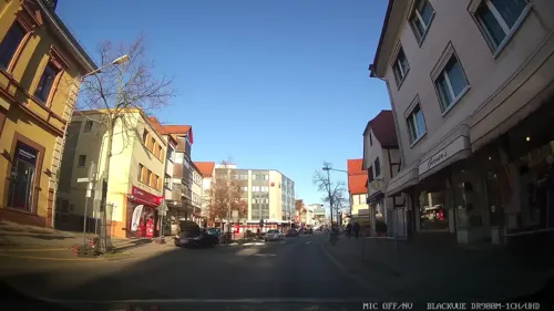
Herrnbrod & Ständecke
Restaurant · German · 3.5 km
29 Hauptstraße, Dreieich
Mo-Fr 11:00-14:00,17:00-23:00; Sa off; Su 17:00-23:00; PH off
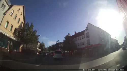
Anka
Cafe · Breakfast, Brunch, Coffee Shop · 3.4 km
43 Hauptstraße, Dreieich
Mo-Th 09:30-19:00; Fr-Su 09:30-20:00
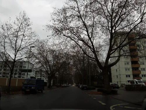
BAB Marrakesch
Restaurant · Moroccan · 1.8 km
229 Bahnhofstraße, Neu-Isenburg
Mo-Th 12:00-15:00,17:00-22:00; Fr,Sa 15:00-22:00; Su,PH 14:00-22:00
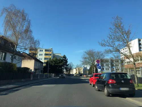
Casa Grande
Restaurant · International · 2.8 km
50 Fichtestraße, Dreieich
Mo-Fr 11:30-14:30, 17:00-23:00; Sa 17:00-23:00; Su 11:30-23:00
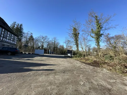
Frankfurter Haus
Restaurant · German · 1.2 km
741 Darmstädter Landstraße, Neu-Isenburg
Mo-Su 12:00-24:00

Apfelwein Föhl
Restaurant · German, Regional · 0.9 km
1 Marktplatz, Neu-Isenburg
Mo-Sa 17:00-22:30; PH,Su 12:30-22:00

Cafe Vielfalt
Cafe · Breakfast, Cake · 2.1 km
1 Freiherr-vom-Stein-Straße, Dreieich
Tu-Fr 10:00-17:00; Su 10:30-17:00
Café Ernst
Cafe · Breakfast, Cake · 1.2 km
Mo-Su 08:00-18:00; Dec 31 08:00-13:00; Dec 24-26 off; PH off
DesiLicious
Restaurant · Indian · 4.1 km
28 Hainer Chaussee, Dreieich
Mo-Fr 11:00-14:30,17:00-22:00; Sa 17:00-22:00; Su 11:00-22:00
Endstation
Restaurant · Mexican, Thai · 3.8 km
2 Buchschlager Allee, Dreieich
Mo-Sa 17:00-22:00; Su 13:00-21:00
Eva - Restaurant, Pizzeria, Café
Restaurant · Pizza, Italian, Coffee Shop · 2.3 km
4 Dreieich Plaza, Dreieich
Mo-Fr 07:30-22:00, Sa 17:00-24:00
189 more on the map.
History
Neu-Isenburg was founded on 24 July 1699 as a town of exiles by Huguenots, French Protestants who had had to flee their homeland after the Edict of Nantes was revoked. Their new landlord, Count Johann Philipp von Isenburg-Offenbach, guaranteed them safety, the free use of the French language and religious freedom.
He gave them leave to settle in the Wildbann Dreieich, an old royal hunting forest, in the place where in the Middle Ages the pilgrimage chapel Zum Heiligen Kreuz ("To the Holy Cross") once stood. By way of thanks to the Count, the town was named Neu-Isenburg after him. The town plan was laid out by Andreas Loeber in a right-angled grid pattern. From corners ran diagonal streets to the marketplace. Also, the middles of the outer sides were linked by streets to the square marketplace. This township survives today in the streets of Kronengasse, Pfarrgasse, Löwengasse and Hirtengasse.
Read more of the history
Neu-Isenburg was one of the planned towns of the 17th and 18th centuries. The settlers at first worked at farming, but later turned back to the handicraft trades that they had learnt, such as the stocking knitter's craft, thereby laying the groundwork for Neu-Isenburg's economic development. The surrounding communities eyed the French settlers with great mistrust and called the town welsches Dorf (the German word welsch refers to peoples who speak Romance languages, especially French; it is cognate with the English word Welsh, but does not have the same meaning).
On 20 May 1700 – a Thursday – the clergyman Isaac Bermond held the first church services under an old oak in the middle of the church square.
About 1701, the Forsthaus was built (today an inn called Frankfurter Haus) by the city of Frankfurt am Main at the city limits with Neu-Isenburg. The first French Reformed church was built of wood between 1702 and 1706. The foundation stone was laid on Ascension Day 1702. Likewise in 1702, the Town Hall was built at the marketplace, and the Haus zum Löwen was mentioned for the first time. This was used until 1918 as an inn called Au Lion d'Or ("At the Golden Lion"), and today it houses the local history museum.
The first school followed in 1704, and in 1705 the Bansamühle (mill). The wooden church was replaced between 1773 and 1775 with a stone building. In 1781, the first German-language school was built.
After the Congress of Vienna in 1815, the County of Ysenburg (Sovereign Principality of Isenburg after 1806), together with the Oberamt of Offenbach and its member municipalities, passed to the Grand Duchy of Hesse. In 1828, the Prussian-Hessian Customs Union built a customs house (Frankfurter Straße 10) as its main customs office on the border with what was then the Free City of Frankfurt.
Despite considerable reservations, German families, too, were moving into the town beginning in the 18th century, leading to the church's having to hold services alternately in German and French as of 1761, much to the French-speaking population's chagrin. In the end, German was confirmed as the town's official language in 1829.
In 1846, the Main-Neckar railway near Neu-Isenburg was completed, but the town did not get its own railway station until 1852.
Other events in Neu-Isenburg's history, in brief, are as follows:
1860 The firm Müller markets Frankfurter Würstchen (sausages, but not the kind often called "Frankfurters" in the English-speaking world) for the first time.
1889 The Waldbahn, a steam tramway, began running to Frankfurt.
April 1896 The Höhere Bürgerschule (now Goetheschule) took on its task as Neu-Isenburg's first secondary school.
1899 On the occasion of its bicentenary, Neu-Isenburg received a coat of arms.
1907 The Jewish Women's Federation's home for Jewish girls was founded by Bertha Pappenheim.
23 October 1911 Consecration of the first Catholic church, St. Josef.
1929 The Waldbahn was electrified and incorporated into the Frankfurt tram network
Between 1943 and 1945 the town suffered heavy damage from air raids.
1945 A broad area in the town's west had to be evacuated for the Occupying Power
1959 Building work began on Gravenbruch, a residential neighbourhood, after the woods there had been cleared.
1960 The Autokino Gravenbruch, Europe's first drive-in cinema, was opened.
1 January 1977 Amalgamation of the formerly self-administering community of Zeppelinheim, which itself had been cobbled together from parts of the self-administering municipal areas of Mitteldick and Gundwald (the latter in Groß-Gerau district) and parts of the community of Kelsterbach on 1 January 1938.
In 1834, Neu-Isenburg had only 1,762 inhabitants. By 1939, there were 15,081. After Zeppelinheim was amalgamated and Gravenbruch had been built, the population reached 35,000 by 1983.
From the History section of Neu-Isenburg on Wikipedia, under CC BY-SA 4.0.
More about Neu-Isenburg
Geography
Neu-Isenburg borders in the west and north on the district-free city of Frankfurt am Main, in the east on the district-free city of Offenbach and in the south on the towns of Dreieich, Langen and Mörfelden-Walldorf (Groß-Gerau district).
In 1959, building work began on the Wohnstadt im Grünen ("Living Town in the Green"), as it was marketed. This was Gravenbruch. Almost 7,000 people found a new home in this satellite town between the main town and Heusenstamm, lying in the woods. Owing to the great number of young families that moved there, this constituent community was known as the town with Europe's densest population of children. It is also well known for the Kempinski-Hotel and the drive-in cinema.
With the amalgamation of the formerly self-administering community of Zeppelinheim in the course of municipal reform in 1977, Neu-Isenburg also stretched farther westwards. Here is found the Zeppelinmuseum.
Economy
Given its proximity to the trade fair city of Frankfurt and to Frankfurt Airport, Neu-Isenburg is a common location for businesses in various sectors. One of the major businesses that are found here are hotels, which see more than 230,000 overnight stays every year, the highest figure in the Offenbach district.
Over time, the town has converted itself from a location for producing businesses to a service-industry-based location and is among the biggest high-technology locations in the Frankfurt Rhine Main Region.
Harley-Davidson GmbH (Managing Germany, Austria and Switzerland)
G. A. Müller GmbH (meat products factory, oldest manufacturer of the original Frankfurter Würstchen)
Hans Wirth GmbH & Co. KG (meat products factory, manufacturer of the original Frankfurter Würstchen)
Around the 1980s and 1990s the airline Condor was headquartered in Neu-Isenburg.
The town is close to several routes of the German Autobahn network (A 3, A 5, A 661).
Arts and culture
Neu-Isenburg is known far beyond its limits for the various events staged at the Hugenottenhalle. In this multipurpose hall with a variable capacity of up to 2,000 people, rock concerts are held, guest theatrical performances are given and dancing and music are performed. Citizens are offered a comprehensive cultural programme covering every genre.
Neu-Isenburg is especially well known in the Frankfurt Rhine Main Region for its yearly summertime Open-Doors-Festival (formerly Musikspektakel). For three days, some 40 different bands and artists from all genres of music play. The free event is attended by some 15,000 guests and is held on several different stages throughout the town area.
The parade through town on Shrove Monday (Rosenmontag) — sometimes called Lumpenmontag in Neu-Isenburg — enjoys great popularity.
Friedrich-Fröbel-Schule, school for learning help and speech therapy
From the Wikipedia article Neu-Isenburg, under CC BY-SA 4.0.
Notable people from Neu-Isenburg
 Wilhelm LeichumOlympic jumper (1911–1941)Photo: Le Matin, Public domain
 Norbert WeisserGerman-born actorPhoto: unknown, CC BY 3.0
 Fritz BetzelbacherGerman motorcycle racerPhoto: Harry Pot for Anefo, CC0
- Peter DietrichGerman footballer
- Franz VölkerGerman opera singer (1899-1965)
- Bjarne ForchhammerDanish actor (1903-1970)
- Wolfgang PoppWest German tennis player
- Walter GreilingGerman chemist and futurologist (1900–1986)
- Anny SchlemmGerman opera singer (1929–2026)
- Ernst BalserGerman architect
- Robert SchunkGerman singer and opera singer
- Otto KöhlerGerman opera singer (1903-1976)
Born in Neu-Isenburg, according to Wikidata (CC0). Each name links to its Wikipedia article.
Where to stay20
Churches and places of worship36
Kirche der Evangelischen Kirchengemeinde Gravenbruch
Church · Protestant · 4.2 km
8 Dreiherrnsteinplatz, Neu-Isenburg
Erasmus-Alberus-Kirche
Church · Protestant · 3.8 km
2 Tempelstraße, Dreieich
Evangelisch-Reformierte Gemeinde Am Marktplatz Neu-Isenburg
Church · Protestant · 1.0 km
Evangelisch-methodistische Kirche
Church · Methodist · 3.3 km
27 Poststraße, Dreieich
Shopping50
Gas and EV charging14
Schools, colleges and libraries29
Sankt Georgen Graduate School of Philosophy and Theology
School · 5.7 km
Healthcare12
Map of Neu-Isenburg
250 places. The map loads OpenStreetMap tiles when you open it.
Getting there and nearby towns
Frankfurt Airport (FRA) is the nearest airport with scheduled flights listed in OpenStreetMap, 11 km away.
- Dreieich 3 km south, about 3 min by car
- Langen 7 km south, about 7 min by car
- Frankfurt am Main 8 km north, about 8 min by car
- Offenbach 8 km northeast, about 8 min by car
- Dietzenbach 7 km southeast, about 7 min by car
- Heusenstamm 8 km east, about 8 min by car
- Mörfelden-Walldorf 10 km southwest, about 10 min by car
- Egelsbach 9 km south, about 9 min by car
- Obertshausen 12 km east, about 12 min by car
- Erzhausen 11 km south, about 11 min by car
Drive times are estimates from straight-line distance, not routes.
Towns near Neu-Isenburg


Keep exploring
Local news
Headlines from INDB.
Reviews, tips and questions
Loading what members have shared...
Sources and licences
- GeoNames (CC BY 4.0): population, coordinates, regions and time zone
- Mapillary (see each image): photos
- OpenStreetMap contributors (ODbL 1.0): places, airports, map data
- Wikidata (CC0 1.0): elevation, founding date, time zone, website, landmarks and historic places
- Wikimedia Commons (see each image): photos
- Wikipedia (CC BY-SA 4.0): overview and history text
Photo credits
- Aerial photo of Neu-Isenburg suburban neighborhood, Samra Bergkemper-Mujic, CC BY 3.0
- Frankfurter Straße 184, 1, Neu-Isenburg, Landkreis Offenbach, GeorgDerReisende, CC BY-SA 4.0
- Neu-isenburg gueterbahnhof, Frank Murmann, CC BY-SA 3.0
- Neu-Isenburg Stadt Alter Bahnhof 20070914, Rudolf Stricker, Public domain
- Bushaltestelle Isenburgzentrum West, 1, Neu-Isenburg, Landkreis Offenbach, GeorgDerReisende, CC BY-SA 4.0
- Bushaltestelle Isenburgzentrum West, 2, Neu-Isenburg, Landkreis Offenbach, GeorgDerReisende, CC BY-SA 4.0
- Stadtbibliothek Neu-Isenburg, Grimes2, CC BY-SA 4.0
- Neu-Isenburg - Aerial Scene - geo.hlipp.de - 26920, Lewis Clarke on geo.hlipp.de, CC BY-SA 2.0
- Linie OF-95, 1, Neu-Isenburg, Landkreis Offenbach, GeorgDerReisende, CC BY-SA 4.0
- Bushaltestelle Friedrichstraße, 2, Neu-Isenburg, Landkreis Offenbach, GeorgDerReisende, CC BY-SA 4.0
- Bushaltestelle Isenburgzentrum Süd, 1, Neu-Isenburg, Landkreis Offenbach, GeorgDerReisende, CC BY-SA 4.0
- Bushaltestelle Friedrichstraße, 1, Neu-Isenburg, Landkreis Offenbach, GeorgDerReisende, CC BY-SA 4.0
- Linie OF-54, 1, Neu-Isenburg, Landkreis Offenbach, GeorgDerReisende, CC BY-SA 4.0
- Neu-Isenburg, Ehemaliges Stellwerk, Muck, CC BY-SA 4.0
- Bushaltestelle Bahnhofstraße-Fußgängerzone, 2, Neu-Isenburg, Landkreis Offenbach, GeorgDerReisende, CC BY-SA 4.0
- Herzogstraße 61-63, 1, Neu-Isenburg, Landkreis Offenbach, GeorgDerReisende, CC BY-SA 4.0
- Linie X17, 1, Neu-Isenburg, Landkreis Offenbach, GeorgDerReisende, CC BY-SA 4.0
- Linie OF-51, 2, Neu-Isenburg, Landkreis Offenbach, GeorgDerReisende, CC BY-SA 4.0
- Bushaltestelle Isenburgzentrum Ost, 2, Neu-Isenburg, Landkreis Offenbach, GeorgDerReisende, CC BY-SA 4.0
- Linie X83, 1, Neu-Isenburg, Landkreis Offenbach, GeorgDerReisende, CC BY-SA 4.0
- Bushaltestelle Herzogstraße, 1, Neu-Isenburg, Landkreis Offenbach, GeorgDerReisende, CC BY-SA 4.0
- Bushaltestelle Bahnhofstraße-Fußgängerzone, 1, Neu-Isenburg, Landkreis Offenbach, GeorgDerReisende, CC BY-SA 4.0
- Bushaltestelle Isenburgzentrum Ost, 1, Neu-Isenburg, Landkreis Offenbach, GeorgDerReisende, CC BY-SA 4.0
- Kriegerdenkmal Friedhof Neu-Isenburg 1877, Frank Murmann, CC BY 3.0
- Denkmal Heimatvertriebene Alter Friedhof (Neu-Isenburg), Wikitarisch, CC BY 4.0
- Kriegerdenkmal Germania 1870-71 Alter Friedhof (Neu-Isenburg) 07, Wikitarisch, CC BY 4.0
- Kriegerdenkmal Germania 1870-71 Alter Friedhof (Neu-Isenburg) 06, Wikitarisch, CC BY 4.0
- Kriegerdenkmal Germania 1870-71 Alter Friedhof (Neu-Isenburg) 03, Wikitarisch, CC BY 4.0
- Kriegerdenkmal Germania 1870-71 Alter Friedhof (Neu-Isenburg) 04, Wikitarisch, CC BY 4.0
- Kriegerdenkmal Germania 1870-71 Alter Friedhof (Neu-Isenburg) 02, Wikitarisch, CC BY 4.0
- Kriegerdenkmal Germania 1870-71 Alter Friedhof (Neu-Isenburg) 05, Wikitarisch, CC BY 4.0
- Kriegerdenkmal Germania 1870-71 Alter Friedhof (Neu-Isenburg) 01, Wikitarisch, CC BY 4.0
- Bushaltestelle Herzogstraße, 2, Neu-Isenburg, Landkreis Offenbach, GeorgDerReisende, CC BY-SA 4.0
- Frankfurt am Main - Alte Brücke, Daviidos, CC BY-SA 4.0
- Eiserner-Steg-2012-Ffm-977-8, Simsalabimbam, CC BY-SA 3.0
- Goetheturm, No machine-readable author provided. Popie~commonswiki assumed (based on copyright claims)., CC BY-SA 3.0
- Mk Frankfurt Gallusanlage, Michael König ( User:Magadan ) → Message ., CC BY-SA 3.0
- Schauspiel-ffm002, dontworry, CC BY-SA 3.0
- The English Theatre Ffm DSC 0808, Eva K., GFDL 1.2
- Eingang Caricatura Leinwandhaus, Eva K. / Eva K., GFDL 1.2
- Deutsches Romantik-Museum Frankfurt, Grimes2, CC0
- Frankfurt Judengasse 1868, Unknown author, Public domain
- Frankfurter Kunstverein 2018, Norbert Miguletz (Foto), CC BY-SA 4.0
- Frankfurt Am Main-Saalhof-Ansicht vom Eisernen Steg, Mylius, CC BY-SA 3.0
- Frankfurt Am Main-Untermainkai 15 von Suedwesten-20100808, Mylius, GFDL 1.2
- Liebieghaus Galerieflügel Haupteingang, Photo: Andreas Praefcke, CC BY 3.0
- Erinnerungsstaette Grossmarkthalle Frankfurt.Foto-Norbert Miguletz1, Norbert Miguletz (Frankfurt), CC BY 3.0
- Skyline-sued-ffm001, dontworry, CC BY-SA 3.0
- Exotarium, Zoo Frankfurt, Unknown author, CC BY-SA 3.0
- Nizza Ffm Mainblick 1, Eva K., GFDL 1.2
- Frankfurt Taunusanlage.20130418, Epizentrum, CC BY 3.0
- Deutschordenshaus-Frankfurt-2013-Ffm-Sachsenhausen-988, Simsalabimbam, CC BY-SA 3.0
- Frankfurt Am Main-Dominikanerkloster-Ansicht von der Kurt-Schumacher-Strasse-Gegenwart, No machine-readable author provided. Mylius assumed (based on copyright claims)., CC BY-SA 3.0
- Frankfurt Am Main-Dreikoenigskirche vom Mainkai-20110408, Mylius, GFDL 1.2
- Mensa-im-park-pth-sankt-georgen-frankfurt-main, Ulla Schmitz, CC BY-SA 3.0
- Haupteingang Dürerstr, MarieEgger, CC BY-SA 4.0
- Frankfurt stadium, Arne Müseler, CC BY-SA 3.0 de
- Nuur-Moschee Frankfurt Germany, rupp.de, CC BY-SA 3.0
- Autokino gravenbruch, Popie ( de:Benutzer:Popie ), CC BY-SA 3.0
- NSG Bruch von Gravenbruch 5, KUGerhardt, CC BY-SA 4.0
- NSG Gehspitzweiher bei Neu-Isenburg02, KUGerhardt, CC BY-SA 4.0
- Herrnröther- und Bornwaldswiesen von Sprendlingen03, KUGerhardt, CC BY-SA 4.0
- Monte Scherbelino IMG 4647b, Figure19, CC BY-SA 4.0
- MaxEythSchuleDreieich, Lauterbach-Darmstadt, CC BY-SA 4.0
- Stadtbibliothek Neu-Isenburg, Forum für Medien- und Lesekultur, Grimes2, CC BY-SA 3.0
- Frankfurt, Eintracht Frankfurt Museum - exterior view, Dr. Thomas Liptak, CC BY-SA 4.0
- Haus zum loewen, de:Benutzer:Popie, CC BY-SA 3.0
- Sprendlingen - Lindenplatz (6), John Doe IX, CC BY-SA 4.0
- St. Josef (Neu-Isenburg), sailko (changes by Rabanus Flavus ), CC BY-SA 3.0
- Sprendlingen, Auferstehungskirche-01, Muck, CC BY-SA 4.0
- Evangelische Pfarrkirche Neu-Isenburg, Frank Murmann, CC BY 3.0
- Buchenbuschkirche Neu-Isenburg Suedostansicht, C. M., CC BY-SA 4.0
- Heilig-Kreuz-Kirche Neu-Isenburg Suedostansicht, C. M., CC BY-SA 4.0
- Neu-Isenburg, Johanneskirche (5), Subbass1, CC BY-SA 4.0
- Ricarda-Huch-Schule Dreieich Gymnasium, Helichrysius, CC BY-SA 4.0
- Evangelische Kirche Gravenbruch Kirchenkubus Südansicht, C. M., CC BY-SA 4.0
- Goetheschule Neu-Isenburg, Neuisenburger, CC BY-SA 4.0
- Carlvonweinberg1, No machine-readable author provided. Peng assumed (based on copyright claims)., CC BY 2.5
- Isenburg Zentrum, Frank Murmann, CC BY 3.0
- Street-level photo, chuck, CC BY-SA 4.0
- Street-level photo, quickness805, CC BY-SA 4.0
- Street-level photo, chuck, CC BY-SA 4.0
- Street-level photo, chuck, CC BY-SA 4.0
- Street-level photo, chuck, CC BY-SA 4.0
- Street-level photo, chuck, CC BY-SA 4.0
- Street-level photo, robffm, CC BY-SA 4.0
- Street-level photo, chuck, CC BY-SA 4.0
- Street-level photo, quickness805, CC BY-SA 4.0
- Street-level photo, chuck, CC BY-SA 4.0
- Street-level photo, chuck, CC BY-SA 4.0
- Street-level photo, chuck, CC BY-SA 4.0
- Street-level photo, miguel_andrade, CC BY-SA 4.0
- Street-level photo, chuck, CC BY-SA 4.0
- Street-level photo, xodes, CC BY-SA 4.0
- Street-level photo, chuck, CC BY-SA 4.0
- Street-level photo, chuck, CC BY-SA 4.0
- Street-level photo, chuck, CC BY-SA 4.0
- Street-level photo, chuck, CC BY-SA 4.0
- Street-level photo, xodes, CC BY-SA 4.0


Page built November 9, 2026. Spotted a mistake? Tell us or suggest a place.