


Gau-Algesheim, Germany
Gau-Algesheim is a town of 6,553 people in Rheinland-Pfalz, Germany.
Why visit Gau-Algesheim
Townapedia lists 60 museums and landmarks, 18 parks and trails, 86 places to eat, 11 places to stay and 8 attractions in and around town.
Highlights include Bismarckturm Ingelheim, Obsthof Hemmes, Rheinhessisches Fahrradmuseum Gau-Algesheim and Altes Rathaus.
Weather in Gau-Algesheim
Forecast from MET Norway (CC BY 4.0). Full forecast
About Gau-Algesheim
Gau-Algesheim (German pronunciation: [ɡaʊ ˈʔalɡəshaɪm] ) is a town in the Mainz-Bingen district in Rhineland-Palatinate, Germany. It is the seat of the Verbandsgemeinde of Gau-Algesheim, a kind of collective municipality.
From the Wikipedia article Gau-Algesheim (this version), under CC BY-SA 4.0.
Travel tips from other travellers: Gau-Algesheim on Wikivoyage (CC BY-SA 4.0).
Photos of Gau-Algesheim


Things to do8

Bismarckturm Ingelheim
Scenic view · 1.5 km
Apr-Sep: 09:00-20:00; Oct-Mar: 10:00-16:00

Casablanca & Cadillac
Cinema and theater · 3.5 km
75 Binger Straße, Ingelheim am Rhein


Hindenburg Bridge
Bridge · 5.6 km
Former train bridge over the Rhine at Rüdesheim, Germany

Johannisberger Türmchen
Scenic view · 2.4 km
Kombinierter Aussichtsturm mit Schutzhütte

Museums and landmarks60

Rheinhessisches Fahrradmuseum Gau-Algesheim
Museum
12 Schlossgasse, Gau-Algesheim
easter-Oct Su[2]: Su,PH 11:00-17:00 || "nach Vereinbarung"

Altes Rathaus
Monument and historic site · 3.3 km
Anspruchsvoller klassizistischer Walmdachbau, bezeichnet 1827, Architekt Friedrich Schneider
1 Marktplatz, Ingelheim am Rhein

Roter Turm
Monument and historic site · 2.5 km
198 Binger Straße, Ingelheim am Rhein

Imperial Palace Ingelheim
Museum · 4.6 km
An important Imperial Palace erected in the second half of the 8th century in Germany




Begegnung mit Jesus auf dem Kreuzweg
Monument and historic site · Catholic · 2.9 km
Die Begegnung Mariens mit ihrem Sohn auf dem Kreuzweg, vgl. die 4. Station des Kreuzwegs.
48 more on the map.
Parks, trails and playgrounds18





6 more on the map.
Restaurants and cafes86
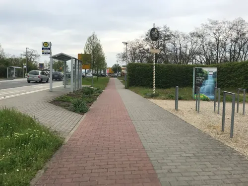
Brauhaus Goldener Engel
Restaurant · German · 1.8 km
1 Neisser Straße, Ingelheim am Rhein
Mo off; PH,Tu-Su 11:00-01:00
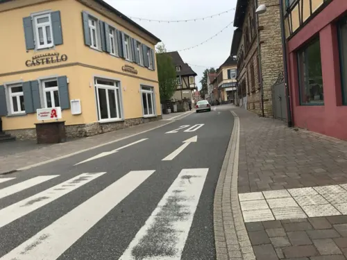
Lily’s
Restaurant · Fusion, Asian, European · 3.4 km
84 Binger Straße, Ingelheim am Rhein
Mo-Fr 11:00-22:00; Sa 09:00-12:00
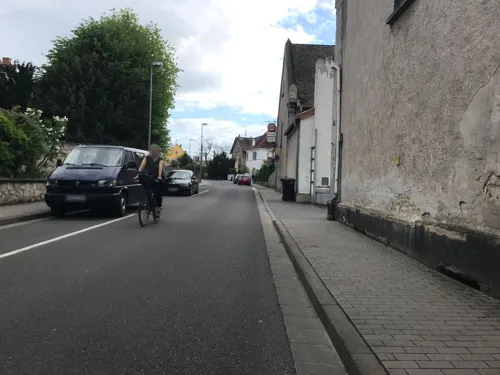
Marone
Restaurant · Balkan · 3.4 km
102 Grundstraße, Ingelheim am Rhein
Tu,Fr,Sa 11:30-14:30,17:30-23:00; We,Th 17:30-23:00; Su...
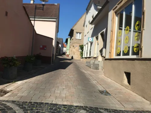
Pastis - Café & Bistro
Cafe · Breakfast, Cake
4 Marktplatz, Gau-Algesheim
Mo,We-Su 09:00-17:00; Tu off; "gelegentlich auch während der...
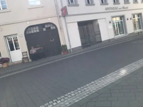
Pizzeria Capri
Restaurant · Italian · 3.3 km
11 Marktplatz, Ingelheim am Rhein
Tu-Su 11:00-14:30,17:30-23:00

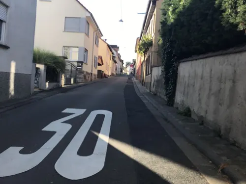

Taverne Athen
Restaurant · Greek · 3.3 km
128 Bahnhofstraße, Ingelheim am Rhein
Tu-Sa 17:30-23:30; Su 11:30-14:30,17:30-23:30
Weingut Eberle Runkel
Restaurant · Regional · 3.2 km
25 Niedergasse, Appenheim
May-Sep: Fr 18:00+, Sa 17:00+, Su, PH 16:00+

74 more on the map.
History
In Roman times this was a border area, but already by the Middle Ages it had grown into part of the Holy Roman Empire’s heartland.
Before the town’s first documentary mention in the Lorsch codex in 766, Alagastesheim may already have had more than two centuries of history behind it. The documents about Alagastesheim and Bergen (Laurenziberg) in the lists of holdings from the Lorsch and Fulda Abbeys beginning in 766-767 allow inferences about cropraising, livestock raising, winegrowing, fruitgrowing and individual inhabitants’ wealth. Gau-Algesheim came to the fore in history along with all the other places in the Binger Land with the ″Verona Donation″ on 14 June 983, when Emperor Otto II donated to his Archchancellor Willigis in Verona the town of Bingen and the land “that stretches this side of the Rhine from the bridge over the Selzbach as far as Heimbach, beyond the Rhine but from the spot where the Elzbächlein (a small stream) flows into the same, as far as the little village of Caub”.
Read more of the history
Under financial pressure, Gau-Algesheim was pledged to the Baden Margraves. The Margrave himself then further pledged it in 1461, and the villages of Dromersheim, Gau-Bickelheim, Ockenheim, Windesheim, Kempten, Münster and Büdesheim to the financially strong Count Philipp I, Count of Katzenelnbogen. Under him, the term Wein vom Gau, meaning “Wine from the Gau (or Region)”, was coined. As Philipp died in 1479 without a male heir, Gau-Algesheim ended up involved in the Katzenelnbogen succession dispute.
“Living well under the crozier” was not something that held true at all times. Often domestic or foreign armies would sweep through the town bringing war's attendant burdens and havoc, for instance, in 1248 during the struggles between Emperor Frederick II's and King William II's troops, in 1553 in the war of Protestant princely opposition to Emperor Charles V, in 1631 when Swedish King Gustav II Adolf's troops burnt much of the town down, or 1690, 1733 and 1792, when French soldiers burnt or seized Gau-Algesheim.
Even the two conferrals of town rights, the one in 1332 at Elector of Mainz Baldwin of Luxembourg's request by Emperor Louis the Bavarian and the one in 1355 by King Charles IV in support of the Archbishop of Mainz, were primarily motivated by political and military considerations and were only secondarily meant to further the towsfolk's security and well-being. Nevertheless, there arose a weekly market and a wine market along with a healthy number of craftsmen and businessmen with the urban life then creating supply and demand for regular markets.
At the same time, a great many financial pledges and the mention of a Jewish head tax point to rather a high demand for cash and business. Eventually, for over 400 years, from the latter half of the 14th century until the end of the Old Empire, there arose the Amt of Algesheim under the governance of Amtmänner, Landschreiber, Amtskeller (all titles for various officials) and Schultheißen (roughly “sheriffs”) of the Mainz overlords.
The overlords’ might, already demonstrated in the municipal law of 15 July 1417, was keenly felt by Gau-Algesheim when Elector Albrecht of Brandenburg put an end to efforts to secure self-administration for the town by issuing the state law of 3 January 1527 because the town had taken part in the “Rheingau Uprising” in 1525, and released “unser stadt Algeßheym von unserm landt dem Ringgaw” (“our town Algesheim from our land, the Rheingau”, in archaic German), cutting the town off from the Rheingau, supposedly in perpetuity. Alongside this, pictures of the town, cadastral plans and village descriptions from cartographer Gottfried Mascop's 1577 atlas, the 1590 and 1668 village descriptions and the 1595 Police Law give impressions of the extent to which, and within what bounds of administrative structures the small farming town's social and economic life, and also the townsfolk's self-awareness and self-will developed.
From 1797 to 1815, Gau-Algesheim, along with the whole of the territory on the Rhine's left bank, belonged to the French Republic or the Napoleonic Empire. In the person of scientist, engineer and officer Rudolf Eickemeyer, who was from 1811 to 1813 and again from 1814 to 1815 the maire and from 1815 to 1822 the Bürgermeister (“mayor” in French and German respectively), Gau-Algesheim had a personal continuity from the time of French rule on into Hessian times. Eickemeyer gave the community a modern shape by reforming fire control, restructuring finances, expanding the town's building work, and furthering schooling and agriculture.
The town's growing importance found expression in the institution of a notary's office (1809), the building of the Ludwigsbahn (Mainz-Bingen railway) with a station (1859), the building of a postal depot (1861) out of which grew postal shipping and a post office, and in Georg Presser's (1862) and the Avenarius Brothers’ (1869) first factories.
The traces left in Gau-Algesheim by the Catholic priest Peter Koser from 1869 to 1890 are still apparent today. The Rheinischer Volksbote (“Rhenish Messenger”), first published by the printer Reidel in 1869 and under Father Koser's editorship, was for decades a regionally important organ of the Catholic Centre Party. A teacher preparation institute (an institution that prepared students for teacher's college), known to locals as the Lateinschul (“Latin School”) or the Aljesemer Hochschul (“Algesheim College”, in dialectal German), a childcare centre, a credit and savings union on a coöperative basis, a farmers’ and consumers’ association, and not least of all the newly built Catholic parish church and the establishment of church music in 1888 confirm Peter Koser's religious and sociopolitical contributions in a time of political and ideological struggles.
From the History section of Gau-Algesheim on Wikipedia, under CC BY-SA 4.0.
More about Gau-Algesheim
Geography
Gau-Algesheim lies roughly 20 km west of Mainz and just under 3 km away from the Rhine on the edge of the Ingelheimer Rheinebene (“Ingelheim Rhine Plain”) on the terraces at the Rhenish Hesse West Plateau, into whose varied soil structure the “Geo-Ecological Teaching Path” on the Westerberg slopes allows a glimpse. Through the municipal area flows the Welzbach.
Clockwise from the north, these are Ingelheim, Appenheim, Ockenheim and Bingen.
Gau-Algesheim's Stadtteile are Gau-Algesheim and Laurenziberg.
Economy
The town lies in a favourable location for transport on the Left Rhine railway towards Frankfurt, Koblenz, and Mainz and the line to Bad Kreuznach, which connects to the Nahe Valley line to Saarbrücken and on Autobahn A 60.
The town's landmarks are the ensemble of the Catholic parish church, the Town Hall, townsmen's houses and marketplace, Schloss Ardeck (castle), the Graulturm (tower) and the Evangelical church.
Schloss Ardeck has housed since 2002 the Rhenish Hesse Bicycle Museum. It is open every Sunday and holiday from 11:00 to 17:00 from Easter to the Young Wine Festival on the second weekend in October.
Since late 2005, the new regional “Rheinwelle” adventure pool on Landesstraße (State Road) 419 within Gau-Algesheim town limits has been open. It is run jointly by Gau-Algesheim, Ingelheim and Bingen.
From the Wikipedia article Gau-Algesheim, under CC BY-SA 4.0.
Where to stay11
Churches and places of worship17
Evangelische Versöhnungskirche
Church · Protestant · 2.5 km
1 Dietrich-Bonhoeffer-Straße, Ingelheim am Rhein
Appenheim Evangelische Kirche
Church · Protestant · 3.2 km
8 Niedergasse, Appenheim
Burgkirche
Church · Protestant · 3.5 km
17 An der Burgkirche, Ingelheim am Rhein
Evangelische Gustav-Adolf-Kirche
Church · Protestant
3 Schulstraße, Gau-Algesheim
Shopping21
Gas and EV charging5
Schools, colleges and libraries14
Berufsbildende Schule Ingelheim am Rhein
School · 3.6 km
25 Wilhelm-Leuschner-Straße, Ingelheim am Rhein
Integrierte Gesamtschule Kurt Schumacher Ingelheim
School · 2.2 km
30 Albrecht-Dürer-Straße, Ingelheim am Rhein
Healthcare7
Map of Gau-Algesheim
247 places. The map loads OpenStreetMap tiles when you open it.
Getting there and nearby towns
Wiesbaden Army Airfield (WIE) is the nearest airport with scheduled flights listed in OpenStreetMap, 24 km away.
- Ingelheim am Rhein 3 km northeast, about 3 min by car
- Geisenheim 5 km northwest, about 5 min by car
- Rüdesheim am Rhein 7 km west, about 7 min by car
- Bingen am Rhein 8 km west, about 8 min by car
- Aulhausen 10 km northwest, about 10 min by car
- Walluf 14 km northeast, about 14 min by car
- Wörrstadt 14 km southeast, about 14 min by car
- Nieder-Olm 14 km east, about 14 min by car
- Bad Kreuznach 17 km southwest, about 17 min by car
- Mainz 19 km east, about 19 min by car
Drive times are estimates from straight-line distance, not routes.
Towns near Gau-Algesheim




Local news
Headlines from INDB.
Reviews, tips and questions
Loading what members have shared...
Sources and licences
- GeoNames (CC BY 4.0): population, coordinates, regions and time zone
- Mapillary (see each image): photos
- OpenStreetMap contributors (ODbL 1.0): places, airports, map data
- Wikidata (CC0 1.0): elevation, founding date, time zone, website, landmarks and historic places
- Wikimedia Commons (see each image): photos
- Wikipedia (CC BY-SA 4.0): overview and history text
Photo credits
- Gau-Algesheim - Rathaus am Marktplatz, Traveler100, CC BY-SA 4.0
- Gau-Algesheim, der Markt mit Ratskeller, Dguendel, CC BY 3.0
- Gau-Algesheim, Rathaus und Turm der Kirche St. Cosmas und Damian, Dguendel, CC BY 3.0
- Gau-Algesheim Wohnhaus Weingasse 1, Aidexxx, CC BY-SA 4.0
- Gau-Algesheim, Markt mit Bäckerei, Dguendel, CC BY 3.0
- Gau-Algesheim Hofanlage Marktplatz 10, Aidexxx, CC BY-SA 4.0
- Gau-Algesheim Rathaus 20100910, Rudolf Stricker, Attribution
- Gau-Algesheim Altes Kaufhaus Flösserstraße 2, Aidexxx, CC BY-SA 4.0
- Gau-Algesheim Spolie Kloppgasse 2, Aidexxx, CC BY-SA 4.0
- Gau-Algesheim Wohnhaus Kloppgasse 6, Aidexxx, CC BY-SA 4.0
- Gau-Algesheim Greiffenclauer Hof Langgasse 9, Aidexxx, CC BY-SA 4.0
- Gau-Algesheim, der Turm der Kirche St. Cosmas und Damian, Dguendel, CC BY 3.0
- Gau-Algesheim, Langgasse mit Haus Nr. 8, Dguendel, CC BY 3.0
- Gau-Algesheim - St. Cosmas und Damian (von Kloppgasse), ManuelB701, CC0
- Gau-Algesheim - St. Cosmas und Damian - Turmdach, ManuelB701, CC0
- Gau-Algesheim Hofanlage Kloppgasse 10, Aidexxx, CC BY-SA 4.0
- Gau-Algesheim, Kirche St. Cosmas und Damian, Seitenaltar, Dguendel, CC BY 3.0
- Gau-Algesheim, Kirche St. Cosmas und Damian, die Orgel, Dguendel, CC BY 3.0
- Gau-Algesheim, Kirche St. Cosmas und Damian, der Hauptaltar, Dguendel, CC BY 3.0
- Gau-Algesheim, Kirche St. Cosmas und Damian, Seitenaltar und Taufbecken, Dguendel, CC BY 3.0
- Gau-Algesheim Weingut Langgasse 8, Aidexxx, CC BY-SA 4.0
- Gau-Algesheim Katholihsches Pfarrhaus Schlossgasse 1, Aidexxx, CC BY-SA 4.0
- Gau-Algesheim, die Langgasse, Blick zum Rathaus, Dguendel, CC BY 3.0
- Gau-Algesheim, der Kronenbergerhof, Dguendel, CC BY 3.0
- Gau-Algesheim, Haus Weingasse 9, Dguendel, CC BY 3.0
- Gau-Algesheim Schulhaus Schlossgasse 2, Aidexxx, CC BY-SA 4.0
- Gau-Algesheim Wegekapelle Kegelplatz, Aidexxx, CC BY-SA 4.0
- Gau-Algesheim Kronenbergerhof Neugasse 7, Aidexxx, CC BY-SA 4.0
- Gau-Algesheim Hofanlage Flösserstraße 15, Aidexxx, CC BY-SA 4.0
- Gau-Algesheim ehem. Synagoge Querbein 9, Aidexxx, CC BY-SA 4.0
- NI-Kaiserpfalz, Braveheart09, CC0
- Heilig Kruiskerk (Rheingauer Dom), RomkeHoekstra, CC BY-SA 3.0
- Selztaldom2, Braveheart09, CC BY-SA 3.0
- Oestrich-St Martin-06-2021-gje, Gerd Eichmann, CC BY-SA 4.0
- Schloss und Campus der EBS Business School, IdaLovesStockholm, CC BY-SA 4.0
- Bingen Rochusallee 4 Fachhochschule 001, Aidexxx, CC BY-SA 4.0
- Burgkirche-Ingelheim6Spring, Braveheart09, CC BY-SA 3.0
- Gau-algesheim-3-begradigt, Gau-algesheim-3.jpg : Traveler100 derivative work: VinylVictim ( talk ), CC BY-SA 3.0
- OhrenbrückerTor, Braveheart09, CC BY-SA 3.0
- St-Michael-Ingelheim-Süd, Braveheart09, CC BY-SA 3.0
- Ober-Ingelheim Weingut Neus Bahnhofstraße 96, Aidexxx, CC BY-SA 4.0
- Ockenheim, Petrus en Pauluskerk, RomkeHoekstra, CC BY-SA 4.0
- Gau-Algesheim, Bedevaartskerk Sint-Laurentius, RomkeHoekstra, CC BY-SA 4.0
- Gau-Algesheim Ev-Kirche Kirchstraße 3, Aidexxx, CC BY-SA 4.0
- Gau-algesheim-1, Traveler100, CC BY-SA 4.0
- IBB Hotel Ingelheim, ManuelB701, CC0
- 20230313 City walls Ingelheim am Rhein 06, Flocci Nivis, CC BY 4.0
- Appenheim Evangelische Kirche 20100830, Rudolf Stricker, Attribution
- IW-Versöhnungskirche, Braveheart09, CC0
- Bismarckturm-Ingelheim, Stefan Frerichs ( Stefan ), CC BY-SA 3.0
- Rathaus-OberIngelheim3, No machine-readable author provided. Momo assumed (based on copyright claims)., CC BY-SA 3.0
- IW-Rotes-Türmchen, Braveheart09, CC0
- OhrenbrückerTor22, Braveheart09, CC BY-SA 3.0
- SteigelpforteSüden, Braveheart09, CC BY-SA 3.0
- Ober-Ingelheim-Uffhubtor, Braveheart09, CC BY-SA 3.0
- Fulder Aue-Ilmen Aue- 02, Bodow, CC BY-SA 3.0
- NSG Gau-Algesheimer Kopf 004, Aidexxx, CC BY-SA 3.0
- NSG Gau-Algesheimer Kopf - Erweiterung 004, Aidexxx, CC BY-SA 3.0
- 55218 Ingelheimer Dünen und Sande 3, Astloch, CC BY-SA 3.0
- Fliegen-Ragwurz (Ophrys insectifera) Naturschutzgebiet Jakobsberg, Christoph Nohles, CC BY-SA 4.0
- NSG Nordausläufer Westerberg 017, Aidexxx, CC BY-SA 3.0
- Casablanca & Cadillac - Kino in Ingelheim, ManuelB701, CC0
- Street-level photo, miguel_andrade, CC BY-SA 4.0
- Street-level photo, miguel_andrade, CC BY-SA 4.0
- Street-level photo, miguel_andrade, CC BY-SA 4.0
- Street-level photo, miguel_andrade, CC BY-SA 4.0
- Street-level photo, miguel_andrade, CC BY-SA 4.0
- Street-level photo, miguel_andrade, CC BY-SA 4.0
- Street-level photo, miguel_andrade, CC BY-SA 4.0
- Street-level photo, miguel_andrade, CC BY-SA 4.0
- Street-level photo, miguel_andrade, CC BY-SA 4.0
- Street-level photo, miguel_andrade, CC BY-SA 4.0
- Street-level photo, miguel_andrade, CC BY-SA 4.0
- Street-level photo, miguel_andrade, CC BY-SA 4.0
- Street-level photo, Vosgivince, CC BY-SA 4.0
- Street-level photo, miguel_andrade, CC BY-SA 4.0
- Street-level photo, miguel_andrade, CC BY-SA 4.0
- Street-level photo, robffm, CC BY-SA 4.0
- Street-level photo, soulcover, CC BY-SA 4.0
- Street-level photo, miguel_andrade, CC BY-SA 4.0
- Street-level photo, miguel_andrade, CC BY-SA 4.0
- Street-level photo, teddy73, CC BY-SA 4.0
- Street-level photo, miguel_andrade, CC BY-SA 4.0


Page built November 9, 2026. Spotted a mistake? Tell us or suggest a place.