


Why visit Nieder-Olm
Townapedia lists 28 museums and landmarks, 18 parks and trails, 56 places to eat, 3 places to stay and 6 attractions in and around town.
Highlights include Reinhildes Hofladen, Selzstellung Dechenberg in Zornheim, Bernhard Goldschmidt and Am Laurenzihof.
Weather in Nieder-Olm
Forecast from MET Norway (CC BY 4.0). Full forecast
About Nieder-Olm
Nieder-Olm (German pronunciation: [ˈniːdɐ ʔɔlm], lit. 'Lower Olm', in contrast to "Upper Olm") is a town in the Mainz-Bingen district in Rhineland-Palatinate, Germany. Until 5 November 2006 it was an Ortsgemeinde – a municipality belonging to a Verbandsgemeinde, a kind of collective municipality – but it was raised to town the next day. It is still the seat of the Verbandsgemeinde of Nieder-Olm, and functions as a middle centre in the region.
From the Wikipedia article Nieder-Olm (this version), under CC BY-SA 4.0.
Travel tips from other travellers: Nieder-Olm on Wikivoyage (CC BY-SA 4.0).
Photos of Nieder-Olm


Things to do6
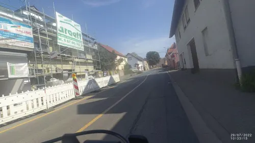
Reinhildes Hofladen
Farm and orchard · 3.1 km
Mo,We 08:30-13:00; Tu,Th 08:30-13:00,15:00-18:00, Fr 08:30-18:00,...



Museums and landmarks28

Selzstellung Dechenberg in Zornheim
Monument and historic site · 3.0 km
Rest des vorgeschobenen Stützpunktes Dechenberg der Selzstellung in Zornheim. Heute mit Efeu eingewachsen.

Fort Muhl
Monument and historic site · 1.9 km
Bunkerdecke des Fort Muhl, Teil der Selzstellungen vom Beginn des 1. Weltkriegs
16 more on the map.
Parks, trails and playgrounds18



Rheinhessen-Bad
Sports field and stadium · 1.1 km
165 Pariser Straße, Nieder-Olm
May 20-Sep 10 Mo 13:00-21:00,May 20-Sep 10 Tu-Fr...


6 more on the map.
Restaurants and cafes56
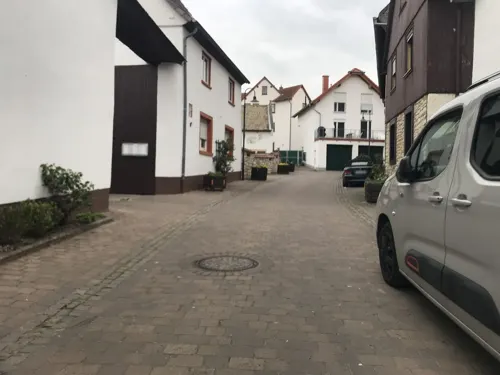
Nieder Olmer Weinstube
Restaurant · Regional
Eingang in der Wassergasse
96 Pariser Straße
Mo-Sa 17:00-23:00; Su 12:00-15:00, 17:00-21:00
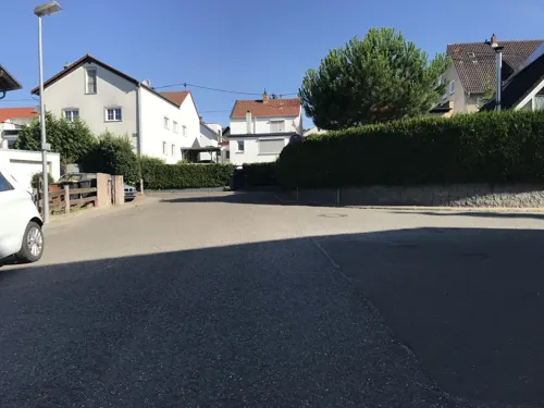
El Greco
Restaurant · Greek · 2.9 km
53 Lannerstraße, Ober-Olm
Tu-Sa 17:00-22:00; Su 11:30-14:30, 17:00-22:00
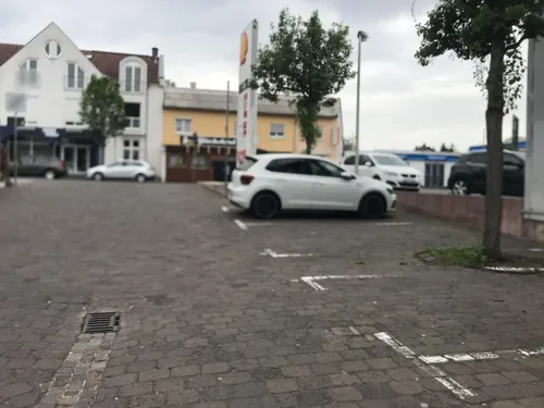
Il Vecchio Mulino
Restaurant · Italian · 0.6 km
6 Bussolengo-Platz, Nieder-Olm
Tu-Fr 12:00-14:30,18:00-23:00; Sa 18:00-23:30; Su 12:00-14:30,18:00-22:30
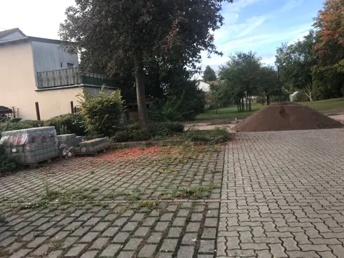
Landgasthaus "Zur Linde"
Restaurant · German · 3.1 km
25 Bahnhofstraße, Klein-Winternheim
Mo-Su 17:30-23:00; We off
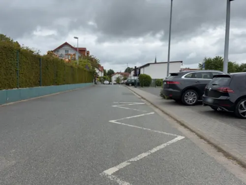
PlatzWart
Restaurant · Regional · 3.2 km
2 Am Sportplatz, Ober-Olm
Mo,We-Sa 17:00-20:30; Su 11:30-14:30
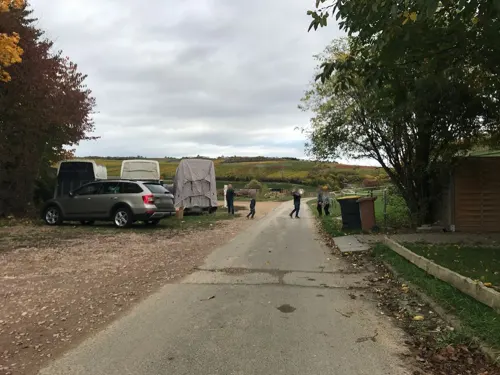
Taverna bei Saki - Essenheimer Reiterstube
Restaurant · Greek · 3.0 km
Im Klotzklauer, Essenheim
We-Fr 17:00-23:00; Sa 15:00-23:00; Su 12:00-23:00
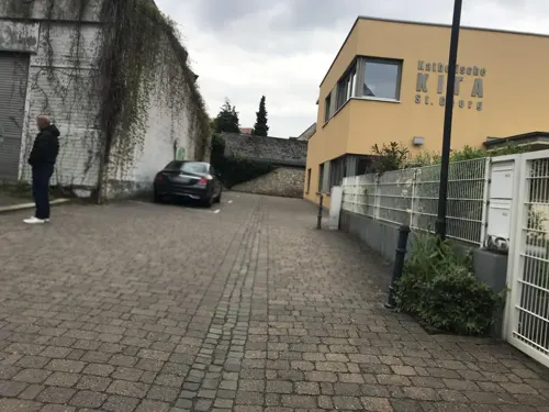


cAPEccino
Cafe · Espresso Und Andere Kaffeespezialitäten, Sowie Kakao, Chai Latte Und Tee · 3.3 km
Ein kleines charmantes Kaffeemobil, das bei gutem Wetter Espresso und andere Spezialitäten ausschenkt.
"Ab und zu Sonntags/Feiertags bei gutem Wetter. Für Nähere Infos...
Oma Lotte Straußwirtschaft
Restaurant · German · 3.3 km
48 Hauptstraße
We-Sa 17:00-22:00; Su 11:00-22:00
44 more on the map.
History
Since so few written documents about Nieder-Olm from the Middle Ages are available, dating Nieder-Olm founding is difficult. Finds from grave digs from the late 6th century, however, point to an early settlement in this area.
It is believed that this may have been brought about by the early Franks during the so-called Fränkische Landnahme (“Frankish Land-Taking”), when the Franks reconquered the lands formerly held by the Romans. The Frankish settlement called Reichelsheim lay roughly where the commercial development now lies in northwest Nieder-Olm and can still be made out in aerial photographs. The placename ending —heim is typical of names that the Franks gave places, including many other nearby places. Reichelsheim, though, was later forsaken.
Read more of the history
From the Middle Ages, Nieder-Olm was an Electoral Mainz holding. It is established by documents that in 899 Archbishop of Mainz Hatto I made over a landholding called Ulmena (Olm) to the wife of Emperor Arnulf of Carinthia with a lifetime term. This estate is believed to have lain in the area now occupied by Ober-Olm and is both municipalities’ namesake. In 994, at Emperor Otto III's behest, the estate was put back under the Archbishopric's ownership. In the late 11th century, ownership was transferred to the Mainz Cathedral Foundation, in which time also arose Saint George's Catholic Church, expedited by strong ecclesiastical influence.
The settlement's first fortifications are believed to date from the 12th century. These were made up of walls and ditches and had four main gates. Later, in the late 13th century, supposedly as a reaction to the building of Stadeck Castle, a castle with a moat was built within the municipal boundaries, to which noble Burgmänner were given priority.
In the 15th century, Nieder-Olm found itself caught between the frontlines in an archiepiscopal feud being waged by Archbishops Diether von Isenburg and Adolf von Nassau. Its consequences entailed frequent changes in rulers. In 1503, Archbishop Berthold had the castle newly built to meet the requirements of what were then modern attack techniques. From this time, the castle was known as St. Laurenziburg. In the years that followed, both the castle and the fortifications were repeatedly destroyed. Today only a few remnants are left. In the early 19th century, the castle finally had to give way to a road. Quite well preserved is the defensive complex at the graveyard, which at the time surrounded the church.
During the Thirty Years' War, Nieder-Olm was repeatedly overrun by the enemy and in 1632 it was occupied by Swedish troops. Some 60 years later, in the Nine Years' War, Nieder-Olm was sacked by French troops.
Once again in the late 18th century, Nieder-Olm was occupied. This time it was French Revolutionary troops. The French put a Liberty pole up in 1792 and made Nieder-Olm a part of the Republic of Mainz, which was the first democratic republic on German territory. Only a short time later – the Republic of Mainz only lasted 100 days – Nieder-Olm was reconquered by Imperial troops.
As soon afterwards as 1797, though, French troops managed to take Nieder-Olm once again, and it thus became part of the Napoleonic Empire. After this fell, Nieder-Olm became in 1816 part of the newly founded province of Rhenish Hesse (Rheinhessen), which also made it part of the Grand Duchy of Hesse-Darmstadt.
With the opening of the Hessian Ludwig Railway from Mainz to Alzey in 1871, Nieder-Olm was linked to the railway network.
After the First World War, Nieder-Olm once again became French-occupied under the terms of the Treaty of Versailles. A border station of the occupied Rhineland was set up in an inn at that time, the Gasthaus zur schönen Aussicht.
Having been returned to German sovereignty in 1929, Nieder-Olm was no more spared National Socialism than any other part of Germany. After Kristallnacht (9 November 1938), in which Jewish houses and shops were looted and destroyed, there were no more Jewish inhabitants in Nieder-Olm.
Into the history of the Second World War went Nieder-Olm when during the Allied advance, scattered German troops in the Selz valley put up considerable resistance. Bearing witness to this time are American emplacements west of the Selz, which have, however, for safety's sake, been filled in.
From 1946, Nieder-Olm belonged to the newly founded state of Rhineland-Palatinate.
In the decades that followed, the infrastructure was under ongoing expansion: new schools arose (in 1957 the new primary school Burgschule Nieder-Olm, in 1974 the Hauptschule and special school and in 1981 the Gymnasium, as well as two schools for physically handicapped pupils and those with learning difficulties), a gymnasium and festival hall (1961) and the indoor and outdoor swimming pool (1968) were built. In 1980 the town acquired a connection to the A 63.
Also in the last two decades, development was steadily furthered: new residential areas were laid out and older ones continually expanded. The commercial area was amply expanded and three new bypasses were built. In 1997 the old festival hall was torn down and replaced with the new Ludwig-Eckes-Halle. Likewise, the indoor and outdoor swimming pool was expanded into an adventure pool.
Further upgrading is planned with a view to barring all through traffic and doing further building work, especially in the area around the primary school and Pariser Straße.
Today, Nieder-Olm has over 10,000 inhabitants and the number is growing. The Rhineland-Palatinate Cabinet decided on 24 October 2006 to grant Nieder-Olm the designation “town” (Stadt in German). Nieder-Olm has been allowed since the delivery of the granting documents on 6 November 2006 by Rhineland-Palatinate Interior Minister Karl Peter Bruch to call itself the “Town of Nieder-Olm” (Stadt Nieder-Olm).
From the History section of Nieder-Olm on Wikipedia, under CC BY-SA 4.0.
More about Nieder-Olm
Geography
Nieder-Olm lies some 10 km south of Mainz in the heart of Rhenish Hesse, on the east bank of the Selz in the northern part of the Rhenish-Hessian Hills (Rheinhessisches Hügelland), known as the Mainz Basin.
The town's average elevation lies at some 150 m above sea level. The highest elevation within municipal limits is the Mühlberg at 243 m in the northeast between Nieder-Olm and Mainz-Ebersheim.
The landscape is strongly characterized by winegrowing and fruit growing. A wood named Im Loh can be found in the northeast of the municipal area. It is only some 11 ha in area.
Predominant here are loess soils, which are of very high quality.
Owing to the location in the Mainz Basin, the climate in Nieder-Olm is very mild and dry.
The mean temperature over the year is 8 °C, making the area one of the warmest in Central Europe. The yearly precipitation is, at 500 mm, rather slight.
Economy
The head office of Eckes AG, a financial holding company, has been in Nieder-Olm since 1857.
The Autobahn A 63 from Kaiserslautern to Mainz passes Nieder-Olm in the west and is linked to the town through two interchanges. On the one hand it is easy to reach the important north–south connection, the A 61 along this road, and on the other, it serves as a feeder to the urban agglomeration of the Frankfurt Rhine Main Region and the other Autobahnen that lead there.
Over several Landesstraßen (State Roads), Nieder-Olm is linked with neighbouring municipalities.
Starting from 2023, Nieder-Olm has its own minibus route numbered 651 with the goal to connect the neighbourhoods with the centre.
The town is further connected with other bus routes to local public transport by the bus operator Kommunalverkehr Rhein-Nahe:
Route 66: Nieder-Olm - Mainz-Ebersheim - Mainz-Hechtsheim - Mainz-Oberstadt - Mainz-Altstadt (Mainzer Verkehrsgesellschaft)
Route 640: RegioLinie Ingelheim - Schwabenheim - Nieder-Olm - Zornheim - Mommenheim - Nierstein-Schwabsburg - Nierstein - Oppenheim
Route 652: Mainz - Klein-Winternheim - Nieder-Olm - Sörgenloch - Hahnheim - Selzen - Köngernheim - Undenheim
Route 653: Mainz - Klein-Winternheim - Ober-Olm - Essenheim - Nieder-Olm
Route 656: Mainz-Lerchenberg - Klein-Winternheim - Ober-Olm - Essenheim - Nieder-Olm
Arts and culture
The Evangelical Parish Church from the Late Classicist period was completed in 1865. It harbours a pulpit and altar table from 1808, both from the now demolished Welschnonnenkirche in Mainz.
Saint George's Catholic Parish Church comes from the year 1779. The quire tower on the east side is a remnant of the old mediaeval church from the 12th century; it was given a greater height and modified later in the 19th century.
Fire brigade's New Year's Ball on the first Saturday in January
Collective Municipality's Wine Culture Days (Weinkulturtage der Verbandsgemeinde) on the third weekend in June
Wind Ensemble's Summer Night Festival (Sommernachtsfest des Bläserchores) in the summer holidays
Kermis (church consecration festival, locally known as the Kerb) on the first weekend in September
From the Wikipedia article Nieder-Olm, under CC BY-SA 4.0.
Where to stay3
Churches and places of worship14
St. Andreas
Church · Roman Catholic · 3.1 km
2 Hauptstraße, Klein-Winternheim
Shopping15
Fahrräder & Reparatur 4Ubikes.de
Shop · 3.3 km
27 Raiffeisenstraße, Klein-Winternheim
Gas and EV charging11
Schools, colleges and libraries11
Healthcare7
Zornheimer Apotheke
Clinic and pharmacy · 2.7 km
12 Nieder-Olmer-Straße, Zornheim
Frau Dr. med. Gabriele Schwab-Vradelis
Clinic and pharmacy · 3.2 km
9 Dietrich-Bonhoeffer-Weg, Ober-Olm
Map of Nieder-Olm
169 places. The map loads OpenStreetMap tiles when you open it.
Getting there and nearby towns
Wiesbaden Army Airfield (WIE) is the nearest airport with scheduled flights listed in OpenStreetMap, 18 km away.
- Mainz 9 km northeast, about 9 min by car
- Wörrstadt 9 km southwest, about 9 min by car
- Nierstein 10 km southeast, about 10 min by car
- Ginsheim-Gustavsburg 12 km northeast, about 12 min by car
- Ingelheim am Rhein 12 km northwest, about 12 min by car
- Oppenheim 13 km southeast, about 13 min by car
- Trebur 15 km east, about 15 min by car
- Bischofsheim 15 km northeast, about 15 min by car
- Walluf 15 km north, about 15 min by car
- Hochheim am Main 16 km northeast, about 16 min by car
Drive times are estimates from straight-line distance, not routes.
Towns near Nieder-Olm


Local news
Headlines from INDB.
Reviews, tips and questions
Loading what members have shared...
Sources and licences
- GeoNames (CC BY 4.0): population, coordinates, regions and time zone
- Mapillary (see each image): photos
- OpenStreetMap contributors (ODbL 1.0): places, airports, map data
- Wikidata (CC0 1.0): elevation, founding date, time zone, website
- Wikimedia Commons (see each image): photos
- Wikipedia (CC BY-SA 4.0): overview and history text
Photo credits
- Nieder-olm, Florian Weyl, Public domain
- Nieder-Olm Kath. Kirche St.Georg 20100618, Rudolf Stricker, Attribution
- Nieder-Olm Evangelische Kirche 20100618, Rudolf Stricker, Attribution
- Backhausstraße in Nieder-Olm, ManuelB701, CC0
- Nieder-Olm - Pariser Straße, Kleinbus der Linie 656, ManuelB701, CC0
- Nieder-Olm - Vorbeifahrt der Linien 651 und 653, ManuelB701, CC0
- Nieder-Olm - Kindergasse, ManuelB701, CC0
- Nieder-Olm - Pariser Straße, alter Stationszeichen, ManuelB701, CC0
- Bushalt Nieder-Olm Kirche, Fahrgastanzeige der MVG, ManuelB701, CC0
- Nieder-Olm - Glockenturm St. Georg zur Blauen Stunde, ManuelB701, CC0
- Nieder-Olm - Steinpfad hinter St. Georg, ManuelB701, CC0
- Stadtbus Nieder-Olm an Kirche, ManuelB701, CC0
- NIeder-Olmer Wochenmarkt im Winter, ManuelB701, CC0
- Nieder-Olm - Marktplatz, Platane zur Blauen Stunde, ManuelB701, CC0
- St. Georg (Nieder-Olm) währender der Blauen Stunde, ManuelB701, CC0
- Marktplatz Nieder-Olm vor dem alten Rathaus 1, Nixnubix, CC BY-SA 3.0
- Nieder-Olm - Rathaus mit Weihnachtsdeko, ManuelB701, CC0
- Nieder-Olm - Altes Rathaus zur Blauen Stunde, ManuelB701, CC0
- Nieder-Olm - Altes Rathaus, Informationstafel und Fahrradständer, ManuelB701, CC0
- BINO - Bücher in Nieder-Olm, ManuelB701, CC0
- Nieder-Olm - Ingelheimer Straße, Betonlampe am Bushalt, ManuelB701, CC0
- Nieder-Olm - Wohnhäuser von An den Selzwiesen, ManuelB701, CC0
- Bushalt Nieder-Olm, Mühlweg, Stadtauswärts, ManuelB701, CC0
- Bushalt Nieder-Olm, Mühlweg vor Ingelheimer Straße 10, ManuelB701, CC0
- Bushaltestelle Nieder-Olm Kirche, Richtung Bahnhof, ManuelB701, CC0
- Nieder-Olm - An den Selzwiesen, ManuelB701, CC0
- Nieder-Olm - Bäckerei Sieben, ManuelB701, CC0
- Nieder-Olm - Wanderwegweiser am Mühlweg, ManuelB701, CC0
- Nieder-Olm - Pariser Straße, DHL-Streetscooter, ManuelB701, CC0
- Nieder-Olm - Fichte an der Pariser Straße, ManuelB701, CC0
- Nieder-Olm - Kreisel Pariser Straße-Oppenheimer Straße-Bahnhofstraße, ManuelB701, CC0
- Haupteingang des Gymnasiums Nieder-Olm- GYMNO-Front, Reuelsiepen, CC BY-SA 3.0
- Ebersheim St Laurentius, Bkmzde, CC BY-SA 3.0
- Klein-Winternheim St. Andreas 20100624, Rudolf Stricker, Attribution
- Ober-Olm Katholische Kirche St.Martin - 2017, Bodow, CC BY-SA 4.0
- Zornheim Evangelische Kirche 20101001, Rudolf Stricker, Attribution
- Soergenloch Germany Church 2, HesseTom, Public domain
- Ev Kirche Ober-Olm DSC9955, Nneuni, CC BY 4.0
- Selzstellung Zornheim, Wiemaha, CC BY-SA 4.0
- Naturschutzgebiet "Am Laurenzihof" an der Selz im Landkreis Mainz-Bingen, Bodow, CC BY-SA 4.0
- Der Hohenberg - Naturschutzgebiet - Landkreis Mainz-Bingen 01, Bodow, CC BY-SA 4.0
- In der Au (19), Sat Ra, CC BY-SA 4.0
- Zornheim Katholische Kirche 20101001, Rudolf Stricker, Attribution
- Katholische St. Valentinus-Kapelle Ober-Olm, Enbodenumer, CC BY-SA 3.0 de
- Burgschule Nieder-Olm, Bendix Grünlich, CC BY-SA 4.0
- Street-level photo, miguel_andrade, CC BY-SA 4.0
- Street-level photo, miguel_andrade, CC BY-SA 4.0
- Street-level photo, miguel_andrade, CC BY-SA 4.0
- Street-level photo, miguel_andrade, CC BY-SA 4.0
- Street-level photo, miguel_andrade, CC BY-SA 4.0
- Street-level photo, miguel_andrade, CC BY-SA 4.0
- Street-level photo, miguel_andrade, CC BY-SA 4.0
- Street-level photo, miguel_andrade, CC BY-SA 4.0
- Street-level photo, miguel_andrade, CC BY-SA 4.0
- Street-level photo, miguel_andrade, CC BY-SA 4.0
- Street-level photo, miguel_andrade, CC BY-SA 4.0
- Street-level photo, miguel_andrade, CC BY-SA 4.0
- Street-level photo, VIA_CH, CC BY-SA 4.0
- Street-level photo, miguel_andrade, CC BY-SA 4.0
- Street-level photo, miguel_andrade, CC BY-SA 4.0
- Street-level photo, miguel_andrade, CC BY-SA 4.0
- Street-level photo, miguel_andrade, CC BY-SA 4.0
- Street-level photo, VIA_CH, CC BY-SA 4.0
- Street-level photo, VIA_CH, CC BY-SA 4.0
- Street-level photo, miguel_andrade, CC BY-SA 4.0
- Street-level photo, miguel_andrade, CC BY-SA 4.0
- Street-level photo, miguel_andrade, CC BY-SA 4.0
- Street-level photo, miguel_andrade, CC BY-SA 4.0
- Street-level photo, miguel_andrade, CC BY-SA 4.0
- Street-level photo, miguel_andrade, CC BY-SA 4.0
- Street-level photo, miguel_andrade, CC BY-SA 4.0
- Street-level photo, VIA_CH, CC BY-SA 4.0


Page built November 9, 2026. Spotted a mistake? Tell us or suggest a place.