


Germersheim, Germany
Germersheim is a town of 20,972 people in Rheinland-Pfalz, Germany.
Why visit Germersheim
Townapedia lists 43 museums and landmarks, 37 parks and trails, 95 places to eat, 8 places to stay and 5 attractions in and around town.
Highlights include Mehlmanufaktur, Rhine Bridge, Germersheim, Ziegeleimuseum Sondernheim and Ludwigstor.
Weather in Germersheim
Forecast from MET Norway (CC BY 4.0). Full forecast
About Germersheim
Germersheim (German: [ˈɡɛʁmɐshaɪm] ) is a town in the German state of Rhineland-Palatinate, of around 20,000 inhabitants. It is also the seat of the Germersheim district. The neighboring towns and cities are Speyer, Landau, Philippsburg, Karlsruhe and Wörth.
From the Wikipedia article Germersheim (this version), under CC BY-SA 4.0.
Things to do5

Mehlmanufaktur
Farm and orchard · 3.5 km
Holzmühle, Westheim
Mo-Fr 09:00-12:00,14:00-18:00; Sa 09:00-13:00



Museums and landmarks43

Ziegeleimuseum Sondernheim
Museum · 2.9 km
1834 gegründete, ehem. Ziegelei Stubenrauch, heute Industriedenkmal, mit 1,2 km langer Feldbahn
Rheindamm, Germersheim
Apr-Oct: Su[1] 10:00-15:00

Ludwigstor
Museum · 0.9 km
Westliches Stadttor der ehem. Festung, 73m langes Gebäude, auf 850 Eichenpfählen errichtet, heute Sitz des Stadt - und Festungsmuseums
2 Ludwigsring, Germersheim
Apr-Dec: Su[1] 10:00-17:00; We 14:00-18:00

Deutsches Straßenmuseum
Museum · 1.0 km
Apr-Sep: Mo-Fr 10:00-17:00; Apr-Sep: Sa,Su,PH 10:00-18:00;...

Zeughaus
Monument and historic site · 1.0 km
Das Zeughaus, im Bereich der ehemaligen Fronte Reuß, war als Material- und Waffenlager ein wichtiger Teil der Festung, 73m Front- und...
Tu-Fr 10:00-18:00; Sa-Su 11:00-18:00; PH 11:00-18:00

Der Rhein
Monument and historic site · 3.9 km
Vermutete Position etwa 50 m vom Nordwestufer bei km 386,75. Bei Vorbereitungen zu einer für den 21. Oktober 2018 geplanten Bergung...


Stadt und Festungsmuseum Germersheim
Museum · 0.9 km
"geöffnet von April bis Dezember, jeden ersten Sonntag im Monat,...

ehem. Seysselkaserne
Monument and historic site
Benannt nach dem General Graf Seyssel d`Aix (1776-1855), war die größte Kriegskaserne der Festung, die Länge der Gebäudefront beträgt 284m
2 An der Hochschule, Germersheim

Kunstverein Germersheim
Museum · 1.0 km
Der Kunstverein Germersheim bringt seit 1992 in Ausstellungen und Veranstaltungen in die neu restaurierten Räume des Zeughauses.
10 Zeughausstraße, Germersheim

Alter Bahnhof
Monument and historic site · 1.2 km
31 Am Alten Bahnhof, Germersheim

Fronte Beckers
Monument and historic site
Benannt nach dem bayerischen General Karl August Reichsgraf von Beckers zu Westerstetten (1770-1832), vollständig erhaltener...
5A,7A,9 An Fronte Beckers
31 more on the map.
Parks, trails and playgrounds37



Motorboot Sportverein Germersheim
Marina and boat launch · 2.6 km
MYCG - Motoryachtclub Germersheim
Marina and boat launch · 2.3 km

Festungspark Fronte Lamotte
Park · 0.7 km
Der Park wurde 2001 eingeweiht, Fronte Lamotte war ein Verteidigungsabschnitt der ehem. Festung mit Hauptumwallung und vorgelagertem...
Luitpoldplatz
Park · 0.6 km
Mitte des 19. Jahunderts noch als Kleiner Paradeplatz benannt
25 more on the map.
Restaurants and cafes95

GFV Clubhaus
Restaurant · Regional, German · 0.8 km
Frische saisonale Küche, Spezialitäten aus der pfälzischen und regionalen Küche
1 Am Sportzentrum Wrede, Germersheim
Tu-Su 11:30-21:00
Schützenhaus am See
Restaurant · Regional, German · 1.9 km
Vorspeisen, Regionale Küche, Fleischgerichte, Fischgerichte, Vegetarische Gerichte, Getränke, Wein, Desserts
Am Schützenhaus, Germersheim
We-Sa 17:00-22:00; Th,Su 11:30-14:00; PH 11:30+
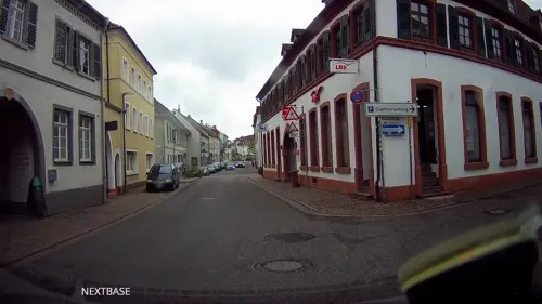
Akropolis
Restaurant · Greek · 0.8 km
18 Hauptstraße, Germersheim
Mo-Sa 17:30-23:00; Su 11:30-14:30,17:30-22:00
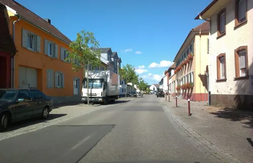
BürgerhausLöwen
Restaurant · German · 3.7 km
40 Hauptstraße, Philippsburg
Mo,Th-Sa 18:00-23:00; Su 10:30-11:30 open "Brunch", 11:30-16:00...
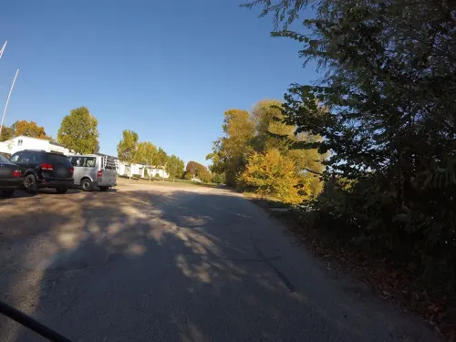
Gaststätte Rhenania
Restaurant · German, Fish, Cake · 1.3 km
1 Werftstraße, Germersheim
We-Sa 11:00-22:00; Su,PH 11:00-21:30; Mo,Tu off
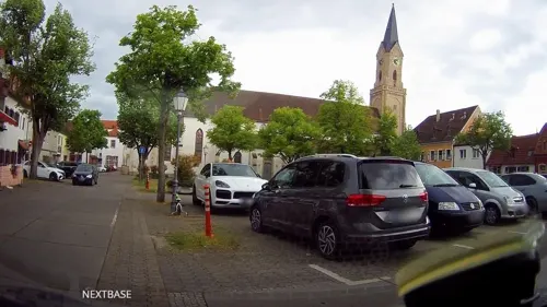


Pizzeria Milano
Restaurant · Pizza · 0.6 km
13 August-Keiler-Straße, Germersheim
Mo-Sa 11:30-14:30,17:30-23:00; Su 11:30-23:00
Restaurant Akropolis
Restaurant · Greek · 3.5 km
8 In den Heidenäckern, Lingenfeld
Mo-Sa 17:00-00:00; Su 11:30-14:30, 17:00-00:00

Bäcker Görtz
Bakery
2 Friedrich-Ebert-Straße, Germersheim
Mo-Fr 05:30-19:00; Sa 06:30-17:00; Su 07:30-17:00; PH off
83 more on the map.
History
After his invasion of Gallia, Gaius Iulius Caesar made the Rhine river the border between the Roman Empire and Germania. Some small areas east of it were later invaded and added to the Roman province of Agri Decumates. As it was attacked more and more it was given up in the second half of the third century and a military camp was founded, named "Vicus Iulii" ("Village of Julius/Julius' Village). It was supported up to the fourth century.
The first record of the name "Germersheim" is from 1090, when it was named in the Sinsheimer Chronik (Chronicle of Sinsheim). The citadel was rebuilt by the emperor Conrad II, and the German king Rudolph von Habsburg (Rudolf of Habsburg) gave Germersheim city rights in 1276 (18 August). There is a legend which says that he, as a sick man, rode from Germersheim to Speyer to die there and not in Germersheim.
In 1325 the town was given to the Electorate of the Palatinate by King Ludwig IV. It got a higher status in the following centuries. A Catholic Order founded a monastery in 1298 which it used up to 1527.
Having been nearly destroyed in the times of the plague and the Thirty Years' War, during which it was conquered by Austria and then by France, Germersheim was burned down by French troops in 1674. Only the crypt and the foundations of the Catholic Church survived.
From the History section of Germersheim on Wikipedia, under CC BY-SA 4.0.
Where to stay8
Churches and places of worship10
Versöhnungskirche
Church · Lutheran · 0.7 km
19 Marktstraße, Germersheim
Sankt Johannes der Täufer
Church · Catholic · 2.8 km
40 Kirchstraße, Germersheim
Moschee Germersheim Islamischer Verein für Völkerverständigung Germersheim e.V.
Place of worship · 0.6 km
9 Lilienstraße
Shopping17
Gas and EV charging5
Schools, colleges and libraries15
Richard-von-Weizsäcker-Realschule plus Germersheim
School · 0.7 km
1 August-Keiler-Straße, Germersheim
Healthcare6
Apotheke Lingenfeld
Clinic and pharmacy · 3.8 km
110 Germersheimer Straße, Lingenfeld
Map of Germersheim
241 places. The map loads OpenStreetMap tiles when you open it.
Getting there and nearby towns
City-Airport Mannheim (MHG) is the nearest airport with scheduled flights listed in OpenStreetMap, 31 km away.
- Philippsburg 7 km east, about 7 min by car
- Linkenheim-Hochstetten 10 km south, about 10 min by car
- Graben-Neudorf 11 km southeast, about 11 min by car
- Waghäusel 11 km east, about 11 min by car
- Speyer 13 km north, about 13 min by car
- Eggenstein-Leopoldshafen 14 km south, about 14 min by car
- Landau in der Pfalz 18 km west, about 18 min by car
- Hockenheim 18 km northeast, about 18 min by car
- Haßloch 18 km northwest, about 18 min by car
- Bruchsal 20 km southeast, about 20 min by car
Drive times are estimates from straight-line distance, not routes.
Local news
Headlines from INDB.
Reviews, tips and questions
Loading what members have shared...
Sources and licences
- GeoNames (CC BY 4.0): population, coordinates, regions and time zone
- Mapillary (see each image): photos
- OpenStreetMap contributors (ODbL 1.0): places, airports, map data
- Wikidata (CC0 1.0): elevation, founding date, time zone, website, landmarks and historic places
- Wikimedia Commons (see each image): photos
- Wikipedia (CC BY-SA 4.0): overview and history text
Photo credits
- 2025-08-19 D500-0364-Pano Achim-Lammerts Germersheim-Stadtverwaltung, Achim Lammerts (Syntaxys), CC BY-SA 4.0
- Germersheim, Hans-Graf-Sponeck-Straße 20181226, P170, CC BY-SA 4.0
- Germersheim, Josef-Probst-Straße, Esso-Tankstelle 20180407, P170, CC BY-SA 4.0
- Wasserturm in Germersheim - panoramio, Immanuel Giel, CC BY 3.0
- Fronte Beckers, Dieser noch vollständig erhaltene Teil der ehemaligen Festung verdeutlicht das für die Festung Germersheim typische Befestigungssystem exemplarisch und wurde benannt nach dem..., qwesy qwesy, CC BY 3.0
- Germersheim, Germany - panoramio (34), Immanuel Giel, CC BY 3.0
- Germersheim, Blumenstraße 20180407 (2), P170, CC BY-SA 4.0
- Uni Germersheim - panoramio, Immanuel Giel, CC BY 3.0
- Germersheim, Germany - panoramio (32), Immanuel Giel, CC BY 3.0
- Festung Germersheim 16, Immanuel Giel, CC BY-SA 3.0
- Germersheim, Germany - panoramio (33), Immanuel Giel, CC BY 3.0
- Die Fronte Beckers ist der letzte, komplett erhaltene, Teil der Festung Germersheim. - panoramio, Immanuel Giel, CC BY 3.0
- Germersheim, Jägerstraße 20171224, P170, CC BY-SA 4.0
- Germersheim, Jägerstraße 20190102, P170, CC BY-SA 4.0
- Germersheim, Gebäude an der Josef-Probst-Straße 20120203, P170, CC BY-SA 4.0
- Germersheim, Jägerstraße Höhe Blumenstraße 20190102, P170, CC BY-SA 4.0
- Germersheim, Germany - panoramio (36), Immanuel Giel, CC BY 3.0
- Festung Germersheim 19, Immanuel Giel, CC BY-SA 3.0
- Germersheim, Bellheimer Straße, Blick zum Wasserturm 20120203, P170, CC BY-SA 4.0
- Germersheim, Kreisverkehr 20120203, P170, CC BY-SA 4.0
- Germersheim, Germany - panoramio (35), Immanuel Giel, CC BY 3.0
- Rheinbrücke Germersheim Eisenbahn, Eurext, CC BY-SA 3.0
- Goethe-Gymnasium Germersheim Aulabau, The original uploader was SPS at German Wikipedia ., CC BY-SA 2.0 de
- Deutsches Straßenmuseum, Germersheim, Germany. Front 01, Gun Powder Ma, CC BY-SA 3.0
- Germersheim Carnot'sche Mauer, The original uploader was SPS at German Wikipedia . Later versions were uploaded by FelixReimann at de.wikipedia ., CC BY-SA 2.0 de
- Stjakobuskirche-ger, P170, CC BY-SA 3.0
- Versöhnungskirche Germersheim 01, Immanuel Giel, CC BY-SA 3.0
- 140914-Sondernheim-03, BlueBreezeWiki, CC BY-SA 3.0
- 20140723Russheimer Altrhein7, AnRo0002, CC0
- Rheinsheim-01, Immanuel Giel, CC BY-SA 3.0
- Kirche-Sondernheim-01, Immanuel Giel, CC BY-SA 3.0
- Lingenfeld, protestantische Christuskirche 20130102, P170, CC BY-SA 4.0
- Germersheim, Festung, Zeughaus 20170531 002, Tilman2007, CC BY-SA 4.0
- Germersheim, Festung, Seyssel-Defesions-Kaserne 20170531 001, Tilman2007, CC BY-SA 4.0
- 150319-Germersheim-01, BlueBreezeWiki, CC BY-SA 3.0
- 20140723Brueckenkopf1, AnRo0002, CC0
- Im Willig 01, Joachim Lutz, CC BY-SA 4.0
- 20140723Russheimer Altrhein5, AnRo0002, CC0
- Festung Germersheim, The original uploader was Pascal Auricht at German Wikipedia ., CC BY-SA 3.0
- Germersheim, Ev. Pfarrkirche 20170531 005, Tilman2007, CC BY-SA 4.0
- In Fronte Beckers ist heute die städtische Musikschule und das Jugendzentrum untergebracht. - panoramio, Immanuel Giel, CC BY 3.0
- Germersheim, Häuser in der Straße Am Vogelpark und Hans-Mayer-Straße 20251228, P170, CC BY-SA 4.0
- Ludwigstor der Festung - panoramio, Immanuel Giel, CC BY 3.0
- Knaudenheim, Anglerskulptur (2), Hozro, CC0
- Street-level photo, derlipper, CC BY-SA 4.0
- Street-level photo, derlipper, CC BY-SA 4.0
- Street-level photo, derlipper, CC BY-SA 4.0
- Street-level photo, derlipper, CC BY-SA 4.0
- Street-level photo, pic_nick, CC BY-SA 4.0
- Street-level photo, wegavision, CC BY-SA 4.0
- Street-level photo, derlipper, CC BY-SA 4.0
- Street-level photo, ramap, CC BY-SA 4.0
- Street-level photo, mfa, CC BY-SA 4.0
- Street-level photo, mfa, CC BY-SA 4.0
- Street-level photo, derlipper, CC BY-SA 4.0
- Street-level photo, mathe-hilde, CC BY-SA 4.0
- Street-level photo, derlipper, CC BY-SA 4.0
- Street-level photo, derlipper, CC BY-SA 4.0
- Street-level photo, derlipper, CC BY-SA 4.0


Page built November 8, 2026. Spotted a mistake? Tell us or suggest a place.