


Hansestadt Stade, Germany
Stade
Hansestadt Stade is a town of 45,634 people in Lower Saxony, Germany.
Why visit Hansestadt Stade
Townapedia lists 62 museums and landmarks, 44 parks and trails, 173 places to eat, 19 places to stay and 24 attractions in and around town.
Highlights include Hof Vollmers, Stadeum, Schwedenspeicher and Freilichtmuseum auf der Insel.
Weather in Hansestadt Stade
Forecast from MET Norway (CC BY 4.0). Full forecast
About Hansestadt Stade
Stade (German pronunciation: [ˈʃtaːdə] ; Low German: Stood), officially the Hanseatic City of Stade (German: Hansestadt Stade, Low German: Hansestadt Stood), is a city in Lower Saxony in northern Germany. First mentioned in records in 934, it is the seat of the district (Landkreis) which bears its name. It is located roughly 45 km (28 mi) to the west of Hamburg and belongs to that city's wider metropolitan region. Within the area of the city are the urban districts of Bützfleth, Hagen, Haddorf and Wiepenkathen, each of which have a council (Ortsrat) of their own with some autonomous decision-making rights.
From the Wikipedia article Stade (this version), under CC BY-SA 4.0.
Travel tips from other travellers: Hansestadt Stade on Wikivoyage (CC BY-SA 4.0).
Photos of Hansestadt Stade


Things to do24
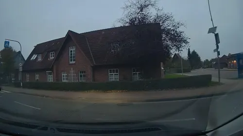
Hof Vollmers
Farm and orchard · 3.7 km
Kartoffeln,...
56 Alte Dorfstraße, Stade
Mo-Sa 07:15-12:30, Mo,Th,Fr 14:00-18:15


Juelssand
Lighthouse · 6.3 km
Leitfeuer Juelssand wird am 11.01.2010 abgeschaltet. Angaben zum Feuer sind aus Seekarten und Leuchtfeuertverzeichnissen zu streichen....



Hofladen Hof Bohlmann
Farm and orchard · 8.3 km
60 Groß Sterneberger Straße, Hammah
Tu-Sa 08:00-12:00, 14:00-18:00
Obsthof Ramdohr
Farm and orchard · 3.9 km
156 Hollernstraße, Hollern-Twielenfleth
Mar Su[-1]-Oct Su[-1] -1 day: Mo-Sa 08:00-18:00; Mar Su[-1]-Oct...

CineStar
Cinema and theater · 1.0 km
1-3 Kommandantendeich, Stade
Mo,Tu 16:30-20:30; We,Th 14:00-20:30; Fr 14:00-23:15; Sa...


12 more on the map.
Museums and landmarks62


Heimatmuseum Stade
Museum · 0.7 km
12 Inselstraße, Stade
24/7 closed "wegen Sanierung geschlossen"


Kunsthaus
Museum · 1.1 km
Tu,Th,Fr 10:00-17:00; We 10:00-19:00; Sa,Su 10:00-18:00

Venti Amica
Monument and historic site · 5.5 km
Galerieholländer
16 Mühlenstraße, Hollern-Twielenfleth

Kupfergalerie UNIKATE
Museum · 5.6 km
57A Hauptstraße, Agathenburg
Tu,Th,Fr 10:00-18:00, We,Sa 10:00-14:00

50 more on the map.
Parks, trails and playgrounds44




Freibad Hollern-Twielenfleth
Sports field and stadium · 5.9 km
"during the bathing season"; Mo 13:00-20:00; Tu-Fr 06:00-20:00;...

Motor- und Yachtclub Stade e.V. - Oberhafen
Marina and boat launch · 3.1 km
Motor- und Yachtclub Stade e.V. - Unterhafen
Marina and boat launch · 3.4 km

32 more on the map.
Restaurants and cafes173
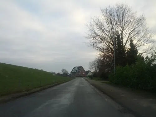
Cafe & Restaurant Auszeit
Restaurant · German · 6.3 km
15 Feriendorf Altes Land, Hollern-Twielenfleth
Tu-Fr 14:30-22:00; Sa 11:30-22:00; Su 11:30-21:00
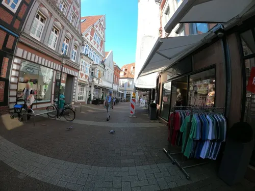
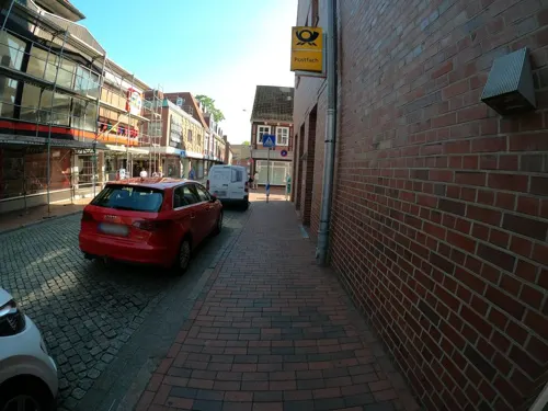
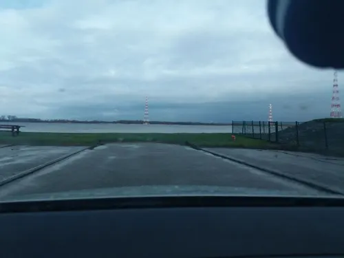
Fährhaus Twielenfleth
Restaurant · Regional, Seafood · 5.8 km
43 Am Deich, Hollern-Twielenfleth
Apr-Sep: Mo-Su 11:30-21:00; Oct-Mar: Tu,Su 11:30-20:00
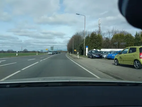
Gül Gemüse Döner Dollern
Restaurant · Italian, Pizza · 7.5 km
3 Hauptstraße, Dollern
Tu-Su 11:30-21:30
Hollerner Hof
Restaurant · Regional · 4.7 km
91 Hollernstraße, Hollern-Twielenfleth
Mo-Sa 16:00+; Su 11:00+
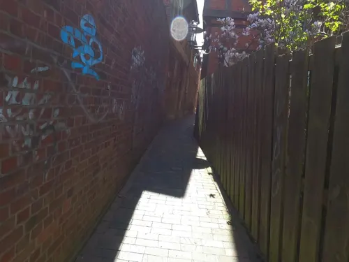
Knechthausen
Restaurant · Western · 1.0 km
20-22 Bungenstraße, Stade
We-Sa "Ab 18:00 Uhr"; Su-Tu "auf Anfrage"
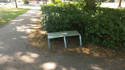

Köpke's Eiscafé
Cafe · Ice Cream · 2.4 km
152 Bremervörder Straße, Stade
Mo-Fr 14:00-20:00; PH,Sa,Su 13:00-20:00

LUCA RESTAURANT
Restaurant · Italian · 1.1 km
4 Wasser Ost, Stade
We, Th 17:30-21:30; Fr 17:30-22:00; Sa 12:00-14:00, 17:30-22:00;...
161 more on the map.
History
The first human settlers came to the Stade area in 30,000 BC.
Swedish and Danish Vikings under Eric the Victorious conquered Stade and looted the town during the 990s. Many prominent Saxons were taken back as slaves by Swedish troops. A majority of Vikings withdrew after taking plenty of plunder. A minor part of the Swedish and Danish forces stayed but were later defeated by reinforcements sent by the emperor.
From 1180 Stade belonged to the Prince-Archbishopric of Bremen. In early 1208 King Valdemar II of Denmark and his troops conquered Stade. In August Valdemar II's cousin, being in enmity with the king, the then Prince-Archbishop Valdemar reconquered the city only to lose it again soon afterwards to Valdemar II. In 1209 Emperor Otto IV persuaded his ally Valdemar II to withdraw to north of the Elbe, and the deposed Prince-Archbishop Valdemar took Stade.
Read more of the history
On 2 May 1209 Otto IV granted important town privileges to Stade. Otto IV confirmed the burghers to be personally free and recognised them as constituting a political entity under their own law, the burgenses and optimi cives of Stade. Property within the municipal boundaries could not be subjected to feudal overlordship and was to be freely inherited without feudal claims to reversion. Fair juridical procedures were constituted and maximal fines fixed. Otto IV committed himself to preventing burghers from being taken as hostages and to liberating captured burghers.
After Otto IV had changed his mind and reinvested Prince-Archbishop Valdemar with the See in 1211, Valdemar II recaptured Stade. In 1213 Otto's elder brother Count Palatine Henry V of the Rhine, reconquered Stade for the Prince-Archbishop. In 1215 Henry repelled another Danish attack on Stade. In the winter of 1216 Valdemar II and his Danish troops, unable to take the city of Stade, ravaged the County of Stade. From then on Stade remained a part of the Prince-Archbishopric of Bremen.
From the 13th century to the late 17th century, Stade was a prominent member of the Hanseatic League, but was later eclipsed by Hamburg. In 1611 the city signed a contract with Sephardic Jews, allowing the foundation of a community. In 1613, Johann Friedrich, Administrator of the Prince-Archbishopric, followed by settling Ashkenazic Jews in the city, but with the turmoil of Catholic conquest and Lutheran reconquest the last archival traces of Jews date from 1630. In 1648, by the Treaty of Westphalia, the Prince-Archbishopric of Bremen underwent a constitutional transformation from a prince-bishopric into a monarchy, the Duchy of Bremen. The duchy and the neighbouring Principality of Verden, colloquially referred to as Bremen-Verden, were granted by the Treaty of Westphalia as an appanage to the Swedish crown. Stade, already under Swedish occupation since 1645, was a part of the Swedish province of Bremen-Verden-Wildeshausen from 1645 to 1712, and some of the buildings built by the Swedes are still in use today.
Stade's heyday lasted until the Thirty Years' War. In 1628 Tilly conquered the town; shortly thereafter, Sweden took possession of it until 1636. After a period of Danish occupation, Sweden finally recaptured it in 1643 and was also officially granted possession of it, together with the Archbishopric of Bremen, in the Peace of Westphalia. Two-thirds of the town were razed in the great town fire on 26 May 1659. The town was rebuilt again to the same plan.
From 1675 to 1676, in the Swedish-Brandenburg War, Swedish Stade was conquered during a campaign by Denmark-Norway and several states of the Holy Roman Empire and remained in allied hands until the end of that war in 1679. Stade, as the headquarters of the Swedish Stadhalter, was besieged from early April 1676 to 13 Aug 1676. In the wake of the Treaty of Saint Germain in 1679, Stade was once again awarded to Sweden.
The Elbe customs station near Stade, in Brunshausen at the mouth of the Schwinge, played special role in trading on the River Elbe from the period of the archbishopric. In 1663, the Swedes stationed an Elbe customs frigate as a permanent patrol ship. This arrangement continued to exist under various rulers until 1850 and the customs station on the Schwinge fieldworks itself existed until 1865.
Swedish sovereignty ended in 1712. Danish troops besieged the town in the Great Northern War and shelled it from 29 August to 7 September 1712, resulting in the destruction of 152 houses, a quarter of the built-up area.
During the Swedish times Stade was the capital of the province.
In 1712 Denmark-Norway conquered Stade and the whole of Bremen-Verden. Stade remained Bremen-Verden's capital also after the Danes ceded it to the Electorate of Hanover in 1715. When in 1823 Bremen-Verden was replaced by new administrative forms, Stade continued to be the capital of the Stade region.
In 1355 and in 1712, Stade suffered from plague epidemics, which killed at least 30–40% of the city's population.
In 1757 following the French Invasion of Hanover, the Hanoverian Army of Observation under Prince William, Duke of Cumberland, and the Privy Council of Hanover (government) took shelter in Stade. Cumberland prepared to defend the town before accepting the Convention of Klosterzeven which brought about a temporary armistice.
From the History section of Stade on Wikipedia, under CC BY-SA 4.0.
Notable people from Hansestadt Stade
 August Karl von GoebenPrussian general (1816-1880)Photo: Unknown author Unknown author, Public domain
 Tabea KemmeGerman footballerPhoto: Sven Mandel, CC BY-SA 4.0
 Amalia Wilhelmina KönigsmarckSwedish poet and painter (1663-1740)Photo: Amalia Wilhelmina Königsmarck, Public domain
 Stefan AustGerman journalistPhoto: Raimond Spekking, CC BY-SA 4.0
 Ulrich de MaizièreGerman general (1912–2006)Photo: Bundeswehr-Fotos Wir.Dienen.Deutschland., CC BY 2.0
 Philip Christoph von KönigsmarckSwedish count of Brandenburgian extraction and a soldierPhoto: Unknown author Unknown author, Public domain
 Stefan KonarskeGerman actorPhoto: Maximilian Bühn, CC BY-SA 4.0
 Patrick DöringGerman politicianPhoto: Patrick Döring, CC BY-SA 3.0
 Juliette SchoppmannGerman singerPhoto: Elke Wetzig Elya, CC BY-SA 3.0
- Ernst-Eberhard HellGerman general (1887–1973)
- Ernst Hans Ludwig KrauseGerman botanist (1859–1942)
- Peter von SiversDanish military officer (1674-1740)
Born in Hansestadt Stade, according to Wikidata (CC0). Each name links to its Wikipedia article.
Where to stay19
Churches and places of worship25
St. Cosmae et Damiani
Church · Lutheran · 0.9 km
Cosmae-Kirchhof, Stade
Shopping58
Gas and EV charging18
Schools, colleges and libraries33
Healthcare18
Map of Hansestadt Stade
250 places. The map loads OpenStreetMap tiles when you open it.
Getting there and nearby towns
Hamburg Finkenwerder Airport (XFW) is the nearest airport with scheduled flights listed in OpenStreetMap, 25 km away.
- Horneburg 12 km southeast, about 12 min by car
- Wedel 15 km east, about 15 min by car
- Drochtersen 14 km northwest, about 14 min by car
- Jork 15 km southeast, about 15 min by car
- Harsefeld 16 km south, about 16 min by car
- Uetersen 16 km northeast, about 16 min by car
- Buxtehude 20 km southeast, about 20 min by car
- Tornesch 20 km northeast, about 20 min by car
- Elmshorn 21 km northeast, about 21 min by car
- Pinneberg 23 km east, about 23 min by car
Drive times are estimates from straight-line distance, not routes.
Towns near Hansestadt Stade


Keep exploring
Local news
Headlines from INDB.
Reviews, tips and questions
Loading what members have shared...
Sources and licences
- GeoNames (CC BY 4.0): population, coordinates, regions and time zone
- Mapillary (see each image): photos
- OpenStreetMap contributors (ODbL 1.0): places, airports, map data
- Wikidata (CC0 1.0): elevation, founding date, time zone, website, landmarks and historic places
- Wikimedia Commons (see each image): photos
- Wikipedia (CC BY-SA 4.0): overview and history text
Photo credits
- Stade-Hansehafen, Jürgen Howaldt, CC BY-SA 2.0 de
- Himmelpforten church, Morn the Gorn, CC BY-SA 3.0
- StadeStCosmaeDamiani, MrsMyer at German Wikipedia, CC BY-SA 3.0
- Exterior of the Athenaeum Stade, Marvin Ruder, CC BY-SA 3.0
- Barger Heide (Stade 2007-07) - panoramio, Tapico, CC BY-SA 3.0
- Naturschutzgebiet Feerner Moor, Lämpel, CC BY-SA 3.0
- StWilhadi-Stade, User:Florean Fortescue, CC BY-SA 2.5
- ItDozent Inselhaus 1, ItDozent, CC BY-SA 3.0
- Heilig-Geist-Kirche (Stade)-Aussenansicht, Bahnmoeller, CC BY-SA 3.0
- Luftaufnahmen Nordseekueste 2012-05-by-RaBoe-483, © Ra Boe / Wikipedia, CC BY-SA 3.0 de
- Naturschutzgebiet Kuhlstückenmoor, Smarties, CC BY-SA 4.0
- Sandentnahme Hammah, Christian Buck, CC BY-SA 4.0
- Schwarzer Berg Winter 2010, SkySilver, CC BY-SA 3.0
- Schwedenspeicher Stade1, Lämpel, CC BY-SA 3.0
- Steinbeck, R2Dine ( Diskussion ), CC BY-SA 4.0
- Cuxhaven Fotoflugkurs 4011, Ailura, CC BY-SA 3.0
- Luftaufnahmen Nordseekueste -Stadeum- 2012-05-by-RaBoe-484, © Ra Boe / Wikipedia, CC BY-SA 3.0 de
- Hollern Orgel Prospekt, Wikiwal, CC BY-SA 3.0
- Leuchtturm Julssand 03, Frank Schwichtenberg, CC BY-SA 3.0
- Moschee in Stood, Tadü, CC BY-SA 4.0
- Johanniskirche Stade 12, Ulf Heinsohn, CC BY-SA 3.0
- Markuskirche Stade 7, Ulf Heinsohn, CC BY-SA 4.0
- Stade Wasser West 07, ClausNe, CC BY-SA 4.0
- Leuchtfeuer Stadersand, Morn the Gorn, CC BY-SA 3.0
- Unterfeuer Bützflethersand, 2, Morn, CC BY-SA 4.0
- Heimatmuseum Stade, Gerd Fahrenhorst, CC BY 4.0
- Gemeinder HF 50 B des DFKM, Bananenschale 99, CC BY-SA 4.0
- Luftaufnahmen Nordseekueste Stade -Parkhotel Stader Hof 2012-05-by-RaBoe-484, © Ra Boe / Wikipedia, CC BY-SA 3.0 de
- Schloss Agathenburg, Hof, PodracerHH at German Wikipedia, CC BY-SA 3.0
- Elbe Klinikum Stade2, SkySilver, CC BY-SA 3.0
- Schloss Agathenburg-msu-1567-, Matthias Süßen, CC BY-SA 4.0
- Haupteingang Vincent-Lübeck-Gymnasium August 2018, Lämpel, CC BY-SA 3.0 de
- St. Cosmae et Damiani Stade 2019, Roland Struwe ( Sneecs ), CC BY 3.0
- ItDozent Insel Eingang Wohltmannbrücke 1, ItDozent, CC BY-SA 3.0
- St. Wilhadi, facade, Morn the Gorn, CC BY-SA 3.0
- Stade.Kunsthaus, Usuari:Flamenc, CC BY-SA 3.0
- Dampflokomotive Nr.1 Des DFKM, Bananenschale 99, CC BY-SA 4.0
- Klinik Dr Hancken, Slomox, CC BY-SA 4.0
- Stolpersteinlage Stade Teichstraße 6, Gmbo 2013, CC0
- Stolperstein Stade Teichstraße 6 Moritz Wertheim, Gmbo 2013, CC0
- Greundiek (Museumsschiff) - panoramio, hh oldman, CC BY 3.0
- Větrný mlýn "Venti Amica", Hollern-Twielenfleth, spolek obcí Lühe, Zemský okres Stade, Německo 2026, Fry72 (Karel Frydrýšek), CC BY-SA 4.0
- Street-level photo, tian, CC BY-SA 4.0
- Street-level photo, 5rmft, CC BY-SA 4.0
- Street-level photo, macsico, CC BY-SA 4.0
- Street-level photo, macsico, CC BY-SA 4.0
- Street-level photo, macsico, CC BY-SA 4.0
- Street-level photo, macsico, CC BY-SA 4.0
- Street-level photo, macsico, CC BY-SA 4.0
- Street-level photo, macsico, CC BY-SA 4.0
- Street-level photo, atze02, CC BY-SA 4.0
- Street-level photo, veloroute_hamburg, CC BY-SA 4.0
- Street-level photo, nesshof, CC BY-SA 4.0
- Street-level photo, jbasic, CC BY-SA 4.0
- Street-level photo, nesshof, CC BY-SA 4.0
- Street-level photo, hotteliene, CC BY-SA 4.0
- Street-level photo, hotteliene, CC BY-SA 4.0
- Street-level photo, StefanS79, CC BY-SA 4.0
- Street-level photo, thetornado76, CC BY-SA 4.0
- Street-level photo, jbasic, CC BY-SA 4.0
- Street-level photo, nesshof, CC BY-SA 4.0
- Street-level photo, zoegglmeyr, CC BY-SA 4.0
- Street-level photo, veloroute_hamburg, CC BY-SA 4.0
- Street-level photo, nesshof, CC BY-SA 4.0
- Street-level photo, thetornado76, CC BY-SA 4.0
- Street-level photo, calmapill, CC BY-SA 4.0
- Street-level photo, nesshof, CC BY-SA 4.0
- Street-level photo, patrickk, CC BY-SA 4.0
- Street-level photo, StefanS79, CC BY-SA 4.0
- Street-level photo, skaycle, CC BY-SA 4.0
- Street-level photo, hendel, CC BY-SA 4.0


Page built November 9, 2026. Spotted a mistake? Tell us or suggest a place.