


Höchst im Odenwald, Germany
Höchst im Odenwald is a town of 10,209 people in Hesse, Germany.
Why visit Höchst im Odenwald
Townapedia lists 116 museums and landmarks, 12 parks and trails, 53 places to eat, 13 places to stay and 16 attractions in and around town.
Highlights include Lichtspiele Höchst, Borberg, Kloster Höchst and Burg Breuberg.
Weather in Höchst im Odenwald
Forecast from MET Norway (CC BY 4.0). Full forecast
About Höchst im Odenwald
Höchst im Odenwald (officially Höchst i. Odw.) is a municipality in the Odenwaldkreis (district) in Hesse, Germany.
From the Wikipedia article Höchst im Odenwald (this version), under CC BY-SA 4.0.
Things to do16




4 more on the map.
Museums and landmarks116



Denkmal f. Höchster Synagoge;Zum Gedenken an die jüdischen Gemeinde Höchst
Monument and historic site
2 Wilhelminenstraße, Höchst im Odenwald


Dein Reich komme
Monument and historic site · Protestant · 0.9 km
Die Stationen des Vaterunserwegs sind ein Teil der geistlichen Angebote am evangelischen Tagungshaus Kloster Höchst.
Dein Wille geschehe wie im Himmel so auf Erden
Monument and historic site · Protestant · 1.1 km
Die Stationen des Vaterunserwegs sind ein Teil der geistlichen Angebote am evangelischen Tagungshaus Kloster Höchst.
Denn dein ist die Kraft und die Herrlichkeit in Ewigkeit. Amen.
Monument and historic site · Protestant
Die Stationen des Vaterunserwegs sind ein Teil der geistlichen Angebote am evangelischen Tagungshaus Kloster Höchst.
104 more on the map.
Parks, trails and playgrounds12

Sandsteinbrüche am Burzelberg bei Frau-Nauses
Hiking and trails · 3.7 km



Grünfläche am Nonnenbrunnen
Park
Sitzgelegenheit unter großem Nussbaum bei Brunnen, Wasser aus der Quelle, bespielbare Rasenfläche
Parkfläche "Am See"
Park
Wird für Flohmärkte, Festivitäten und zum Wandern genutzt. Diverse Bänke, kein gepflasterter Weg, Parkplätze vorhanden

Restaurants and cafes53

Dornrös'chen
Restaurant · German · 3.8 km
Mit Terasse zu Straße und Tal. Hausgemachte Apfelweine.
43 Annelsbacher Tal, Höchst im Odenwald
Th-Su 09:00-21:30
Café am Markt Stapp
Cafe · Coffee Shop · 2.5 km
6 Ernst-Ludwig-Straße, Breuberg
Mo-Fr 06:30-18:00; Sa 06:30-12:00; Su 08:00-17:00; PH off
Heckenhof
Restaurant · Regional · 3.9 km
1, Bad König
Su 10:00+;May-Oct We-Sa 14:00+;Nov-Apr We-Fr 15:00+
Landgasthof Zum Löwen
Restaurant · Regional · 5.0 km
76 Mainstraße, Breuberg
Tu-Sa 16:00-22:00; Su 11:00-14:30,16:00-22:00
Namaste India
Restaurant · Indian · 3.7 km
34 An der Kempfsruh, Höchst im Odenwald
Tu-Sa 11:00-14:30, 17:00-22:00; Su, PH 11:30-21:30; Mo off
Pizza Milan Höchst
Restaurant · Pizza
88a Erbacher Straße, Höchst im Odenwald
Su-Mo, Th 12:00-22:00; We, Fr 14:00-22:00; Sa 15:00-22:00
Restaurant Sonnenhof am Rondell
Restaurant · Regional · 2.8 km
15 Frau Nauses, Groß-Umstadt
Fr 16:00-21:00; Sa,Su 11:00-21:00
Ristorante Acquario
Restaurant · Italian
41 Aschaffenburger Straße, Höchst im Odenwald
We-Su 11:30-14:00, 17:30-22:00
Sophienhof
Restaurant · Regional · 4.7 km
1, Breuberg
We, Sa 11:00-22:00; Th, Fr 17:00-22:00; Su 11:00-21:30
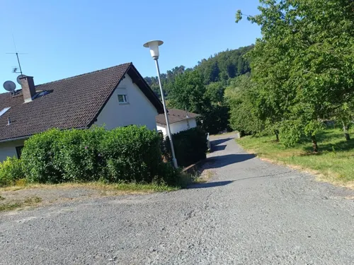
Zum Jonny Gaststätte und Cafe
Restaurant · Regional · 2.1 km
5 Am Roten Rain, Höchst im Odenwald
We-Fr 17:00-22:00; Sa 17:00-23:00; Su 11:00-22:00
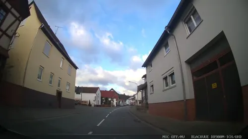


Bäcker Stapp
Bakery · 4.8 km
62 Mainstraße, Breuberg
Mo-Fr 06:30-11:00; Sa 06:30-12:00; Su 08:00-11:00
41 more on the map.
History
The Höchster Becken ("Höchst Basin"), was permanently settled, as were other favourable locations, no later than the New Stone Age. Many Stone Age remnants as well as finds from Celtic and Roman times bear witness to this. In the outlying centre of Hummetroth, a Roman villa rustica from the 2nd century was unearthed and may be visited as an open-air museum. It is known as the Römische Villa Haselburg.
Höchst had its first documentary mention in 1156. Its overlords in the Middle Ages were, among others, the Lords of Breuberg, the Counts of Wertheim, the Lords of Eppstein and the Counts of Erbach. By the time that the Thirty Years' War was over, the community had nearly died out, recovering only very slowly.
Through municipal restructuring in Hesse, the community of Annelsbach, which up to this time had been self-governing, was amalgamated in 1969. Following in 1971 were Forstel, Hummetroth, Pfirschbach, Hassenroth, Mümling-Grumbach, Hetschbach and Dusenbach. Since 1857, the valley of the Obrunnbach has been known as the Obrunnschlucht ("Obrunn Gorge") and has undergone changes due to tourism.
From the History section of Höchst im Odenwald on Wikipedia, under CC BY-SA 4.0.
Where to stay13
Pension Waldblick
Motel and hotel · 1.0 km
20 Siegfriedstraße, Höchst im Odenwald
Churches and places of worship17
Bergkirche Mümling-Grumbach
Church · Protestant · 3.1 km
5 Friedhofsweg, Höchst im Odenwald
Evangelische Kirche Hassenroth
Church · Reformed · 4.8 km
8 Kirchweg, Höchst im Odenwald
Evangelische Kirche Höchst im Odw.
Church · Protestant
1 Kirchberg, Höchst im Odenwald
Evangelische Kirche Rai-Breitenbach
Church · Protestant · 4.4 km
4 Kapellenweg, Breuberg
Gemeindehaus Ev. Kirchengemeinde Mümling-Grumbach
Church · Protestant · 3.1 km
5 Pfarrstraße, Höchst im Odenwald
Shopping12
Gas and EV charging5
Schools, colleges and libraries7
Healthcare7
Vitos Kinder- und Jugendambulanz und Tagesklinik für psychische Gesundheit Höchst im Odenwald
Hospital
84-86 Erbacher Straße, Höchst im Odenwald
Map of Höchst im Odenwald
250 places. The map loads OpenStreetMap tiles when you open it.
Getting there and nearby towns
Frankfurt Airport (FRA) is the nearest airport with scheduled flights listed in OpenStreetMap, 41 km away.
- Ober-Ramstadt 18 km west, about 18 min by car
- Roßdorf 18 km west, about 18 min by car
- Darmstadt 26 km west, about 26 min by car
- Hösbach 27 km northeast, about 27 min by car
- Wald-Michelbach 28 km southwest, about 28 min by car
- Mörlenbach 29 km southwest, about 29 min by car
- Mömbris 32 km north, about 32 min by car
- Offenbach 37 km northwest, about 37 min by car
- Weinheim 37 km southwest, about 37 min by car
- Frankfurt am Main 42 km northwest, about 42 min by car
Drive times are estimates from straight-line distance, not routes.
Local news
Headlines from INDB.
Reviews, tips and questions
Loading what members have shared...
Sources and licences
- GeoNames (CC BY 4.0): population, coordinates, regions and time zone
- Mapillary (see each image): photos
- OpenStreetMap contributors (ODbL 1.0): places, airports, map data
- Wikidata (CC0 1.0): elevation, founding date, time zone, website
- Wikimedia Commons (see each image): photos
- Wikipedia (CC BY-SA 4.0): overview and history text
Photo credits
- Höchst Alte Kirche, ThomasPusch, CC BY-SA 3.0
- Höchst im Odenwald, Kriegerdenkmal 1870-71-01, Muck, CC BY-SA 4.0
- Höchst im Odenwald, Kriegerdenkmal 1870-71-02, Muck, CC BY-SA 4.0
- Höchst im Odenwald, Kriegerdenkmal 1914-18, Muck, CC BY-SA 4.0
- Höchst im Odenwald, Vertriebenendenkmal-02, Muck, CC BY-SA 4.0
- Höchst im Odenwald, Christ-König-Kirche, Muck, CC BY-SA 4.0
- Höchst im Odenwald, Vertriebenendenkmal-01, Muck, CC BY-SA 4.0
- Burg Breuberg05, Haselburg-müller, CC BY-SA 3.0
- Wasserschloß Schloß-Nauses, Dennis140 at German Wikipedia, CC BY-SA 3.0
- Kloster Höchst Terrassenhof, Presse03, CC BY-SA 3.0
- Breuberg Muehlhaeuser Schloesschen Westseite, Haselburg-müller, CC BY-SA 3.0
- Evangelische Pfarrkirche Neustadt01, Haselburg-müller, CC BY-SA 3.0
- EvKirchemitFriedhof (3), Rfuhr, CC BY-SA 3.0
- Ernst-Ludwig-Heilstätte (2), Rfuhr, CC BY-SA 3.0
- Muemling-Grumbach Bergkirche, Haselburg-müller, CC BY-SA 3.0
- Steinkreuze Muemling-Grumbach, Rudolf Wild, CC BY-SA 4.0
- Sandsteinbrüche am Burzelberg bei Frau-Nauses 2021b, Thiotrix, CC BY-SA 4.0
- Evangelische Kirche Hassenroth (2018), Domjtri, CC BY-SA 4.0
- Evangelische Kirche Wiebelsbach (Groß-Umstadt), Domjtri, CC BY-SA 4.0
- Katholische Kirche St. Bartholomäus Heubach (Groß-Umstadt), Domjtri, CC BY-SA 4.0
- Mümling-Grumbach, Drei Steinkreuze (4), Manfred Schröter, Berga, CC BY-SA 4.0
- 2014-06-19 Wasserburg-Schloß-Nauses Herrenhaus, Commander-pirx, CC BY-SA 3.0
- Heubach Wamboltsches Schloesschen01, Haselburg-müller, CC BY-SA 3.0
- ISS067-E-262184 - View of Earth, Earth Science and Remote Sensing Unit , Lyndon B. Johnson Space Center, Public domain
- ISS056-E-164929 - View of Earth, Earth Science and Remote Sensing Unit, NASA Johnson Space Center, Public domain
- ISS051-E-22683 - View of Earth, Earth Science and Remote Sensing Unit , Lyndon B. Johnson Space Center, Public domain
- ISS056-E-164928 - View of Earth, Earth Science and Remote Sensing Unit, NASA Johnson Space Center, Public domain
- ISS067-E-262185 - View of Earth, Earth Science and Remote Sensing Unit , Lyndon B. Johnson Space Center, Public domain
- Mümling Staustufe zwischen Breuberg Sandbach und Höchst, Ben Benzin, CC BY-SA 4.0
- Obrunngraben trocken, Freak-Line-Community, CC BY-SA 4.0
- Bau der Brücke - panoramio (7), Zyzak2846, CC BY-SA 3.0
- Bau der Brücke - panoramio (6), Zyzak2846, CC BY-SA 3.0
- Bau der Brücke - panoramio (5), Zyzak2846, CC BY-SA 3.0
- Bau der kleinen Brücke - panoramio (1), Zyzak2846, CC BY-SA 3.0
- Bau der Brücke - panoramio (4), Zyzak2846, CC BY-SA 3.0
- Bau der Brücke - panoramio (3), Zyzak2846, CC BY-SA 3.0
- Bau der Brücke - panoramio (2), Zyzak2846, CC BY-SA 3.0
- Bau der Brücke - panoramio (1), Zyzak2846, CC BY-SA 3.0
- Bau der Brücke - panoramio, Zyzak2846, CC BY-SA 3.0
- Bau der kleinen Brücke - panoramio, Zyzak2846, CC BY-SA 3.0
- Burg Breuberg Brunnenschacht, Haselburg-müller, CC BY-SA 3.0
- Street-level photo, ramap, CC BY-SA 4.0
- Street-level photo, poxonline, CC BY-SA 4.0
- Street-level photo, Mlink, CC BY-SA 4.0
- Street-level photo, ramap, CC BY-SA 4.0
- Street-level photo, chuck, CC BY-SA 4.0
- Street-level photo, miguel_andrade, CC BY-SA 4.0
- Street-level photo, bct, CC BY-SA 4.0
- Street-level photo, ramap, CC BY-SA 4.0
- Street-level photo, chuck, CC BY-SA 4.0
- Street-level photo, Mlink, CC BY-SA 4.0
- Street-level photo, chuck, CC BY-SA 4.0
- Street-level photo, miguel_andrade, CC BY-SA 4.0
- Street-level photo, chuck, CC BY-SA 4.0
- Street-level photo, ramap, CC BY-SA 4.0
- Street-level photo, Mlink, CC BY-SA 4.0
- Street-level photo, vofi, CC BY-SA 4.0
- Street-level photo, ramap, CC BY-SA 4.0
- Street-level photo, ramap, CC BY-SA 4.0
- Street-level photo, ramap, CC BY-SA 4.0


Page built November 8, 2026. Spotted a mistake? Tell us or suggest a place.