


Why visit Grebenhain
Townapedia lists 32 museums and landmarks, 18 parks and trails, 29 places to eat, 22 places to stay and 29 attractions in and around town.
Highlights include Alte Burg, Hofladen, MUNA-Museum Grebenhain and Teufelsmühle.
Weather in Grebenhain
Forecast from MET Norway (CC BY 4.0). Full forecast
About Grebenhain
Grebenhain (German pronunciation: [ˈɡʁeːbn̩ˌhaɪn]) is a municipality in the Vogelsbergkreis in Hesse, Germany.
From the Wikipedia article Grebenhain (this version), under CC BY-SA 4.0.
Things to do29


Hofladen
Farm and orchard · 6.6 km
9 Erlenweg, Herbstein
Mo,Tu,Th,Fr 09:00-12:30,14:30-18:00; We,Sa 09:00-12:30
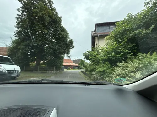
Kastanienhof
Farm and orchard · 5.7 km
14 Völzberger Straße, Birstein
Mo,Th 16:00-18:00; Sa 10:00-12:00




17 more on the map.
Museums and landmarks32

MUNA-Museum Grebenhain
Museum · 2.4 km
7 An der Alten Schule, Grebenhain
Sa 14:00-17:00; Su 10:00-17:00

Teufelsmühle
Monument and historic site · 3.5 km
5 Mühlweg, Grebenhain

Naxburg
Monument and historic site · 5.8 km
Mountain in Hesse, Germany



20 more on the map.
Parks, trails and playgrounds18







6 more on the map.
Restaurants and cafes29
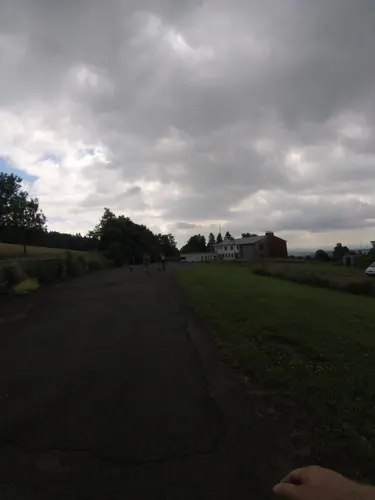
Vogelschmiede
Cafe · Regional · 4.5 km
Hausgemachte Kuchen, Vesperplatten, hausgemachter Kochkäse
19b Rasthausstraße, Grebenhain
Mo-Su 09:00-11:00, 18:00-18:00
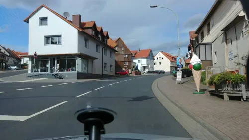
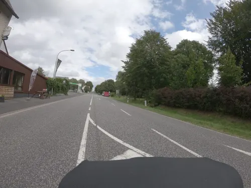
Tor zum Vogelsberg
Restaurant · German, Regional · 4.9 km
6 Lauterbacher Straße, Grebenhain
Mo-Su 11:30-21:00; We off; Th 11:30-17:00

Bäckerei / Cafe Pappert
Bakery
10 Hauptstraße, Grebenhain
Mo-Fr 06:00-18:00, Sa 06:00-17:00, Su 07:00-17:00

Hessischer Hof
Restaurant · Italian · 3.6 km
39 Hindenburgstraße, Grebenhain
Mo-Sa 17:00-23:00; Su,PH 11:00-14:00,17:00-23:00; We off
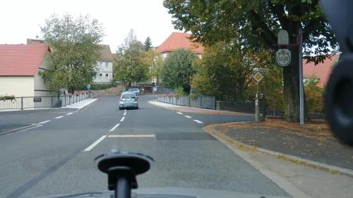



Zum Oberwald
Bar and pub · 6.7 km
29 Herbsteiner Straße, Herbstein
Mo-Su 11:00-13:30,18:00+
17 more on the map.
History
The area nowadays occupied by the greater municipality of Grebenhain in the Vogelsberg was likely settled by waves of settlers from the Wetterau between the eighth and eleventh centuries as part of the expansion carried out in the High Middle Ages by the Abbots of Fulda.
The oldest place in today's municipal area is Crainfeld, which was alluded to as early as the ninth century in a Fulda donation announcement. The first definite and verifiable mention of Crainfeld, however, is in a king's document from 1012, which also mentions Bermuthshain and Ilbeshausen in a document for the first time.
From the History section of Grebenhain on Wikipedia, under CC BY-SA 4.0.
Where to stay22
Churches and places of worship15
Andreaskirche
Church · Protestant · 6.2 km
5 An der Kirche, Herbstein
Evangelische Kirche
Church · Protestant · 5.6 km
3 Reichloser Straße, Freiensteinau
Kath. Kirche Maria Himmelfahrt
Church · Roman Catholic · 0.8 km
13 Eisenbergsweg, Grebenhain
Kirche Lichenroth
Church · Protestant · 5.9 km
35 Bermuthshainer Straße, Birstein
Shopping7
Gas and EV charging4
Schools, colleges and libraries3
Freiherr-vom-Stein-Schule Herbstein
School · 7.7 km
30 Oelegemer Straße, Herbstein
Helmut-von-Bracken-Schule Herbstein
School · 7.7 km
3 Pestalozzistraße, Herbstein
Healthcare3
Map of Grebenhain
162 places. The map loads OpenStreetMap tiles when you open it.
Getting there and nearby towns
Fritzlar Air Base (FRZ) is the nearest airport with scheduled flights listed in OpenStreetMap, 70 km away.
- Herbstein 8 km north, about 8 min by car
- Hosenfeld 10 km east, about 10 min by car
- Schotten 15 km west, about 15 min by car
- Lauterbach 17 km north, about 17 min by car
- Großenlüder 18 km northeast, about 18 min by car
- Schlüchtern 20 km southeast, about 20 min by car
- Neuhof 20 km east, about 20 min by car
- Steinau an der Straße 21 km southeast, about 21 min by car
- Fulda 25 km east, about 25 min by car
- Bad Soden-Salmünster 24 km south, about 24 min by car
Drive times are estimates from straight-line distance, not routes.
Local news
Headlines from INDB.
Reviews, tips and questions
Loading what members have shared...
Sources and licences
- GeoNames (CC BY 4.0): population, coordinates, regions and time zone
- Mapillary (see each image): photos
- OpenStreetMap contributors (ODbL 1.0): places, airports, map data
- Wikidata (CC0 1.0): elevation, founding date, time zone, website, landmarks and historic places
- Wikimedia Commons (see each image): photos
- Wikipedia (CC BY-SA 4.0): overview and history text
Photo credits
- Ansicht Grebenhain, CarstenE, CC BY-SA 3.0
- Grebenhain Grebenhain Tanzplatz Backhaus df, UuMUfQ, CC BY-SA 3.0
- Grebenhain Grebenhain Tanzplatz Bruecke Schwarza 202607 df, UuMUfQ, CC BY-SA 4.0
- Grebenhain Grebenhain Church 202607 a, UuMUfQ, CC BY-SA 4.0
- Grebenhain Grebenhain Tanzplatz Kirche Bruecke Schwarza b, UuMUfQ, CC BY-SA 3.0
- Grebenhain Crainfeld Schwarza Flood River Plain 202508 a, UuMUfQ, CC BY-SA 4.0
- Grebenhain Grebenhain Tanzplatz Backhaus b, UuMUfQ, CC BY-SA 3.0
- Grebenhain Grebenhain Footbridge Schwarza detail d, UuMUfQ, CC BY-SA 3.0
- Grebenhain Grebenhain Footbridge Schwarza d, UuMUfQ, CC BY-SA 3.0
- Grebenhain Crainfeld Kreuzstrasse Edelhof d, UuMUfQ, CC BY-SA 3.0
- Grebenhain Oberwald Oberwald May 2023 pano cyl W small, UuMUfQ, CC BY-SA 4.0
- Grebenhain Grebenhain Pature flooded Detail, UuMUfQ, CC BY-SA 3.0
- Grebenhain Crainfeld Kreuzstrasse Edelhof f, UuMUfQ, CC BY-SA 3.0
- Grebenhain Grebenhain Crainfeld Floodplain Patures flooded a, UuMUfQ, CC BY-SA 3.0
- Grebenhain Crainfeld SCI 555520894 Vogelsbergteiche und Luederaue bei Grebenhain Lueder b, UuMUfQ, CC BY-SA 3.0
- Grebenhain Grebenhain Weidefass Brauchwasser Hydrant b, UuMUfQ, CC BY-SA 3.0
- Grebenhain Crainfeld L3167 K91 Crossroads a, UuMUfQ, CC BY-SA 4.0
- Grebenhain Crainfeld Clearance Cairn 20240810 a, UuMUfQ, CC BY-SA 4.0
- Grebenhain Crainfeld Clearance Cairn 20240810 b, UuMUfQ, CC BY-SA 4.0
- Grebenhain Vaitshain Schwarza River Beaver Pond 20250505 a, UuMUfQ, CC BY-SA 4.0
- Grebenhain Grebenhain Pasture Oaks 202310 E, UuMUfQ, CC BY-SA 4.0
- Grebenhain Crainfeld E Lueder River SCI 555520894 Aue, UuMUfQ, CC BY-SA 4.0
- Grebenhain Grebenhain Pasture Oaks 202310 W, UuMUfQ, CC BY-SA 4.0
- Duttelswiese NR 162827 near Bermuthshain Grebenhain S, UuMUfQ, CC BY-SA 3.0
- Grebenhain Grebenhain Zeltplatz Oberwald Ford 202607 d, UuMUfQ, CC BY-SA 4.0
- Grebenhain Grebenhain Zeltplatz Oberwald Graben am Breungeshainer Weg 202607 a, UuMUfQ, CC BY-SA 4.0
- Grebenhain Grebenhain Zeltplatz Oberwald Hut 202607 df d, UuMUfQ, CC BY-SA 4.0
- Grebenhain Grebenhain Zeltplatz Oberwald Hut 202607 df c, UuMUfQ, CC BY-SA 4.0
- Auf der Naxburg 1, J. Braukmann Milseburg, CC BY-SA 3.0
- Taufstein - Horst, J. Braukmann Milseburg, CC BY-SA 3.0
- Herchenhainer Hoehe, J. Braukmann Milseburg, CC BY-SA 3.0
- Nieder-Mooser-Teich, J. Braukmann Milseburg, CC BY-SA 3.0
- Naxburg, J. Braukmann Milseburg, CC BY-SA 3.0
- Alte Schule Bermuthshain1, CarstenE, CC BY-SA 3.0
- Grebenhain Crainfeld Kirche d entz archit, UuMUfQ, CC BY-SA 3.0
- Vogelsberg - Ilbeshausen - Teufelsmühle - WLMMH 3605, Sven Teschke , Büdingen, CC BY-SA 3.0 de
- Kirche Grebenhain, CarstenE, CC BY-SA 3.0
- Hosenfeld Jossa Kirche db, UuMUfQ, CC BY-SA 3.0
- Blockfelder am Taufstein, Thee uploader, CC BY-SA 3.0
- Ernstberg bei Sichenhausen, Felix Ritz, CC BY-SA 3.0
- Ober-Mooser-Teich, Felix Ritz, CC BY-SA 3.0
- Reichloser Teich, Felix Ritz, CC BY-SA 3.0
- Rothenbachteich, Felix Ritz, CC BY-SA 3.0
- Freiensteinau Salz Bruchwiesen Salz NR 162590 N c, UuMUfQ, CC BY-SA 3.0
- Duttelswiese bei Bermuthshain, Felix Ritz, CC BY-SA 3.0
- Mühlwiesen bei Nieder-Moos, Felix Ritz, CC BY-SA 3.0
- Hoher Vogelsberg Wannersbruch NR 319289 River Alte Hasel Alnus glutinosa, UuMUfQ, CC BY-SA 3.0
- Herbstein Altenschlirf Protestant Church s, UuMUfQ, CC BY-SA 3.0
- Freiensteinau Gunzenau Protestant Church d2, UuMUfQ, CC BY-SA 3.0
- Evangelische Kirche in Ober-Moos, Protestanticus, CC BY-SA 3.0
- Alte Schule 2011-06-18, CarstenE, CC BY-SA 3.0
- Vogelsberg - Ilbeshausen - Teufelsmühle-Wasserrad - WLMMH 3607, Sven Teschke , Büdingen, CC BY-SA 3.0 de
- Roter Berg Bermuthshain, CarstenE, CC BY-SA 3.0
- Schotten Kaulstoss Alte Burg Summit 20251026 c, UuMUfQ, CC BY-SA 4.0
- Schotten Sichenhausen Ernstberg Detail NR 81624 S, UuMUfQ, CC BY-SA 3.0
- Hoher Vogelsberg Rehberg Wilde Saudeck Fagus Trachyte for, UuMUfQ, CC BY-SA 3.0
- Taufstein Bonifatiusborn 01, Own work, CC BY-SA 3.0
- Grebenhain Herchenhain Bonifatiuskanzel s, UuMUfQ, CC BY-SA 3.0
- Grebenhain Herchenhain Das Gesicht s, UuMUfQ, CC BY-SA 3.0
- Street-level photo, chuck, CC BY-SA 4.0
- Street-level photo, nakaner, CC BY-SA 4.0
- Street-level photo, ramap, CC BY-SA 4.0
- Street-level photo, nakaner, CC BY-SA 4.0
- Street-level photo, kreuzschnabel, CC BY-SA 4.0
- Street-level photo, ramap, CC BY-SA 4.0
- Street-level photo, ramap, CC BY-SA 4.0
- Street-level photo, LaraBr98, CC BY-SA 4.0
- Street-level photo, kreuzschnabel, CC BY-SA 4.0
- Street-level photo, nakaner, CC BY-SA 4.0
- Street-level photo, ramap, CC BY-SA 4.0
- Street-level photo, ramap, CC BY-SA 4.0
- Street-level photo, ramap, CC BY-SA 4.0
- Street-level photo, LaraBr98, CC BY-SA 4.0
- Street-level photo, chuck, CC BY-SA 4.0
- Street-level photo, ramap, CC BY-SA 4.0
- Street-level photo, LaraBr98, CC BY-SA 4.0
- Street-level photo, kreuzschnabel, CC BY-SA 4.0
- Street-level photo, ramap, CC BY-SA 4.0
- Street-level photo, ramap, CC BY-SA 4.0


Page built November 9, 2026. Spotted a mistake? Tell us or suggest a place.