


Why visit Schlüchtern
Townapedia lists 98 museums and landmarks, 44 parks and trails, 88 places to eat, 13 places to stay and 59 attractions in and around town.
Highlights include Theatrium Steinau, Seidenröther Warte, Teufelshöhle and Brüder Grimm-Haus Steinau.
Weather in Schlüchtern
Forecast from MET Norway (CC BY 4.0). Full forecast
About Schlüchtern
Schlüchtern (German pronunciation: [ˈʃlʏçtɐn] ) is a town in the Main-Kinzig district, in Hessen, Germany. It is located on the river Kinzig, approximately 30 km southwest of Fulda. Schlüchtern has a population close to 16,000.
From the Wikipedia article Schlüchtern (this version), under CC BY-SA 4.0.
Things to do59
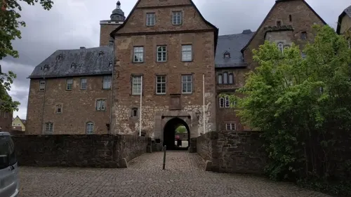

Seidenröther Warte
Scenic view · 7.9 km
Die Seidenröther Warte ist der Nachbau eines mittelalterlichen Beobachtungsposten und stand ursprünglich ca. 190 m nordöstlich von hier....



Herbertehof
Farm and orchard · 8.6 km
Mo-Sa "Nach telefonischer Anfrage"; PH off
47 more on the map.
Museums and landmarks98

Teufelshöhle
Monument and historic site · 5.1 km
Cave in Germany
1 Mooshecke
Apr 20-Sep 30: Mo-Fr 11:00-17:00; Sa 11:00-18:00; PH,Su 10:00-18:00

Brüder Grimm-Haus Steinau
Museum · 6.1 km
80 Brüder-Grimm-Straße, Steinau an der Straße
Mo-Su 10:00-17:00



Kloster Schlüchtern
Monument and historic site
Im Kloster, Schlüchtern


Schloß Ramholz
Monument and historic site · 6.4 km
2 Parkstraße, Schlüchtern

Schloss Steinau
Monument and historic site · 6.1 km
1-7 Im SchIoß, Steinau an der Straße
86 more on the map.
Parks, trails and playgrounds44

Erlebnispark Steinau an der Straße
Sports field and stadium · 6.5 km
1 Thalhof, Steinau an der Straße
09:00-18:00




Lietebach und Kelterberg von Ahlersbach und Hohenzell
Hiking and trails · 3.6 km


32 more on the map.
Restaurants and cafes88

Deutsches Haus
Restaurant · German, Pizza · 7.8 km
2 In der Ährecke, Steinau an der Straße
Mo-Fr 16:30-23:00; Tu off; We off; Sa 11:00-23:00; Su 11:00-21:30
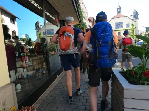
Gasthaus Hausmann
Restaurant · German, Hessian, Regional
5 Obertorstraße, Schlüchtern
Mo-Sa 11:30-14:00; Mo-Tu 18:00-23:30; Th-Fr 18:00-23:30
La Vita
Restaurant · Italian
Ristorante, Pizzeria
53 Krämerstraße, Schlüchtern
Tu-Fr, Su 11:00-14:00, 17:00-23:00; Sa 17:00-23:00
Bellingser Elephant
Restaurant · German · 4.6 km
4 Sportplatzweg, Steinau an der Straße
Tu 17:00-24:00; Su,PH 11:30-17:00
Brathähnchen Farm
Restaurant · 3.7 km
1 Im Ohl, Steinau an der Straße
Tu-Su 12:00-22:00; PH 12:00-22:00
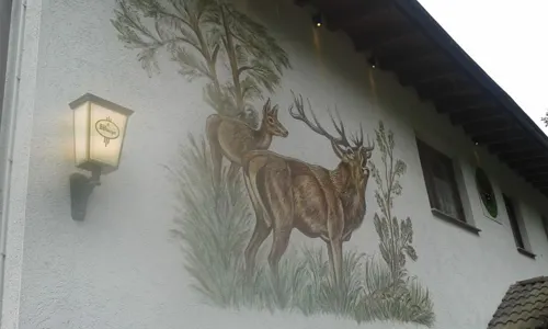
Fabrice Café
Cafe · Regional, Coffee Shop, Burger, Ice Cream, German, Breakfast, Noodle
3 Breitenbacher Straße, Schlüchtern
Mo-Sa 05:30-18:00; Su 10:00-18:00
Gaststätte Bauernschänke
Restaurant · German, Burger · 6.3 km
28 Ringstraße
Tu 18:00-23:30; We-Th 18:00-22:00; Fr-Sa 18:00-22:30
Landgasthaus Bayrischer Hof
Restaurant · 8.4 km
2 Am Bayrischen Hof, Steinau an der Straße
Tu,Th-Sa 17:00-20:00+; Mo,We off; Su 12:00-14:00,17:00-21:30

Manuelas Café Stübchen
Cafe · Sandwich, Ice Cream, Tea, Cake, Coffee Shop · 8.2 km
2 Michaelspfad, Sinntal
Mo-Fr 08:30-18:00; Sa-Su 14:00-18:00
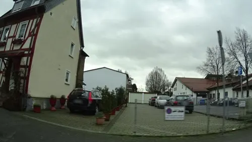


Ristorante da Carlo
Restaurant · Italian, Mediterranean, Fish, Pasta, Pizza, Dessert
13 Schloßstraße, Schlüchtern
Mo 12:00-14:00,17:00-21:30; We-Sa 12:00-14:00,17:00-21:30; Su...
76 more on the map.
History
The town itself is mentioned in a document for the first time in 1278. However, since by the mid-12th century there was a family using that name, the town is likely older than that.
The oldest documented local establishment was the Benedictine abbey of Schlüchtern. A foundation document allegedly signed by Charlemagne was discovered to be a medieval forgery. A possible first mention of the abbey dates from 819, but cannot be attributed without doubt to this location. The earliest mention that irrefutably referred to Schlüchtern Abbey dates from 993, when Otto III granted the abbey sluohderin to the Bishop of Würzburg.
The abbey became influential and by the High Middle Ages had acquired substantial land holdings far beyond the Kinzig valley. However, by the late Middle Ages its power was already waning. The Peasants' War and the Reformation accelerated its decline. The last (Protestant) abbot, Johannes Wankel, died in April 1609. Today, the abbey buildings continue to serve as a Gymnasium (school) and education facility for the regional Protestant church.
The abbey church, rebuilt in Gothic style in the 15th century, became a teachers' seminary in 1835/6. However, the crypt from Carolingian times has been preserved.
An ancient trade route, the Eselsweg connected Schlüchtern to Großheubach/Miltenberg on the river Main.
From the History section of Schlüchtern on Wikipedia, under CC BY-SA 4.0.
Where to stay13
Haus Sigrid Zimmervermietung
Motel and hotel · 6.5 km
4 Auf der Leimenheeg, Steinau an der Straße
Fremdenzimmer Westenberger
Motel and hotel · 7.8 km
5a Oberdorfstraße, Steinau an der Straße
Churches and places of worship33
Mariae Himmelfahrt
Church · Catholic · 7.9 km
12 An der Kirche, Steinau an der Straße
Reinhardskirche
Church · Protestant · 5.9 km
5 Ziegelgasse, Steinau an der Straße
Shopping27
Gas and EV charging18
Schools, colleges and libraries21
Healthcare10
Praxisklinik Dr. med. Sonchai Tiyaworabun
Clinic and pharmacy
7-9 Breitenbacher Straße, Schlüchtern
Map of Schlüchtern
250 places. The map loads OpenStreetMap tiles when you open it.
Getting there and nearby towns
Frankfurt Airport (FRA) is the nearest airport with scheduled flights listed in OpenStreetMap, 79 km away.
- Steinau an der Straße 6 km southwest, about 6 min by car
- Neuhof 13 km northeast, about 13 min by car
- Bad Soden-Salmünster 14 km southwest, about 14 min by car
- Bad Orb 18 km southwest, about 18 min by car
- Wächtersbach 19 km southwest, about 19 min by car
- Eichenzell 20 km northeast, about 20 min by car
- Lauterbach 33 km north, about 33 min by car
- Schotten 33 km northwest, about 33 min by car
- Gemünden am Main 36 km south, about 36 min by car
- Schlitz 36 km north, about 36 min by car
Drive times are estimates from straight-line distance, not routes.
Local news
Headlines from INDB.
Reviews, tips and questions
Loading what members have shared...
Sources and licences
- GeoNames (CC BY 4.0): population, coordinates, regions and time zone
- Mapillary (see each image): photos
- OpenStreetMap contributors (ODbL 1.0): places, airports, map data
- Wikidata (CC0 1.0): elevation, founding date, time zone, website
- Wikimedia Commons (see each image): photos
- Wikipedia (CC BY-SA 4.0): overview and history text
Photo credits
- Kloster Schlüchtern Südseite 2, Reinhard Dietrich, CC0
- Steinau Brüder-Grimm-Haus 2016-04-10-12-06-37, Alexander Hoernigk, CC BY 3.0
- Burg Steckelberg2, Emmaus at German Wikipedia, Public domain
- Aerial image of Schloss Ramholz (view from the southwest), Carsten Steger, CC BY-SA 4.0
- Schloss Steinau Panorama Fotos RL - Stitch GD, Fotografien von Rainer Lippert , zusammengefügt von mir, Grand-Duc, Public domain
- Kloster Schlüchtern Westfassade 1, Reinhard Dietrich, CC0
- Steinau an der Straße, die Reinhardskirche, Dguendel, CC BY 3.0
- Flieden Synagoge, Unknown author Unknown author, Public domain
- Die Bellingerwarte am Bellinger Berg, Ersin Caylak, CC BY-SA 4.0
- NSG Neudorfwiesen bei Steinau 2022-03-09 02, Leonhard Lenz, CC0
- Die Ohlwarte im Ohlsteinbruch bei Steinau an der Straße, Ersin Caylak, CC BY-SA 4.0
- Schluechtern Elm Hainberg bei Elm SCI 555520983 may, UuMUfQ, CC BY-SA 3.0
- Schluechtern Elm Ebertsberg SCI 555520980 S, UuMUfQ, CC BY-SA 3.0
- Kloster und Hadermann, Alphasigma, CC BY-SA 4.0
- Bellinger Warte, Emmaus, Attribution
- Ev. Kirche Schlüchtern-Elm, FauleBirne 007, CC BY-SA 4.0
- Gundhelm, Ev. Kirche und Kirchhof Schlüchtern 20230304 0003, Tilman2007, CC BY-SA 4.0
- Seidenrother Warte, Surveyor54, Attribution
- Bellinger Warte 2014, Surveyor54, Attribution
- Lauterschlösschen vorne, Reinhard Dietrich, CC0
- Burgruine Steckelberg 08, Commander-pirx, CC BY-SA 4.0
- SteinauBGHFrosch retouched, Unknown author, CC BY-SA 3.0
- Schloss Steinau, 3, Rainer Lippert, CC0
- Street-level photo, chuck, CC BY-SA 4.0
- Street-level photo, chuck, CC BY-SA 4.0
- Street-level photo, bernd_niemann, CC BY-SA 4.0
- Street-level photo, cello, CC BY-SA 4.0
- Street-level photo, chuck, CC BY-SA 4.0
- Street-level photo, ramap, CC BY-SA 4.0
- Street-level photo, chuck, CC BY-SA 4.0
- Street-level photo, chuck, CC BY-SA 4.0
- Street-level photo, ramap, CC BY-SA 4.0
- Street-level photo, ramap, CC BY-SA 4.0


Page built November 8, 2026. Spotted a mistake? Tell us or suggest a place.