


Why visit Haibach
Townapedia lists 38 museums and landmarks, 25 parks and trails, 55 places to eat, 8 places to stay and 33 attractions in and around town.
Highlights include Büchelberg, Fußberg, Kippenburg and museum Pompejanum.
Weather in Haibach
Forecast from MET Norway (CC BY 4.0). Full forecast
About Haibach
Haibach (German pronunciation: [ˈhaɪbax]) is a municipality in the Aschaffenburg district in the Regierungsbezirk of Lower Franconia (Unterfranken) in Bavaria, Germany. It has a population of around 8,300.
From the Wikipedia article Haibach, Lower Franconia (this version), under CC BY-SA 4.0.
Things to do33




21 more on the map.
Museums and landmarks38

Kippenburg
Monument and historic site · 2.5 km
Künstlich errichtete Burganlage, 1839 von Adam Kipp
Jul

museum Pompejanum
Museum · 5.3 km
Cultural heritage monument D-6-61-000-232 (0) in Aschaffenburg, Bavaria

Naturwissenschaftlichen Museum Aschaffenburg
Museum · 4.3 km
Museum in Bavaria, Germany

Schloss Johannisburg
Museum · 4.9 km
Palace in Aschaffenburg, Germany

Staatsgalerie Aschaffenburg
Museum · 4.9 km
Art museum in Schloss Johannisburg in Aschaffenburg





26 more on the map.
Parks, trails and playgrounds25


13 more on the map.
Restaurants and cafes55

Zeughaus
Restaurant · German · 2.9 km
5 Bismarckallee, Aschaffenburg
Mo-Sa 17:30-23:00; Su 11:30-14:30,17:30-22:00
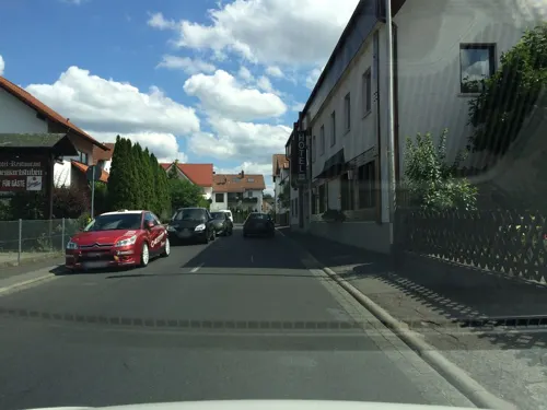
Spessartstuben
Restaurant · Bavarian, Regional, International
7 Jahnstraße, Haibach
Mo-Fr 17:00-21:30; Su 12:00-14:00,17:00-21:30
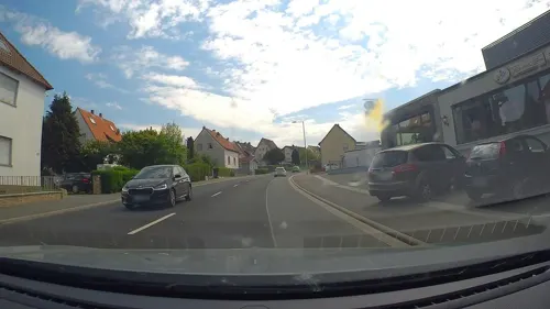
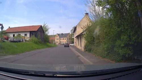
Klosterschänke
Restaurant · German · 2.7 km
4 Schmerlenbacher Straße, Schmerlenbach
We-Sa 11:00-22:00; Su 11:00-21:00; Mo,Tu off
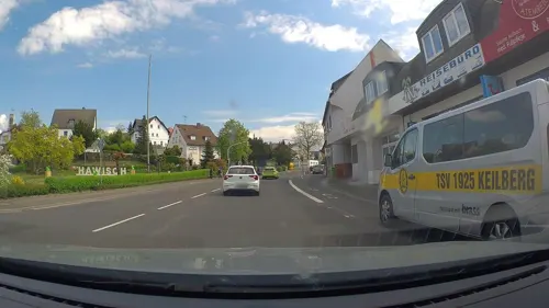
Gasthaus"zum Weißen Roß"
Restaurant · 2.8 km
3 Dorfstraße, Bessenbach
Su,We 11:00-22:00;Mo,Th,Fr 16:00-22:00
Ristorante La Villetta
Restaurant · Pizza, Noodle · 2.8 km
56 Molkenbornstraße, Aschaffenburg
Tu-Sa 17:30-22:30


43 more on the map.
History
Haibach had its first documentary mention in 1187. At the time there was a noble seat called Ketzelburg on the edge of the municipality, whose ruins were archaeologically explored in 2004 and 2005.
Haibach's original name was Haginaha, meaning "Border Brook". Over the course of 500 years the name became Hegebach, Heybach and Haydebach until 1790 when it settled on the current form.
In the course of municipal reform in 1978, the former municipality of Dörrmorsbach was amalgamated with Haibach. As early as 1972, Grünmorsbach had been swallowed up into the greater municipality.
In the Bavaria State Development Plan (Landesentwicklungsplan Bayern), Haibach is set out as a small centre and is among the most progressive municipalities in the Vorspessart and Lower Main regions.
Out of the original residential and farming village, Haibach developed after the Second World War into more of a preferred residential municipality in the Aschaffenburg region. With small and midsize industrial and craft businesses locating here, the municipality was strengthened in its economic performance and tax base. A school centre with primary school and Hauptschule was built in 1965 and three kindergartens sponsored by the Catholic church administration and the Saint John organizations were established.
From the History section of Haibach, Lower Franconia on Wikipedia, under CC BY-SA 4.0.
Where to stay8
Churches and places of worship12
Kath. Kirche St. Matthäus
Church · Catholic · 1.9 km
3 Glaserstraße, Aschaffenburg
Sankt Laurentius
Church · Roman Catholic · 2.6 km
20 Dörrmorsbacher Straße, Haibach
Neue Kath. Kirche St. Johannes d. Täufer
Church · Catholic · 0.7 km
11 Breitenwiesenstraße
Shopping12
Schreck F.J. oHG Eisenhandlung
Hardware store · 2.2 km
1 Fürther Straße, Aschaffenburg
Gas and EV charging6
Schools, colleges and libraries5
Healthcare7
Elisabeth-Apotheke
Clinic and pharmacy · 2.5 km
4-6 Josef-Dinges-Straße, Aschaffenburg
Map of Haibach
201 places. The map loads OpenStreetMap tiles when you open it.
Getting there and nearby towns
Frankfurt Airport (FRA) is the nearest airport with scheduled flights listed in OpenStreetMap, 48 km away.
- Aschaffenburg 4 km west, about 4 min by car
- Goldbach 4 km northwest, about 4 min by car
- Hösbach 5 km north, about 5 min by car
- Sulzbach am Main 7 km southwest, about 7 min by car
- Mainaschaff 9 km west, about 9 min by car
- Laufach 9 km northeast, about 9 min by car
- Stockstadt am Main 10 km west, about 10 min by car
- Kleinwallstadt 10 km south, about 10 min by car
- Großostheim 11 km southwest, about 11 min by car
- Kleinostheim 11 km west, about 11 min by car
Drive times are estimates from straight-line distance, not routes.
Local news
Headlines from INDB.
Reviews, tips and questions
Loading what members have shared...
Sources and licences
- GeoNames (CC BY 4.0): population, coordinates, regions and time zone
- Mapillary (see each image): photos
- OpenStreetMap contributors (ODbL 1.0): places, airports, map data
- Wikidata (CC0 1.0): elevation, founding date, time zone, website, landmarks and historic places
- Wikimedia Commons (see each image): photos
- Wikipedia (CC BY-SA 4.0): overview and history text
Photo credits
- Haibach - vom Erbig aus, Maulaff, CC BY-SA 3.0
- Haibach ND Quercus Jahnstr, KaiBorgeest, CC BY-SA 4.0
- Haibach ND05262 fW, KaiBorgeest, CC BY 4.0
- Haibach ND05262 fE, KaiBorgeest, CC BY 4.0
- Haibach ND Tilia Nepomuk 4, KaiBorgeest, CC BY-SA 4.0
- Haibach Friedhofskreuz, KaiBorgeest, CC BY-SA 4.0
- Haibach Hauptstr 72, KaiBorgeest, CC BY-SA 4.0
- Burgstall Haibach - heute, Commander-pirx, CC BY-SA 4.0
- Haibach Wuerzburger Str 184 186, KaiBorgeest, CC BY-SA 4.0
- Haibach Wuerzburger Str 249, KaiBorgeest, CC BY-SA 4.0
- Aschaffenburg - Pompejanum - 5396, Sven Teschke , Büdingen, CC BY-SA 3.0 de
- Aschaffenburg dum printempo Schönborner Hof 1, No machine-readable author provided. ThomasPusch assumed (based on copyright claims)., CC BY-SA 3.0
- Schloss Johannisberg (Aschaffenburg) II, Jörg Braukmann, CC BY-SA 4.0
- Schloss Johannisburg Aschaffenburg, Wladyslaw Sojka at German Wikipedia ( Original text: ? Wladyslaw [Disk.] ), CC BY-SA 3.0
- Stiftskirche Sankt Peter und Alexander Aschaffenburg, Johann H. Addicks - [email protected], CC BY-SA 3.0
- St Matthäus Gailbach aussen, ekpah, CC BY-SA 3.0
- Stengerts - Berg im Spessart, Maulaff at German Wikipedia, CC BY-SA 3.0
- Hasenkopf, Freak-Line-Community, CC BY-SA 4.0
- Klinikum Aschaffenburg und Gartenberg, Freak-Line-Community, CC BY-SA 4.0
- Haibach Doerrmorsbach St Laurentius, KaiBorgeest, CC BY-SA 4.0
- Brunnenstube, Freak-Line-Community, CC BY-SA 3.0
- Sühnekreuz (Schmerlenbach), Kd6=dra, CC0
- Schmerlenbach, Klosterkirche-001a, Tilman2007, CC BY-SA 3.0
- AB Teufelskanzel, KaiBorgeest, CC BY-SA 4.0
- FHeymann, User:Ekpah, CC BY-SA 3.0
- AB Kippenburg, KaiBorgeest, CC BY-SA 3.0
- AB Godelsb Ludwigssaeule, KaiBorgeest, CC BY-SA 3.0
- Haibach Doerngraben, KaiBorgeest, CC BY-SA 3.0
- Luftaufnahme des Fasaneriesee Aschaffenburg, Verbesserer7, CC BY-SA 4.0
- Dörnbach, Freak-Line-Community, CC BY-SA 3.0
- Schmerlenbach, Klosterkirche-001, Tilman2007, CC BY-SA 3.0
- Burgstall Ketzelburg 1, Commander-pirx, CC BY-SA 4.0
- Grasbüschel aus Grasstreu, Plexi83, CC BY-SA 4.0
- Grasstreu, Plexi83, CC BY-SA 4.0
- Fire-fighting-facility node-3409715905, Thoric67, CC BY 4.0
- Fire-fighting-facility node-3422595516, Thoric67, CC BY 4.0
- Fire-fighting-facility node-3400117832, Thoric67, CC BY 4.0
- Fire-fighting-facility node-3830705399, Thoric67, CC BY 4.0
- Fire-fighting-facility node-3623207228, Thoric67, CC BY 4.0
- Fire-fighting-facility node-3410465662, Thoric67, CC BY 4.0
- AB Godelsberg Steinbank, KaiBorgeest, CC BY-SA 4.0
- Goldbacher Kanzel, Freak-Line-Community, CC BY-SA 4.0
- Klappermühlchen Haibach, Freak-Line-Community, CC BY-SA 4.0
- Street-level photo, m_groebs, CC BY-SA 4.0
- Street-level photo, poxonline, CC BY-SA 4.0
- Street-level photo, poxonline, CC BY-SA 4.0
- Street-level photo, poxonline, CC BY-SA 4.0
- Street-level photo, tob1, CC BY-SA 4.0
- Street-level photo, poxonline, CC BY-SA 4.0
- Street-level photo, poxonline, CC BY-SA 4.0
- Street-level photo, kontali63, CC BY-SA 4.0
- Street-level photo, mapcreator, CC BY-SA 4.0
- Street-level photo, chuck, CC BY-SA 4.0
- Street-level photo, m_groebs, CC BY-SA 4.0
- Street-level photo, chuck, CC BY-SA 4.0
- Street-level photo, mapcreator, CC BY-SA 4.0
- Street-level photo, Velo63739, CC BY-SA 4.0
- Street-level photo, Velo63739, CC BY-SA 4.0
- Street-level photo, poxonline, CC BY-SA 4.0
- Street-level photo, kontali63, CC BY-SA 4.0
- Street-level photo, Velo63739, CC BY-SA 4.0
- Street-level photo, Velo63739, CC BY-SA 4.0
- Street-level photo, Velo63739, CC BY-SA 4.0
- Street-level photo, kontali63, CC BY-SA 4.0
- Street-level photo, m_groebs, CC BY-SA 4.0
- Street-level photo, kontali63, CC BY-SA 4.0
- Street-level photo, kontali63, CC BY-SA 4.0
- Street-level photo, Velo63739, CC BY-SA 4.0
- Street-level photo, mapcreator, CC BY-SA 4.0
- Street-level photo, Velo63739, CC BY-SA 4.0
- Street-level photo, Velo63739, CC BY-SA 4.0
- Street-level photo, mapcreator, CC BY-SA 4.0
- Street-level photo, kontali63, CC BY-SA 4.0
- Street-level photo, kontali63, CC BY-SA 4.0
- Street-level photo, m_groebs, CC BY-SA 4.0
- Street-level photo, chuck, CC BY-SA 4.0


Page built November 9, 2026. Spotted a mistake? Tell us or suggest a place.