


Stockstadt am Main, Germany
Stockstadt am Main is a town of 7,663 people in Bavaria, Germany.
Why visit Stockstadt am Main
Townapedia lists 58 museums and landmarks, 44 parks and trails, 79 places to eat, 7 places to stay and 12 attractions in and around town.
Highlights include Aussichtsturm Schönbusch, Auhof, Schloß Schönbusch and ehem. Bunker 224.
Weather in Stockstadt am Main
Forecast from MET Norway (CC BY 4.0). Full forecast
About Stockstadt am Main
Stockstadt am Main (German pronunciation: [ˈʃtɔkʃtat ʔam ˈmaɪn], lit. 'Stockstadt on the Main'; officially: Stockstadt a.Main) is a market municipality in the Aschaffenburg district in the Regierungsbezirk of Lower Franconia (Unterfranken) in Bavaria, Germany.
From the Wikipedia article Stockstadt am Main (this version), under CC BY-SA 4.0.
Things to do12


Bauer Becker
Farm and orchard · 2.6 km
Hofladen Spargel, Erdbeeren, Gurken
Mo,We 14:00-18:00;Fr 09:00-12:00,14:00-18:00;Sa 09:00-13:00; Su...


12-Stufen-Theater
Cinema and theater · 3.4 km
24 Aschaffenburger Straße, Kleinostheim


Museums and landmarks58


ehem. Bunker 224
Monument and historic site · 3.3 km
Bunker 224 der Befestigungslinie - "Wetterau-Main-Tauber-Stellung"



museum Pompejanum
Museum · 4.7 km
Cultural heritage monument D-6-61-000-232 (0) in Aschaffenburg, Bavaria

Naturwissenschaftlichen Museum Aschaffenburg
Museum · 5.5 km
Museum in Bavaria, Germany

Schloss Johannisburg
Museum · 5.1 km
Palace in Aschaffenburg, Germany

Staatsgalerie Aschaffenburg
Museum · 5.1 km
Art museum in Schloss Johannisburg in Aschaffenburg

ehem. Bunker 200
Monument and historic site · 1.9 km
Bunker 200 der Befestigungslinie - "Wetterau-Main-Tauber-Stellung"

Ehem. Bunker 206
Monument and historic site · 1.7 km
Ehemaliger und heute übererdeter Bunker 206 der Wetterau-Main-Tauber-Stellung (kurzform WMTS, von den Alliierten auch "little Siegfried...

ehem. Bunker 207
Monument and historic site · 3.1 km
Übererdeter Bunker 207 der Befestigungslinie - "Wetterau-Main-Tauber-Stellung"

ehem. Bunker 210
Monument and historic site · 2.5 km
Bunker 210 der Befestigungslinie - "Wetterau-Main-Tauber-Stellung"
46 more on the map.
Parks, trails and playgrounds44

Vitamar
Sports field and stadium · 3.9 km
58 Kirchstraße, Kleinostheim
Mo,We-Fr 06:15-09:00,12:00-22:00; Tu 12:00-22:00; Sa 12:00-19:00;...

Wasserskiclub Mainaschaff e.V.
Marina and boat launch · 1.2 km
Km 82,7 RU, Gastliegeplätze, Strom/Wasser, Dusche/WC, LPG-Tankstelle, Achtung! sehr eng! max 8,5m Länge




32 more on the map.
Restaurants and cafes79

Kulinarischer Schönbusch
Restaurant · 2.7 km
1 Kleine Schönbuschallee, Aschaffenburg
Mo-Su 09:00-22:00
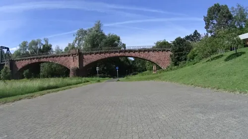
Picok
Restaurant · Croatian · 3.8 km
83 Mainwiesenweg
Mo-We, Fr 17:00-24:00; Sa 17:00-01:00; Su, PH 11:30-15:00, 17:00-22:00

Ristorante Maintalstuben
Restaurant · Italian · 1.8 km
50 Jahnstraße, Mainaschaff
Mo off; Tu-Sa 17:00-23:00; Su,PH 11:00-22:00
Sportheim SG Strietwald
Restaurant · Balkan, Italian, Pasta, Pizza · 4.1 km
2 Adlerstraße, Aschaffenburg
Tu-Su 17:00-22:00, Su 09:30-13:00
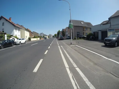
Trattoria Isola Bella
Restaurant · Italian
25 Obernburger Straße, Stockstadt am Main
Tu-Sa 17:00-23:00; Su 11:30-15:00, 17:00-22:00
da Cosimo
Restaurant · Italian, German · 3.7 km
70 Babenhäuser Straße, Großostheim
Mo-Fr 11:00-14:00, 17:00-22:00; Sa-Su 11:00-22:00; We off

Back Cafè Großmann
Bakery · 3.2 km
51 Aschaffenburger Straße, Kleinostheim
Mo-Sa 05:30-12:00; Su 07:00-08:00 "nur Abholung nach Bestellung"
Backhaus Bickert
Bakery · 3.4 km
64 Goethestraße, Kleinostheim
Mo-Fr 06:00-18:00; Sa 06:00-13:00; Su 08:00-12:00
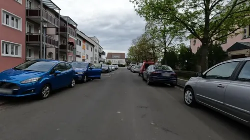
Da Vinci
Restaurant · Italian · 3.6 km
49 Leiderer Stadtweg
Tu-Sa 16:00-22:00; Su 12:00-14:00,16:00-22:00
Goldener Engel
Restaurant · 1.2 km
16 Mauerheimstraße, Stockstadt am Main
Mo-Sa 11:00-14:00,17:00-24:00; Fr off; Su 11:00-23:00


Main Bäcker Hench
Bakery · 3.7 km
4 Geschwister-Scholl-Platz, Aschaffenburg
Mo-Fr 07:00-18:00, Sa 07:00-14:00
67 more on the map.
History
The Romans built a castrum at Stockstadt, as part of the Limes Germanicus. In the 1st century AD a small earthen fortification was erected. Around the year 100 it was replaced by a full cohort fort further to the southeast. This castrum had a size of 3.2 ha. Over time, it was occupied by the cohorts III Aquitanorum, II Hispanorum and I Aquitanorum. Stockstadt was also the site of a "de:Benefiziarer station" (i.e. a road house).
After the withdrawal of the Romans from the area, the regional population declined. Burgundians and Alemanni moved through the lower Main region, but it was only under the Franks (after 500 AD) that the population density again rose noticeably. Their settlements often did not simply grow out of the formerly Roman cores but included separate newly established sites.
From the History section of Stockstadt am Main on Wikipedia, under CC BY-SA 4.0.
Where to stay7
R&R Apartments
Motel and hotel · 0.9 km
11 Hans-Böckler-Straße, Stockstadt am Main
Churches and places of worship20
Shopping31
Gas and EV charging16
Schools, colleges and libraries19
Katholische Öffentliche Bücherei Kleinostheim
Library · Roman Catholic · 3.4 km
75 Schillerstraße, Kleinostheim
Berufsfachschule für Hebammen
School · 3.2 km
25 Hafenbahnhofstraße, Aschaffenburg
Healthcare8
Map of Stockstadt am Main
250 places. The map loads OpenStreetMap tiles when you open it.
Getting there and nearby towns
Frankfurt Airport (FRA) is the nearest airport with scheduled flights listed in OpenStreetMap, 38 km away.
- Großostheim 6 km south, about 6 min by car
- Aschaffenburg 6 km east, about 6 min by car
- Babenhausen 9 km west, about 9 min by car
- Goldbach 9 km east, about 9 min by car
- Sulzbach am Main 9 km southeast, about 9 min by car
- Seligenstadt 11 km northwest, about 11 min by car
- Hösbach 11 km northeast, about 11 min by car
- Mömbris 13 km northeast, about 13 min by car
- Alzenau in Unterfranken 13 km north, about 13 min by car
- Mömlingen 12 km south, about 12 min by car
Drive times are estimates from straight-line distance, not routes.
Local news
Headlines from INDB.
Reviews, tips and questions
Loading what members have shared...
Sources and licences
- GeoNames (CC BY 4.0): population, coordinates, regions and time zone
- Mapillary (see each image): photos
- OpenStreetMap contributors (ODbL 1.0): places, airports, map data
- Wikidata (CC0 1.0): elevation, founding date, time zone, website, landmarks and historic places
- Wikimedia Commons (see each image): photos
- Wikipedia (CC BY-SA 4.0): overview and history text
Photo credits
- Stockstadt am Main Aerial fg155, Fritz Geller-Grimm supported by Rüdiger Wandke, CC BY-SA 3.0
- Hochspannung in Stockstadt am Main, Berlinschneid, CC BY-SA 4.0
- Baum des Lebens in Stockstadt am Main, Berlinschneid, CC BY-SA 4.0
- Besuch in Stockstadt am Main, Berlinschneid, CC BY-SA 4.0
- Besuch in Stockstadt am Main 18 48 03 370000, Berlinschneid, CC BY-SA 4.0
- Sportplatz der Hauptschule Stockstadt am Main 2019, Berlinschneid, CC BY-SA 4.0
- ORL 33 tab 02 pic 01 Grundriss, Unknown author Unknown author, Public domain
- Aschaffenburg - Pompejanum - 5396, Sven Teschke , Büdingen, CC BY-SA 3.0 de
- Aschaffenburg dum printempo Schönborner Hof 1, No machine-readable author provided. ThomasPusch assumed (based on copyright claims)., CC BY-SA 3.0
- Schloss Johannisberg (Aschaffenburg) II, Jörg Braukmann, CC BY-SA 4.0
- Schloss Johannisburg Aschaffenburg, Wladyslaw Sojka at German Wikipedia ( Original text: ? Wladyslaw [Disk.] ), CC BY-SA 3.0
- Stiftskirche Sankt Peter und Alexander Aschaffenburg, Johann H. Addicks - [email protected], CC BY-SA 3.0
- StLaurentius Aschaffenburg Aussen1, ekpah, CC0
- Nilkheim p 026, Peng ( talk ) 10:42, 28 June 2010 (UTC), CC BY-SA 3.0
- Leider p 002, Own work, CC BY-SA 3.0
- Nilkheim p 035, Peng ( talk ) 10:44, 28 June 2010 (UTC), CC BY-SA 3.0
- Aschaffenburg - Stadion am Schönbusch - Haupttribüne, Christian Chelvier. Flunsch123 at de.wikipedia, CC BY-SA 3.0
- Leonharduskirche-bjs120313-02, Bjs, CC BY-SA 3.0
- Mainaschaff, Kath. Pfarrkirche, 001, Tilman2007, CC BY-SA 3.0
- Katholische Pfarrkirche Maria Rosenkranz-Königin 2015, Generalinquisitor, CC BY-SA 4.0
- Kapellenberg, Freak-Line-Community, CC BY-SA 4.0
- Kleinostheim St. Laurentius, KaiBorgeest, CC BY-SA 4.0
- Aussichtsturm Schönbusch-02, Muck, CC BY-SA 4.0
- Schönbusch15 Aussichtsturm, Lutz Hartmann, CC BY-SA 3.0
- Schönbusch22 Schloss, Lutz Hartmann, CC BY-SA 3.0
- Bunker 224 Aschaffenburg, Freak-Line-Community, CC BY-SA 4.0
- Bunker 200 Mainaschaff, Freak-Line-Community, CC BY-SA 4.0
- Bunker 206 Mainaschaff, Unknown author Unknown author, CC BY-SA 4.0
- Bunker 207 Mainaschaff, Freak-Line-Community, CC BY-SA 4.0
- Bunker 210 Mainaschaff (5), Freak-Line-Community, CC BY-SA 4.0
- Schönbusch04 Wirtschaftsgebäude, Lutz Hartmann, CC BY-SA 3.0
- Schönbusch, Freak-Line-Community, CC BY-SA 4.0
- Karte Deutsche Westbefestigungen vor Westwall, K. Jähne, Public domain
- Lukaskirche leider 2, Peng ( talk ) 09:56, 4 May 2011 (UTC), CC BY-SA 3.0
- Stockstadt im November 2019 11, Berlinschneid, CC BY-SA 4.0
- Stockstadt im November 2019 01, Berlinschneid, CC BY-SA 4.0
- D-6-71-155-21, Generalinquisitor, CC BY-SA 4.0
- Stockstadt im November 2019 02, Berlinschneid, CC BY-SA 4.0
- Kastell Stockstadt Hinweistafel, Haselburg-müller, CC BY-SA 3.0
- Stockstadt im November 2019 07, Berlinschneid, CC BY-SA 4.0
- Street-level photo, mfa, CC BY-SA 4.0
- Street-level photo, chuck, CC BY-SA 4.0
- Street-level photo, ramap, CC BY-SA 4.0
- Street-level photo, robffm, CC BY-SA 4.0
- Street-level photo, seehund, CC BY-SA 4.0
- Street-level photo, Velo63739, CC BY-SA 4.0
- Street-level photo, Velo63739, CC BY-SA 4.0
- Street-level photo, m_groebs, CC BY-SA 4.0
- Street-level photo, Velo63739, CC BY-SA 4.0
- Street-level photo, mfa, CC BY-SA 4.0
- Street-level photo, ramap, CC BY-SA 4.0
- Street-level photo, robffm, CC BY-SA 4.0
- Street-level photo, m_groebs, CC BY-SA 4.0
- Street-level photo, Velo63739, CC BY-SA 4.0
- Street-level photo, Velo63739, CC BY-SA 4.0
- Street-level photo, ziltoidium, CC BY-SA 4.0
- Street-level photo, tob1, CC BY-SA 4.0


Page built November 9, 2026. Spotted a mistake? Tell us or suggest a place.