


Why visit Kleinwallstadt
Townapedia lists 48 museums and landmarks, 22 parks and trails, 76 places to eat, 8 places to stay and 9 attractions in and around town.
Highlights include Marie's Hofladen, Dörnetshöhe, Templerhaus and Heimatmuseum Elsenfeld.
Weather in Kleinwallstadt
Forecast from MET Norway (CC BY 4.0). Full forecast
About Kleinwallstadt
Kleinwallstadt is a market municipality in the Miltenberg district in the Regierungsbezirk of Lower Franconia (Unterfranken) in Bavaria, Germany and the seat of the like-named Verwaltungsgemeinschaft (Administrative Community).
From the Wikipedia article Kleinwallstadt (this version), under CC BY-SA 4.0.
Things to do9





Museums and landmarks48


Brunnen
Monument and historic site · 0.9 km
Historischer Brunnen mit runde Brunnenfassung mit übergiebeltem Ziehbrunnengerüst Jahreszahl 1566

Gumpenturm
Monument and historic site · 3.8 km
Gumpenturm Teil der Stadtbefestigung in Obernburg am Main
22A Untere Wallstraße, Obernburg am Main

Hexenturm
Monument and historic site · 3.8 km
Hexenturm Teil der Stadtbefestigung in Obernburg am Main


ehem. Bunker 256
Monument and historic site · 3.5 km
Bunker 256 der Befestigungslinie - "Wetterau-Main-Tauber-Stellung"

ehem. Bunker 258
Monument and historic site · 3.0 km
Bunker 258 der Befestigungslinie - "Wetterau-Main-Tauber-Stellung"

ehem. Bunker 259
Monument and historic site · 2.7 km
Bunker 259 der Befestigungslinie - "Wetterau-Main-Tauber-Stellung"
36 more on the map.
Parks, trails and playgrounds22

Elsavapark
Park · 3.7 km
Naherholung in Elsenfeld - Beachvolleyball, Skatepark, Kinderspielplatz, Tischtennis, Streichelzoo, ...
10:00-sunset "spätestens 21 Uhr";Oct-Mar 10:00-sunset "spätestens 18 Uhr"



10 more on the map.
Restaurants and cafes76
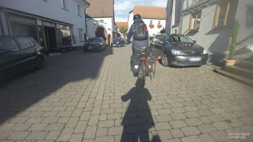

Bayerischer Hof
Restaurant · Italian · 1.7 km
26 Großostheimer Straße, Großwallstadt
Mo,We-Sa 17:00-22:00; Su 11:30-14:00,17:00-22:00
De Luca
Restaurant · Italian · 3.2 km
7 Marienstraße, Elsenfeld
Mo-Fr 11:30-14:00,17:00-22:00; Sa 17:00-22:00; Su,PH...
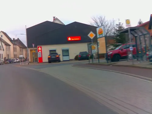
HAUPTSACHE LECKER
Restaurant · Burger, Fish, German, Grill, Pasta, Pizza
4 Wallstraße, Kleinwallstadt
Mo-Sa 16:00-22:00; Su,PH 12:00-22:00
Hohmann‘s by Sascha & Katrin
Restaurant · Regional · 3.7 km
2 Schulstraße, Sulzbach am Main
We 17:00-23:00; Th 17:00-01:00; Fr 16:00-01:00; Sa 15:00-01:00; Su...
Kelterschänke
Restaurant · German · 3.5 km
2 a Jahnstraße
Mo off; Tu-Th 17:00-22:00; Fr-Sa 17:00-24:00; Su, PH 16:00-22:00
La Valle
Restaurant · Pizza, Italian · 1.5 km
4 Sportplatzstraße, Großwallstadt
Tu,Th 11:00-14:00,17:00-23:00; We,Fr,Sa 17:00-23:00; Su,PH...
Pizzeria Lanzelot
Restaurant · German, Italian, Pizza · 3.8 km
50 Höhwaldweg, Sulzbach
Mo-Tu 17:00-22:00; Th-Sa 17:00-22:00; Su 11:30-14:00,17:00-21:00
Ristorante Pizzeria Toscana
Restaurant · Italian, Pizza · 3.4 km
6a Jahnstraße, Elsenfeld
Tu-Sa 17:00-22:00; Su 11:30-14:00,17:00-21:00; Mo off
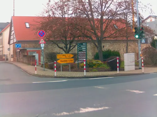
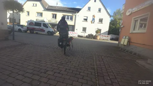


Ädemi's Pub 24*11
Bar and pub
24 Marktstraße, Kleinwallstadt
Mo 14:00-21:00; We,Sa,Su 10:00+; Th 14:00+; Fr 12:00+
64 more on the map.
History
Kleinwallstadt was already settled quite early on. Archaeological finds from Hallstatt times bear witness to the prehistoric settlers. At a find in 1980, not only were some female skeletal remains unearthed, but also some lovely grave goods from Alamannic times (4th-5th century).
In Kleinwallstadt, then also known as Bischofswallstadt, which was converted to Christianity as early as the early 8th century, the Archbishop of Mainz established in 1023 a Vogtei and a tithe court over a great expanse of the Spessart (range). In the 12th and early 13th century, the Lords of Waldenberg were enfeoffed with the place. About 1185 they built a castle on a crag east of the community, but this had already been destroyed by the mid 13th century. (The remains of the Altes Schloss were explored by archaeologists in 2006 and 2007). From the 16th century, the Focke von Wallstadt family were resident in the community. Their seat, the “Ingelheimer Hof” next to the town hall, and all appurtenances passed in 1587 to the Echter von Mespelbrunn family, and thereafter to the Imperial Counts (Reichsgrafen) of Ingelheim.
From the History section of Kleinwallstadt on Wikipedia, under CC BY-SA 4.0.
Where to stay8
Churches and places of worship29
Shopping24
Gas and EV charging7
Schools, colleges and libraries14
Berufsschule Obernburg-Miltenberg, Berufsfachschulen
School · 3.4 km
10 Berufsschulstraße, Obernburg am Main
Staatliche Fachoberschule und Berufsoberschule Obernburg
School · 3.3 km
5-9 Dekaneistraße, Obernburg am Main
Berufsschule Obernburg-Miltenberg, Berufsfachschulen (Werkstatt)
School · 3.2 km
Healthcare4
Map of Kleinwallstadt
241 places. The map loads OpenStreetMap tiles when you open it.
Getting there and nearby towns
Frankfurt Airport (FRA) is the nearest airport with scheduled flights listed in OpenStreetMap, 48 km away.
- Mömlingen 6 km west, about 6 min by car
- Großostheim 8 km northwest, about 8 min by car
- Klingenberg am Main 10 km south, about 10 min by car
- Aschaffenburg 11 km north, about 11 min by car
- Goldbach 14 km north, about 14 min by car
- Hösbach 15 km north, about 15 min by car
- Höchst im Odenwald 15 km southwest, about 15 min by car
- Groß-Umstadt 17 km west, about 17 min by car
- Laufach 18 km northeast, about 18 min by car
- Babenhausen 19 km northwest, about 19 min by car
Drive times are estimates from straight-line distance, not routes.
Local news
Headlines from INDB.
Reviews, tips and questions
Loading what members have shared...
Sources and licences
- GeoNames (CC BY 4.0): population, coordinates, regions and time zone
- Mapillary (see each image): photos
- OpenStreetMap contributors (ODbL 1.0): places, airports, map data
- Wikidata (CC0 1.0): elevation, founding date, time zone, website
- Wikimedia Commons (see each image): photos
- Wikipedia (CC BY-SA 4.0): overview and history text
Photo credits
- Kleinwallstadt Rathaus, Tilman AB, Public domain
- Kleinwallstadt Hauptstr 14 House, KaiBorgeest, CC BY-SA 4.0
- Kleinwallstadt Hauptstr 14 Gate, KaiBorgeest, CC BY-SA 4.0
- Bildstock Kleinwallstadt Am Dammsrain, Salino01, CC BY-SA 4.0
- Templerhaus Kleinwallstadt 04, Salino01, CC BY-SA 4.0
- Templerhaus Kleinwallstadt 03, Salino01, CC BY-SA 4.0
- Bildstock Kleinwallstadt Flurgraben, Salino01, CC BY-SA 4.0
- Fachwerkhaus Kleinwallstadt, Salino01, CC BY-SA 4.0
- Templerhaus Kleinwallstadt 02, Salino01, CC BY-SA 4.0
- Kleinwallstadt Miltenberger Str 7, KaiBorgeest, CC BY 4.0
- Bunker 281 Kleinwallstadt, Freak-Line-Community, CC BY-SA 4.0
- Bunker 281 Kleinwallstadt (2), Freak-Line-Community, CC BY-SA 4.0
- Bunker 281 Kleinwallstadt (3), Freak-Line-Community, CC BY-SA 4.0
- Hohe Berg (Sulzbach), Salino01, CC BY-SA 4.0
- Waleburg kleinwallstadt Aufgang-westseite, Commander-pirx, CC BY-SA 3.0
- Plattenberg (Kleinwallstadt), Salino01, CC BY-SA 4.0
- Kleinwallstadt Kirche, Tilman AB, Public domain
- Großwallstadt Historischer Brunnen 1566 von O, Heinrich Stürzl, CC BY-SA 4.0
- Obernburg am Main - St. Peter und Paul - 2018-07-19 14-13-21, Photographs by Radosław Drożdżewski (User:Zwiadowca21), CC BY-SA 4.0
- Heimatmuseum (Elsenfeld), Salino01, CC BY-SA 3.0
- Christkönigskirche, Manro, CC BY 3.0
- Neue Kirche St. Michael (Hausen) 01, Salino01, CC BY 3.0
- Kleinwallstadt Wohnhaus Marktstraße 13, Salino01, CC BY-SA 3.0
- Kleinwallstadt Ehemaliges Rathaus, Salino01, CC BY-SA 3.0
- Christkönigskapelle Kleinwallstadt 01, Salino01, CC BY-SA 4.0
- Bunker 256 Sulzbach, Freak-Line-Community, CC BY-SA 4.0
- Bunker 258 Sulzbach, Freak-Line-Community, CC BY-SA 4.0
- Bunker 259 Sulzbach (2), Freak-Line-Community, CC BY-SA 4.0
- An den Mainauen Sulzbach (15331540420), Carsten Frenzl from Obernburg, Deutschland, CC BY 2.0
- Kleinwallstadt Pfarrkirche Marktstraße 15, Salino01, CC BY-SA 3.0
- Kleinwallstadt Kapelle Kirchgasse 6, Salino01, CC BY-SA 3.0
- Hausen Kapelle Alter Nack, Salino01, CC BY-SA 3.0
- St. Gertraud Elsenfeld, Manro, CC BY-SA 3.0
- Hofstetten 001, Tilman2007, CC BY-SA 3.0
- Karte Deutsche Westbefestigungen vor Westwall, K. Jähne, Public domain
- Mainauen Sulzbach 14a, Salino01, CC BY-SA 4.0
- Marktstraße 15 Kleinwallstadt 20190329 001, Tilman2007, CC BY-SA 4.0
- St. Peter und Paul Obernburg a. Main-2, Rufus46, CC BY-SA 3.0
- Kabelbrunnen Wetterau-Main-Tauber-Stellung (3), Freak-Line-Community, CC BY-SA 4.0
- Katholische Pfarrkirche Mariä Himmelfahrt und Peter und Paul (Großwallstadt) 11, Salino01, CC BY-SA 4.0
- Street-level photo, ramap, CC BY-SA 4.0
- Street-level photo, VIA_CH, CC BY-SA 4.0
- Street-level photo, ramap, CC BY-SA 4.0
- Street-level photo, ramap, CC BY-SA 4.0
- Street-level photo, VIA_CH, CC BY-SA 4.0
- Street-level photo, troher15, CC BY-SA 4.0
- Street-level photo, ramap, CC BY-SA 4.0
- Street-level photo, ramap, CC BY-SA 4.0
- Street-level photo, changchun1, CC BY-SA 4.0
- Street-level photo, georginakirrin, CC BY-SA 4.0
- Street-level photo, chuck, CC BY-SA 4.0
- Street-level photo, changchun1, CC BY-SA 4.0


Page built November 9, 2026. Spotted a mistake? Tell us or suggest a place.