


Why visit Haiger
Townapedia lists 78 museums and landmarks, 52 parks and trails, 121 places to eat, 17 places to stay and 42 attractions in and around town.
Highlights include Wildpark Donsbach, Aubachbrücke, Villa Grün and Herbstlabyrinth-Adventhöhle-System.
Weather in Haiger
Forecast from MET Norway (CC BY 4.0). Full forecast
About Haiger
Haiger (German pronunciation: [ˈhaɪɡɐ] ) is a country town in the Lahn-Dill-Kreis in Hesse, Germany. The nearest city is Siegen, about 25 km to the north.
From the Wikipedia article Haiger (this version), under CC BY-SA 4.0.
Things to do42



Wendel
Farm and orchard · 8.6 km
16 Burger Hauptstraße, Herborn
Apr-Jun: Mo-Fr 08:30-12:30,13:30-17:30,Sa 08:30-17:00



30 more on the map.
Museums and landmarks78

Villa Grün
Museum · 5.4 km
Wirtschaftsgeschichtliches Museum
3 Schloßberg, Dillenburg
Apr 01-Nov 01 Tu-Su,PH 10:00-12:00,13:00-17:00



Töpfermuseum
Museum · 6.5 km
27 Kirchstraße
Mar-Nov We 10:00-12:00,14:00-17:00, Su 14:30-17:00; PH off; "und...

Altes Bürgermeisteramt
Monument and historic site · 6.4 km
22 Alte Hauptstraße, Herborn

Leinen- und Spitzenmuseum
Museum · 3.3 km
9 Seelbachstraße, Haiger
Apr-Nov: Su[1] 14:00-17:00|| "Gruppentermine auch nach Vereinbarung"
Museum für Heimat- und Industriegeschichte
Museum · 8.4 km
39 Burger Hauptstraße, Herborn
"nach Vereinbarung"

Wilhelmsturm
Monument and historic site · 5.5 km
Oranien-Nassauisches Museum
Apr 01-Nov 01 Tu-Su,PH 10:00-13:00,14:00-17:00


66 more on the map.
Parks, trails and playgrounds52




40 more on the map.
Restaurants and cafes121

Algati
Restaurant · Italian · 5.6 km
4 Marktstraße, Dillenburg
Mo off; Tu-Fr 11:30-15:00; Sa-Su 11:30-21:30
Bartmanns Haus
Restaurant · 5.8 km
3 Untertor, Dillenburg
Mo-Fr 11:30-14:30,17:30-22:00; Sa 17:30-22:00
Breitscheider Stube
Restaurant · German, Breakfast, Lunch, Diner · 6.8 km
34 Schönbacher Straße, Breitscheid
Mo-We 10:00-20:00, Th-Sa 10:00-22:00, Su 10:00-21:00, PH off
China Restaurant Palace
Restaurant · Chinese, Buffet, Sushi, Teppanyaki · 0.7 km
10 Bahnhofstraße, Haiger
Mo-Fr 11:30-15:00,17:30-21:30; Sa 11:30-22:30; Su,PH 11:30-21:30
EzTenya Grillparadies
Restaurant · Steak House, Turkish
61 Bahnhofstraße, Haiger
Mo,We,Th 10:00-14:00,17:00-23:00; Fr 10:00-14:00,17:00-24:00; Sa...
Gasthof Kanzelstein
Restaurant · German, Local · 7.5 km
2 Fasanenweg, Dillenburg
Fr,Sa 17:00-22:00; Su 11:00-14:00,17:00-21:00
Hickengrundhalle
Restaurant · Greek, German · 5.7 km
80 Westerwaldstraße, Burbach
Tu-Sa 17:30-22:00+; Su 11:30-15:00,17:30-22:00+; Mo off
Liebezeit
Restaurant · 5.7 km
Hüttenplatz, Dillenburg
Mo-Fr 15:00-23:00, Sa,Su 12:00-24:00, PH 12:00-23:00
Minh Minh
Restaurant · Asian · 5.6 km
6 Marktstraße, Dillenburg
Mo-Fr 11:00-15:30,17:00-21:30; Sa off; Su 12:00-21:30; PH off
Pizzeria Milan
Restaurant · Pizza · 7.3 km
1 Auf der Hub, Breitscheid
Su,Mo 11:00-22:00; Tu off; We,Th 16:00-22:00; Fr,Sa 16:00-00:00
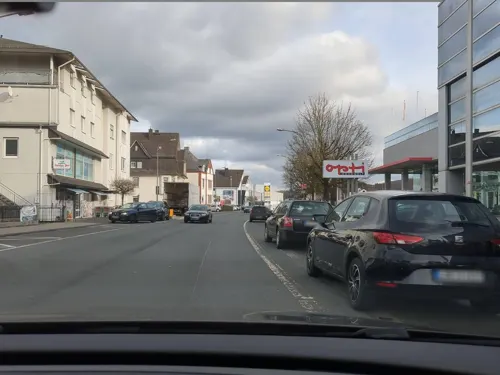


Ristorante Bacco
Restaurant · Italian
33 Bahnhofstraße, Haiger
We-Su 11:30-14:00,17:30-23:00; Sa 17:30-23:00
109 more on the map.
History
Haiger is the earliest documented town on the river Dill. It was first mentioned in 778 in a gift deed of Lorsch monastery. The town is located at the meeting of three small valleys formed by the Haigerbach, Aubach and Dill, which in medieval times placed the town along important communication routes, but later more on the periphery. The town's most famous son was Johann Textor who was born here in 1582. Between 1608 and 1619 he was town clerk in Haiger and subsequently wrote the Nassauische Chronik, a comprehensive description of the area. One of the most famous historic depictions of the town is an engraving by Matthäus Merian. On 8 May 1729, the still fully walled town perished in a great fire that destroyed all buildings within a few hours. Even the town's church, built on an outcrop rising within the centre of town, was left in ruins. Quick financial help from surrounding principalities, towns and provinces, as well as a generous donation of 400 florins by Princess Isabella of Nassau-Dillenburg, helped relieve some of the worst deprivation.
From the History section of Haiger on Wikipedia, under CC BY-SA 4.0.
Where to stay17
Churches and places of worship68
Wehrkirche Würgendorf
Church · Reformed · 6.2 km
2 Turmstraße, Burbach
Shopping38
Gas and EV charging23
Schools, colleges and libraries31
Healthcare17
Map of Haiger
250 places. The map loads OpenStreetMap tiles when you open it.
Getting there and nearby towns
Siegerlandflughafen (SGE) is the nearest airport with scheduled flights listed in OpenStreetMap, 10 km away.
- Herborn 10 km southeast, about 10 min by car
- Siegen 20 km northwest, about 20 min by car
- Aßlar 25 km southeast, about 25 min by car
- Gladenbach 26 km east, about 26 min by car
- Solms 27 km southeast, about 27 min by car
- Wetzlar 29 km southeast, about 29 min by car
- Braunfels 28 km southeast, about 28 min by car
- Weilburg 29 km south, about 29 min by car
- Biedenkopf 29 km northeast, about 29 min by car
- Hadamar 35 km south, about 35 min by car
Drive times are estimates from straight-line distance, not routes.
Local news
Headlines from INDB.
Reviews, tips and questions
Loading what members have shared...
Sources and licences
- GeoNames (CC BY 4.0): population, coordinates, regions and time zone
- Mapillary (see each image): photos
- OpenStreetMap contributors (ODbL 1.0): places, airports, map data
- Wikidata (CC0 1.0): elevation, founding date, time zone, website, landmarks and historic places
- Wikimedia Commons (see each image): photos
- Wikipedia (CC BY-SA 4.0): overview and history text
Photo credits
- Haiger-Panorama, Jörg Braukmann, CC BY-SA 4.0
- Haiger - Evangelische Pfarrkirche Kirchberg (KD.HE 132834 4 08.2015), Oliver Abels, CC BY-SA 4.0
- Haiger - Hauptstraße 16-18 (KD.HE 132821 1 08.2015), Oliver Abels, CC BY-SA 4.0
- Haiger Aubachbrücke, Oliver Abels ( SBT ), CC BY-SA 3.0
- Haiger - Gebäude in der Gesamtanlage Isabellenstraße 4 (KD.HE 132817 3 08.2015), Oliver Abels, CC BY-SA 4.0
- Haiger - Isabellenstraße 36 (KD.HE 132835 1 08.2015), Oliver Abels, CC BY-SA 4.0
- Haiger - Marktbrunnen (1 08.2015), Oliver Abels, CC BY-SA 4.0
- Haiger - Isabellenstraße 34 (KD.HE 132836 1 08.2015), Oliver Abels, CC BY-SA 4.0
- Haiger - Isabellenstraße 34 (KD.HE 132836 2 08.2015), Oliver Abels, CC BY-SA 4.0
- Haiger - Isabellenstraße 32 Kreuzgasse 4 (KD.HE 132837 1 08.2015), Oliver Abels, CC BY-SA 4.0
- Brunnen am Marktplatz in Haiger - geo.hlipp.de - 39706, Uwe Seibert on geo.hlipp.de, CC BY-SA 2.0
- Haiger - Hauptstraße 33 (KD.HE 132823 1 08.2015), Oliver Abels, CC BY-SA 4.0
- Haiger Museum, Oliver Abels ( SBT ), CC BY-SA 3.0
- Haiger - Marktplatz 2 (KD.HE 132838 2 08.2015), Oliver Abels, CC BY-SA 4.0
- Haiger - Isabellenstraße 32 Kreuzgasse 4 (KD.HE 132837 2 08.2015), Oliver Abels, CC BY-SA 4.0
- Haiger - Marktplatz 2 (KD.HE 132838 1 08.2015), Oliver Abels, CC BY-SA 4.0
- Haiger kath Kirche, Oliver Abels ( SBT ), CC BY-SA 3.0
- Blick auf Haiger - geo.hlipp.de - 39933, Uwe Seibert on geo.hlipp.de, CC BY-SA 2.0
- Haiger Pfarrhaus, Oliver Abels ( SBT ), CC BY-SA 3.0
- Haiger - Gebäude in der Gesamtanlage Hauptstraße 82 (KD.HE 187606 2 08.2015), Oliver Abels, CC BY-SA 4.0
- Haiger - Pfarrhaus Frigghof 4 (KD.HE 132833 1 08.2015), Oliver Abels, CC BY-SA 4.0
- Haiger - Pfarrhaus Frigghof 4 (KD.HE 132833 2 08.2015), Oliver Abels, CC BY-SA 4.0
- Haiger - Evangelische Pfarrkirche Kirchberg (KD.HE 132834 3 08.2015), Oliver Abels, CC BY-SA 4.0
- Blick auf die Ev. Stadtkirche Haiger - geo.hlipp.de - 36553, Uwe Seibert on geo.hlipp.de, CC BY-SA 2.0
- Haiger - Evangelische Pfarrkirche Kirchberg (KD.HE 132834 1 08.2015), Oliver Abels, CC BY-SA 4.0
- Haiger - Evangelische Pfarrkirche Kirchberg (KD.HE 132834 2 08.2015), Oliver Abels, CC BY-SA 4.0
- Haiger - Frigghof 12 (KD.HE 132820 1 08.2015), Oliver Abels, CC BY-SA 4.0
- Haiger - Wachhaus Hauptstraße 96 (KD.HE 132828 2 08.2015), Oliver Abels, CC BY-SA 4.0
- Haiger - Wachhaus Hauptstraße 96 (KD.HE 132828 1 08.2015), Oliver Abels, CC BY-SA 4.0
- Haiger - Wachhaus Hauptstraße 96 (KD.HE 132828 3 08.2015), Oliver Abels, CC BY-SA 4.0
- Haiger ev Kirche, Oliver Abels ( SBT ), CC BY-SA 3.0
- Haiger - Teil der Stadtmauer Hinterm Graben (KD.HE 133267 1 08.2015), Oliver Abels, CC BY-SA 4.0
- Haiger - Gebäude in der Gesamtanlage Obertor 1 (KD.HE 187584 1 08.2015), Oliver Abels, CC BY-SA 4.0
- Haiger - Westerwaldstraße 4 (KD.HE 132842 1 08.2015) Villa, Oliver Abels, CC BY-SA 4.0
- Haiger - Obertor 3 (KD.HE 132840 1 08.2015), Oliver Abels, CC BY-SA 4.0
- Haiger - Westerwaldstraße 4 (KD.HE 132842 2 08.2015) Villa, Oliver Abels, CC BY-SA 4.0
- Haiger - Westerwaldstraße 4 (KD.HE 132842 3 08.2015) Remise, Oliver Abels, CC BY-SA 4.0
- Haiger - Friedhof (1 08.2015), Oliver Abels, CC BY-SA 4.0
- Haiger - Stadthalle (2 08.2015), Oliver Abels, CC BY-SA 4.0
- Evangelische Kirche Dillbrecht, USeibert, CC BY-SA 3.0 de
- Herbstlabyrinth04 2013-04-29, KlausFoehl, CC BY-SA 3.0
- Wilhelmsturm, No machine-readable author provided. Famulus~commonswiki assumed (based on copyright claims)., Public domain
- Wuergendorf Wehrkirche 2007, Jan-Torben Becker ( SüdSI at de.wikipedia ), CC BY-SA 2.0 de
- Dillenburg, Schloßberg 3, Grünsche Villa Eingang Museum, Stefan Didam - Schmallenberg, CC BY-SA 4.0
- Frohnhausen Evangelische Kirche, Useibert, CC BY-SA 4.0
- Dillenburg - Wehrturm Am Zwingel o. Nr. (KD.HE 132534 1 08.2015), Oliver Abels, CC BY-SA 4.0
- Hof Feldbach, Useibert, CC BY-SA 4.0
- Kirchenruine Feldbach, USeibert, CC BY-SA 3.0 de
- Evangelische Kirche Haiger Allendorf, USeibert, CC BY-SA 3.0 de
- Aubachbrücke, USeibert, CC BY-SA 3.0 de
- Langenaubach Rabenscheider Tunnel, Otto Domes, CC BY-SA 4.0
- Ehemalige Evangelische Kirche Langenaubach, USeibert, CC BY-SA 3.0 de
- Betsaal Amdorf, Useibert, CC BY-SA 4.0
- Amdorfer Viehweide - 2, Otto Domes, CC BY-SA 4.0
- Wilhelm-von-Oranien-Schule, WIlhelm-von-Oranien-Schule, CC BY-SA 4.0
- Evangelische Kirche Lützeln, Dbawwsnrw, CC BY 3.0
- Dillbrücke, Useibert, CC BY-SA 4.0
- Gleichenhäuschen, Clisch, CC BY-SA 4.0
- Altes Bürgermeisteramt Uckersdorf, Useibert, CC BY-SA 4.0
- Dillenburg Kastanien bei Hof Feldbach, Otto Domes, CC BY-SA 4.0
- Rabenscheider Holz 7, Otto Domes, CC BY-SA 4.0
- Evangelische Kirche Uckersdorf, Useibert, CC BY-SA 4.0
- Toepfermuseum Breitscheid, Marco.dienst, CC0
- Papageienfütterung 02.04.2016, Britta L, CC BY-SA 4.0
- Wildpark Donsbach 2017 Damwild, Otto Domes, CC BY-SA 4.0
- Heimhof-Theater, Lutz, CC BY-SA 4.0
- Naturschutzgebiet Caan 2330, Otto Domes, CC BY-SA 4.0
- Street-level photo, rab, CC BY-SA 4.0
- Street-level photo, akinogermany, CC BY-SA 4.0
- Street-level photo, akinogermany, CC BY-SA 4.0
- Street-level photo, akinogermany, CC BY-SA 4.0
- Street-level photo, rab, CC BY-SA 4.0
- Street-level photo, thetornado76, CC BY-SA 4.0
- Street-level photo, rab, CC BY-SA 4.0
- Street-level photo, troher15, CC BY-SA 4.0
- Street-level photo, rab, CC BY-SA 4.0
- Street-level photo, rab, CC BY-SA 4.0
- Street-level photo, ede875, CC BY-SA 4.0
- Street-level photo, akinogermany, CC BY-SA 4.0
- Street-level photo, grinninghamster, CC BY-SA 4.0
- Street-level photo, akinogermany, CC BY-SA 4.0
- Street-level photo, grinninghamster, CC BY-SA 4.0


Page built November 8, 2026. Spotted a mistake? Tell us or suggest a place.