


Why visit Hammelburg
Townapedia lists 69 museums and landmarks, 17 parks and trails, 65 places to eat, 16 places to stay and 40 attractions in and around town.
Highlights include Sturmiushof Bauernladen, Baderturm, Trimburg and Museum Herrenmühle.
Weather in Hammelburg
Forecast from MET Norway (CC BY 4.0). Full forecast
About Hammelburg
Hammelburg (German pronunciation: [ˈhaml̩bʊʁk] ) is a town in Bavaria, Germany. It sits in the district of Bad Kissingen, in Lower Franconia. It lies on the river Franconian Saale, 25 km west of Schweinfurt. Hammelburg is the oldest winegrowing town (Weinstadt) in Franconia.
From the Wikipedia article Hammelburg (this version), under CC BY-SA 4.0.
Things to do40





28 more on the map.
Museums and landmarks69

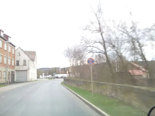

Schloss Saaleck
Monument and historic site · 1.5 km
1 Saaleckstraße, Hammelburg

Schloß Waizenbach
Monument and historic site · 8.6 km
3 Diebacher Straße, Wartmannsroth




terroir f Hammelburg
Monument and historic site · 0.9 km
„terroir f“ – Magische Orte des Frankenweins
57 more on the map.
Parks, trails and playgrounds17





5 more on the map.
Restaurants and cafes65

Gasthaus zum Adler
Restaurant · Regional · 4.0 km
17 Hauptstraße, Elfershausen
Mo,Tu,Th-Sa 17:00-21:00; Su,PH 11:00-14:00,17:00-20:00

Weingut Lange - Schloss Saaleck
Brewery and winery
Vinothek
1 Am Marktplatz, Hammelburg
Mo-Fr 09:00-13:00,14:00-18:00; Sa 09:00-14:00; Jun-Oct: Su 11:00-16:00
Ausblick
Restaurant · Pizza, Regional · 5.5 km
30 Am Erlich, Hammelburg
We-Sa 16:00-21:00; Su,PH 12:00-20:00
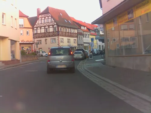
Downtown-Diner
Restaurant · Burger
51 Bahnhofstraße, Hammelburg
Mo-Th,Su 17:00-23:30; Fr-Sa 18:00-24:00
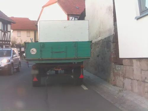
Gasthaus Goldenes Roß
Restaurant · German · 3.9 km
28 Diebacher Straße, Hammelburg
We-Th 11:00-14:00, 18:00-22:00; Fr-Sa 11:00-00:00; Su 11:00-22:00
Gasthof Nöth
Restaurant · German · 6.2 km
6 Morlesauer Straße, Hammelburg
Fr-Su,Mo-Tu 11:30-14:00,17:30-21:00; Th 16:00-21:00
Gasthof und Pension Schultheis
Restaurant · Regional · 4.4 km
30 Zum Riedbrunnen, Hammelburg
Mo 17:00-22:00; We-Sa 12:00-22:00; Su 11:00-17:30
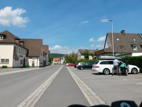


Landgasthof zum Goldenen Kreuz
Restaurant · Bavarian · 3.5 km
11 Brückenauer Straße, Hammelburg
Th-Fr 17:00-23:00; Sa 17:00-00:00; Su 11:00-00:00
Müller Weinwirtschaft
Restaurant · Regional
12 Am Marktplatz, Hammelburg
Mo-Su 12:00-22:00; Tu off; We off
Saaletalstuben
Restaurant · Regional · 8.8 km
1 An der Saale, Gräfendorf-Michelau
We-Sa 17:30+; Su 11:00-14:00,17:30+;Mo,Tu off
53 more on the map.
History
Hammelburg was first documented on 18 April 716 as Hamulo Castellum, when Hedan II, Duke of Thuringia, donated the place to Saint Willibrord. In 741, Carloman bequeathed Saint Martin's Church (Martinskirche) to Saint Boniface for the foundation of the Diocese of Würzburg. In 777, Charlemagne donated Hammelburg with its entire municipal area to the Abbey of Fulda. At this time, the fortress (Castellum) was in a favorable location at a ford on the Franconian Saale, and on the intersection of east–west and north–south trade routes.
From the History section of Hammelburg on Wikipedia, under CC BY-SA 4.0.
Where to stay16
Churches and places of worship38
Katholische Pfarrkirche St. Vitus
Church · Roman Catholic · 4.1 km
8 Kirchplatz, Elfershausen
St. Johannes der Täufer
Church · Roman Catholic · 7.2 km
5 Stadtweg, Gräfendorf
Shopping14
Gas and EV charging5
Schools, colleges and libraries9
Healthcare4
Map of Hammelburg
250 places. The map loads OpenStreetMap tiles when you open it.
Getting there and nearby towns
Sonderlandeplatz Kitzingen (KZG) is the nearest airport with scheduled flights listed in OpenStreetMap, 47 km away.
- Karlstadt 19 km southwest, about 19 min by car
- Werneck 21 km southeast, about 21 min by car
- Schweinfurt 25 km east, about 25 min by car
- Lohr am Main 27 km southwest, about 27 min by car
- Veitshöchheim 32 km south, about 32 min by car
- Würzburg 36 km south, about 36 min by car
- Marktheidenfeld 36 km southwest, about 36 min by car
- Steinau an der Straße 38 km northwest, about 38 min by car
- Neuhof 42 km northwest, about 42 min by car
- Kitzingen 46 km southeast, about 46 min by car
Drive times are estimates from straight-line distance, not routes.
Local news
Headlines from INDB.
Reviews, tips and questions
Loading what members have shared...
Sources and licences
- GeoNames (CC BY 4.0): population, coordinates, regions and time zone
- Mapillary (see each image): photos
- OpenStreetMap contributors (ODbL 1.0): places, airports, map data
- Wikidata (CC0 1.0): elevation, founding date, time zone, website
- Wikimedia Commons (see each image): photos
- Wikipedia (CC BY-SA 4.0): overview and history text
Photo credits
- Flug -Nordholz-Hammelburg 2015 by-RaBoe 1185 - Hammelburg, © Ra Boe / Wikipedia, CC BY-SA 3.0 de
- Hammelburg Kirchgasse 8 4, Doris Antony , Berlin, CC BY-SA 4.0
- Hammelburg Main PostLogistik, Doris Antony , Berlin, CC BY-SA 4.0
- Hammelburg Kissinger Str 31, Doris Antony , Berlin, CC BY-SA 4.0
- Hammelburg - panoramio, Werner Petermann (We…, CC BY-SA 3.0
- Hammelburg Kirchgasse, Doris Antony , Berlin, CC BY-SA 4.0
- Hammelburg Kirchgasse 2, Doris Antony , Berlin, CC BY-SA 4.0
- Hammelburg Bahnhofstr 18, Doris Antony , Berlin, CC BY-SA 4.0
- Hammelburg wayside shrine Berliner Str, Doris Antony , Berlin, CC BY-SA 4.0
- Hammelburg Herrenmuehle, E-W, CC BY-SA 4.0
- 2026-05-02 Hammelburg 05, Burkhard Mücke, CC BY-SA 4.0
- Hammelburg Kellereischloss SW, Doris Antony , Berlin, CC BY-SA 4.0
- 2026-05-02 Hammelburg 04, Burkhard Mücke, CC BY-SA 4.0
- 2026-05-02 Hammelburg 03, Burkhard Mücke, CC BY-SA 4.0
- Hammelburg Moenchsturm, Doris Antony , Berlin, CC BY-SA 4.0
- 2026-05-02 Hammelburg 06, Burkhard Mücke, CC BY-SA 4.0
- Hammelburg rectory, Doris Antony , Berlin, CC BY-SA 4.0
- 2026-05-02 Hammelburg 08, Burkhard Mücke, CC BY-SA 4.0
- 2026-05-02 Hammelburg 07, Burkhard Mücke, CC BY-SA 4.0
- Hammelburg St Michael, Doris Antony , Berlin, CC BY-SA 4.0
- Hammelburg Martin-Luther-Haus, E-W, CC BY-SA 4.0
- 2026-05-02 Hammelburg 02, Burkhard Mücke, CC BY-SA 4.0
- Hammelburg St Johannes SW, Doris Antony , Berlin, CC BY-SA 4.0
- 2026-05-02 Hammelburg 01, Burkhard Mücke, CC BY-SA 4.0
- Hammelburg Pfarrhaus Kindergarten St Michael 1, E-W, CC BY-SA 4.0
- Hammelburg crucifixion group, Doris Antony , Berlin, CC BY-SA 4.0
- Hammelburg Pfarrhaus Kindergarten St Michael 2, E-W, CC BY-SA 4.0
- Hammelburg Kreuzigungsgruppe, Doris Antony , Berlin, CC BY-SA 4.0
- Hammelburg cemetery, Doris Antony , Berlin, CC BY-SA 4.0
- Hammelburg chapel, Doris Antony , Berlin, CC BY-SA 4.0
- 2026-05-02 Hammelburg 11, Burkhard Mücke, CC BY-SA 4.0
- Hammelburg gravestones, Doris Antony , Berlin, CC BY-SA 4.0
- 2026-05-02 Hammelburg 09, Burkhard Mücke, CC BY-SA 4.0
- Hammelburg ssw PICT0065 200010, Karlunun, CC BY-SA 4.0
- 2026-05-02 Hammelburg 10, Burkhard Mücke, CC BY-SA 4.0
- Frobenius-Gymnasium Hammelburg, Helmut Schreiner, CC BY-SA 4.0
- Klosterkirche Unbefleckte Empfängnis (Hammelburg) 1, MarcelBuehner, CC BY 4.0
- Reußenburg 27, Scheurebe2000, CC BY-SA 3.0
- Bonnländer Schloss, Bonnlander, CC BY-SA 3.0
- 2004-09-12 Schloss-Saaleck-Ostfassade, Unknown author, CC BY-SA 3.0
- Saaletal mit Sodenberg, Ginkgo2g, CC BY-SA 3.0
- Trimburg 2, Rainer Lippert, Public domain
- Katholische Stadtpfarrkirche in Hammelburg, MarcelBuehner, CC BY-SA 3.0
- Ki. Morlesau, Passer novus, CC BY-SA 4.0
- Pfarrkirche in Langendorf, Verum, CC BY-SA 3.0
- Elfershausen, Schloß-003, Tilman2007, CC BY-SA 3.0
- Kirche Obererthal mit Osterbrunnen, Ginkgo2g, CC BY-SA 3.0
- Engenthal, Katholische Filialkirche St. Valentin-001, Tilman2007, CC BY-SA 3.0
- Hammelburg, Baderturm-003, Tilman2007, CC BY-SA 3.0
- Hammelburg, Hüterturm-002, Tilman2007, CC BY-SA 3.0
- Hammelburg, Mönchsturm-001, Tilman2007, CC BY-SA 3.0
- Sodenberg-Kapelle – 20160816-008, Darev, CC BY-SA 4.0
- Hammelburg, Friedrich-Müller-Straße 13 20170319 003, Tilman2007, CC BY-SA 4.0
- Aschenroth, Kirche St. Maria Patronin Bayerns-001, Tilman2007, CC BY-SA 3.0
- Weickersgrüben Kath. Kirche 001, Tilman2007, CC BY 3.0
- Am Wacholderberg bei Machtilshausen 6, Stephan van Helden, CC BY-SA 4.0
- Wartmannsroth, Waizenbach, Schloß-001, Tilman2007, CC BY-SA 3.0
- BY SodenBg 04 2007 BasaltStB1, Bonnlander, CC BY-SA 3.0
- Street-level photo, ramap, CC BY-SA 4.0
- Street-level photo, ramap, CC BY-SA 4.0
- Street-level photo, rausk, CC BY-SA 4.0
- Street-level photo, ramap, CC BY-SA 4.0
- Street-level photo, troher15, CC BY-SA 4.0
- Street-level photo, ramap, CC BY-SA 4.0
- Street-level photo, su1dakra, CC BY-SA 4.0
- Street-level photo, ramap, CC BY-SA 4.0
- Street-level photo, troher15, CC BY-SA 4.0
- Street-level photo, rausk, CC BY-SA 4.0
- Street-level photo, tian, CC BY-SA 4.0
- Street-level photo, ramap, CC BY-SA 4.0
- Street-level photo, troher15, CC BY-SA 4.0
- Street-level photo, troher15, CC BY-SA 4.0


Page built November 8, 2026. Spotted a mistake? Tell us or suggest a place.