


Leopoldshöhe, Germany
Leopoldshöhe is a town of 16,219 people in North Rhine-Westphalia, Germany.
Why visit Leopoldshöhe
Townapedia lists 17 museums and landmarks, 38 parks and trails, 58 places to eat, 2 places to stay and 8 attractions in and around town.
Highlights include Blaurocks Bauernladen, Freesenberg, Adolf Kampmeier and Gut Eckendorf.
Weather in Leopoldshöhe
Forecast from MET Norway (CC BY 4.0). Full forecast
About Leopoldshöhe
Leopoldshöhe (German pronunciation: [ˈleːopɔltsˌhøːə]; Low German: Höchte) is a municipality in the Lippe district of North Rhine-Westphalia, Germany, with ca. 17,000 inhabitants (2025).
From the Wikipedia article Leopoldshöhe (this version), under CC BY-SA 4.0.
Things to do8

Blaurocks Bauernladen
Farm and orchard · 2.7 km
157 Helpuper Straße, Lage
Mo-Fr 08:30-12:30,14:30-18:30; Sa 08:00-14:00

Museums and landmarks17


Gut Eckendorf
Monument and historic site · 3.7 km
222 Bielefelder Straße, Leopoldshöhe




Grenzstein OWL No. 32
Monument and historic site · 4.7 km
Ursprüngliche Grenze zwischen dem Fürstentum Lippe und der Grafschaft Ravensberg (Kgr. Preußen)
Gedenkstein für Polizeiwachtmeister August Giebe
Monument and historic site · 5.0 km
5 more on the map.
Parks, trails and playgrounds38



Vogellehrpfad Bexterwald
Park · 4.4 km
Ein Lehrpfad mit Möglichkeit zum Joggen/Wandern.
24/7


26 more on the map.
Restaurants and cafes58

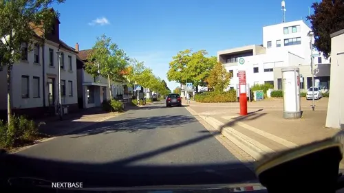

Runkelkrug
Restaurant · German · 4.4 km
177 Salzufler Straße, Bielefeld
We-Mo 17:00+, 15:00+ "Biergarten bei gutem Wetter", Su 10:00-13:00...
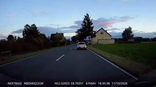
Brinkmann’s Backstube
Bakery · 4.6 km
Filiale der lippischen Bäckereikette Brinkmann's. Die Backstube, die diese Filiale beliefert befindet sich in Oerlinghausen/Helpup
130 Altdorferstraße, Lage
Mo-Fr 06:00-18:00; Sa 06:00-13:00; Su 08:00-11:00,14:00-17:00

Café-Bistro Fahrzeit
Cafe · 4.4 km
12-14 Bahnhofstraße, Leopoldshöhe
Su off; Tu, We 09:00-17:30; Th 09:00-13:00; Fr, Sa 09:00-13:00,...
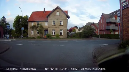
Noah’s Restaurant
Restaurant · 4.6 km
14 Bahnhofstraße, Oerlinghausen
We-Th 16:00-22:00; Fr-Sa 09:00-22:00; Su 09:00-19:00
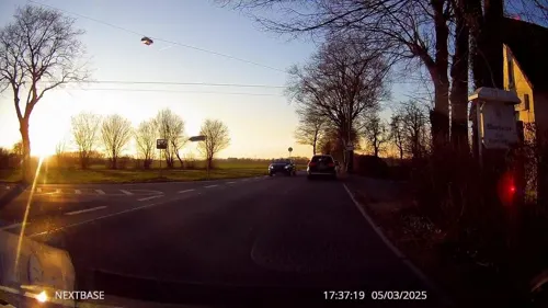
Landcafé Meerkotten
Cafe · 3.8 km
147 Bechterdisser Straße, Bielefeld
Fr 09:30-18:00; Sa 09:30-14:00; Su 14:00-18:00; Mo-Tu off ||...
ReiMans Restaurant
Restaurant · German · 4.9 km
44 Hauptstraße, Bad Salzuflen
We-Sa 16:30-22:30+, Su 16:30-22:30
Restaurant Olympia
Restaurant · Greek · 5.2 km
56 Bielefelder Straße, Bad Salzuflen
Tu-Sa 17:30-23:00, Su 12:00-14:30,17:30-23:00
Zum Löwen
Restaurant · 4.8 km
223 Sylbacher Straße, Bad Salzuflen
Mo-Sa 17:00-23:59, Su,PH 11:00-15:00


Eiscafe Rimini
Cafe · Ice Cream · 4.6 km
14 Hauptstraße, Bad Salzuflen
Mo-Su,PH 11:00-21:00
46 more on the map.
History
Local proper names still existing today - particularly of the village of Krentrup - indicate settlements in the area well before 800 AD. The estate of Niederbarkhausen, at the border between Asemissen and Oerlinghausen, is mentioned in the oldest surviving document about the area, which dates from 1036 AD. In 1616, a total of 55 farms and estates is counted in the area of today's municipality.
Since this large rural area was rather sparsely populated, there was no church and people had to walk to other communities to attend service, until, in 1850, a church was built exactly in the middle between the neighboring churches of Oerlinghausen and Schötmar. Leopold II, Prince of Lippe, attended the consecration and named the budding village around the church after himself. Today, Leopoldshöhe proper is the only one of the eight constituent villages to have a centralized structure with church, market square, etc.
From the History section of Leopoldshöhe on Wikipedia, under CC BY-SA 4.0.
Where to stay2
Churches and places of worship20
Evangelisch-reformierte Kirche Helpup
Church · Evangelical · 4.9 km
36 Lagesche Straße, Oerlinghausen
Evangeliums Christen Gemeinde e.V.
Church · Evangelical · 4.8 km
123 Max-Planck-Straße, Bad Salzuflen
Shopping18
Gas and EV charging10
Schools, colleges and libraries13
Healthcare4
Map of Leopoldshöhe
188 places. The map loads OpenStreetMap tiles when you open it.
Getting there and nearby towns
Flugplatz Bielefeld (BFE) is the nearest airport with scheduled flights listed in OpenStreetMap, 12 km away.
- Oerlinghausen 7 km south, about 7 min by car
- Bielefeld 12 km west, about 12 min by car
- Verl 19 km southwest, about 19 min by car
- Löhne 20 km north, about 20 min by car
- Vlotho 20 km northeast, about 20 min by car
- Steinhagen 20 km west, about 20 min by car
- Spenge 20 km northwest, about 20 min by car
- Werther 21 km west, about 21 min by car
- Porta Westfalica 28 km northeast, about 28 min by car
- Rietberg 29 km southwest, about 29 min by car
Drive times are estimates from straight-line distance, not routes.
Local news
Headlines from INDB.
Reviews, tips and questions
Loading what members have shared...
Sources and licences
- GeoNames (CC BY 4.0): population, coordinates, regions and time zone
- Mapillary (see each image): photos
- OpenStreetMap contributors (ODbL 1.0): places, airports, map data
- Wikidata (CC0 1.0): elevation, founding date, time zone, website, landmarks and historic places
- Wikimedia Commons (see each image): photos
- Wikipedia (CC BY-SA 4.0): overview and history text
Photo credits
- Leopoldshöhe Ortskern, Leopold070, CC BY-SA 4.0
- 33818 Leopoldshöhe, Germany - panoramio (5), coro1404, CC BY-SA 3.0
- 33818 Leopoldshöhe, Germany - panoramio (7), coro1404, CC BY-SA 3.0
- 33818 Leopoldshöhe, Germany - panoramio (6), coro1404, CC BY-SA 3.0
- 33818 Leopoldshöhe, Germany - panoramio (3), coro1404, CC BY-SA 3.0
- 33818 Leopoldshöhe, Germany - panoramio (4), coro1404, CC BY-SA 3.0
- 33818 Leopoldshöhe, Germany - panoramio (2), coro1404, CC BY-SA 3.0
- 33818 Leopoldshöhe, Germany - panoramio (1), coro1404, CC BY-SA 3.0
- 33818 Leopoldshöhe, Germany - panoramio, coro1404, CC BY-SA 3.0
- Leopoldshöhe - 2015-06-07 - LIP-019 Heipker See (15), Tsungam, CC BY-SA 4.0
- Leopoldshöhe - 2015-06-07 - LIP-019 Heipker See (13), Tsungam, CC BY-SA 4.0
- Leopoldshöhe - 2015-06-07 - LIP-019 Heipker See (10), Tsungam, CC BY-SA 4.0
- Ziegelei Lage Ansicht, Axel Hindemith, CC BY 3.0
- Alter Krug Helpup02, Nikater, Public domain
- Ev. ref. Kirche Helpup, Tola69, CC BY-SA 3.0
- Leopoldshöhe Markt, Leopold070, CC BY-SA 3.0
- Leopoldshöhe Felix-Fechenbach-Gesamtschule, Daniel Brockpähler, CC BY-SA 3.0
- Schloss iggenhausen 01, Grugerio, CC0
- Bad Salzuflen - 2015-06-10 - LIP-044 Bexter Wald (15), Tsungam, CC BY-SA 4.0
- Leopoldshöhe - 2015-06-12 - LIP-037 Windwehetal (29), Tsungam, CC BY-SA 4.0
- Evangelische Kirche Ubbedissen6, Chris06, CC BY-SA 4.0
- Evangelisch reformierte Kirche Wülfer–Knetterheide, Grugerio, CC BY-SA 3.0
- Asemissen Neuapostolische Kirche, Daniel Brockpähler, CC BY-SA 3.0
- Stolperstein Horstbrink, Muhmaker, CC BY-SA 4.0
- Stolperstein Beckmann, Muhmaker, CC BY-SA 4.0
- Bikampmeier, Bielibob, CC BY-SA 4.0
- Bad Salzuflen - 2015-06-10 - LIP-044 Bexter Wald (25), Tsungam, CC BY-SA 4.0
- Wiese mit Hungerbach, M,Listander, CC BY-SA 4.0
- Lage - 2015-05-17 - LIP-084 Grutt- und Sunderbach (4), Tsungam, CC BY-SA 3.0
- Leopoldshöhe - 2015-06-07 - LIP-019 Heipker See (3), Tsungam, CC BY-SA 4.0
- Bad Salzuflen - 2015-06-07 - LIP-045 Holzhauser Bruch (12), Tsungam, CC BY-SA 4.0
- Lage - 2015-05-20 - LIP-082 Werreniederung und Haferbach (33), Tsungam, CC BY-SA 3.0
- Bielefeld - 2015-06-12 - BI-018 Windweheniederung (5), Tsungam, CC BY-SA 4.0
- Leopoldshöhe - 2015-06-12 - LIP-037 Windwehetal (4), Tsungam, CC BY-SA 4.0
- Johanneskirche Kachtenhausen, Jochen Löscher, CC BY-SA 3.0
- Leopoldshöhe evangelische Kirche, Joe-Tomato, CC BY-SA 3.0
- Leopoldshöhe Eckendorf 2011, Ub12vow, CC BY-SA 3.0
- Leopoldshöhe-Greste Auferstehung Christi 01, Nowidid, CC BY-SA 3.0
- Werre Holzhauser Bruch 2, Tola69, CC BY-SA 3.0
- Bad Salzuflen - 2015-06-10 - LIP-044 Bexter Wald (20), Tsungam, CC BY-SA 4.0
- Street-level photo, derlipper, CC BY-SA 4.0
- Street-level photo, derlipper, CC BY-SA 4.0
- Street-level photo, Schmarvis, CC BY-SA 4.0
- Street-level photo, derlipper, CC BY-SA 4.0
- Street-level photo, derlipper, CC BY-SA 4.0
- Street-level photo, derlipper, CC BY-SA 4.0
- Street-level photo, deusfigendi, CC BY-SA 4.0
- Street-level photo, zuse, CC BY-SA 4.0
- Street-level photo, poxonline, CC BY-SA 4.0
- Street-level photo, derlipper, CC BY-SA 4.0
- Street-level photo, derlipper, CC BY-SA 4.0
- Street-level photo, poxonline, CC BY-SA 4.0
- Street-level photo, derlipper, CC BY-SA 4.0
- Street-level photo, deusfigendi, CC BY-SA 4.0
- Street-level photo, Schmarvis, CC BY-SA 4.0
- Street-level photo, derlipper, CC BY-SA 4.0
- Street-level photo, derlipper, CC BY-SA 4.0
- Street-level photo, derlipper, CC BY-SA 4.0
- Street-level photo, derlipper, CC BY-SA 4.0
- Street-level photo, derlipper, CC BY-SA 4.0


Page built November 8, 2026. Spotted a mistake? Tell us or suggest a place.