


Wattenscheid, Germany
Wattenscheid is a town of 73,965 people in North Rhine-Westphalia, Germany.
Why visit Wattenscheid
Townapedia lists 123 museums and landmarks, 45 parks and trails, 198 places to eat, 6 places to stay and 28 attractions in and around town.
Highlights include Jahrhunderthalle, Musiktheater im Revier, Heimatmuseum Helfs Hof and LWL-Industriemuseum Zeche Hannover.
Weather in Wattenscheid
Forecast from MET Norway (CC BY 4.0). Full forecast
About Wattenscheid
Wattenscheid (German pronunciation: [ˈvatn̩ˌʃaɪ̯t] ) is a Stadtbezirk (urban district) of the German city of Bochum, in the Ruhr area of North Rhine-Westphalia. Until its incorporation into Bochum in 1975, Wattenscheid was an independent town with a long history dating back to its first recorded mention in 880. In the Middle Ages, it was a member of the Hanseatic League and later became known as a coal mining center during the industrialization of the Ruhr region. The last local coal mine closed in 1973.
From the Wikipedia article Wattenscheid (this version), under CC BY-SA 4.0.
Photos of Wattenscheid


Things to do28


Musiktheater im Revier
Cinema and theater · 5.2 km
Opera house in Gelsenkirchen, North Rhine-Westphalia, Germany

Prinzregenttheater
Cinema and theater · 6.2 km
Theatre in Bochum, Germany



Hofanlage Köllman
Farm and orchard · 3.5 km
181 Rodenseelstraße, Essen
Mo-Fr 08:30-18:00; Sa 08:00-14:00 || "Spargelzeit Su 10:00-12:00"

Rottstraße 5 Theater
Cinema and theater · 4.9 km
Theatre in Bochum, Germany
Westerhoffs Bauernladen
Farm and orchard · 1.4 km
155 Westenfelder Straße, Bochum
Mo-Fr 10:00-13:00,15:00-18:00; We,Sa 10:00-13:00; PH,Su off
Appelbaum Erzeugnisse
Farm and orchard · 2.6 km
4 In den Höfen, Bochum
Mo-Su 06:00-21:00
16 more on the map.
Museums and landmarks123

Heimatmuseum Helfs Hof
Museum · 2.6 km
37 In den Höfen, Bochum
Mo-We off; Th-Su 11:00-17:00; Dec 24 off; Dec 25 off; Dec 31 off;...
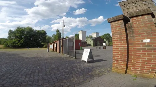
LWL-Industriemuseum Zeche Hannover
Museum · 3.1 km
251 Günnigfelder Straße, Bochum
We-Sa 14:00-18:00; Su, PH 11:00-18:00; Mo, Tu off

Bismarckturm Essen
Monument and historic site · 3.7 km
Feuersäule zu Ehren von Otto von Bismarck
Nettelnbusch, Essen


Zeche Holland
Monument and historic site · 1.0 km
13 Lyrenstraße, Bochum


Haus Dahlhausen
Monument and historic site · 3.1 km
10 Berthastraße, Bochum

Berta Wassermann, geb. Laster
Monument and historic site
Da sich der Gehweg vor Hausnummer 77 sowie der Nachbarhäuser in Privat besitz befindet , wurde der Stolperstein vor Hausnummer 81 verlegt

Eugen Sondheimer
Monument and historic site · 1.2 km
Die Verlegung erfolgte ohne die Anwesenheit des Künstlers Gunter Demnig

111 more on the map.
Parks, trails and playgrounds45


ZOOM Erlebniswelt
Park · 7.4 km
Zoological garden in Gelsenkirchen, in Germany

Lohrheidestadion
Sports field and stadium · 1.8 km
82 Lohrheidestraße, Bochum-Wattenscheid



Alma Park
Sports field and stadium · 3.4 km
39 Almastraße, Gelsenkirchen
Mo-Fr 15:00-22:00; Sa-Su,PH,SH 10:00-22:00



33 more on the map.
Restaurants and cafes198
China Restaurant Feng-Hua
Restaurant · Chinese · 2.2 km
131 Wattenscheider Hellweg, Bochum
Tu-Fr 12:00-15:00,17:30-22:00; Sa-Su 12:00-15:00,17:00-22:00; PH...
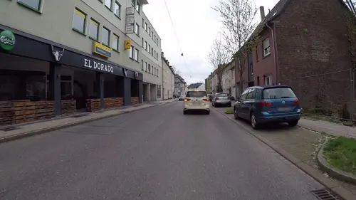
El Dorado
Restaurant · Steak House
15 Otto-Brenner-Straße, Bochum
Mo,Tu,Th,Fr,Sa 11:30-15:00,17:00-22:30; We off; Su,PH 11:30-22:30
Tobys BBQ
Diner · American · 2.9 km
41 Darpestraße, Bochum
Mo-Th 12:00-21:30; Fr-Sa 12:00-22:30; Su 11:00-21:30
Altes Höntroper Brauhaus
Restaurant · 2.2 km
155 Wattenscheider Hellweg, Bochum
Mo-Su 11:00-14:00,17:00-24:00

Athena
Restaurant · Greek · 3.7 km
17 Munscheidstraße, Essen
Tu-Sa 17:00-23:00; Su,PH 12:00-14:30,17:00-22:00
Baseburger
Restaurant · Burger · 0.7 km
1 Alter Markt, Bochum
Mo-Th 11:30-22:00; Fr, Sa 11:30-00:00; Su 17:00-22:00
Doros Kotten
Restaurant · Italian · 3.4 km
8 Am Thie, Bochum
Tu-Sa 17:00-23:00; Su,PH 10:00-22:00; Mo off
Lakshmi Mahal
Restaurant · Indian
23 Querstraße, Bochum
Mo,We,Th,Fr 11:30-22:00; Sa 13:00-22:30; Su,PH 12:00-22:00, Tu off
186 more on the map.
History
Wattenscheid is first mentioned in a church document from Werden Abbey (Kloster Werden in Essen) in AD 880, by the name of Villa Uattanscethe.
The oldest church in Wattenscheid, St. Gertrud von Brabant, was built in the 9th century.
From 1554, Wattenscheid was a member of the Hanseatic League. During the Thirty Years' War, the area was occupied by Spanish troops, from 1623 to 1629. In 1633, imperial auxiliary troops plundered Wattenscheid, before Hessian and Swedish troops arrived. A fire destroyed the city on 15 September 1635.
Wattenscheid was best known as a coal mining town, with the first mine being built in the 1720s. By the 1840s, there were about twelve mines, with around 580 professional miners. This accelerated the development of the city during the period of industrialization. The last coal mine in Wattenscheid and Bochum (Zeche Hannover) was closed in 1973 and is now part of a museum.
Until 2016, Wattenscheid was home to the fashion group Steilmann, which went bankrupt that year.
From the History section of Wattenscheid on Wikipedia, under CC BY-SA 4.0.
Notable people from Wattenscheid
 Mark WaschkeGerman actorPhoto: Martin Kraft, CC BY-SA 4.0
 Klaus RinkeGerman sculptor and university teacher (1939-2026)Photo: Andreas Schwarzkopf, CC BY-SA 4.0
 Dennis RadtkeGerman politicianPhoto: Raimond Spekking, CC BY-SA 4.0
 Katharina BorchertGerman journalistPhoto: Foundations World Economic Forum, CC BY 2.0
- Willi SchulzGerman footballer
- Uli MasloGerman footballer and manager
- Josef FrankeGerman architect (1876–1944)
- Helmut JagielskiGerman association football player (1934-2002)
- Heinz-Josef KoitkaGerman footballer
- Reinhard DöhlGerman literary scholar, writer, artist and university teacher (1934–2004)
- Gisbert SchneiderGerman director of church music (1934–2018)
- Werner IptaGerman footballer (1942-2019)
Born in Wattenscheid, according to Wikidata (CC0). Each name links to its Wikipedia article.
Where to stay6
Hotel Bochum Wattenscheid Affiliated By Meliá
Motel and hotel · 1.1 km
1 Josef-Haumann-Straße, Bochum
Churches and places of worship39
Ev.-luth. Kreuz-Gemeinde Bochum der SELK
Church · Lutheran · 3.6 km
146-152 Gahlensche Straße, Bochum
Herz-Jesu-Kirche
Church · Catholic · 2.5 km
101 Sevinghauser Weg, Bochum
Herz-Jesu-Kirche
Church · Roman Catholic · 3.7 km
31 Reichsstraße, Bochum
Shopping46
Gas and EV charging22
Schools, colleges and libraries42
Alice-Salomon-Berufskolleg Zweigstelle Von-der-Recke-Straße
School · 3.3 km
53 Von-der-Recke-Straße, Bochum
Healthcare27
Map of Wattenscheid
250 places. The map loads OpenStreetMap tiles when you open it.
Getting there and nearby towns
Flughafen Essen-Mülheim (ESS) is the nearest airport with scheduled flights listed in OpenStreetMap, 17 km away.
- Gelsenkirchen 4 km northwest, about 4 min by car
- Bochum 5 km east, about 5 min by car
- Herne 9 km northeast, about 9 min by car
- Niederwenigern 8 km south, about 8 min by car
- Essen 9 km west, about 9 min by car
- Hattingen 10 km south, about 10 min by car
- Herten 13 km north, about 13 min by car
- Castrop-Rauxel 14 km northeast, about 14 min by car
- Gladbeck 15 km northwest, about 15 min by car
- Recklinghausen 15 km north, about 15 min by car
Drive times are estimates from straight-line distance, not routes.
Towns near Wattenscheid


Keep exploring
Local news
Headlines from INDB.
Reviews, tips and questions
Loading what members have shared...
Sources and licences
- GeoNames (CC BY 4.0): population, coordinates, regions and time zone
- Mapillary (see each image): photos
- OpenStreetMap contributors (ODbL 1.0): places, airports, map data
- Wikidata (CC0 1.0): elevation, founding date, time zone, website, landmarks and historic places
- Wikimedia Commons (see each image): photos
- Wikipedia (CC BY-SA 4.0): overview and history text
Photo credits
- Wattenscheid, straatzicht Bahnhofstrasse met Friedenskirche DmA027 foto1 2013-07-28 10.47, Michielverbeek, CC BY-SA 3.0
- Büdchen am Stadtgarten, Parkstraße in Wattenscheid, 21-03-2026, Rotkelchen511, CC BY-SA 4.0
- Wandmalerei in Wattenscheid, Sebastian Martin Dicke, CC BY-SA 4.0
- Wattenscheid, straatzicht Hochstrasse foto3 2013-07-28 10.36, Michielverbeek, CC BY-SA 3.0
- Stadtgarten Wattenscheid, Sept 2025, No 29, Heinrich Kämpchen, CC BY-SA 4.0
- Stadtgarten Wattenscheid, Sept 2025, No 30, Heinrich Kämpchen, CC BY-SA 4.0
- Stadtgarten Wattenscheid, Sept 2025, No 20, Heinrich Kämpchen, CC BY-SA 4.0
- Stadtgarten Wattenscheid, Sept 2025, No 19, Heinrich Kämpchen, CC BY-SA 4.0
- MiR außen ganz, MiR Gelsenkirchen, CC BY-SA 3.0
- PRINZREGENTTHEATER BOCHUM, PRINZREGENTTHEATER, CC BY-SA 4.0
- Herne Mondpalast Autostitch, The original uploader was Stahlkocher at German Wikipedia ., CC BY-SA 3.0
- Bergbaumuseum Sommer 2013, Christian Nawrot, CC BY-SA 3.0
- Gelsenkirchen - Zoom - Afrika - African Queen 06 ies, Frank Vincentz, CC BY-SA 3.0
- Bochum Technische Fachhochschule Georg Agricola, Unknown author, CC BY-SA 3.0
- Foerdergerüst Zeche Holland Wattenscheid, Thorsten Bachner, Public domain
- Lohrheidestadion2025, JTCEPB, CC BY-SA 4.0
- Bochum Jahrhunderthalle, The original uploader was Stahlkocher at German Wikipedia ., CC BY-SA 3.0
- Klaus-Steilmann-Haus, Thommek, CC BY-SA 3.0
- Haus Dahlhausen - Bochum (1), Knochen, CC BY-SA 3.0
- Bochum - In den Höfen - Helfs Hof ex (TdoD) 03 ies, Frank Vincentz, CC BY-SA 3.0
- Louis-Baare-Berufskolleg 02, Unknown author, CC BY-SA 3.0
- Gelsenkirchen - NSG + Halde Rheinelbe nord+süd (Mechtenberg) 02 ies, Frank Vincentz, CC BY-SA 3.0
- Martin-Luther-Krankenhaus Wattenscheid aussen1, Julius2209, CC BY-SA 3.0
- Herne - Königsgruber Straße - Park 01 ies, Frank Vincentz, CC BY-SA 3.0
- Stadtgarten Wattenscheid, Herbst 2002, No machine-readable author provided. Maschinenjunge assumed (based on copyright claims)., CC BY-SA 3.0
- Herz-Jesu-Kirche-Sevinghausen-2013, Tuxyso, CC BY-SA 3.0
- Kreuzkirche (Bochum-Hamme) (03), Chris06, CC BY-SA 4.0
- Gelsenkirchen, Baudenkmal 068 Nicolai-Kirche Ückendorfer Strasse 106 - Ückendorf 2020-04-25, W.Strickling, CC BY-SA 4.0
- Bochum-Leithe St Johannes Kirche, Raenmaen, CC BY-SA 3.0
- Bochum-Leithe Ev Gemeindezentrum, Raenmaen, CC BY-SA 3.0
- Gelsenkirchen, Baudenkmal 110 St. Josef Ückendorfer Strasse 124 - Ückendorf 2020-04-25, W.Strickling, CC BY-SA 4.0
- Bismarckturm Essen-Kray, Kungfuman, CC BY-SA 3.0
- Stolperstein Bochum Vorwärtsstraße 6 Eugen Sondheimer, Gmbo 2013, CC0
- NSG BO-001 Blumenkamp NRW Weiher-02, Mamiwat, CC BY-SA 4.0
- Bochum, Jahrhunderthalle positie6 foto3 2012-08-19 09.39, Michielverbeek, CC BY-SA 3.0
- Essen - Am Mechtenberg - NSG - Mechtenberg - Bismarckturm 06 ies, Frank Vincentz, CC BY-SA 3.0
- Landschaftspark Mechtenberg by Moehre1992, Moehre1992, CC BY-SA 2.0
- ZecheHannover0003, Unknown author, CC BY-SA 3.0
- Alte-Evangelische-Kirche-Wattenscheid-2013, Tuxyso, CC BY-SA 3.0
- Stolperstein Bochum Hochstraße 81 Berta Wassermann, Gmbo 2013, CC0
- Klaus-Steilmann-Berufskolleg (2017), Baumhaus26 ( Diskussion ), CC BY-SA 3.0 de
- 2313-01-048 - Bücherschrank bei Thorpe Heimatmuseum, Eppendorf, Bochum, Heinrich Kämpchen, CC BY-SA 4.0
- Street-level photo, bravewaffle, CC BY-SA 4.0
- Street-level photo, miguel_andrade, CC BY-SA 4.0
- Street-level photo, bravewaffle, CC BY-SA 4.0
- Street-level photo, bravewaffle, CC BY-SA 4.0
- Street-level photo, TechniPorter, CC BY-SA 4.0
- Street-level photo, TechniPorter, CC BY-SA 4.0
- Street-level photo, hiwi234, CC BY-SA 4.0
- Street-level photo, fourfourcharly, CC BY-SA 4.0
- Street-level photo, avikdor, CC BY-SA 4.0
- Street-level photo, bravewaffle, CC BY-SA 4.0
- Street-level photo, avikdor, CC BY-SA 4.0
- Street-level photo, geogladbecker, CC BY-SA 4.0
- Street-level photo, StefanS79, CC BY-SA 4.0
- Street-level photo, geogladbecker, CC BY-SA 4.0
- Street-level photo, rororo, CC BY-SA 4.0
- Street-level photo, geogladbecker, CC BY-SA 4.0
- Street-level photo, TechniPorter, CC BY-SA 4.0
- Street-level photo, TechniPorter, CC BY-SA 4.0
- Street-level photo, TechniPorter, CC BY-SA 4.0
- Street-level photo, bravewaffle, CC BY-SA 4.0
- Street-level photo, bravewaffle, CC BY-SA 4.0
- Street-level photo, bravewaffle, CC BY-SA 4.0


Page built November 9, 2026. Spotted a mistake? Tell us or suggest a place.