


Why visit Heusweiler
Townapedia lists 155 museums and landmarks, 17 parks and trails, 129 places to eat, 4 places to stay and 20 attractions in and around town.
Highlights include Kühlberg, Bauernkuppe, Bietschieder Schlösschen and Eiweiler Mühle.
Weather in Heusweiler
Forecast from MET Norway (CC BY 4.0). Full forecast
About Heusweiler
Heusweiler (German pronunciation: [ˈhɔʏsvaɪlɐ] ; Palatine German: Heiswiller [ˈhaɪ̯svɪla]; older French: Hoysviller) is a municipality in the District of Saarbrücken, Saarland, Germany. It is located in the upper Köllerbach valley, 15 km north of Saarbrücken. As of 2025, it has 18,385 inhabitants.
From the Wikipedia article Heusweiler (this version), under CC BY-SA 4.0.
Things to do20

Kühlberg
Scenic view · 3.6 km
Bezeichnung ist Kühlberg, nicht Kyllberg wie der Straßenname vermuten lässt


8 more on the map.
Museums and landmarks155

Bietschieder Schlösschen
Monument and historic site · 2.0 km
Bietschieder Schlösschen, Herrenhaus des Hofgutes mit reicher Innenausstattung und Stuckaturen aus der Fabrik Joseph Beunat, Portal von...
14 Bietschieder Straße, Heusweiler

Eiweiler Mühle
Monument and historic site · 2.1 km
Mit komplett erhaltenem Mahlwerk, gen. 1597, 1771 Zerstörung durch Hochwasser, 1776 Wiederaufbau, 1821 Umbau
2 An der Mühle, Heusweiler

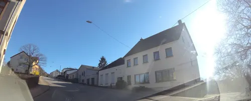

ehem. Burg Mühlenbach
Monument and historic site · 2.8 km
Niederungsburg, verfallen

ehem. kath. Pfarrhaus
Monument and historic site · 4.5 km
26 Sprenger Straße, Püttlingen

Himbert / Rupp
Monument and historic site · 4.5 km
Sanssteinkreuz mit Metalkruzifix und Statue auf Steinsockel

Müller / Neu
Monument and historic site · Catholic · 1.6 km
Weißes Kreuz mit Metalkruzifix auf Altarsockel, Höhe ca 3 m, im Vorgarten eines alten Bauernhauses


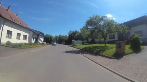
Schmitttrenze Kreiz
Monument and historic site · 2.6 km
Steinkreuz mit Metalkruzifix auf Sandsteinsockel

Wegkreuz
Monument and historic site · Christian · 1.5 km
Fundament, gemauerter Steinsockel, Abdeckplatte Kreuz mit Kruzifix aus Messing. Standort : Am Kappelberg.
143 more on the map.
Parks, trails and playgrounds17

Köllertaler Wald, mit Bietschieder- und Rödelbachtal (Teilbereich Heusweiler)
Hiking and trails · 3.3 km
Landschaftsschutzgebiet im Saarland mit der Nummer L 5.01.01

Quellgebiet des Köllerbaches zwischen Großwald und Kirschhofer Tal
Hiking and trails · 3.4 km
Landschaftsschutzgebiet im Saarland





Leichtathletikanlage Breitwies
Sports field and stadium · 5.5 km
144 Köllner Straße, Püttlingen

5 more on the map.
Restaurants and cafes129
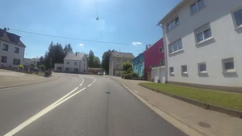
Cafe Benjamico
Cafe · Coffee Shop, Breakfast, Cafe, Cake · 1.6 km
1 Salbacher Straße, Riegelsberg
Tu-Su,PH 09:00-17:00; Mo off
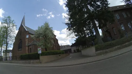
Café Ottilie
Cafe · Breakfast, Frühstücksbuffet, Cake, Torten, Regional, Tea · 3.6 km
2 Buchschacher Straße, Riegelsberg
Mo-Fr 09:00-19:00, Sa 09:00-13:00, Su 09:00-18:00
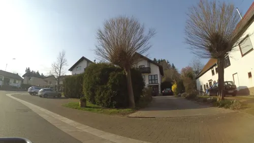
Don Lillo
Restaurant · Italian · 1.7 km
31 Kirschhofer Straße, Heusweiler
Mo,Tu,Th-Sa 16:00-22:00; Su,PH 11:30-14:00,17:00-22:00; We off
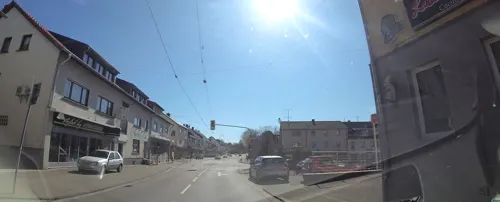
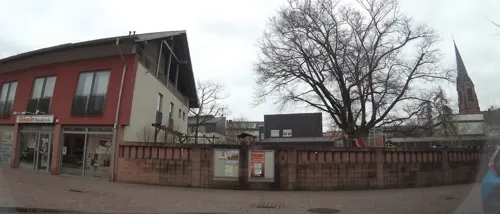
Restaurant Roter Hirsch
Restaurant · Regional
4 Am Markt, Heusweiler
Mo off; Tu-Fr 11:30-14:30,18:00-22:30; Sa 18:00-22:30; Su...
Roj Kebab
Restaurant · Kebab, Pizza, Pasta · 1.8 km
1 Etzenhofer Straße, Riegelsberg
Mo-Fr 11:00-22:30; Sa,Su,PH 13:00-22:00

Don Camillo
Restaurant · Pizza · 3.2 km
Mo-Su 11:30-14:00,17:30-23:30; Sa 17:30-23:30; Tu off; PH Tu...


M3 Bar & Lounge
Bar and pub
3 Am Markt, Heusweiler
Mo-We 10:00-22:00; Th 08:00-22:00; Sa,Su 10:00-00:00
Restaurant Hundehütt Heusweiler
Restaurant · 1.8 km
27 Am Schwimmbad, Heusweiler
Mo-Th off; Fr 17:30+; Su 11:30-14:00
117 more on the map.
Where to stay4
Churches and places of worship34
Evangelische Kirche
Church · Protestant · 3.7 km
Buchschacher Straße, Riegelsberg
Shopping22
Gas and EV charging7
Schools, colleges and libraries15
Katholische Öffentliche Bücherei Herz Jesu Köllerbach / Oberes Köllertal Heilige Familie
Library · 4.5 km
Healthcare10
Schulze-Kathrin Apotheke
Clinic and pharmacy · 5.0 km
8 Bartholomäusstraße, Saarwellingen
Map of Heusweiler
250 places. The map loads OpenStreetMap tiles when you open it.
Getting there and nearby towns
Saarbrücken Airport (SCN) is the nearest airport with scheduled flights listed in OpenStreetMap, 19 km away.
- Riegelsberg 4 km south, about 4 min by car
- Püttlingen 6 km southwest, about 6 min by car
- Eppelborn 8 km north, about 8 min by car
- Lebach 8 km north, about 8 min by car
- Merchweiler 9 km east, about 9 min by car
- Quierschied 9 km east, about 9 min by car
- Schwalbach 9 km southwest, about 9 min by car
- Illingen 9 km northeast, about 9 min by car
- Saarwellingen 9 km west, about 9 min by car
- Sulzbach 10 km southeast, about 10 min by car
Drive times are estimates from straight-line distance, not routes.
Local news
Headlines from INDB.
Reviews, tips and questions
Loading what members have shared...
Sources and licences
- GeoNames (CC BY 4.0): population, coordinates, regions and time zone
- Mapillary (see each image): photos
- OpenStreetMap contributors (ODbL 1.0): places, airports, map data
- Wikidata (CC0 1.0): elevation, founding date, time zone, website
- Wikimedia Commons (see each image): photos
- Wikipedia (CC BY-SA 4.0): overview and history text
Photo credits
- Heusweiler Ansicht, H.Hei52, CC BY-SA 3.0
- Heusweiler Bahnhof Juli 2013, atreyu, CC BY-SA 3.0
- Bahnhof Heusweiler, Lantus, CC BY-SA 3.0
- Heusweiler Bahnstrecke Lebach–Völklingen (Köllertalbahn) 02, atreyu, CC BY-SA 4.0
- Heusweiler, der Markt, Dguendel, CC BY 3.0
- Heusweiler Partie an der Evangelischen Kirche 02, atreyu, CC BY-SA 3.0
- Heusweiler Partie an der Evangelischen Kirche 01, atreyu, CC BY-SA 3.0
- Downtown Heusweiler - panoramio, SSobachek, CC BY-SA 3.0
- Heusweiler, die evangelische Kirche, Dguendel, CC BY 3.0
- Heusweiler, die Kirche Mariä Heimsuchung, Dguendel, CC BY 3.0
- 20200705Heusweiler Schulzentrum 01, Flocci Nivis, CC BY-SA 4.0
- Heusweiler, die Trierer Straße (Südwestteil), Dguendel, CC BY 3.0
- 20200705Heusweiler Schulzentrum 05, Flocci Nivis, CC BY-SA 4.0
- 20200705Heusweiler Schulzentrum 04, Flocci Nivis, CC BY-SA 4.0
- 20200705Heusweiler Schulzentrum 06, Flocci Nivis, CC BY-SA 4.0
- Sender Heusweiler28122015 1, Zonk43, CC BY-SA 3.0
- Sender Heusweiler22122015 9, Zonk43, CC BY-SA 3.0
- Sender Heusweiler22122015 1, Zonk43, CC BY 3.0
- Sender Heusweiler10122015 1, Zonk43, CC BY-SA 3.0
- Hallenbad Heusweiler28122015, Zonk43, CC BY-SA 3.0
- Hallenbad Heusweiler22122015, Zonk43, CC BY-SA 3.0
- Hallenbad Heusweiler10122015, Zonk43, CC BY-SA 3.0
- Wahlschied Kirche, LoKiLeCh, CC BY 3.0
- Reisbach St. Marien 05, atreyu, CC BY-SA 3.0
- 20201031 Herz-Jesu-Kirche Köllerbach 05, Flocci Nivis, CC BY 4.0
- Köllerbach Martinskirche 05, atreyu, CC BY-SA 3.0
- Heusweiler Barockkirche, LoKiLeCh, CC BY 3.0
- Heusweiler Mariä Heimsuchung 05, atreyu, CC BY-SA 3.0
- Schloss Bietschied 02, Anna16, CC BY-SA 3.0
- Riegelsberg Evangelische Kirche 02, atreyu, CC BY-SA 3.0
- Riegelsberg Josefskirche, atreyu, CC BY-SA 3.0
- Holz Evangelische Kirche, LoKiLeCh, CC BY 3.0
- 20191228Frohn-Wald-Weg 05, Flocci Nivis, CC BY-SA 4.0
- 20200705 Quellgebiet des Köllerbaches zwischen Großwald und Kirschhofer Tal 03, Flocci Nivis, CC BY 4.0
- 20191203Frohn-Wald-Weg 07, Flocci Nivis, CC BY-SA 4.0
- 20200119Engelfangen 03, Flocci Nivis, CC BY-SA 4.0
- 20200705 Eiweiler Viaduct 04, Flocci Nivis, CC BY-SA 4.0
- 20200705 Eiweiler Mühle 03, Flocci Nivis, CC BY-SA 4.0
- 20200705 Kreuzweg Vogelsbornkapelle 02, Flocci Nivis, CC BY 4.0
- 20200119 Schachtanlage Viktoria III 02, Flocci Nivis, CC BY 4.0
- 20201216 Holzer Freibad 07, Flocci Nivis, CC BY 4.0
- 20201031 Katholisches Pfarrhaus Köllerbach 02, Flocci Nivis, CC BY 4.0
- Schloss Bietschied, Anna16, CC BY-SA 3.0
- Wegekreuz Himbert Rupp 01, Flocci Nivis, CC BY 4.0
- Wegkreuz Hirtel 01.1, Pelayo 08, CC BY-SA 4.0
- Wegkreuz Kirschhof 01, Pelayo 08, CC BY-SA 4.0
- Saarwellingen-Schwarzenholz, Bartholomäuskirche., Rosarap, CC BY-SA 3.0
- Kirche reisbach, Loeschie, CC BY-SA 2.0 de
- Burg Bucherbach Köllerbach Püttlingen 01, Amber16, CC BY-SA 4.0
- Street-level photo, teddy73, CC BY-SA 4.0
- Street-level photo, teddy73, CC BY-SA 4.0
- Street-level photo, teddy73, CC BY-SA 4.0
- Street-level photo, teddy73, CC BY-SA 4.0
- Street-level photo, teddy73, CC BY-SA 4.0
- Street-level photo, teddy73, CC BY-SA 4.0
- Street-level photo, teddy73, CC BY-SA 4.0
- Street-level photo, teddy73, CC BY-SA 4.0
- Street-level photo, teddy73, CC BY-SA 4.0
- Street-level photo, teddy73, CC BY-SA 4.0
- Street-level photo, teddy73, CC BY-SA 4.0
- Street-level photo, teddy73, CC BY-SA 4.0
- Street-level photo, teddy73, CC BY-SA 4.0
- Street-level photo, teddy73, CC BY-SA 4.0
- Street-level photo, teddy73, CC BY-SA 4.0
- Street-level photo, teddy73, CC BY-SA 4.0
- Street-level photo, teddy73, CC BY-SA 4.0
- Street-level photo, teddy73, CC BY-SA 4.0
- Street-level photo, map24, CC BY-SA 4.0
- Street-level photo, teddy73, CC BY-SA 4.0
- Street-level photo, teddy73, CC BY-SA 4.0
- Street-level photo, teddy73, CC BY-SA 4.0
- Street-level photo, teddy73, CC BY-SA 4.0
- Street-level photo, teddy73, CC BY-SA 4.0
- Street-level photo, arayla, CC BY-SA 4.0
- Street-level photo, teddy73, CC BY-SA 4.0
- Street-level photo, teddy73, CC BY-SA 4.0
- Street-level photo, teddy73, CC BY-SA 4.0


Page built November 8, 2026. Spotted a mistake? Tell us or suggest a place.