


Why visit Idstein
Townapedia lists 67 museums and landmarks, 64 parks and trails, 134 places to eat, 12 places to stay and 50 attractions in and around town.
Highlights include Atzelberg Tower, Hofladen Taunushof Volz, Limeswachturm Wp 3/26 and Alte Kirche.
Weather in Idstein
Forecast from MET Norway (CC BY 4.0). Full forecast
About Idstein
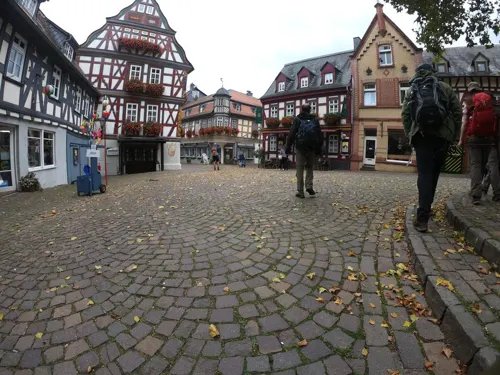
Idstein (German: [ˈɪtʃtaɪn] ) is a town of about 25,000 inhabitants in the Rheingau-Taunus-Kreis in the Regierungsbezirk of Darmstadt in Hesse, Germany. Because of its well preserved historical Altstadt (old town), it is part of the Deutsche Fachwerkstraße (German Timber-Frame Road), connecting towns with fine fachwerk buildings and houses. In 2002, the town hosted the 42nd Hessentag state festival.
From the Wikipedia article Idstein (this version), under CC BY-SA 4.0.
Things to do50

Atzelberg Tower
Monument and historic site · 9.8 km
Observation tower in Taunus

Hofladen Taunushof Volz
Farm and orchard · 2.8 km
5 Hohe Straße, Idstein
Fr 16:00-18:00; Sa 10:00-12:00
Hofladen Waldhof Niederseelbach
Farm and orchard · 3.5 km
1, Niedernhausen
Fr 15:00-18:00, Sa 09:00-13:00
Kreuzhecker Hof
Farm and orchard · 3.6 km
Hofladen, 24/7 Regiomat und Eisautomat, Raststelle für Wanderer und Radfahrer,
1 Kreuzhecker Hof, Waldems
24/7
Bauer Schmidt’s
Farm and orchard · 6.5 km
Jan-Apr: Fr 10:00-19:00; Apr-Nov: Mo-Fr 10:00-19:00; Sa...


38 more on the map.
Museums and landmarks67

Limeswachturm Wp 3/26
Monument and historic site · 2.5 km
Nachbau eines römischen Wachturms auf der Dasbacher Höhe
Easter - Oct: Su 14:30 - 17:00



55 more on the map.
Parks, trails and playgrounds64







52 more on the map.
Restaurants and cafes134
Morcher Mühle
Restaurant · Regional · 6.0 km
Landgasthof. Durchgehend warme Küche. Sonntags Brunch 10:30-15:00.
1, Idstein
Tu-Sa 17:00-22:00; Su 11:30-22:00; Mo off
La Fattoria
Restaurant · Italian
Kartenzahlung ab 20€
8 Himmelsgasse, Idstein
Mo off; Tu-Su 12:00-15:00,18:00-23:00

Pizzeria Bacco
Restaurant · Pizza, Italian · 7.4 km
Kleine Pizzeria
146 Frankfurter Straße, Bad Camberg
Mo-Su 11:30-14:00,17:00-22:30

Zum Schwarzen Hahn
Restaurant · International · 5.9 km
(Am Sportplatz)
32 Am Forsthaus, Hünstetten
Mo-Fr 17:30-23:00; Sa 16:00-22:00; Su,PH 11:00-22:00; We off
Zum schwarzen Roß
Restaurant · German, Pizza, International, Pasta, Pakistani · 7.3 km
Seit 1996 bin ich Inhaber des Restaurants "Zum Schwarzen Ross".Zusammen mit meinem erfahrenen Team biete ich Ihnen ein großes Angebot an...
148 Frankfurter Straße, Bad Camberg
Mo-Su 11:00-14:00,17:30-22:30
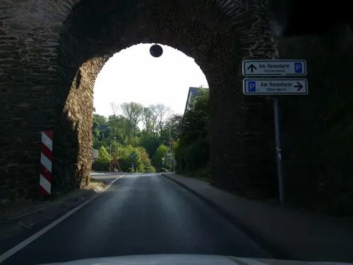
Ambach
Restaurant · Burger, International, Mediterranean
9 Am Hexenturm, Idstein
Mo,We-Th 17:30-24:00; Tu,PH off; Fr 11:30-14:30,17:30-01:00; Sa...



Deutsches Haus
Restaurant · Spanish, Greek
4 Obergasse, Idstein
Mo-Tu,Th-Fr 17:00-23:00; We off; Sa-Su,PH 11:30-14:30,17:00-23:00
Dolce Sapore
Restaurant · Italian
12 Himmelsgasse, Idstein
Tu-Th 10:30-19:00; Fr 10:30-21:00; Sa 10:30-14:30; Su,PH off; Mo...
Golden Lotus
Restaurant · Chinese
27 Rodergasse, Idstein
Mo-Sa 11:30-15:00,18:00-23:00; Su 12:00-22:00
Gut Henriettenthal
Restaurant · German, Tapas, Burger · 4.6 km
10 Am Nassen Berg, Idstein
Oct-Mar 12:00+; Apr-Sep 11:00+
122 more on the map.
History
Idstein, which had its first documentary mention in 1102 as Etichenstein, was granted town and market rights in 1287 by King Rudolph of Habsburg. Besides the above-mentioned Hexenturm near the old Nassau castle, the town has a mediaeval town centre with many timber-frame buildings. The town's oldest preserved house was originally built in 1410.
From the documentary mention in 1102 until 1721, Idstein was, with interruptions, residence of the Counts of Nassau-Idstein and other Nassau lines. One of the Counts, Adolf of Germany, was, as a compromise candidate, the Holy Roman Emperor from 1292 to 1298, later falling in battle against the anti-king Albrecht I of Habsburg.
The Nassau Counts' holdings were subdivided many times among heirs, with the parts being brought together again whenever a line died out. This yielded an older Nassau-Idstein line from 1480 to 1509, later merging once again with Nassau-Wiesbaden and Nassau-Weilburg and, from 1629 to 1721, a newer Nassau-Idstein line.
In the 17th century, Count Johann of Nassau-Idstein persecuted witches in Idstein.
In 1721, Idstein passed to Nassau-Ottweiler, and in 1728 to Nassau-Usingen, thereby losing its status as a residence town, although it became the seat of the Nassau Archives and of an Oberamt.
From the History section of Idstein on Wikipedia, under CC BY-SA 4.0.
Where to stay12
Frühstücks-Pension Schikowsky
Motel and hotel · 5.5 km
13 An der Siebenmeisterbrücke, Idstein
Churches and places of worship34
Christuskirche
Church · Lutheran · 7.1 km
2 Fritz-Gontermann-Straße, Niedernhausen
Shopping36
Gas and EV charging12
Schools, colleges and libraries23
Healthcare10
Map of Idstein
250 places. The map loads OpenStreetMap tiles when you open it.
Getting there and nearby towns
Wiesbaden Army Airfield (WIE) is the nearest airport with scheduled flights listed in OpenStreetMap, 19 km away.
- Niedernhausen 7 km southeast, about 7 min by car
- Bad Camberg 9 km north, about 9 min by car
- Taunusstein 11 km southwest, about 11 min by car
- Eppstein 12 km southeast, about 12 min by car
- Wiesbaden 15 km south, about 15 min by car
- Königstein im Taunus 15 km east, about 15 min by car
- Klarenthal 15 km south, about 15 min by car
- Bad Schwalbach 16 km southwest, about 16 min by car
- Hofheim am Taunus 19 km southeast, about 19 min by car
- Neu-Anspach 20 km northeast, about 20 min by car
Drive times are estimates from straight-line distance, not routes.
Local news
Headlines from INDB.
Reviews, tips and questions
Loading what members have shared...
Sources and licences
- GeoNames (CC BY 4.0): population, coordinates, regions and time zone
- Mapillary (see each image): photos
- OpenStreetMap contributors (ODbL 1.0): places, airports, map data
- Wikidata (CC0 1.0): elevation, founding date, time zone, website, landmarks and historic places
- Wikimedia Commons (see each image): photos
- Wikipedia (CC BY-SA 4.0): overview and history text
Photo credits
- Idstein - Rathaus, Oliver Abels ( SBT ), CC BY 2.5
- Stolpersteinlage Idstein Wiesbadener Straße 22, Gmbo 2013, CC0
- Stolperstein Idstein Wiesbadener Straße 22 Ruth Löwenstein, Gmbo 2013, CC0
- Stolperstein Idstein Wiesbadener Straße 22 Bertha Löwenstein, Gmbo 2013, CC0
- Stolperstein Ruth Löwenstein, 1, Wiesbadener Straße 22, Idstein, Rheingau-Taunus-Kreis, GeorgDerReisende, CC BY-SA 4.0
- Stolperstein Bertha Löwenstein, 1, Wiesbadener Straße 22, Idstein, Rheingau-Taunus-Kreis, GeorgDerReisende, CC BY-SA 4.0
- Stolperstein David Löwenstein, 1, Wiesbadener Straße 22, Idstein, Rheingau-Taunus-Kreis, GeorgDerReisende, CC BY-SA 4.0
- Stolperstein Idstein Wiesbadener Straße 22 David Löwenstein, Gmbo 2013, CC0
- Stolpersteinlage in Idstein Wiesbadener Straße 22, Gmbo 2013, CC0
- Stolpersteine Idstein Wiesbadener Straße 22, Gmbo 2013, CC0
- Sankt Martin-Kirche Idstein Wiesbadener Straße, Gmbo 2013, CC0
- Wiesbadener Straße 28, 1, Idstein, Rheingau-Taunus-Kreis, GeorgDerReisende, CC BY-SA 4.0
- Wiesbadener Straße 33, 1, Idstein, Rheingau-Taunus-Kreis, GeorgDerReisende, CC BY-SA 4.0
- Schillerstraße, 1, Idstein, Rheingau-Taunus-Kreis, GeorgDerReisende, CC BY-SA 4.0
- Wiesbadener Straße 30, 1, Idstein, Rheingau-Taunus-Kreis, GeorgDerReisende, CC BY-SA 4.0
- Wiesbadener Straße 35, 1, Idstein, Rheingau-Taunus-Kreis, GeorgDerReisende, CC BY-SA 4.0
- Ferdinand-Abt-Straße 2, 1, Idstein, Rheingau-Taunus-Kreis, GeorgDerReisende, CC BY-SA 4.0
- Wiesbadener Straße 32, 1, Idstein, Rheingau-Taunus-Kreis, GeorgDerReisende, CC BY-SA 4.0
- Idstein, St. Martin (02), Subbass1, CC BY-SA 4.0
- Idstein, St. Martin (06), Subbass1, CC BY-SA 4.0
- Idstein, St. Martin (05), Subbass1, CC BY-SA 4.0
- Idstein, St. Martin (01) (cropped), Subbass1, CC BY-SA 4.0
- Idstein, St. Martin (01), Subbass1, CC BY-SA 4.0
- Wiesbadener Straße 38, 1, Idstein, Rheingau-Taunus-Kreis, GeorgDerReisende, CC BY-SA 4.0
- Wiesbadener Straße 34, 1, Idstein, Rheingau-Taunus-Kreis, GeorgDerReisende, CC BY-SA 4.0
- Wiesbadener Straße 37, 3, Idstein, Rheingau-Taunus-Kreis, GeorgDerReisende, CC BY-SA 4.0
- Wiesbadener Straße 36, 1, Idstein, Rheingau-Taunus-Kreis, GeorgDerReisende, CC BY-SA 4.0
- Wiesbadener Straße 37, 2, Idstein, Rheingau-Taunus-Kreis, GeorgDerReisende, CC BY-SA 4.0
- Wiesbadener Straße 37, 1, Idstein, Rheingau-Taunus-Kreis, GeorgDerReisende, CC BY-SA 4.0
- Gesamtanlage Wiesbadener Straße, 1, Idstein, Rheingau-Taunus-Kreis, GeorgDerReisende, CC BY-SA 4.0
- Wiesbadener Straße 40, 1, Idstein, Rheingau-Taunus-Kreis, GeorgDerReisende, CC BY-SA 4.0
- Verdi Requiem St Martin Idstein, Gerda Arendt, CC BY-SA 3.0
- Lautzstraße, 1, Idstein, Rheingau-Taunus-Kreis, GeorgDerReisende, CC BY-SA 4.0
- Idstein, St. Martin (03), Subbass1, CC BY-SA 4.0
- Idstein, St. Martin (07), Subbass1, CC BY-SA 4.0
- Idstein, St. Martin (04), Subbass1, CC BY-SA 4.0
- Treppenaufgang Liegehalle Leichenhalle gesperrt Idstein Aufnahme HaMe 2025, FritzBauerFrankfurt, CC0
- ESWE eMC, Idstein (LRM 20251013 180301), Matti Blume, CC BY-SA 4.0
- ESWE eMC, Idstein (LRM 20251013 180247), Matti Blume, CC BY-SA 4.0
- Gedenkstätte Kalmenhof Idstein, Gmbo 2013, CC0
- Atzelbergturm, Jörg Braukmann, CC BY-SA 4.0
- Unionskirche Idstein, Frank Winkelmann, CC BY 3.0
- Türmchen, Ehrenbach, November, Gerda Arendt, CC BY-SA 4.0
- Taunusstein - Limes Wachturm, Oliver Abels ( SBT ), CC BY 2.5
- Kirche Walsdorf, Frank Winkelmann, CC BY 3.0
- Burg-Wallrabenstein-JR-A40-0669-2009-06-13, Johannes Robalotoff, CC BY-SA 3.0 de
- Idstein Killingerhaus-Fassade, Mylius, CC BY-SA 3.0
- Idstein-Schloss, No machine-readable author provided. RalfZi assumed (based on copyright claims)., CC BY-SA 3.0
- Katholische Kirche Idstein 022, Frank Winkelmann, CC BY 3.0
- Hexenturm Idstein P1150158 0 1 2 3 4 5 6 fused, Karl-Heinz Meurer (-- Charlie1965nrw ( Diskussion )), CC BY-SA 3.0 de
- Standort Köln Innenhof, Hochschule Fresenius, CC BY-SA 3.0
- Nassauer Hof - Scheuer Wörsdorf, Frank Winkelmann, CC BY 3.0
- Schiefes Haus Idstein1, Frank Winkelmann, CC BY 3.0
- Kirche Engenhahn 037-2, Kirche_Engenhahn_037.JPG : Frank Winkelmann derivative work: Rabanus Flavus ( talk ), CC BY 3.0
- Niedernhausen evangelische Kirche, Karsten11, Public domain
- 2010-02-27 Johanneskirche Niederseelbach 01, Wo st 01 (There are 682 Pictures in my Category ) See also Toolserver, CC BY-SA 3.0 de
- Oberjosbach, Kirche (3), Karsten Ratzke, CC0
- Oberjosbach, Kriegerdenkmal, Karsten Ratzke, CC0
- Esch, Kriegerdenkmal, Karsten Ratzke, CC0
- Esch Kirche, Karsten11, Public domain
- Idstein, Erlensumpf im Gerloh bei Idstein (2), Karsten Ratzke, CC0
- Felssporn Dattenberg, Frank Winkelmann, CC BY 3.0
- WP-HeftricherMoor-4240, Peter Sieling (Bluespete), CC BY-SA 4.0
- Theißtal von Niedernhausen, Gearhead064, CC BY-SA 3.0
- Niedernhausen, Maria Königin (07), Subbass1, CC BY-SA 4.0
- Wörsdorf, Katholische Pfarrkirche Nikolaus-von-Flüe-Friedenskirche, Karsten Ratzke, CC0
- Buchwaldskopf-2018, FkMohr, CC BY-SA 3.0 de
- Limeswachturm Dasbacher Höhe Idstein, Kreuzschnabel, CC BY-SA 3.0
- 20-Hohler Stein, FkMohr, CC BY-SA 3.0 de
- Alteburger Markgelände, Karsten11, Public domain
- 5-Waldschwimmbad, FkMohr, CC BY-SA 3.0 de
- Street-level photo, b166er, CC BY-SA 4.0
- Street-level photo, changchun1, CC BY-SA 4.0
- Street-level photo, b166er, CC BY-SA 4.0
- Street-level photo, chuck, CC BY-SA 4.0
- Street-level photo, chuck, CC BY-SA 4.0
- Street-level photo, b166er, CC BY-SA 4.0
- Street-level photo, tmka, CC BY-SA 4.0
- Street-level photo, b166er, CC BY-SA 4.0
- Street-level photo, chuck, CC BY-SA 4.0
- Street-level photo, raymond, CC BY-SA 4.0
- Street-level photo, chuck, CC BY-SA 4.0
- Street-level photo, kreuzschnabel, CC BY-SA 4.0
- Street-level photo, chuck, CC BY-SA 4.0
- Street-level photo, b166er, CC BY-SA 4.0
- Street-level photo, b166er, CC BY-SA 4.0
- Street-level photo, mapcreator, CC BY-SA 4.0
- Street-level photo, b166er, CC BY-SA 4.0
- Street-level photo, b166er, CC BY-SA 4.0
- Street-level photo, b166er, CC BY-SA 4.0
- Street-level photo, b166er, CC BY-SA 4.0


Page built November 8, 2026. Spotted a mistake? Tell us or suggest a place.