


Taunusstein, Germany
Taunusstein is a town of 30,145 people in Hesse, Germany, founded in 1971.
Why visit Taunusstein
Townapedia lists 133 museums and landmarks, 34 parks and trails, 105 places to eat, 15 places to stay and 52 attractions in and around town.
Highlights include Tier- und Pflanzenpark Fasanerie, Hessisches Staatstheater Wiesbaden, Kur- Stadt- und Apothekenmuseum and Burg Adolfseck.
Weather in Taunusstein
Forecast from MET Norway (CC BY 4.0). Full forecast
About Taunusstein
Taunusstein (German: [ˈtaʊnʊsˌʃtaɪn] ) is the biggest town in the Rheingau-Taunus-Kreis in the Regierungsbezirk of Darmstadt in Hesse, Germany. It has 30,068 inhabitants (2020).
From the Wikipedia article Taunusstein (this version), under CC BY-SA 4.0.
Photos of Taunusstein


Things to do52

Tier- und Pflanzenpark Fasanerie
Zoo and aquarium · 5.8 km
22 Wilfried-Ries-Straße, Wiesbaden
Apr-Oct 09:00-18:00; Nov-Mar 09:00-16:00

Hessisches Staatstheater Wiesbaden
Cinema and theater · 10.0 km
Theatre and opera house in Wiesbaden, Germany


Gustav Vietor Tower
Monument and historic site · 4.7 km
Former observation tower in Taunusstein, Hesse, Germany


40 more on the map.
Museums and landmarks133
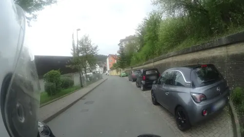
Kur- Stadt- und Apothekenmuseum
Museum · 5.7 km
16a Pestalozzistraße, Bad Schwalbach
We-Su 14:00-18:00


Altes Gemeindebackhaus
Monument and historic site · 2.3 km
240 Aarstraße


Wehener Schloss
Monument and historic site · 2.4 km
6 Weiherstraße, Taunusstein
Rothenburger Schlößchen
Monument and historic site · 6.1 km
12 Am Kurpark, Bad Schwalbach

Museum im Wehener Schloss
Museum · 2.4 km
Tu 10:00-13:00; We 10:00-20:00; Sa,Su 14:00-17:00; PH off
121 more on the map.
Parks, trails and playgrounds34



Wunderkiste
Playground · 6.0 km
11 Heimbacher Straße, Bad Schwalbach
Mo-Fr 14:30-19:00; Sa,Su 10:30-18:30

Golfplatz Hofgut Georgenthal
Golf course · 3.8 km
18-Loch Platz, Kurzplatz und Driving Range
1 Georgenthal, Hohenstein

Silberbach, Schwarzbach und Fürstenwiese bei Wehen
Hiking and trails · 4.7 km
22 more on the map.
Restaurants and cafes105
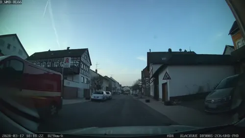
Pizzeria Aspendos
Restaurant · Kebab, Pizza · 6.3 km
Lieferservice
35 Langgasse, Hohenstein
Tu-Fr 11:30-22:00; Sa,Su 17:00-22:00; Mo off
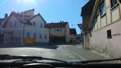
Jasmin
Restaurant · Chinese · 1.5 km
5 Erich-Kästner-Straße, Taunusstein
11:30-14:30,17:30-23:30; Mo off

Gasthof Jagdschloss Platte
Restaurant · German · 5.1 km
Durchgehend warme Küche. Biergarten.
1, Wiesbaden
We-Su,PH 12:00-22:00; Mo,Tu off
Waldgeist zur Eisernen Hand
Restaurant · German · 3.0 km
Warme Küche täglich 12 - 22 Uhr
1, Taunusstein
11:00+
Ganh Que
Restaurant · Vietnamese · 6.2 km
1a-1b Goetheweg, Bad Schwalbach
Tu-Su 11:30-15:00,17:00-22:00
Hotel & Restaurant Asia Linh
Restaurant · Asian · 1.6 km
4 Dresdener Straße, Taunusstein
Mo-Sa 11:30-14:30,17:30-23:00; Su,PH 12:30-22:00; Tu off
Hotel Restaurant zur Burg
Restaurant · Regional · 4.7 km
47 Limburger Straße, Taunusstein
Mo-Fr 07:00-10:30,18:00-21:30; Su,PH...
Langenschwalbacher Schlemmer & Kultur Station
Restaurant · German · 4.8 km
7 Aarstraße, Bad Schwalbach
Mo-Fr 11:30-14:00,17:00-23:00; Sa 17:00-23:00; Su 11:00-23:00
93 more on the map.
History
The town of Taunusstein came into being on 1 October 1971 through the merger of the formerly self-governing communities of Bleidenstadt, Hahn, Neuhof, Seitzenhahn, Watzhahn and Wehen, whereupon Taunusstein was also given town rights. On 1 July 1972, the communities of Hambach, Niederlibbach, Orlen and Wingsbach were amalgamated into the town of Taunusstein.
In 1991, Dr.-Peter-Nikolaus-Platz, a square in the constituent community of Hahn, was dedicated and named after the longtime mayor of Taunusstein. Fronting onto it are the "Taunus" community centre, the Catholic church centre of St. Johannes Nepomuk and the New Town Hall, whose functions together make the square into the new town centre. The "Taunus" community centre was opened in 1989, the church centre in 1991, both designed by the Hamburg architect Bernhard Hirche, from whom also sprang the whole concept of planning the new town centre. It was not until 1998, on the other hand, that the Town Hall, designed by another architect, could be dedicated.
From the History section of Taunusstein on Wikipedia, under CC BY-SA 4.0.
More about Taunusstein
Geography
Taunusstein lies roughly 10 km northwest of Wiesbaden and about 10 km west of Idstein and the Autobahn A 3. It is part of the Untertaunus (lower Taunus) range.
Taunusstein itself is a rural area and is about 30 km from the river Rhine. The lowest point in Taunusstein is 310 m above sea level, and the highest 613.9 m.
Taunusstein borders in the north on the communities of Hohenstein and Hünstetten and the town of Idstein, in the east on the community of Niedernhausen, in the south on the district-free city of Wiesbaden and in the west on the community of Schlangenbad and the town of Bad Schwalbach.
Economy
There are two railway stations (in Hahn and Bleidenstadt) which lie on the stretch of the Aartalbahn running through Taunusstein, however since 1983 the line was only used for steam tourist trips run by the Nassauische Touristik-Bahn (NTB). But since a truck damaged a bridge on the line in Wiesbaden-Dotzheim on 20 November 2009 then the line had to be closed completely. Despite promises from the city council of Wiesbaden money to replace the bridge has not been forthcoming, and the NTB are themselves facing financial problems due to not being able to run any trains on the line.
In 1998 it was proposed that the line be reopened to form part of a new light rail line into Wiesbaden Stadtbahn, this was however dropped in 2001. Although some plans for such a line have been revived since the 2011 election, these do not currently involve this section of the line.
The town is also linked to Wiesbaden over Bundesstraßen 417 (Neuhof/Wehen) and 54 (Hahn). The nearest Autobahn interchange is on the A 3 (Cologne–Frankfurt) in Idstein.
The nearest international airport is Frankfurt Airport, about 25 miles away. The smaller Mainz Finthen Airport, a regional public airfield, is about 15 miles away.
Motorola Deutschland (German business headquarters, advertising and marketing) in Neuhof
Brita GmbH water filtration, international headquarters in Neuhof and Wiesbaden
Arts and culture
In 1995, the Museum of the Town of Taunusstein, with permanent rooms at the Wehen Castle, was established. Since then, there has been a thematic emphasis on more recent regional history as seen in a permanent exhibit featuring this, which lately has also presented information about Taunusstein's condition in, before and after the World War II. This it does mainly by exhibiting everyday culture in the first half of the 20th century. A second and equally valid pillar is the displays in the series Kunst im Schloss ("Art at the Palace") through which contemporary art – not only from the local region – is offered a forum in Taunusstein.
Formerly used for, among other things, a widow's seat and a hunting palace, it now houses the Taunusstein Museum.
This was built by using stones from the old town fortifications, with a black marble altar brought from the Idstein palace church in 1722 and furnishings from the secularized monasteries at Marienhausen and Eberbach. The historic Voigt organ is one of the few instruments by Wiesbaden organ builder Heinrich Voigt still preserved in its original state. It was built in 1890 for the Old Catholic congregation of Wiesbaden and acquired by the Wehen congregation in 1899. In October 1999 it was restored to its original condition.
Built about 1900, this building is transitional in design between the Gründerzeit and Art Nouveau.
From the Wikipedia article Taunusstein, under CC BY-SA 4.0.
Notable people from Taunusstein

Born in Taunusstein, according to Wikidata (CC0). Each name links to its Wikipedia article.
Where to stay15
Churches and places of worship34
Martin-Luther-Kirche
Church · Lutheran · 5.4 km
145 Adolfstraße, Bad Schwalbach
Ev. Kirche Klarenthal
Church · Protestant · 6.9 km
12 Am Kloster Klarenthal, Wiesbaden
Evangelische Kirche
Church · Protestant · 4.7 km
5 Fabriciusstraße, Taunusstein
Evangelische Kirche Orlen
Church · Protestant · 4.3 km
3 Mittelgasse, Taunusstein
Shopping24
Gas and EV charging12
Schools, colleges and libraries19
Healthcare14
Map of Taunusstein
250 places. The map loads OpenStreetMap tiles when you open it.
Getting there and nearby towns
Wiesbaden Army Airfield (WIE) is the nearest airport with scheduled flights listed in OpenStreetMap, 17 km away.
- Bad Schwalbach 6 km west, about 6 min by car
- Schlangenbad 7 km southwest, about 7 min by car
- Klarenthal 8 km southeast, about 8 min by car
- Wiesbaden 10 km southeast, about 10 min by car
- Sonnenberg 10 km southeast, about 10 min by car
- Frauenstein 10 km south, about 10 min by car
- Idstein 11 km northeast, about 11 min by car
- Niedernhausen 12 km east, about 12 min by car
- Walluf 12 km south, about 12 min by car
- Kloppenheim 13 km southeast, about 13 min by car
Drive times are estimates from straight-line distance, not routes.
Towns near Taunusstein


Keep exploring
Local news
Headlines from INDB.
Reviews, tips and questions
Loading what members have shared...
Sources and licences
- GeoNames (CC BY 4.0): population, coordinates, regions and time zone
- Mapillary (see each image): photos
- OpenStreetMap contributors (ODbL 1.0): places, airports, map data
- Wikidata (CC0 1.0): elevation, founding date, time zone, website, landmarks and historic places
- Wikimedia Commons (see each image): photos
- Wikipedia (CC BY-SA 4.0): overview and history text
Photo credits
- Taunusstein-Bleidenstadt-Hahn-ks01, Kreuzschnabel, CC BY-SA 3.0
- Pestalozzistraße (Taunusstein-Hahn), ManuelB701, CC0
- Hohe Wurzel Taunusstein, Kreuzschnabel, CC BY-SA 3.0
- Taunusstein Christuskirche, Kreuzschnabel, CC BY-SA 3.0
- 2016 Leitungsmasten Taunusstein, Kreuzschnabel, CC BY-SA 3.0
- Taunusstein-Hanh, Aarstraße - altes Übergangszeichen, ManuelB701, CC0
- Taunusstein-Hahn - Telefonzelle als Bücherschrank, ManuelB701, CC0
- Taunusstein-Hahn, BÜ Gottfried-Keller-Straße - Einfahrt verboten, ManuelB701, CC0
- Taunusstein-Hahn, BÜ Gottfried-Keller-Straße - Blick zum Bahnhof, ManuelB701, CC0
- Taunusstein-Hahn, BÜ Wiesbadener Straße - abgebaute Schranke, ManuelB701, CC0
- Taunusstein-Hahn, BÜ Wiesbadener Straße - Minibus, ManuelB701, CC0
- Taunusstein-Hahn, Busbahnhof - 245 Schnellbus, ManuelB701, CC0
- Luftbild Wiesbaden Hessisches Staatstheater IMG 0130, Wolfgang Pehlemann at de.wikipedia, CC BY-SA 3.0 de
- Taunusstein - Limes Wachturm, Oliver Abels ( SBT ), CC BY 2.5
- Ein Wiese in Rabengrund, T, CC BY-SA 3.0
- Bowling Green, Wiesbaden, Basti007, CC BY-SA 3.0
- MK10831 Nerotalanlagen, Martin Kraft, CC BY-SA 3.0
- 2010-03-02 Herz-Jesu-Kirche Wiesbaden-Sonnenberg 01, Wo st 01 (There are 682 Pictures in my Category ) See also Toolserver, CC BY-SA 3.0 de
- Wiesbaden - Mariae Heimsuchung, Oliver Abels ( SBT ), CC BY 2.5
- Marktkichegross Regi51, asspixx.de selbst fotografiert und bearbeitet, nachbearbeitet Regi51, CC BY-SA 2.0
- Hochschule RheinMain Wiesbaden Bleichstrasse, Oliver Abels ( SBT ) modified by xavax, CC BY 2.5
- Fasanerie fg03, Fritz Geller-Grimm, CC BY-SA 3.0
- Burg-adolfseck-mauer-aussen, Adolfseggle, CC BY-SA 4.0
- Ev. Kirche Wehen, Joker, CC BY-SA 3.0
- AdolfseckBurgKapelleNW, Brühl, Public domain
- 2012-08-16 Jadschloss Platte, Wo st 01 (There are 682 Pictures in my Category ) See also Toolserver, CC BY-SA 3.0 de
- Wiesbaden Klarenthal - ev Kapelle, Oliver Abels ( SBT ), CC BY-SA 3.0
- Wehener-schloss, tjoker, Public domain
- Wehen, Aarstraße 240, Karsten11, CC0
- Bad Schwalbach Kurhaus am Kurpark Cursaal Bau Baumeister Ph. Hoffmann bis 1879 - Hessen - Foto Wolfgang Pehlemann IMG 4586, Wolfgang Pehlemann, CC BY-SA 3.0 de
- Evangelische Martin-Luther-Kirche - Bad Schwalbach - 2, Nixnubix, CC BY-SA 3.0
- Bleidenstadter Kopf, Bleiko, CC BY-SA 4.0
- Adler-Apotheke - Adolfstraße 32, Nixnubix, CC BY-SA 4.0
- Neuapostolische Kirche Bad Schwalbach - 2, Nixnubix, CC BY-SA 3.0
- Taunusstein-Neuhof, ev. Kirche, 1717 eingeweiht, Batusura, CC BY-SA 3.0
- Kirche Orlen, Andreas Pohl, CC BY-SA 3.0
- Adolfseck-burg-kirche-2, Adolfseggle, CC BY-SA 4.0
- Pohlbachtal bei Adolfseck 01, Adolfseggle, CC BY-SA 4.0
- Katholische Pfarrkirche St. Elisabeth - 1, Nixnubix, CC BY-SA 3.0
- Wiesbaden Fasanerie Jagdschloss, Oliver Abels ( SBT ), CC BY-SA 3.0
- Eingang Taunus Wunderland 2019, TWL Muckel, CC BY-SA 4.0
- Street-level photo, wambacher, CC BY-SA 4.0
- Street-level photo, mapcreator, CC BY-SA 4.0
- Street-level photo, wambacher, CC BY-SA 4.0
- Street-level photo, kreuzschnabel, CC BY-SA 4.0
- Street-level photo, hahn112, CC BY-SA 4.0
- Street-level photo, mapcreator, CC BY-SA 4.0
- Street-level photo, mapcreator, CC BY-SA 4.0
- Street-level photo, bct, CC BY-SA 4.0
- Street-level photo, mapcreator, CC BY-SA 4.0
- Street-level photo, mapcreator, CC BY-SA 4.0
- Street-level photo, kreuzschnabel, CC BY-SA 4.0
- Street-level photo, mapcreator, CC BY-SA 4.0
- Street-level photo, mapcreator, CC BY-SA 4.0
- Street-level photo, mapcreator, CC BY-SA 4.0
- Street-level photo, bct, CC BY-SA 4.0


Page built November 9, 2026. Spotted a mistake? Tell us or suggest a place.