


Why visit Kemnath
Townapedia lists 47 museums and landmarks, 24 parks and trails, 42 places to eat, 10 places to stay and 24 attractions in and around town.
Highlights include Kastler Berg, Armesberg, Kaibitz and Burg Waldeck.
Weather in Kemnath
Forecast from MET Norway (CC BY 4.0). Full forecast
About Kemnath
Kemnath (German: [ˈkɛm.naːt] ; Bavarian: Kemmat) is a small town in the district of Tirschenreuth, in Bavaria, Germany. It is situated near the Fichtel Mountains, 24 km southeast of Bayreuth.
From the Wikipedia article Kemnath (this version), under CC BY-SA 4.0.
Things to do24



12 more on the map.
Museums and landmarks47




35 more on the map.
Parks, trails and playgrounds24



Hirschberg- und Heidweiher in der Gabellohe
Hiking and trails · 3.2 km


12 more on the map.
Restaurants and cafes42

Waldfrieden
Restaurant · Regional · 6.1 km
2, Kemnath
We-Fr 11:00-14:00,17:00-22:00; Sa,Su 10:30-22:00
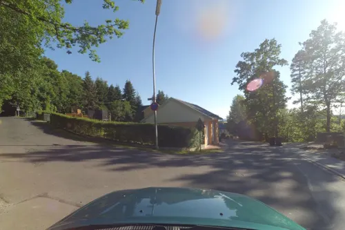
Kulmterrasse
Restaurant · 5.8 km
9 Rauher-Kulm-Straße, Neustadt am Kulm
Th-Fr 14:00-20:30; Sa 14:00-20:30; Su 10:00-20:30
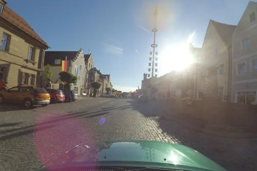
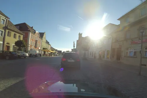
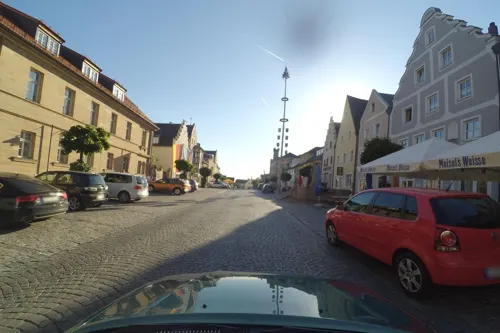
Gasthof zur Goldenen Krone & Weißes Roß
Restaurant
26 Stadtplatz, Kemnath
Mo-Fr 18:00+; We,Su 11:30-14:00


30 more on the map.
History
Kemnath was first referenced in historical documents on 6 July 1008 by the Holy Roman Emperor Henry II when he donated Keminata to the Diocese of Bamberg. In 2008, Kemnath celebrated its 1000th anniversary with a series of special events throughout the town culminating in a major celebration in August 2008.
From the History section of Kemnath on Wikipedia, under CC BY-SA 4.0.
Where to stay10
Churches and places of worship27
Friedhofskirche Sankt Maria Magdalena
Church · Catholic
20 Bayreuther Straße, Kemnath
Evangelische Friedenskirche Kemnath
Church · Protestant · 0.6 km
11 Berndorfer Straße, Kemnath
Shopping13
Gas and EV charging3
Schools, colleges and libraries9
Healthcare5
Map of Kemnath
204 places. The map loads OpenStreetMap tiles when you open it.
Getting there and nearby towns
Verkehrslandeplatz Bayreuth (BYU) is the nearest airport with scheduled flights listed in OpenStreetMap, 22 km away.
- Speichersdorf 8 km west, about 8 min by car
- Marktredwitz 20 km northeast, about 20 min by car
- Wunsiedel 20 km northeast, about 20 min by car
- Windischeschenbach 21 km east, about 21 min by car
- Bayreuth 24 km west, about 24 min by car
- Neustadt an der Waldnaab 26 km southeast, about 26 min by car
- Pegnitz 28 km southwest, about 28 min by car
- Münchberg 36 km north, about 36 min by car
- Selb 38 km northeast, about 38 min by car
- Pottenstein 36 km west, about 36 min by car
Drive times are estimates from straight-line distance, not routes.
Local news
Headlines from INDB.
Reviews, tips and questions
Loading what members have shared...
Sources and licences
- GeoNames (CC BY 4.0): population, coordinates, regions and time zone
- Mapillary (see each image): photos
- OpenStreetMap contributors (ODbL 1.0): places, airports, map data
- Wikidata (CC0 1.0): elevation, founding date, time zone, website, landmarks and historic places
- Wikimedia Commons (see each image): photos
- Wikipedia (CC BY-SA 4.0): overview and history text
Photo credits
- Kemnath Stadtplatz 2015, Kereul, CC BY-SA 4.0
- Kemnath, Teil der Straße Weihergraben, Dguendel, CC BY 3.0
- Kemnath, die Friedrichstraße-2, Dguendel, CC BY 3.0
- Kemnath, die Friedrichstraße, Dguendel, CC BY 3.0
- Mariä Himmelfahrt Kemnath 02, Helmlechner, CC0
- Kemnath, der Stadtplatz mit Rathaus-2, Dguendel, CC BY 3.0
- Kemnath, Nepomukstatue-1, Dguendel, CC BY 3.0
- Mariä Himmelfahrt Kemnath 05, Helmlechner, CC0
- Kemnath, Häuserzeile am Stadtplatz, Dguendel, CC BY 3.0
- Kemnath, die Kirche Mariä Himmelfahrt, Hochaltar, Dguendel, CC BY 3.0
- Kemnath, die Kirche Mariä Himmelfahrt, Blick zur Orgel, Dguendel, CC BY 3.0
- Mariä Himmelfahrt Kemnath 03, Helmlechner, CC0
- Kemnath, die Häuser Schmidtstraße 19, 21 und 23, Dguendel, CC BY 3.0
- Mariä Himmelfahrt Kemnath 04, Helmlechner, CC0
- Kemnath, der Karpfenweg, der Schirnitzbach, Dguendel, CC BY 3.0
- Kemnath, Haus am Cammerloherplatz (Altstadtladl), Dguendel, CC BY 3.0
- Kemnath, Häuserzeile am Stadtplatz, Brunnen, Dguendel, CC BY 3.0
- Mariä Himmelfahrt Kemnath 01, Helmlechner, CC0
- Kemnath Stadtplatz 02, Helmlechner, CC0
- Kemnath, der Cammerloherplatz, Turm der Kirche Mariä Himmelfahrt, Dguendel, CC BY 3.0
- Kemnath Stadtplatz 03, Helmlechner, CC0
- Sebastianssäule Kemnath, Helmlechner, CC0
- Altes Rathaus Kemnath 01, Helmlechner, CC0
- Kemnath, die Klosterbrauerei, Dguendel, CC BY 3.0
- Kemnath, die Sankt-Sebastian-Säule, Dguendel, CC BY 3.0
- Altes Rathaus Kemnath 02, Helmlechner, CC0
- Kemnath, Gasthaus Weißes Ross und Goldene Krone, Gewerbeschild, Dguendel, CC BY 3.0
- Kemnath Stadtplatz 01, Helmlechner, CC0
- Altes Rathaus Kemnath 03, Helmlechner, CC0
- Kemnath, der Brunnen auf dem Stadtplatz, Dguendel, CC BY 3.0
- Kemnath, Haus Stadtplatz 28, Dguendel, CC BY 3.0
- Kemnath, Stadtplatz, Sankt-Sebastian-Säule und Turm der Kirche Mariä Himmelfahrt, Dguendel, CC BY 3.0
- Kemnath, die Kirche Mariä Himmelfahrt, Madonna mit Kind, Dguendel, CC BY 3.0
- Kemnath, Haus Stadtplatz 18, Gewerbeschild, Dguendel, CC BY 3.0
- Kemnath Trautenbergstraße 8 vorne, Claus Schl, CC BY-SA 4.0
- Kemnath Trautenbergstraße 8 hinten, Claus Schl, CC BY-SA 4.0
- Kemnath, Häuserzeile am Stadtplatz-2, Dguendel, CC BY 3.0
- Kemnath, die Trautenbergstraße, westliches Ende, Dguendel, CC BY 3.0
- Kemnath, der Stadtplatz mit Rathaus, Dguendel, CC BY 3.0
- Burgruine Waldeck Nordansicht, Kereul, CC BY-SA 3.0
- Waldeck Kemnath 2019 xy6, PeterBraun74, CC BY-SA 4.0
- Naturschutzgebiet Haidenaab 07, Nauswärdzzeit, CC BY-SA 4.0
- St. M. Magdalena-Kemnath 2016-09-04, Kereul, CC BY-SA 4.0
- Kalvarienbergkirche zum Gekreuzigten Heiland in Kemnath-Stadt - Foto Otto Pilz, Otto J. P., CC BY-SA 4.0
- Neustadt am Kulm, Ev. Kirche-002, Tilman2007, CC BY-SA 3.0
- Katholische Dorfkapelle Sankt Helena in Oberbruck (Gemeinde Kulmain) - Foto Otto Pilz, Otto J. P., CC BY-SA 4.0
- Kemnath Wohnmobil, Benreis, CC BY-SA 3.0
- Kastl bei Kemnath, Blick zur Dorfkirche, Dguendel, CC BY 3.0
- Schlossgut Wolframshof 2015 Copyright F A Büscher, Alexander Buescher, CC BY-SA 4.0
- Kemnath Trautenbergstraße 36 West, Kereul, CC BY 3.0
- Kemnath vom Armesberg - panoramio, G. Zapf, CC BY 3.0
- Kuschberg - panoramio, G. Zapf, CC BY 3.0
- Anzenstein - panoramio (1), G. Zapf, CC BY 3.0
- Kleiner Kulm bei Neustadt - panoramio, G. Zapf, CC BY 3.0
- Burgruine Waldeck - panoramio, G. Zapf, CC BY 3.0
- Street-level photo, wegavision, CC BY-SA 4.0
- Street-level photo, wegavision, CC BY-SA 4.0
- Street-level photo, wegavision, CC BY-SA 4.0
- Street-level photo, wegavision, CC BY-SA 4.0
- Street-level photo, SuedOstLink, CC BY-SA 4.0
- Street-level photo, wegavision, CC BY-SA 4.0
- Street-level photo, SuedOstLink, CC BY-SA 4.0
- Street-level photo, r66, CC BY-SA 4.0
- Street-level photo, SuedOstLink, CC BY-SA 4.0
- Street-level photo, SuedOstLink, CC BY-SA 4.0
- Street-level photo, wegavision, CC BY-SA 4.0
- Street-level photo, wegavision, CC BY-SA 4.0


Page built November 9, 2026. Spotted a mistake? Tell us or suggest a place.