


Why visit Bayreuth
Townapedia lists 85 museums and landmarks, 21 parks and trails, 256 places to eat, 21 places to stay and 15 attractions in and around town.
Highlights include Margravial Opera House, Festspielhaus, Franz-Liszt-Museum and Freimaurermuseum.
Weather in Bayreuth
Forecast from MET Norway (CC BY 4.0). Full forecast
About Bayreuth
Bayreuth (German pronunciation: [ˈbaɪʁɔʏt] or [baɪˈʁɔʏt] ; Upper Franconian: Bareid, pronounced [ba(ː)ˈɾaɪ̯t]) is a town in northern Bavaria, Germany, on the Red Main river in a valley between the Franconian Jura and the Fichtel Mountains. The town's roots date back to 1194. In the 21st century, it is the capital of Upper Franconia and has a population of 72,148 (2015). It hosts the annual Bayreuth Festival, at which performances of operas by the 19th-century German composer Richard Wagner are presented.
From the Wikipedia article Bayreuth (this version), under CC BY-SA 4.0.
Travel tips from other travellers: Bayreuth on Wikivoyage (CC BY-SA 4.0).
Photos of Bayreuth


Things to do15

Margravial Opera House
Cinema and theater
UNESCO-Weltkulturerbe
14 Opernstraße, Bayreuth
Apr-Sep Mo-Su 09:00-18:00; Oct-Mar Mo-Su 10:00-16:00; Dec...


Cineplex
Cinema and theater · 0.6 km
2 Hindenburgstraße, Bayreuth
Mo-Fr 18:30-21:00+; Sa 14:00-21:00+; Su 14:00-21:00+

Bayreuth Festival Theatre
Cinema and theater · 1.4 km
Opera house and cultural heritage monument in Bayreuth, Bavaria




Dachterrasse Rathaus I
Scenic view
13 Luitpoldplatz, Bayreuth
Mo,Tu,Th 10:00-16:00, We 10:00-17:00, Fr 10:00-14:30
3 more on the map.
Museums and landmarks85

Franz-Liszt-Museum
Museum · 0.8 km
9 Wahnfriedstraße, Bayreuth
Jul,Aug: Mo-Su 10:00-17:00; Sep-Jun: Mo-Su...

Freimaurermuseum
Museum · 0.7 km
1 Im Hofgarten, Bayreuth
Tu-Fr 10:00-12:00,14:00-17:00; Sa 10:00-12:00; Su 13:00-16:00


Jean-Paul-Museum
Museum · 0.8 km
1 Wahnfriedstraße, Bayreuth
Jul,Aug: Mo-Su 10:00-17:00; Sep-Jun: Mo-Su...


Kunstmuseum
Museum
33 Maximilianstraße, Bayreuth
Tu-Su,PH 10:00-17:00; Jul-Aug: Mo 10:00-17:00 "während der...

Richard-Wagner-Museum
Museum · 0.8 km
48 Richard-Wagner-Straße, Bayreuth
Jul-Aug: Mo-Su 10:00-18:00, Sep-Jun: Tu-Su 10:00-18:00


Wilhelm-Leuschner-Gedenkstätte
Museum · 1.3 km
25 Moritzhöfen, Bayreuth
Dec-Jan: Tu-Fr 10:00-14:00, Dec-Jan: Sa,Su 13:00-16:00

73 more on the map.
Parks, trails and playgrounds21

Kreuzsteinbad
Sports field and stadium · 1.7 km
Wifi only 30min
20-24 Universitätsstraße, Bayreuth
May-Sep: 07:00-20:00

Eremitage
Park · 3.2 km
Cultural heritage monument D-4-62-000-392 (0) in Bayreuth, Bavaria




Abenteuerspielplatz KiWi
Playground · 1.9 km
Mo 16:00-19:00, Tu-Th 15:00-18:00
9 more on the map.
Restaurants and cafes256

Café Florian
Cafe · Coffee Shop
13 Badstraße, Bayreuth
Mo,We,Th 09:00-23:00; Fr,Sa 09:00-23:30; Su 09:00-22:00
Bei Niko
Restaurant · Greek · 1.8 km
15 Eubener Straße, Bayreuth
Tu-Su 17:30-22:00, Sa,Su 11:30-14:30; Mo off

China-Haus
Restaurant · Chinese · 2.2 km
1-3 Himmelkronstraße, Bayreuth
Mo-Su 11:30-14:30, 17:30-23:00
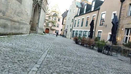
Dötzer
Restaurant · Italian · 0.6 km
22 Sophienstraße, Bayreuth
Tu-Th 17:30-23:00; Fr,Sa 11:30-14:00,17:30-23:00; Su 11:30-14:00

Zur Eule
Restaurant · Regional · 0.6 km
Ehemalige Künstlerkneipe der Richard-Wagner-Festspiele
8 Kirchgasse, Bayreuth
Tu-Fr 17:00-22:00, Sa,Su 11:00-14:00, Sa 17:00-22:00
BTS Vereinsgaststätte
Restaurant · German · 1.3 km
1a Neunundneunzig Gärten, Bayreuth
Mo-Fr 18:00-23:00; Su 10:00-13:00; Sa "Nach Vereinbarung"
244 more on the map.
History
The town is believed to have been founded by the counts of Andechs probably around the mid-12th century, but was first mentioned in 1194 as Baierrute in a document by Bishop Otto II of Bamberg. The syllable -rute may mean Rodung or "clearing", whilst Baier- indicates immigrants from the Bavarian region.
Already documented earlier, were villages later merged into Bayreuth: Seulbitz (in 1035 as the royal Salian estate of Silewize in a document by Emperor Conrad II) and St. Johannis (possibly 1149 as Altentrebgast). Even the district of Altstadt (formerly Altenstadt) west of the town centre must be older than the town of Bayreuth itself. Even older traces of human presence were found in the hamlets of Meyernberg: pieces of pottery and wooden crockery were dated to the 9th century based on their decoration.
While Bayreuth was previously (1199) referred to as a villa ("village"), the term civitas ("town") appeared for the first time in a document published in 1231. One can therefore assume that Bayreuth was awarded its town charter between 1200 and 1230. The town was ruled until 1248 by the counts of Andechs-Merania. After they died out in 1260 the burgraves of Nuremberg from the House of Hohenzollern took over the inheritance.
As early as 1361 Emperor Charles IV conferred on Burgrave Frederick V the right to mint coins for the towns of Bayreuth and Kulmbach.
Read more of the history
In 1398 Bayreuth was partitioned from Nuremberg, becoming the Principality of Bayreuth (German: Fürstentum Bayreuth). Until 1604, however, the princely residence and the centre of the territory was the castle of Plassenburg in Kulmbach and as such the territory was officially known as the Principality of Kulmbach. The town of Bayreuth developed slowly and was affected time and again by disasters.
In February 1430, the Hussites devastated Bayreuth and the town hall and churches were razed. Matthäus Merian described this event in 1642 as follows: "In 1430 the Hussites from Bohemia attacked / Culmbach and Barreut / and committed great acts of cruelty / like wild animals / against the common people / and certain individuals. / The priests / monks and nuns they either burnt at the stake / or took them onto the ice of lakes and rivers / (in Franconia and Bavaria) and doused them with cold water / and killed them in a deplorable way / as Boreck reported in the Bohemian Chronicle, page 450".
By 1528, less than ten years after the start of the Reformation, the lords of the Frankish margrave territories switched to the Lutheran faith.
In 1605 a great fire, caused by negligence, destroyed 137 of the town's 251 houses. In 1620 plague broke out and, in 1621, there was another big fire in the town. The town also suffered during the Thirty Years' War.
A turning point in the town's history came in 1603 when Margrave Christian, the son of the elector, John George of Brandenburg, moved the aristocratic residence from the castle of Plassenburg above Kulmbach to Bayreuth. The first Hohenzollern palace was built in 1440–1457 under Margrave John the Alchemist. It was the forerunner of today's Old Palace (Altes Schloss) and was expanded and renovated many times. The development of the new capital stagnated due to the Thirty Years' War, but afterwards many baroque buildings were added to the town. After Christian's death in 1655 his grandson, Christian Ernest, followed him, ruling from 1661 until 1712. He was an educated and well-travelled man, whose tutor had been the statesman Joachim Friedrich von Blumenthal. He founded the Christian-Ernestinum Grammar School and, in 1683, participated in the liberation of Vienna which had been besieged by the Turks. To commemorate this feat, he had the Margrave Fountain built as a monument on which he is depicted as the victor of the Turks; it now stands outside the New Palace (Neues Schloss). During this time, the outer ring of the town wall and the castle chapel (Schlosskirche) were built.
Christian Ernest's successor, the Crown Prince and later Margrave, George William, began in 1701 to establish the then independent town of St Georgen am See (today, the district of St Georgen) with its castle, the so-called Ordensschloss, a town hall, a prison and a small barracks. In 1705 he founded the Order of Sincerity (Ordre de la Sincérité), which was renamed in 1734 to the Order of the Red Eagle and had the monastery church built, which was completed in 1711. In 1716 a princely porcelain factory was established in St. Georgen.
The first 'castle' in the park of the Hermitage was built at this time by Margrave George William (1715–1719).
In 1721, the town council acquired the palace of Baroness Sponheim (today's Old Town Hall or Altes Rathaus) as a replacement for the town hall built in 1440 in the middle of the market place and destroyed by fire.
In 1735, a nursing home, the so-called Gravenreuth Stift, was founded by a private foundation in St. Georgen. The cost of the building exceeded the funds of the foundation, but Margrave Frederick came to their aid.
Bayreuth experienced its Golden Age during the reign (1735–1763) of Margrave Frederick and Margravine Wilhelmina of Bayreuth, the favourite sister of Frederick the Great. During this time, under the direction of court architects, Joseph Saint-Pierre and Carl von Gontard, numerous courtly buildings and attractions were created: the Margravial Opera House with its richly furnished baroque theatre (1744–1748), the New 'Castle' and Sun Temple (1749–1753) at the Hermitage, the New Palace with its courtyard garden (1754 ff) to replace the Old Palace which had burned down through the carelessness of the margrave, and the magnificent row of buildings in today's Friedrichstraße. There was even a unique version of the rococo architectural style, the so-called Bayreuth Rococo which characterised the aforementioned buildings, especially their interior design.
From the History section of Bayreuth on Wikipedia, under CC BY-SA 4.0.
More about Bayreuth
Geography
Bayreuth lies on the Red Main river, the southern of the two headstreams of the river Main, between the Fichtelgebirge Mountains and Franconian Switzerland. The town is also part of the Nuremberg Metropolitan Region.
Climate in this area has mild differences between highs and lows, and there is adequate rainfall year-round. The Köppen Climate Classification subtype for this climate is "Dfb" (Humid continental climate) using the 0 °C isotherm and "Cfb" (Marine West Coast Climate/Oceanic climate) using the −3 °C isotherm.
Economy
B 2: Rosow–Berlin–Lutherstadt Wittenberg–Leipzig–Gera–Hof–Bayreuth–Nuremberg–Donauwörth–Augsburg–Munich–Mittenwald
B 85: Berga–Weimar–Ludwigsstadt–Kulmbach–Bayreuth–Amberg–Schwandorf–Cham–Neukirchen vorm Wald–Passau
From Bayreuth Central Station (Hauptbahnhof) railway lines run north to Neuenmarkt-Wirsberg, and from there to Bamberg and over the Schiefe Ebene to Hof, east to Weidenberg, southeast to Weiden and south to Schnabelwaid with connections to Nuremberg on the Pegnitz Valley Railway. The lines around Bayreuth are all single-tracked and non-electrified.
Since 23 May 1992 tilting Class 610 diesel multiple units have worked the Pegnitz Valley route. These were bought by the former Deutsche Bundesbahn specifically for the winding track.
Since a 2006/2007 timetable change, Bayreuth has no longer been connected to the DB's long-distance network. However, the Franken-Sachsen-Express still provides a direct connection to Dresden (since December 2007, every two hours). This service is worked by Class 612 diesel multiple units. There are also Regional-Express links via Lichtenfels to Bamberg and Würzburg, and via Lichtenfels and Kronach to Saalfeld.
Arts and culture
The Margravial Opera House was opened in 1748 and is one of the finest Baroque theatres in Europe. The UNESCO World Heritage Site is both a museum and the oldest working tableau in Bayreuth.
The Festival Hall dates to the 19th century and is now used solely for the Bayreuth Festival. Only works by Richard Wagner are performed.
The former Stadthalle (lit.: city hall) did not have its own ensemble but was regularly used by the Theater Hof as well as various travelling theatres. It has been under reconstruction since 2017 and is supposed to be re-opened under the new name Friedrichsforum in 2023.
The only two theatres with their own ensemble are the Studiobühne Bayreuth and amateur dramatic society, Brandenburg Kulturstadt. The venues of the Studiobühne are the domicile of the theatre in the Röntgenstraße, the artificial ruins of the Hermitage and the courtyard of piano manufacturer Steingraeber & Söhne.
The Richard Wagner Museum at Wahnfried House was the residence of Richard Wagner and his family's home until 1966. Since 1976 it has been a museum with attached national archives and a research centre for the Richard Wagner Foundation in Bayreuth.
The Jean Paul Museum in the former residence of Richard Wagner's daughter, Eva Chamberlain, with autographs, first editions of works, portraits and other pictorial material.
From the Wikipedia article Bayreuth, under CC BY-SA 4.0.
Notable people from Bayreuth
 Florian MayerGerman tennis playerPhoto: si.robi, CC BY-SA 2.0
 Christiane Eberhardine of Brandenburg-BayreuthQueen of PolandPhoto: Unknown artist Unknown artist, Public domain
 Philipp PetzschnerGerman tennis playerPhoto: si.robi, CC BY-SA 2.0
 Rudolf WagnerGerman scientist (1805–1864)Photo: Portrait by C. Oesterley,..., Public domain
 Heinrich von GagernPresident of the Frankfurt Parliament, leader of the German government (1799-1880)Photo: Seib, Jacob, Public domain
 Katharina WagnerGerman opera directorPhoto: Tafkas , 2009, CC BY-SA 3.0
 Ludwig FörsterAustrian architect (1797-1863)Photo: Josef Kriehuber (1800 -1876), Public domain
- Max StirnerGerman philosopher (1806–1856)
- Robert Ritter von GreimGerman field marshal (1892–1945)
- Wolfgang WagnerGerman stage director
- Moritz WagnerGerman naturalist (1813-1887)
- Fritz RaspGerman actor (1891–1976)
Born in Bayreuth, according to Wikidata (CC0). Each name links to its Wikipedia article.
Where to stay21
Churches and places of worship32
Shopping74
Gas and EV charging18
Schools, colleges and libraries43
Healthcare22
Map of Bayreuth
250 places. The map loads OpenStreetMap tiles when you open it.
Getting there and nearby towns
Verkehrslandeplatz Bayreuth (BYU) is the nearest airport with scheduled flights listed in OpenStreetMap, 6 km away.
- Bindlach 5 km northeast, about 5 min by car
- Speichersdorf 17 km southeast, about 17 min by car
- Kulmbach 19 km northwest, about 19 min by car
- Hollfeld 21 km west, about 21 min by car
- Pegnitz 22 km south, about 22 min by car
- Mainleus 22 km northwest, about 22 min by car
- Pottenstein 23 km southwest, about 23 min by car
- Kemnath 24 km east, about 24 min by car
- Münchberg 31 km northeast, about 31 min by car
- Altenkunstadt 31 km northwest, about 31 min by car
Drive times are estimates from straight-line distance, not routes.
Towns near Bayreuth


Keep exploring
Local news
Headlines from INDB.
Reviews, tips and questions
Loading what members have shared...
Sources and licences
- GeoNames (CC BY 4.0): population, coordinates, regions and time zone
- Mapillary (see each image): photos
- OpenStreetMap contributors (ODbL 1.0): places, airports, map data
- Wikidata (CC0 1.0): elevation, founding date, time zone, website, landmarks and historic places
- Wikimedia Commons (see each image): photos
- Wikipedia (CC BY-SA 4.0): overview and history text
Photo credits
- Marktplatz Bayreuth, Michael Sander, CC BY-SA 3.0
- Aerial image of the Eremitage Bayreuth, Carsten Steger, CC BY-SA 4.0
- St. Georgen Bayreuth, PeterBraun74, CC BY-SA 3.0
- Auditorium maximum der Universität Bayreuth im Herbst 2006, H. Wurst, CC BY-SA 2.0 de
- Aerial image of Bayreuth Festspielhaus (view from the southeast, 2024), Carsten Steger, CC BY-SA 4.0
- Städtisches Stadion Bayreuth, Roehrensee, CC BY-SA 3.0
- Wahnfried 1 db, Unknown author, CC BY-SA 3.0
- Bezirkskrankenhaus Bayreuth, Benutzer:Roehrensee, Public domain
- Brauerei Gebrüder Maisel, Tafkas, CC BY 3.0
- Deutsches Freimaurermuseum (Schild), User:Mattes, Public domain
- Bayreuth altes rathaus, 4077, CC BY-SA 1.0
- Karte Forst Sankt Georgen, Alabasterstein, CC BY-SA 4.0
- Dinosaurier Bayreuth 2014, El Grafo, CC BY-SA 4.0
- Krankenhaus Hohe Warte Bayreuth, Benutzer:Roehrensee, Public domain
- Kreuzsteinbad Sprungturm, Roehrensee, Public domain
- Oberfrankenhalle Bayreuth, Olli BB, CC BY-SA 3.0
- Bayreuth - Schlosskirche (Kirchenschiff), User:Mattes, Public domain
- Rondell im Rotmain-Center mit Brunnen, Rotmain-Center Bayreuth, CC BY-SA 4.0
- Bayreuth028, PeterBraun74, CC BY-SA 3.0
- Bayreuth-Lisztmuseum, GertGrer, CC BY-SA 3.0
- Bayreuth, Gottesackerkirche 01, Bayreuth2009, CC BY 3.0
- Bayreuth - Historisches Museum, Außenansicht 1, User:Mattes, Public domain
- Cineplex Bayreuth, El Grafo, CC BY-SA 3.0
- Christuskirche Bayreuth 2019, El Grafo, CC BY-SA 4.0
- Bayreuth Mann Brau, RobThinks, CC BY-SA 4.0
- Bayreuth, Friedenskirche (01), Subbass1, CC BY-SA 4.0
- Bayreuth, Erlangerstraße 29, Reformierte Kirche, 2007, Bayreuth2009, CC BY 3.0
- Bayreuth Fassade, Immanuel Giel, Public domain
- Bayr Festspielhaus 1995 Frontansicht, Lothar Spurzem, CC BY-SA 2.0 de
- Bayreuth 13.09.07 Siegesturm Hohe Warte, Bayreuth2009, CC BY 3.0
- Bayreuth, Wahnfriedstraße 9 20170603 001, Tilman2007, CC BY-SA 4.0
- Bayreuth-Deutsches-Freimaurermuseum-2, GertGrer, CC BY-SA 3.0
- Bayreuth, Kirchplatz 4 20170603 001, Tilman2007, CC BY-SA 4.0
- Bayreuth, Wölfelstraße 2 20170603 001, Tilman2007, CC BY-SA 4.0
- Bayreuth Haus Chamberlain Wahnfriedstrasse 21.04.07 DSC05965, Bayreuth2009, CC BY 3.0
- Rollwenzelei, Thomas Kees ( powerbiker1 ), CC BY-SA 3.0
- Nibelungenstraße 2 (Bayreuth), Bodo Kubrak, CC BY-SA 4.0
- Bayreuth, Kirchplatz 1, Evang.-Luth. Stadtpfarrkirche 20170603 009, Tilman2007, CC BY-SA 4.0
- Bayreuth, Münzgasse 2-001, Tilman2007, CC BY-SA 3.0
- Richard-Wagner-Festspielhaus 2016 (Frontansicht, Sichtachse Siegfried-Wagner-Allee, unverhüllt nach Sanierung), Markus Gögelein, CC BY-SA 4.0
- Hofgarten - panoramio, Vámos Sándor, CC BY-SA 3.0
- Brunnen Dammwäldchen Bayreuth, El Grafo, CC BY-SA 4.0
- Street-level photo, changchun1, CC BY-SA 4.0
- Street-level photo, hdmn, CC BY-SA 4.0
- Street-level photo, hdmn, CC BY-SA 4.0
- Street-level photo, Dariton, CC BY-SA 4.0
- Street-level photo, changchun1, CC BY-SA 4.0
- Street-level photo, changchun1, CC BY-SA 4.0
- Street-level photo, changchun1, CC BY-SA 4.0
- Street-level photo, hdmn, CC BY-SA 4.0
- Street-level photo, changchun1, CC BY-SA 4.0
- Street-level photo, changchun1, CC BY-SA 4.0
- Street-level photo, changchun1, CC BY-SA 4.0
- Street-level photo, hdmn, CC BY-SA 4.0
- Street-level photo, changchun1, CC BY-SA 4.0
- Street-level photo, changchun1, CC BY-SA 4.0
- Street-level photo, voltadino, CC BY-SA 4.0
- Street-level photo, r66, CC BY-SA 4.0
- Street-level photo, r66, CC BY-SA 4.0
- Street-level photo, changchun1, CC BY-SA 4.0
- Street-level photo, changchun1, CC BY-SA 4.0
- Street-level photo, hdmn, CC BY-SA 4.0
- Street-level photo, hdmn, CC BY-SA 4.0
- Street-level photo, changchun1, CC BY-SA 4.0


Page built November 9, 2026. Spotted a mistake? Tell us or suggest a place.