


Why visit Kirkel
Townapedia lists 31 museums and landmarks, 20 parks and trails, 78 places to eat, 8 places to stay and 23 attractions in and around town.
Highlights include Leibrocks Hofladen, Gänshorn, Gollenstein and Heimat- und Burgmuseum.
Weather in Kirkel
Forecast from MET Norway (CC BY 4.0). Full forecast
About Kirkel
Kirkel (German pronunciation: [ˈkɪʁkl̩]) is a municipality in the Saarpfalz district in Saarland, Germany. It is situated approximatively 8 km southeast of Neunkirchen, and 20 km east/northeast of Saarbrücken.
From the Wikipedia article Kirkel (this version), under CC BY-SA 4.0.
Things to do23




11 more on the map.
Museums and landmarks31


Bunker WH 338
Monument and historic site · 3.8 km
Gesprengt, große Stützmauer am Zugang



WH 12
Monument and historic site · 5.0 km
Regelbau 10 mit Hangstützmauer und Eingangsüberdeckung
19 more on the map.
Parks, trails and playgrounds20







8 more on the map.
Restaurants and cafes78
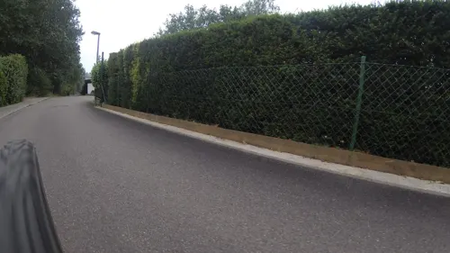
Edelweißhütte
Restaurant · Regional · 5.1 km
2 Gutenbergring, Sankt Ingbert
We,Sa,Su,PH 14:00-20:00; Apr-Sep We 14:00-21:00

Gollensteinhütte
Restaurant · German · 4.8 km
We 17:00-20:00; Fr 11:00-14:00, 17:00-20:00; Sa-Su 11:00-20:00
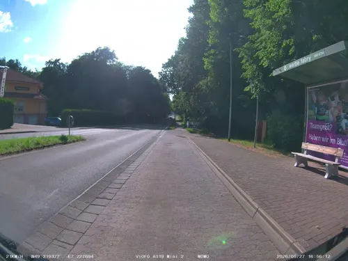
Hostellerie Bacher-Wögerbauer
Restaurant · French · 4.0 km
2 Limbacher Straße, Neunkirchen
Mo closed, Tu-Sa 18:00-00:00, Su 12:00-15:00
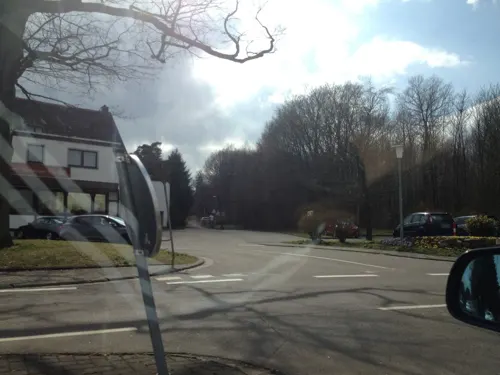
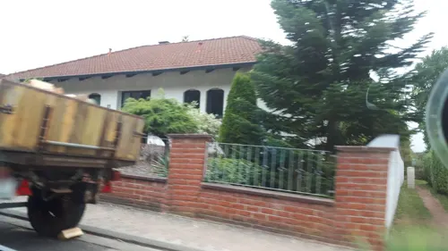
Naturfreundehaus Kirkel
Restaurant · Regional · 0.9 km
8 Limbacher Weg, Kirkel
We-Sa 15:00-20:00; Su,PH 12:00-20:00

Pizzeria Da Paolo
Restaurant · Italian, Pizza · 4.5 km
13 Beim Wallratsroth, Neunkirchen
Tu-Su 11:30-14:00,17:30-23:30
Zum Landsknecht
Restaurant · Regional · 4.8 km
5a Geißenbrünnchen
We 09:00-14:00, 17:30-22:00; Th-Sa 09:00-14:00, 17:30-22:00; Su 09:00-14:30
Zur Rohrbacher Glashütte
Restaurant · Regional · 4.3 km
2 Glashütter Hof, Sankt Ingbert
Tu, Th-Su 12:00-20:30


66 more on the map.
Where to stay8
Churches and places of worship20
Geistkircher Kapelle
Church · Catholic · 3.4 km
2 a Geistkircher Hof, Sankt Ingbert
Shopping11
Gas and EV charging10
Schools, colleges and libraries12
Stadtbibliothek Neunkirchen — Zweigstelle Furpach
Library · 4.7 km
7 Zur Ewigkeit, Neunkirchen
Grundschule am Würzbacher Weiher
School · 4.8 km
41a Kirkeler Straße, Blieskastel
Healthcare7
MediClin Bliestal Kliniken
Clinic and pharmacy · 2.5 km
16 Zur Kurklinik, Blieskastel
Map of Kirkel
220 places. The map loads OpenStreetMap tiles when you open it.
Getting there and nearby towns
Saarbrücken Airport (SCN) is the nearest airport with scheduled flights listed in OpenStreetMap, 12 km away.
- Spiesen-Elversberg 8 km northwest, about 8 min by car
- Zweibrücken 11 km east, about 11 min by car
- Schiffweiler 12 km northwest, about 12 min by car
- Sulzbach 13 km west, about 13 min by car
- Quierschied 14 km west, about 14 min by car
- Ottweiler 14 km north, about 14 min by car
- Merchweiler 15 km northwest, about 15 min by car
- Saarbrücken 17 km west, about 17 min by car
- Kleinblittersdorf 20 km southwest, about 20 min by car
- Riegelsberg 22 km west, about 22 min by car
Drive times are estimates from straight-line distance, not routes.
Local news
Headlines from INDB.
Reviews, tips and questions
Loading what members have shared...
Sources and licences
- GeoNames (CC BY 4.0): population, coordinates, regions and time zone
- Mapillary (see each image): photos
- OpenStreetMap contributors (ODbL 1.0): places, airports, map data
- Wikidata (CC0 1.0): elevation, founding date, time zone, website, landmarks and historic places
- Wikimedia Commons (see each image): photos
- Wikipedia (CC BY-SA 4.0): overview and history text
Photo credits
- 20210214 Kirkel Neuhäusel, Flocci Nivis, CC BY 4.0
- 20180708 Heimat und Burgmuseum Kirkel, Flocci Nivis, CC BY 4.0
- 20180708 St. Joseph Kirkel 01, Flocci Nivis, CC BY 4.0
- 20180708 St. Joseph Kirkel 02, Flocci Nivis, CC BY 4.0
- 20180812 Friedenskirche Kirkel, Flocci Nivis, CC BY 4.0
- Burg Kirkel-05-Bergfried innen, Muck, CC BY-SA 4.0
- 20210214 Burg Kirkel, Flocci Nivis, CC BY 4.0
- 20180708 Burg Kirkel 02, Flocci Nivis, CC BY-SA 4.0
- 20180708 Burg Kirkel 01, Flocci Nivis, CC BY-SA 4.0
- Burg Kirkel-06-Ausblick, Muck, CC BY-SA 4.0
- Burg Kirkel-01, Muck, CC BY-SA 4.0
- Burg Kirkel-02-Zugang, Muck, CC BY-SA 4.0
- Burg Kirkel-03-Zugang, Muck, CC BY-SA 4.0
- Burg Kirkel-04-Bergfried, Muck, CC BY-SA 4.0
- 20240323Kirkel3, AnRo0002, CC0
- Burg Kirkel, Pascal Dihé, CC BY-SA 4.0
- 20240323Kirkel2, AnRo0002, CC0
- 20240323Kirkel4, AnRo0002, CC0
- 20240323Kirkel5, AnRo0002, CC0
- Blieskastel Heilig-Kreuz-Kapelle 02, atreyu, CC BY-SA 3.0
- Gollenstein, Christoph Bubel, CC BY-SA 2.0 de
- Burgruine von Kirkel, Christian Bohr at de.wikipedia, CC BY-SA 3.0
- Limbach Protestantische Elisabeth-Kirche 05, atreyu, CC BY-SA 3.0
- 20120825Friedenskirche Kirkel7, AnRo0002, CC0
- Blieskastel Jüdischer Friedhof 03, Mstp77, CC BY-SA 3.0
- Kohlhof - Katholische Kirche St. Georg, Dietmar Ruff, CC BY-SA 2.0 de
- StIngbert Rohrbach Kirche aussen, Lokilech, CC BY-SA 3.0
- Lautzkirchen Kirche St. Mauritius 2011-10-29, Mstp77, CC BY 3.0
- Neuhaeuseler Arm, EHaseler, CC BY-SA 3.0
- 20181230Waldklassenzimmer Kirkel 02, Flocci Nivis, CC BY-SA 4.0
- 20210703 Limbacher Sanddüne 03, Flocci Nivis, CC BY 4.0
- Bunker WH 338 1, Flocci Nivis, CC BY-SA 4.0
- Geistkirch Kapelle, EHaseler, CC BY-SA 3.0
- Wasserfelsen, Flocci Nivis, CC BY-SA 4.0
- Kirkel Frauenbrunnen, atreyu, CC BY-SA 3.0
- Gollensteinhütte2, Tara2, CC BY-SA 3.0
- 20180812Waldklassenzimmer Kirkel, Flocci Nivis, CC BY-SA 4.0
- Niederwürzbach Kirche, Fotoman2012, CC BY-SA 3.0
- Auf dem Hirschberg bei Kirkel 2010-04-21, atreyu, CC BY-SA 3.0
- 20210703 Klosterberg Blieskastel, Flocci Nivis, CC BY 4.0
- 20210810 Bos taurus 02, Flocci Nivis, CC BY 4.0
- Niederwürzbach Protestantische Kirche, Fotoman2012, CC BY-SA 3.0
- Schwarzenacker Gallo Römischer Tempel innen-2, Lokilech, CC BY-SA 3.0
- Street-level photo, teddy73, CC BY-SA 4.0
- Street-level photo, soulcover, CC BY-SA 4.0
- Street-level photo, teddy73, CC BY-SA 4.0
- Street-level photo, teddy73, CC BY-SA 4.0
- Street-level photo, teddy73, CC BY-SA 4.0
- Street-level photo, teddy73, CC BY-SA 4.0
- Street-level photo, teddy73, CC BY-SA 4.0
- Street-level photo, soulcover, CC BY-SA 4.0
- Street-level photo, teddy73, CC BY-SA 4.0
- Street-level photo, teddy73, CC BY-SA 4.0
- Street-level photo, teddy73, CC BY-SA 4.0
- Street-level photo, teddy73, CC BY-SA 4.0
- Street-level photo, teddy73, CC BY-SA 4.0
- Street-level photo, teddy73, CC BY-SA 4.0
- Street-level photo, teddy73, CC BY-SA 4.0
- Street-level photo, teddy73, CC BY-SA 4.0
- Street-level photo, teddy73, CC BY-SA 4.0
- Street-level photo, teddy73, CC BY-SA 4.0
- Street-level photo, meskalin, CC BY-SA 4.0
- Street-level photo, teddy73, CC BY-SA 4.0
- Street-level photo, teddy73, CC BY-SA 4.0
- Street-level photo, teddy73, CC BY-SA 4.0
- Street-level photo, teddy73, CC BY-SA 4.0
- Street-level photo, teddy73, CC BY-SA 4.0
- Street-level photo, teddy73, CC BY-SA 4.0
- Street-level photo, hozerjones, CC BY-SA 4.0
- Street-level photo, teddy73, CC BY-SA 4.0
- Street-level photo, meskalin, CC BY-SA 4.0


Page built November 8, 2026. Spotted a mistake? Tell us or suggest a place.