


Spiesen-Elversberg, Germany
Spiesen-Elversberg is a town of 14,570 people in Saarland, Germany.
Why visit Spiesen-Elversberg
Townapedia lists 44 museums and landmarks, 14 parks and trails, 54 places to eat, 2 places to stay and 2 attractions in and around town.
Highlights include Galgenbergturm, Museum St. Ingbert, Saarländisches Karnevalsmuseum and Das Blau.
Weather in Spiesen-Elversberg
Forecast from MET Norway (CC BY 4.0). Full forecast
About Spiesen-Elversberg
Spiesen-Elversberg (German pronunciation: [ˈʃpiːzn̩ ˈʔɛlvɐsbɛʁk] ) is a municipality in the district of Neunkirchen, in Saarland, Germany. It is situated approximately 4 km (2.5 mi) southwest of Neunkirchen, and 15 km (9.3 mi) northeast of Saarbrücken.
From the Wikipedia article Spiesen-Elversberg (this version), under CC BY-SA 4.0.
Things to do2


Museums and landmarks44


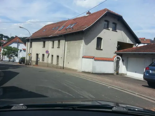


Heinitz-Stollen
Monument and historic site · 1.4 km
Original Stollenmundeinfassung des Heinitzstollens von 1847. Aufgestellt an dieser Stelle als Denkmal 1979.


ehem. Friedensanlage
Monument and historic site · 2.6 km
Diese Anlage wurde gegen Ende des 1.Weltkrieges von der Grube Heinitz als Einfahrtsschacht erbaut. Nach der Stilllegung wurde die Anlage...

Eugenschacht
Monument and historic site · 2.5 km
Diente als Spülschacht für die 3. Sohle. 1928 aßer Betrieb, 1938 verfüllt. Nichts zu sehen außer ein paar Steinhaufen.

Friedrich Anton von Heynitz
Monument and historic site · 1.4 km
Büste auf Sockel und Eisenreliefplatte mit Inschrift.

Heinrich von Dechen
Monument and historic site · 1.4 km
Büste auf Sockel und Eisenreliefplatte mit Inschrift.
32 more on the map.
Parks, trails and playgrounds14

Das Blau
Sports field and stadium · 3.3 km
6 Arthur-Kratzsch-Straße, Sankt Ingbert
Mo 07:30-14:00; Tu-Fr 07:30-22:00; Sa,Su,PH 08:00-20:00
Hallenbad Friedrichsthal
Sports field and stadium · 2.1 km
Hallenbad der Stadt Friedrichsthal mit Sport-, Kinder- und Kleinkinderbecken, Dampfsauna, finnische Sauna, Sonnenbank.
1 Schwimmbadstraße, Friedrichsthal
Freibad Friedrichsthal
Sports field and stadium · 2.1 km
Freibad der Stadt Friedrichsthal mit Sport-, Freizeit- und Springerbecken (3m- und 1m-Brett), 60m Wasserrutsche, Kinderspielplatz, Sauna
1 Schwimmbadstraße, Friedrichsthal


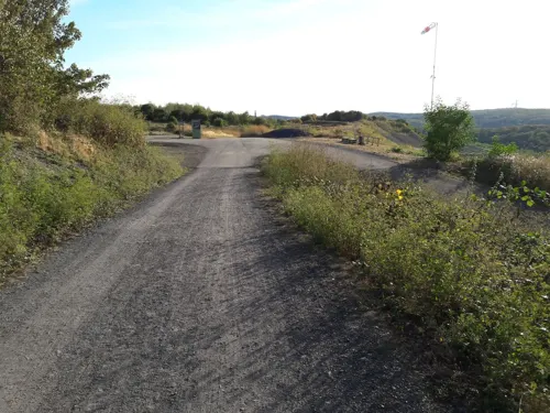

2 more on the map.
Restaurants and cafes54

Braddock
Bar and pub · 3.2 km
256 Saarbrücker Straße, Friedrichsthal
Tu-Th, Su 11:00-01:00; Fr, Sa 11:00-03:00
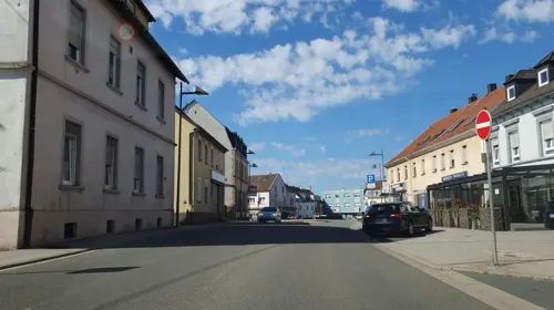
Zum Waldhorn
Restaurant · 3.2 km
3 Neunkircher Straße, Friedrichsthal
Mo-Su 12:00-14:00,18:00-22:00; Tu off; We off
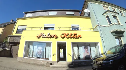

Barbarossa Bäckerei
Bakery · 3.3 km
2a Illinger Straße, Friedrichsthal
Mo-Fr 06:00-18:00; Sa 07:00-13:00; Su 07:00-17:00
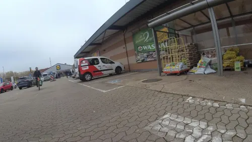
Bäckerei im Wasgau
Bakery · 0.8 km
Mo-Sa 07:00-20:00; Su 08:00-11:00
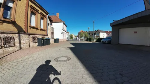
Bäckerei/Konditorei Krämer
Bakery
29 Fichtenstraße, Spiesen-Elversberg
Tu 04:30-17:00; We 04:30-14:00; Th,Fr 04:30-17:00; Sa 04:30-13:00
Porta Romana
Restaurant · Italian
Th-Tu,PH 11:30-14:30, Mo-Su,PH 17:30-23:00; We off

Song Long
Restaurant · Asian · 2.7 km
Mo off; Tu-Su, PH 17:30-22:00; Tu-Fr, Su, PH 11:30-14:00


Zum Hoferkopf
Restaurant · 2.8 km
6a Hoferkopf, Friedrichsthal
Tu-Sa 17:00+; Su 11:00+
Am Bayerischen Wald
Restaurant · German · 1.1 km
48 St.Ingberter Straße, Spiesen-Elversberg
42 more on the map.
Where to stay2
Churches and places of worship11
St. Michael
Church · Roman Catholic · 2.8 km
74 Von-der-Leyen-Straße, Sankt Ingbert
Königreichssaal
Church · Jehovahs Witness · 3.1 km
4 Zum Grühlingsstollen, Friedrichsthal
Shopping15
Gas and EV charging4
Schools, colleges and libraries11
Healthcare6
St. Barbara-Apotheke
Clinic and pharmacy · 2.7 km
81 Saarbrücker Straße, Friedrichsthal
Kreiskrankenhaus St. Ingbert
Hospital · 3.2 km
1 Klaus-Tussing-Straße, Sankt Ingbert
Map of Spiesen-Elversberg
163 places. The map loads OpenStreetMap tiles when you open it.
Getting there and nearby towns
Saarbrücken Airport (SCN) is the nearest airport with scheduled flights listed in OpenStreetMap, 11 km away.
- Sulzbach 6 km west, about 6 min by car
- Saarbrücken 13 km southwest, about 13 min by car
- Zweibrücken 19 km southeast, about 19 min by car
- Tholey 20 km north, about 20 min by car
- Wadgassen 26 km west, about 26 min by car
- Wadern 31 km northwest, about 31 min by car
- Überherrn 33 km west, about 33 min by car
- Trier 60 km northwest, about 1 h by car
- Wittlich 76 km north, about 1 h 15 min by car
- Wörth am Rhein 87 km east, about 1 h 30 min by car
Drive times are estimates from straight-line distance, not routes.
Local news
Headlines from INDB.
Reviews, tips and questions
Loading what members have shared...
Sources and licences
- GeoNames (CC BY 4.0): population, coordinates, regions and time zone
- Mapillary (see each image): photos
- OpenStreetMap contributors (ODbL 1.0): places, airports, map data
- Wikidata (CC0 1.0): elevation, founding date, time zone, website, landmarks and historic places
- Wikimedia Commons (see each image): photos
- Wikipedia (CC BY-SA 4.0): overview and history text
Photo credits
- Galgenberg Aussicht, atreyu, CC BY-SA 3.0
- Ruhbachtal - Kirchendick (Spiesen-Elversberg), ame, CC0
- Museum IGB, [email protected], CC BY-SA 3.0
- Leismann 1, EPei, CC BY-SA 3.0
- Pan waldstadion, Bj.Linnebach, CC BY 3.0
- Spiesen Katholische Pfarrkirche St. Ludwig Innen 02, atreyu, CC BY-SA 3.0
- Galgenbergturm 1 (fcm), Photograph: Frank C. Müller , Baden-Baden, CC BY-SA 4.0
- St. Ingbert St. Michael 04, atreyu, CC BY-SA 3.0
- Friedrichsthal St. Marien 01, atreyu, CC BY-SA 3.0
- NSG-Ruhbach, EHaseler, CC BY-SA 3.0
- 20200425Halde Reden 02, Flocci Nivis, CC BY-SA 4.0
- St. Martin (Spiesen-Elversberg) (1), Chris06, CC BY-SA 4.0
- Galgenbergturm 2 (fcm), Photograph: Frank C. Müller , Baden-Baden, CC BY-SA 4.0
- Mundlocharchitektur Heinitzstollen, Zecke64, CC BY-SA 3.0
- Eugenschacht, Zecke64, CC BY-SA 4.0
- Denkmal Heynitz, Zecke64, CC BY-SA 3.0
- Denkmal Dechen, Zecke64, CC BY-SA 3.0
- UrsapharmArena, MüllerFrankElversberg, CC BY-SA 4.0
- St. Ingbert Beckerturm 1, EPei, CC BY-SA 3.0
- Parapuzosia seppenradensis 4, -- Xocolatl 16:32, 22 April 2006 (UTC), Public domain
- Galgenbergturm-01, Muck, CC BY-SA 4.0
- Kreisel Elversberg Kaiserlinde (1), Gripweed, CC BY-SA 4.0
- Kreisel Elversberg Kaiserlinde (3), Gripweed, CC BY-SA 4.0
- Kreisel Elversberg Kaiserlinde (2), Gripweed, CC BY-SA 4.0
- Pokalsieger 2018, SV Elversberg in der Ursapharm Arena, MüllerFrankElversberg, CC BY-SA 4.0
- Gasmaschinenzentrale Heinitz Giebel, Herrscholl, CC BY-SA 4.0
- Gasmaschinenzentrale Heinitz Stütze, Herrscholl, CC BY-SA 4.0
- FRIEDRICH ANTON FREIHERN VON HEYNITZ, Alain meier, CC BY-SA 4.0
- Hjalmar Maurer - Stolperstein, Gripweed, CC BY-SA 4.0
- Frieda Maurer - Stolperstein, Gripweed, CC BY-SA 4.0
- Gedenkmal Jüdischer Friedhof NK, Gripweed, CC BY-SA 3.0
- Street-level photo, teddy73, CC BY-SA 4.0
- Street-level photo, teddy73, CC BY-SA 4.0
- Street-level photo, teddy73, CC BY-SA 4.0
- Street-level photo, teddy73, CC BY-SA 4.0
- Street-level photo, teddy73, CC BY-SA 4.0
- Street-level photo, teddy73, CC BY-SA 4.0
- Street-level photo, teddy73, CC BY-SA 4.0
- Street-level photo, teddy73, CC BY-SA 4.0
- Street-level photo, teddy73, CC BY-SA 4.0
- Street-level photo, teddy73, CC BY-SA 4.0
- Street-level photo, teddy73, CC BY-SA 4.0
- Street-level photo, teddy73, CC BY-SA 4.0
- Street-level photo, teddy73, CC BY-SA 4.0
- Street-level photo, teddy73, CC BY-SA 4.0
- Street-level photo, soulcover, CC BY-SA 4.0
- Street-level photo, teddy73, CC BY-SA 4.0
- Street-level photo, teddy73, CC BY-SA 4.0
- Street-level photo, teddy73, CC BY-SA 4.0
- Street-level photo, teddy73, CC BY-SA 4.0
- Street-level photo, teddy73, CC BY-SA 4.0
- Street-level photo, teddy73, CC BY-SA 4.0
- Street-level photo, teddy73, CC BY-SA 4.0
- Street-level photo, teddy73, CC BY-SA 4.0
- Street-level photo, babbegeier, CC BY-SA 4.0
- Street-level photo, teddy73, CC BY-SA 4.0
- Street-level photo, teddy73, CC BY-SA 4.0


Page built November 8, 2026. Spotted a mistake? Tell us or suggest a place.