


Why visit Kolitzheim
Townapedia lists 47 museums and landmarks, 19 parks and trails, 95 places to eat, 23 places to stay and 13 attractions in and around town.
Highlights include Der Quittenladen, Obsthof Blendel, Barockscheune Volkach and Museum für Militär und Zeitgeschichte.
Weather in Kolitzheim
Forecast from MET Norway (CC BY 4.0). Full forecast
About Kolitzheim
Kolitzheim is a municipality in the district of Schweinfurt in Bavaria, Germany.
From the Wikipedia article Kolitzheim (this version), under CC BY-SA 4.0.
Things to do13

Der Quittenladen
Farm and orchard · 5.9 km
Laden für Quittenerzeugnisse und Produkte aus Weintrauben
Apr-Aug Sa, Su 10:00-18:00; Sep-Oct Mo-Fr 14:00-18:00, Sa-Su...

1 more on the map.
Museums and landmarks47


Museum für Militär und Zeitgeschichte
Museum · 3.0 km
Feb 15-Oct 31 Tu-Su 10:00-18:00; PH 10:00-18:00

Schloss Zeilitzheim
Monument and historic site · 3.3 km
Barockschloss erbaut 1679-83
14 Marktplatz, Kolitzheim

Unteres Tor
Monument and historic site · 5.5 km
Gaibacher Torturm, quadratischer Turm 6 Geschosse, Turmaufsatz Welsche Haube


ehemaliges Schul- und Rathaus
Monument and historic site · 5.1 km
4 Bürgermeister-Erhard-Straße, Volkach


Oberes Tor
Monument and historic site · 5.8 km
Sommeracher Tor, Oberes Tor, quadratischer Torturm ca. 7 Geschosse, Volutengiebel, rundbogige Durchfahrt

35 more on the map.
Parks, trails and playgrounds19





Schlosspark Gaibach
Park · 2.5 km
Überrest des Landschaftsparkes nach Carl v. Linné
7 more on the map.
Restaurants and cafes95
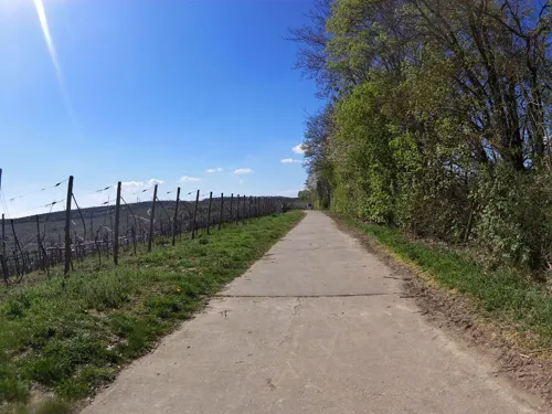
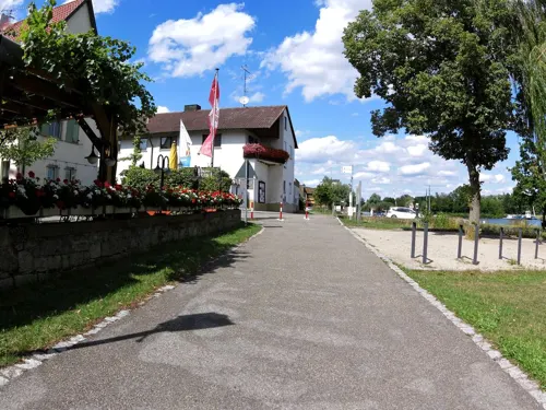
Biergarten ZehntGraf
Bar and pub · 3.9 km
Täglich ab 12:00 Uhr (Von Mitte April bis Ende September)
2 Zur Mainfähre, Wipfeld
Apr-Sep Mo-Su 12:00-21:00;Oct-Mar off
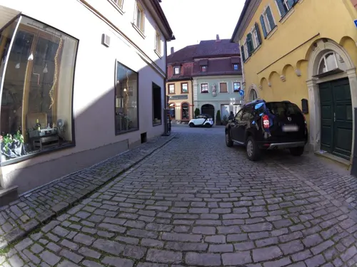
Buonissimo Volkach
Ice cream · Ice Cream · 5.7 km
26 Hauptstraße, Volkach
Mo-Sa 11:00-19:00; Su 13:00-18:00
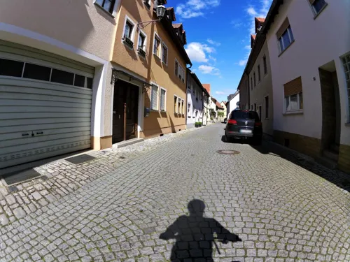

Schwane 1404
Restaurant · Regional · 5.8 km
12 Hauptstraße, Volkach
We,Th 12:00-20:00; Fr-Tu 12:00-14:00,18:00-21:00
The Asian Chef Food
Restaurant · Asian · 5.7 km
24 Hauptstraße, Volkach
Tu 17:00-22:30; Sa-Su 12:00-22:00; Mo,We-Fr 11:30-15:00,17:00-22:30
Tuchhaus - Hotel und Geniesserei
Restaurant · Regional · 5.7 km
5 Marktplatz, Volkach
We-Mo 11:00-22:00; Tu off
Weingasthof Hotel Rose
Restaurant · Regional · 5.9 km
7 Oberer Markt, Volkach
Mo-Su 09:00-23:00; We off


83 more on the map.
Where to stay23
Churches and places of worship36
Evangelische Kirche
Church · Lutheran · 4.9 km
14 Marktplatz, Eisenheim
Heiligste Dreifaltigkeit
Church · Catholic · 2.9 km
36 Schweinfurter Straße, Volkach
Shopping13
Gas and EV charging6
Schools, colleges and libraries11
Franken-Landschulheim Schloss Gaibach
School · 2.9 km
36 Schweinfurter Straße, Volkach
Healthcare2
Riemenschneider-Apotheke
Clinic and pharmacy · 5.8 km
15 Dr.-Eugen-Schön-Straße, Volkach
Map of Kolitzheim
250 places. The map loads OpenStreetMap tiles when you open it.
Getting there and nearby towns
Sonderlandeplatz Kitzingen (KZG) is the nearest airport with scheduled flights listed in OpenStreetMap, 19 km away.
- Werneck 12 km northwest, about 12 min by car
- Schweinfurt 15 km north, about 15 min by car
- Kitzingen 21 km south, about 21 min by car
- Rottendorf 20 km southwest, about 20 min by car
- Würzburg 24 km southwest, about 24 min by car
- Haßfurt 24 km northeast, about 24 min by car
- Gadheim 25 km west, about 25 min by car
- Veitshöchheim 27 km west, about 27 min by car
- Oerlenbach 27 km north, about 27 min by car
- Ochsenfurt 31 km southwest, about 31 min by car
Drive times are estimates from straight-line distance, not routes.
Local news
Headlines from INDB.
Reviews, tips and questions
Loading what members have shared...
Sources and licences
- GeoNames (CC BY 4.0): population, coordinates, regions and time zone
- Mapillary (see each image): photos
- OpenStreetMap contributors (ODbL 1.0): places, airports, map data
- Wikidata (CC0 1.0): elevation, founding date, time zone, website
- Wikimedia Commons (see each image): photos
- Wikipedia (CC BY-SA 4.0): overview and history text
Photo credits
- E-6-78-150-1 Ensemble Marktplatz, Kolitzheim-Zeilitzheim, Monandowitsch, CC BY-SA 3.0
- Kolitzheim-Kath-Kirche, Störfix, CC BY-SA 3.0 de
- 1 Schloss Zeilitzheim 12, Monandowitsch, CC BY-SA 4.0
- Schloss Klingenberg-001, Tilman2007, CC BY-SA 3.0
- Maria im Weingarten 01, Derzno, CC BY 3.0
- Rückseite, Friedhofskapelle, Obervolkach, Monandowitsch, CC BY-SA 3.0
- St. Nikolaus, Obervolkach, Monandowitsch, CC BY-SA 3.0
- GaibachKirche, Settembrini, CC BY 3.0
- Hauptaltar, Kirche Astheim, Volkach, Monandowitsch, CC BY-SA 3.0
- Volkach St. Michael 004, Tilman2007, CC BY 3.0
- KreuzkapelleGaibach, Settembrini, CC BY 3.0
- Konstitutionssäule bei Gaibach, 2, Rainer Lippert, CC0
- GaibachSchloss, Settembrini, CC BY 3.0
- Im Hörnauer Wald 6, Stephan van Helden, CC BY-SA 4.0
- Mariensäule Lindach 2016 (02), andy_king50, CC BY-SA 3.0
- Stammheim, Bildstock, Kirchweinberg-004, Tilman2007, CC BY-SA 3.0
- Obervolkach, D-6-75-174-277 Volkach 20210509 050, Tilman2007, CC BY-SA 4.0
- Obereisenheim, Marktplatz 13, Evangelische Kirche Eisenheim 20191218 001, Tilman2007, CC BY-SA 4.0
- Volkach, Astheim, Kartäuserstraße 16, Klosterkirche-20151109-001, Tilman2007, CC BY-SA 3.0
- Volkach, Gaibach Torturm, 002, Tilman2007, CC BY-SA 3.0
- Stettenburg, Reste, Volkach, Monandowitsch, CC BY-SA 3.0
- Blick zum NSG Hörnauer Wald 2, Stephan van Helden, CC BY-SA 4.0
- NSG-00329.01 Vogelschutzgebiet Garstadt, Ribka, CC BY-SA 3.0
- Wipfeld, Der Main-20161031-002, Tilman2007, CC BY-SA 4.0
- St. Lautentius, Heidenfeld 2014 02, Andy_king50, CC BY-SA 3.0
- Kolitzheim, Unterspiesheim, Katholische Pfarrkirche St. Sebastian, 003, Tilman2007, CC BY-SA 3.0
- Volkach Tor, Benreis, CC BY-SA 3.0
- Elgersheimer Hof 04, Derzno, CC BY 3.0
- Wipfeld, Der Main-20161031-001, Tilman2007, CC BY-SA 4.0
- 1 St. Laurentius Heidenfeld 1, Monandowitsch, CC BY 3.0
- Obereisenheim, Ev. Pfarrkirche-001, Tilman2007, CC BY-SA 3.0
- Schleifwiesen bei Lindach 5, Stephan van Helden, CC BY-SA 4.0
- Feuchter Boden im Nußloch bei Lindach, Stephan van Helden, CC BY-SA 4.0
- Feuchter Boden im Nußloch bei Lindach 2, Stephan van Helden, CC BY-SA 4.0
- Kleine Pilze auf Totholz im Nußloch bei Lindach, Stephan van Helden, CC BY-SA 4.0
- Feuchter Boden im Nußloch bei Lindach 3, Stephan van Helden, CC BY-SA 4.0
- Weide im Nußloch bei Lindach, Stephan van Helden, CC BY-SA 4.0
- Dactylorhiza sp. Knabenkraut im Nußloch bei Lindach, Stephan van Helden, CC BY-SA 4.0
- Nußloch bei Lindach, Stephan van Helden, CC BY-SA 4.0
- Nußloch bei Lindach 2, Stephan van Helden, CC BY-SA 4.0
- Museum für Militär- und Zeitgeschichte, Florian Rettner, CC BY-SA 3.0
- Untereisenheim, das Weingut Hirn, Dguendel, CC BY 4.0
- Street-level photo, zoegglmeyr, CC BY-SA 4.0
- Street-level photo, zoegglmeyr, CC BY-SA 4.0
- Street-level photo, zoegglmeyr, CC BY-SA 4.0
- Street-level photo, zoegglmeyr1, CC BY-SA 4.0
- Street-level photo, zoegglmeyr1, CC BY-SA 4.0
- Street-level photo, bernd_niemann, CC BY-SA 4.0
- Street-level photo, zoegglmeyr1, CC BY-SA 4.0
- Street-level photo, zoegglmeyr1, CC BY-SA 4.0
- Street-level photo, zoegglmeyr1, CC BY-SA 4.0
- Street-level photo, zoegglmeyr, CC BY-SA 4.0
- Street-level photo, zoegglmeyr1, CC BY-SA 4.0
- Street-level photo, zoegglmeyr1, CC BY-SA 4.0
- Street-level photo, zoegglmeyr1, CC BY-SA 4.0
- Street-level photo, zoegglmeyr1, CC BY-SA 4.0
- Street-level photo, zoegglmeyr1, CC BY-SA 4.0
- Street-level photo, changchun1, CC BY-SA 4.0
- Street-level photo, huste, CC BY-SA 4.0
- Street-level photo, zoegglmeyr1, CC BY-SA 4.0
- Street-level photo, zoegglmeyr1, CC BY-SA 4.0
- Street-level photo, bernd_niemann, CC BY-SA 4.0
- Street-level photo, zoegglmeyr1, CC BY-SA 4.0
- Street-level photo, kay_d, CC BY-SA 4.0
- Street-level photo, zoegglmeyr1, CC BY-SA 4.0


Page built November 9, 2026. Spotted a mistake? Tell us or suggest a place.