


Wahn-Heide, Germany
Wahnheide
Wahn-Heide is a town of 7,692 people in North Rhine-Westphalia, Germany.
Why visit Wahn-Heide
Townapedia lists 10 museums and landmarks, 6 parks and trails, 54 places to eat, 14 places to stay and 2 attractions in and around town.
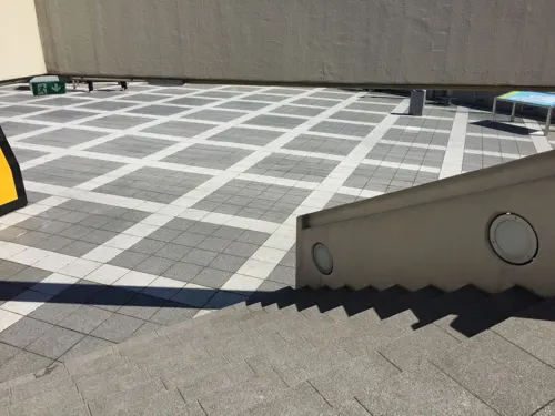
Highlights include Besucherterrasse, Schloss Wahn, Kiesgrube Wahn and Kiesgruben Paulsmaar.
Weather in Wahn-Heide
Forecast from MET Norway (CC BY 4.0). Full forecast
Things to do2

Museums and landmarks10




Anflugbefeuerung
Monument and historic site · 2.4 km
ALS=Approach Lighting System (RWY 24)
Parks, trails and playgrounds6




Restaurants and cafes54
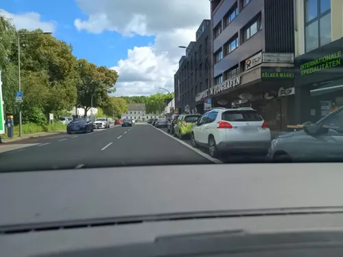
Antica Roma
Restaurant · Italian
238 Heidestraße, Köln
Tu-Fr 11:30-14:30, 17:00-22:30; Sa 17:00-23:00; Su, PH 11:30-22:30

Balsamico
Restaurant · Italian · 1.9 km
39 Akazienweg, Köln
Tu 17:00-22:00; PH,We-Su 12:00-14:30,17:00-22:00; Mo off
Brauhaus Eltzhof
Restaurant · 1.6 km
10 Sankt-Sebastianus-Straße, Köln
Mo-Fr 17:00+; Sa 14:00+; Su 12:00+
Heisters
Bakery · 1.5 km
197 Frankfurter Straße, Köln
Mo-Fr 06:00-18:30; Sa 06:00-14:00; PH,Su 08:00-16:00


Weinlädchen Monika Drews
Brewery and winery · 2.2 km
17 Akazienweg, Köln
Mo 15:00-18:30; Tu-Th 09:00-13:00,15:00-18:30; Fr 09:00-18:30; Sa...
Olymp
Restaurant · Greek, Pizza, Grill · 1.2 km
21 Heidestraße, Köln
We-Mo 16:00+


42 more on the map.
Where to stay14
Churches and places of worship7
Shopping16
Gas and EV charging9
Schools, colleges and libraries8
Gemeinschaftsgrundschule Adolph-Kolping-Straße
School · 1.1 km
41 Adolph-Kolping-Straße, Köln
Healthcare5
Map of Wahn-Heide
131 places. The map loads OpenStreetMap tiles when you open it.
Getting there and nearby towns
Cologne Bonn Airport (CGN) is the nearest airport with scheduled flights listed in OpenStreetMap, 3 km away.
- Zündorf 4 km west, about 4 min by car
- Troisdorf 6 km southeast, about 6 min by car
- Rösrath 7 km northeast, about 7 min by car
- Niederkassel 7 km southwest, about 7 min by car
- Lohmar 8 km east, about 8 min by car
- Siegburg 10 km southeast, about 10 min by car
- Wesseling 10 km west, about 10 min by car
- Sankt Augustin 11 km southeast, about 11 min by car
- Köln 14 km northwest, about 14 min by car
- Bonn 14 km south, about 14 min by car
Drive times are estimates from straight-line distance, not routes.
Local news
Headlines from INDB.
Reviews, tips and questions
Loading what members have shared...
Sources and licences
- GeoNames (CC BY 4.0): population, coordinates, regions and time zone
- Mapillary (see each image): photos
- OpenStreetMap contributors (ODbL 1.0): places, airports, map data
- Wikidata (CC0 1.0): elevation, founding date, time zone, website
- Wikimedia Commons (see each image): photos
Photo credits
- Schloss Wahn Innenhof 2, B. Neulich alias Benutzer:Neulich im Roxy Kino, CC BY 3.0
- Mariae-himmelfahrt-grengel, A.Savin, CC BY-SA 3.0
- Friedenskirche (Köln-Urbach), Journey234, Public domain
- Approach lighting system Cologne Bonn Airport-0175, Raimond Spekking, CC BY-SA 4.0
- Paulsmaar, Mabit1, CC BY-SA 4.0
- Eltzhof Wahn 2013 01, Gordito1869, CC BY 3.0
- Let Köln-Zagreb 112948, Quahadi Añtó 18:28, 29 September 2021 (UTC), CC BY 4.0
- Martin-Luther-Kirche (Köln-Wahnheide), Unknown author, Public domain
- Köln-Wahnheide, Orgel, Christine Sünn, CC BY-SA 4.0
- Luftaufnahme DLR Köln, unknown/German Aerospace Center, CC BY 3.0 de
- Tornado Wahn 44+35 - 6, JeLuF, CC BY-SA 4.0
- Tornado Wahn 44+35 - 4, JeLuF, CC BY-SA 4.0
- Tornado Wahn 44+35 - 2, JeLuF, CC BY-SA 4.0
- Tornado Wahn 44+35 - 5, JeLuF, CC BY-SA 4.0
- Tornado Wahn 44+35 - 1, JeLuF, CC BY-SA 4.0
- Tornado Wahn 44+35 - 3, JeLuF, CC BY-SA 4.0
- Unterer Scheuerteich, Unknown author, Public domain
- Spaceshop (8405753332), DLR German Aerospace Center, CC BY 2.0
- Standortleitung Headquarters (8405752962), DLR German Aerospace Center, CC BY 2.0
- Kantine Cafeteria (8404660535), DLR German Aerospace Center, CC BY 2.0
- Winter auf dem DLR-Gelände Winter at DLR Cologne (8404659045), DLR German Aerospace Center, CC BY 2.0
- Kantine II Cafeteria II (8404660829), DLR German Aerospace Center, CC BY 2.0
- Eichen im Schnee Snow-covered oak trees (8404658729), DLR German Aerospace Center, CC BY 2.0
- Let Köln-Zagreb 112954, Quahadi Añtó 18:28, 29 September 2021 (UTC), CC BY 4.0
- Let Köln-Zagreb 112931, Quahadi Añtó 18:28, 29 September 2021 (UTC), CC BY 4.0
- Institut für Antriebstechnik Institute of Propulsion Technology Cologne (8404659421), DLR German Aerospace Center, CC BY 2.0
- Hauptstraße Main street (8405757144), DLR German Aerospace Center, CC BY 3.0
- CP-140 Aurora at Cologne 2015, Filterkaffee, CC BY-SA 4.0
- ST-C230-4-63. President John F. Kennedy Arrives at Wahn Airport in Bonn, Germany, Cecil W. Stoughton, Public domain
- Fire Brigade - panoramio (1), aachim3, CC BY 3.0
- ST-C230-13-63. President John F. Kennedy Arrives at Wahn Airport in Bonn, Germany, Cecil W. Stoughton, Public domain
- ST-C230-5-63. President John F. Kennedy Arrives at Wahn Airport in Bonn, Germany, Cecil W. Stoughton, Public domain
- KN-C29231. President John F. Kennedy Arrives at Wahn Airport in Bonn, Germany, Cecil W. Stoughton, Public domain
- ST-C230-6-63. President John F. Kennedy Arrives at Wahn Airport in Bonn, Germany, Cecil W. Stoughton, Public domain
- KN-C29230. President John F. Kennedy Arrives at Wahn Airport in Bonn, Germany, Cecil W. Stoughton, Public domain
- ST-C230-22-63. President John F. Kennedy Arrives at Wahn Airport in Bonn, Germany, Cecil W. Stoughton, Public domain
- Wasserstoffspeicher Hydrogen tanks (8404661121), DLR German Aerospace Center, CC BY 2.0
- Street-level photo, zuse, CC BY-SA 4.0
- Street-level photo, ifjj1ref, CC BY-SA 4.0
- Street-level photo, map_dav, CC BY-SA 4.0
- Street-level photo, countzero5, CC BY-SA 4.0
- Street-level photo, wolf404, CC BY-SA 4.0
- Street-level photo, TechniPorter, CC BY-SA 4.0
- Street-level photo, TechniPorter, CC BY-SA 4.0
- Street-level photo, TechniPorter, CC BY-SA 4.0
- Street-level photo, TechniPorter, CC BY-SA 4.0
- Street-level photo, ifjj1ref, CC BY-SA 4.0
- Street-level photo, ifjj1ref, CC BY-SA 4.0
- Street-level photo, ifjj1ref, CC BY-SA 4.0
- Street-level photo, zuse, CC BY-SA 4.0
- Street-level photo, maxd, CC BY-SA 4.0
- Street-level photo, TechniPorter, CC BY-SA 4.0
- Street-level photo, maxd, CC BY-SA 4.0
- Street-level photo, ifjj1ref, CC BY-SA 4.0
- Street-level photo, zuse, CC BY-SA 4.0
- Street-level photo, ifjj1ref, CC BY-SA 4.0
- Street-level photo, zuse, CC BY-SA 4.0
- Street-level photo, mfa, CC BY-SA 4.0
- Street-level photo, tkramm, CC BY-SA 4.0
- Street-level photo, ifjj1ref, CC BY-SA 4.0
- Street-level photo, littimann, CC BY-SA 4.0
- Street-level photo, thomasrosen, CC BY-SA 4.0
- Street-level photo, countzero5, CC BY-SA 4.0


Page built November 9, 2026. Spotted a mistake? Tell us or suggest a place.