


Why visit Eil
Townapedia lists 30 museums and landmarks, 15 parks and trails, 174 places to eat, 22 places to stay and 7 attractions in and around town.
Highlights include Cologne Rodenkirchen Bridge, Besucherterrasse, Schloss Wahn and DEUTZ Motorensammlung.
Weather in Eil
Forecast from MET Norway (CC BY 4.0). Full forecast
About Eil
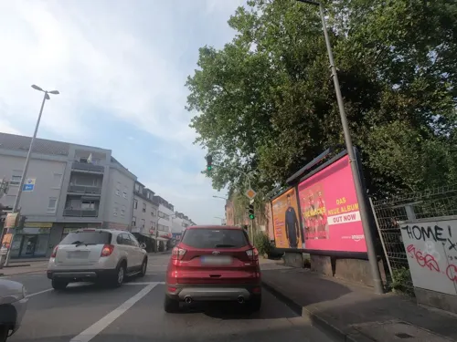
Eil is a suburb of Cologne, Germany located in the city district of Porz, south-east of the city center. With an area totalling 16,24 km2, it is the largest suburb in the city, although not all of the land is built up.
From the Wikipedia article Eil, Cologne (this version), under CC BY-SA 4.0.
Things to do7

Cologne Rodenkirchen Bridge
Bridge · 6.3 km
Freeway(A4)-bridge crossing the Rhine south of Cologne


Rolf's Streichelzoo Köln
Zoo and aquarium · 3.1 km
Mar-Oct: Mo-Fr 09:00-18:30, Sa 09:00-16:00; Nov-Feb: Mo-Fr 10:00-16:00

Museums and landmarks30






18 more on the map.
Parks, trails and playgrounds15


Yachthafen: Club für Wassersport Porz
Marina and boat launch · 3.2 km
Gastliegeplätze, Strom, Wasser, WC, Dusche, bewirtschaftetes Clubhaus




3 more on the map.
Restaurants and cafes174

Balsamico
Restaurant · Italian · 2.4 km
39 Akazienweg, Köln
Tu 17:00-22:00; PH,We-Su 12:00-14:30,17:00-22:00; Mo off
Daisys Tearoom & Garden
Cafe · Breakfast, Cake, Coffee Shop, English, German, Local · 3.6 km
21 Gütergasse, Köln
Tu-Fr 09:00-18:00; Sa-Su 09:30-18:00
Edamame
Restaurant · Sushi · 1.8 km
436 Hauptstraße, Köln
Mo-Sa 11:30-15:00,17:00-22:00; Su,PH 15:00-22:00
Imperial
Restaurant · Italian, Pizza, Steak
641 Frankfurter Straße, Köln
Mo-Sa 17:00-23:00; Su 17:00-22:00; PH 17:00-22:00
Inci Fisch
Restaurant · Fish, Seafood · 2.4 km
293 Hauptstraße, Köln
Tu,We 14:00-23:00; Th 14:00-22:45; Fr,Sa 14:00-23:30; Su 11:30-23:00
Jägerhof
Restaurant · Italian, German · 3.3 km
661 Rösrather Straße
We-Mo 12:00-15:00,17:30-22:00; Tu off


Pizza Martello
Restaurant · Pizza · 2.0 km
33 Mühlenstraße, Köln
Mo off; Tu-Th 10:00-22:00; Fr-Sa 16:30-22:00; Su,PH 11:30-22:00
162 more on the map.
History
The village of Eil first appears in the records in 1268. At that time the inhabitants were very poor, and made a living as day laborers for the local landowners in the nearby manors of Röttgen and Leidenhausen. In the later medieval period Eil passed into the ownership of Porz in the Berg territory. During the rapid urbanisation of the nineteenth century, Eil became the largest settlement in the Heumar administrative region, but still without its own church. In 1903/1904 the church of St Michael was built, and in 1917 Eil finally acquired its own priest.
From the History section of Eil, Cologne on Wikipedia, under CC BY-SA 4.0.
Where to stay22
Churches and places of worship40
Serbisch-Orthodoxe Kirche
Church · Serbian Orthodox · 1.9 km
13 Frankenplatz, Köln
St. Cornelius
Church · Roman Catholic · 2.9 km
100 Eiler Straße, Köln
Shopping46
Gas and EV charging17
Schools, colleges and libraries29
Healthcare21
Map of Eil
250 places. The map loads OpenStreetMap tiles when you open it.
Getting there and nearby towns
Cologne Bonn Airport (CGN) is the nearest airport with scheduled flights listed in OpenStreetMap, 5 km away.
- Gremberghoven 2 km northwest, about 2 min by car
- Zündorf 4 km southwest, about 4 min by car
- Wahn-Heide 4 km southeast, about 4 min by car
- Rösrath 7 km east, about 7 min by car
- Köln 10 km northwest, about 10 min by car
- Niederkassel 9 km south, about 9 min by car
- Wesseling 10 km southwest, about 10 min by car
- Troisdorf 11 km southeast, about 11 min by car
- Bergisch Gladbach 11 km north, about 11 min by car
- Lohmar 11 km southeast, about 11 min by car
Drive times are estimates from straight-line distance, not routes.
Local news
Headlines from INDB.
Reviews, tips and questions
Loading what members have shared...
Sources and licences
- GeoNames (CC BY 4.0): population, coordinates, regions and time zone
- Mapillary (see each image): photos
- OpenStreetMap contributors (ODbL 1.0): places, airports, map data
- Wikidata (CC0 1.0): elevation, founding date, time zone, website, landmarks and historic places
- Wikimedia Commons (see each image): photos
- Wikipedia (CC BY-SA 4.0): overview and history text
Photo credits
- Gut Leidenhausen, Journey234, Public domain
- Kirche St. Michael (Köln-Eil), Journey234, Public domain
- NRW Naturdenkmal Köln-Eil Rosskastanie NDI 705.02, Bagheera-mine, CC BY-SA 4.0
- Bürogebäude Theodor-Heuss-Straße 45, Köln-Eil-7127, Raimond Spekking, CC BY-SA 4.0
- Bürogebäude Theodor-Heuss-Straße 60-64, Köln-Eil-7126, Raimond Spekking, CC BY-SA 4.0
- Rodenkirchener-bruecke-panorama, A.Savin, CC BY-SA 3.0
- Groov 2006, Unknown author, Public domain
- 05Schiffansicht, Lessing-Autor, CC BY-SA 4.0
- Schloss Wahn Innenhof 2, B. Neulich alias Benutzer:Neulich im Roxy Kino, CC BY 3.0
- Köln Rath Heumar St. Cornelius 1, Gordito1869, CC BY 3.0
- Lukaskirche, Köln-Porz-7162, Raimond Spekking, CC BY-SA 4.0
- Sturmgeschädigter Baum - Naturschutzgebiet Wahner Heide, "Nordschneise"; Deutschland, NRW, Volker Dreyer, CC BY-SA 4.0
- Kiesgrubensee Gremberghoven, Greeny69, CC BY-SA 4.0
- Kirche Bartholomaeus (Urbach), Unknown author, Public domain
- Kirche Heilig Geist (Köln-Gremberghoven) (1), Chris06, CC BY-SA 4.0
- Friedenskirche (Köln-Urbach), Journey234, Public domain
- Johanneskirche Köln-Westhoven, Chris06, CC0
- Martin-Luther-Kirche (Köln-Wahnheide), Unknown author, Public domain
- St. Georgskapelle (Köln-Weiß) (01), Chris06, CC BY-SA 4.0
- Wahner Heide 2, Olbertz, CC BY-SA 3.0
- St. Cornelius, Köln-Heumar, Christopher Hoemann, CC BY-SA 4.0
- Hoffnungskirche Finkenberg, Köln-7117, Raimond Spekking, CC BY-SA 4.0
- Lasse Stolley Rucksack Inhalt, Lasse Stolley, CC0
- Wohn- und Geschäftshaus Humboldtstraße 134 und 136, Köln-Porz-7129, Raimond Spekking, CC BY-SA 4.0
- Freie Christengemeinde Köln-Porz-7111, Raimond Spekking, CC BY-SA 4.0
- Franz-Hitze-Haus, Bonner Straße 2b, Köln-Porz-7142, Raimond Spekking, CC BY-SA 4.0
- St. Fronleichnam, Köln-Porz-7136, Raimond Spekking, CC BY-SA 4.0
- Jugendwerkstatt, Inklusive Offene Tür Ohmstraße, Ohmstraße 81, Köln-Porz, -7135, Raimond Spekking, CC BY-SA 4.0
- Inklusive Offene Tür Ohmstraße, Ohmstraße 83, Köln-Porz, -7133, Raimond Spekking, CC BY-SA 4.0
- St. Fronleichnam, Köln-Porz-7138, Raimond Spekking, CC BY-SA 4.0
- Jugendwerkstatt, Inklusive Offene Tür Ohmstraße, Ohmstraße 83 und 81, Köln-Porz, -7137, Raimond Spekking, CC BY-SA 4.0
- St. Fronleichnam, Köln-Porz-7141, Raimond Spekking, CC BY-SA 4.0
- St. Fronleichnam, Köln-Porz-7140, Raimond Spekking, CC BY-SA 4.0
- St. Fronleichnam, Köln-Porz-7132, Raimond Spekking, CC BY-SA 4.0
- Freie Christengemeinde Köln-Porz-7118, Raimond Spekking, CC BY-SA 4.0
- DB-Tunnel Schloss Röttgen, Fluchtbauwerk, Duhon, CC BY 3.0
- St. Fronleichnam, Köln-Porz-7130, Raimond Spekking, CC BY-SA 4.0
- St. Fronleichnam, Köln-Porz-7131, Raimond Spekking, CC BY-SA 4.0
- St. Maximilian Kolbe, Köln-Finkenberg - Detail-7115, Raimond Spekking, CC BY-SA 4.0
- Gut Maarhof, Porz-Urbach, Herrenhaus, Duhon, CC BY 3.0
- Stolpersteine K-Porz Kaiserstr 59 Jenny Recking, Superbass, CC BY-SA 4.0
- Stolperstein Köln, Albert Brünell (Am Markt 6), © 1971markus, CC BY-SA 4.0
- Stolperstein-porz-hauptstr Albert Tobias, Superbass, CC BY-SA 4.0
- Stolpersteine-Porz-Hauptstr Berta Tobias, Superbass, CC BY-SA 4.0
- Stolperstein Köln, Melanie Brünell (Am Markt 6), © 1971markus, CC BY-SA 4.0
- Street-level photo, countzero5, CC BY-SA 4.0
- Street-level photo, raymond, CC BY-SA 4.0
- Street-level photo, ifjj1ref, CC BY-SA 4.0
- Street-level photo, ifjj1ref, CC BY-SA 4.0
- Street-level photo, ifjj1ref, CC BY-SA 4.0
- Street-level photo, raymond, CC BY-SA 4.0
- Street-level photo, raymond, CC BY-SA 4.0
- Street-level photo, wolf404, CC BY-SA 4.0
- Street-level photo, thetornado76, CC BY-SA 4.0
- Street-level photo, poldy, CC BY-SA 4.0
- Street-level photo, uwekoch, CC BY-SA 4.0
- Street-level photo, uwekoch, CC BY-SA 4.0
- Street-level photo, uwekoch, CC BY-SA 4.0
- Street-level photo, ifjj1ref, CC BY-SA 4.0
- Street-level photo, raymond, CC BY-SA 4.0
- Street-level photo, raymond, CC BY-SA 4.0
- Street-level photo, countzero5, CC BY-SA 4.0
- Street-level photo, map_dav, CC BY-SA 4.0
- Street-level photo, raymond, CC BY-SA 4.0
- Street-level photo, ifjj1ref, CC BY-SA 4.0
- Street-level photo, raymond, CC BY-SA 4.0
- Street-level photo, ifjj1ref, CC BY-SA 4.0
- Street-level photo, raymond, CC BY-SA 4.0
- Street-level photo, ifjj1ref, CC BY-SA 4.0
- Street-level photo, poldy, CC BY-SA 4.0
- Street-level photo, ifjj1ref, CC BY-SA 4.0


Page built November 9, 2026. Spotted a mistake? Tell us or suggest a place.