


Why visit Worpswede
Townapedia lists 29 museums and landmarks, 9 parks and trails, 58 places to eat, 20 places to stay and 8 attractions in and around town.
Highlights include Music Hall Worpswede, Weyerberg, Große Kunstschau Worpswede and Museum am Modersohn-Haus.
Weather in Worpswede
Forecast from MET Norway (CC BY 4.0). Full forecast
About Worpswede
Worpswede (German pronunciation: [ˈvɔʁpsˌveːdə]; Low German: Worpsweed) is a municipality in the district of Osterholz, in Lower Saxony, Germany. It is situated in the Teufelsmoor, northeast of Bremen. The small town itself is located near the Weyerberg hill. It has been the home to an artistic community since the end of the 19th century.
From the Wikipedia article Worpswede (this version), under CC BY-SA 4.0.
Things to do8


Aussichtsturm Neu Helgoland
Scenic view · 3.0 km
Gebaut 2014 vom Landkreis Osterholz (Naturschutzbehörde)

Museums and landmarks29


Worpsweder Kunsthalle
Museum
17 Bergstraße, Worpswede
Tu-Su 10:00-18:00

Galerie Altes Rathaus
Museum
1 Bergstraße, Worpswede
Nov-Mar: Tu-Fr 14:00-17:00; Nov-Mar: Sa,Su 11:00-17:00; Apr-Oct:...


Käseglocke
Museum
13 Lindenallee, Worpswede
Oct-Mar: Sa,Su 13:00-16:00; Apr-Sep: Sa,Su 13:00-17:00
Heinrich-Vogeler-Museum
Museum · 0.7 km
Mo-Su 10:00-18:00; Dec 25 off; Dec 24 off; Dec 31 off; Dec 26...


17 more on the map.
Parks, trails and playgrounds9





Restaurants and cafes58

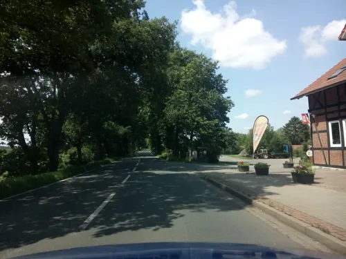
Hüttenbuscher Lieferservice
Restaurant · Regional, Pizza, Burger, Indian · 6.0 km
Lieferservice aus Hüttenbusch mit Pizza, Baguette, American Snacks, Fischgerichte, Gyros, Schnitzel, Aufläufen, Calzone, Indischen...
13 Hüttenbuscher Straße, Worpswede
Tu-Su 16:00-22:00
Gasthaus Schamaika
Restaurant · Regional · 4.9 km
33 Teufelsmoorstraße, Osterholz-Scharmbeck
Oct-Apr: Mo-Fr 09:00-16:00; Oct-Apr: Sa,Su 10:00-18:00;May-Sep:...

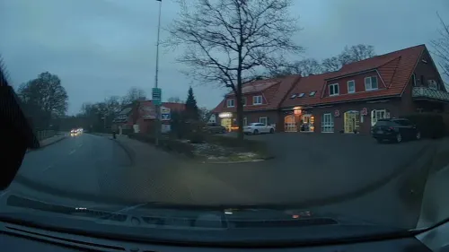
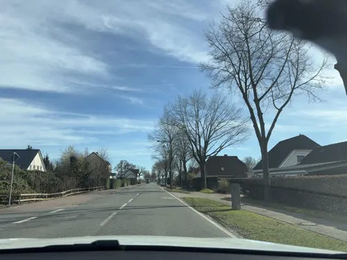
Bäckerei Behrens
Bakery · 5.8 km
Hüttenbuscher Straße, Worpswede
Mo-Fr 05:30-18:00; Sa 05:30-12:00; Su 08:00-11:00



46 more on the map.
History
The origins of Worpswede date back to the Bronze Age. The first time it was mentioned however was in 1218. Then it belonged to the Prince-Archbishopric of Bremen.
In 1630 it was occupied by Sweden for a short period of time. In 1648 the Prince-Archbishopric was transformed into the Duchy of Bremen, which was first ruled in personal union by the Swedish and from 1715 on by the Hanoverian Crown. However, it took another 120 years (1750) until the colonization of the Teufelsmoor was started by Jürgen Christian Findorff by drainage of the bog. In 1823 the Duchy was abolished and its territory became part of the Stade Region.
From the History section of Worpswede on Wikipedia, under CC BY-SA 4.0.
Where to stay20
Übernachtung im kleinen philosophischen Salon
Motel and hotel · 1.0 km
10 Heinrich-Vogeler-Weg, Worpswede
Churches and places of worship8
Ev.-luth. Kirche Hüttenbusch
Church · Lutheran · 6.0 km
Hüttenbuscher Straße, Worpswede
ChristusCentrum OASIS Lilienthal
Church · Pentecostal · 6.9 km
55-57 Goebelstraße, Lilienthal
Shopping22
Gas and EV charging6
Schools, colleges and libraries8
Healthcare3
Map of Worpswede
171 places. The map loads OpenStreetMap tiles when you open it.
Getting there and nearby towns
Bremen Airport (BRE) is the nearest airport with scheduled flights listed in OpenStreetMap, 22 km away.
- Osterholz-Scharmbeck 9 km west, about 9 min by car
- Lilienthal 9 km south, about 9 min by car
- Ritterhude 13 km west, about 13 min by car
- Bremen 18 km southwest, about 18 min by car
- Oyten 20 km south, about 20 min by car
- Ottersberg 19 km southeast, about 19 min by car
- Schwanewede 22 km west, about 22 min by car
- Stuhr 24 km southwest, about 24 min by car
- Achim 24 km south, about 24 min by car
- Delmenhorst 27 km southwest, about 27 min by car
Drive times are estimates from straight-line distance, not routes.
Local news
Headlines from INDB.
Reviews, tips and questions
Loading what members have shared...
Sources and licences
- GeoNames (CC BY 4.0): population, coordinates, regions and time zone
- Mapillary (see each image): photos
- OpenStreetMap contributors (ODbL 1.0): places, airports, map data
- Wikidata (CC0 1.0): elevation, founding date, time zone, website, landmarks and historic places
- Wikimedia Commons (see each image): photos
- Wikipedia (CC BY-SA 4.0): overview and history text
Photo credits
- 2020-09-14 Worpswede kath Kirche Maria Frieden (2), Eduard47, CC BY-SA 4.0
- 2020-09-14 Worpswede Village Hotel (1), Eduard47, CC BY-SA 4.0
- 2020-09-14 Worpswede Kunsthalle (2), Eduard47, CC BY-SA 4.0
- 2020-09-14 Worpswede Café Schulken (3), Eduard47, CC BY-SA 4.0
- Statue Kaffee Worpswede, Marcus Schwan from Fürth, Deutschland, CC BY 2.0
- Bergstraße 18 Worpswede, Clemensfranz, CC BY-SA 4.0
- 2020-09-14 Worpswede Skulpturen Erwartung (4), Eduard47, CC BY-SA 4.0
- 2020-09-14 Worpswede Galerie Cohrs Zirus (1), Eduard47, CC BY-SA 4.0
- 2020-09-14 Worpswede Modersohn Grab (7), Eduard47, CC BY-SA 4.0
- 2020-09-14 Worpswede Modersohn Grab (6), Eduard47, CC BY-SA 4.0
- 2020-09-14 Worpswede Modersohn Grab (5), Eduard47, CC BY-SA 4.0
- 2020-09-14 Worpswede Modersohn Grab (1), Eduard47, CC BY-SA 4.0
- 2020-09-14 Worpswede Schlösschen (4), Eduard47, CC BY-SA 4.0
- 2020-09-14 Worpswede Schlösschen (3), Eduard47, CC BY-SA 4.0
- 2020-09-14 Worpswede Schlösschen (2), Eduard47, CC BY-SA 4.0
- 2020-09-14 Worpswede Schlösschen (1), Eduard47, CC BY-SA 4.0
- 2020-09-14 Worpswede Galerie Cohrs Zirus (3), Eduard47, CC BY-SA 4.0
- 2020-09-14 Worpswede Mimis Erbe-ex Stolte (1), Eduard47, CC BY-SA 4.0
- 2020-09-14 Worpswede Mimis Erbe-ex Stolte (2), Eduard47, CC BY-SA 4.0
- Friedhof Modersohn Becker Worpswede 02, Clemensfranz, CC BY-SA 4.0
- 2020-09-14 Worpswede Mimis Erbe-ex Stolte (3), Eduard47, CC BY-SA 4.0
- 2020-09-14 Worpswede Galerie Schoppe (2), Eduard47, CC BY-SA 4.0
- 2020-09-14 Worpswede Music Hall, Eduard47, CC BY-SA 4.0
- 2020-09-14 Worpswede Große Kunstschau (27), Eduard47, CC BY-SA 4.0
- Innenraum der Kapelle Maria Frieden, Worpswede, SMeyer, CC BY 4.0
- Außenansicht der Kapelle Maria Frieden, Worpswede, SMeyer, CC BY 4.0
- Stefan Stoppok in Worpswede 2024 Bild 05, Fonzie, CC BY-SA 4.0
- Stefan Stoppok in Worpswede 2024 Bild 03, Fonzie, CC BY-SA 4.0
- Stefan Stoppok in Worpswede 2024 Bild 04, Fonzie, CC BY-SA 4.0
- Stefan Stoppok in Worpswede 2024 Bild 10, Fonzie, CC BY-SA 4.0
- Stefan Stoppok in Worpswede 2024 Bild 09, Fonzie, CC BY-SA 4.0
- Haus im Schluh, Alinea, Public domain
- Zionskirche Worpswede South, picture: user:Concord, CC BY-SA 4.0
- Pfad in der Westlichen Hälfte des Langen Moores, AchtungBetreten, CC0
- Kaeseglocke, Unknown author, CC BY-SA 3.0
- Worpsweder Kunsthalle Friedrich Netzel Fassade, Axel Hindemith, CC BY-SA 4.0
- Grasbergchurch-2, Grasbergchurch.jpg : Pax:Vobiscum derivative work: Regi51 ( talk ), CC BY-SA 3.0
- Worpswede Barkenhoff, Till F. Teenck, CC BY-SA 2.5
- 2020-09-14 Worpswede Hüttenbusch Kirche (9), Eduard47, CC BY-SA 4.0
- Niedersachsenstein Worpswede, Till F. Teenck, CC BY-SA 2.5
- 2020-09-14 Worpswede Bahnhof (3), Eduard47, CC BY-SA 4.0
- 2020-09-14 Worpswede Galerie Cohrs Zirus (5), Eduard47, CC BY-SA 4.0
- Street-level photo, live, CC BY-SA 4.0
- Street-level photo, manfredi, CC BY-SA 4.0
- Street-level photo, geogast, CC BY-SA 4.0
- Street-level photo, geogast, CC BY-SA 4.0
- Street-level photo, manfredi, CC BY-SA 4.0
- Street-level photo, hubert87, CC BY-SA 4.0
- Street-level photo, manfredi, CC BY-SA 4.0
- Street-level photo, manfredi, CC BY-SA 4.0
- Street-level photo, StefanS79, CC BY-SA 4.0
- Street-level photo, live, CC BY-SA 4.0
- Street-level photo, abmap, CC BY-SA 4.0
- Street-level photo, StefanS79, CC BY-SA 4.0
- Street-level photo, Karinaclang, CC BY-SA 4.0
- Street-level photo, live, CC BY-SA 4.0
- Street-level photo, live, CC BY-SA 4.0
- Street-level photo, live, CC BY-SA 4.0
- Street-level photo, StefanS79, CC BY-SA 4.0
- Street-level photo, heetENkoel, CC BY-SA 4.0
- Street-level photo, manfredi, CC BY-SA 4.0
- Street-level photo, live, CC BY-SA 4.0
- Street-level photo, manfredi, CC BY-SA 4.0


Page built November 9, 2026. Spotted a mistake? Tell us or suggest a place.