


Why visit Mayen
Townapedia lists 59 museums and landmarks, 23 parks and trails, 101 places to eat, 15 places to stay and 45 attractions in and around town.
Highlights include Brohl's Hofladen, Büden, Erlebniswelten Grubenfeld and Löwenburg.
Weather in Mayen
Forecast from MET Norway (CC BY 4.0). Full forecast
About Mayen
Mayen (German pronunciation: [ˈmaɪən] ) is a town in the Mayen-Koblenz District of the Rhineland-Palatinate Federal State of Germany, in the eastern part of the Volcanic Eifel Region. As well as the main town, additional settlements include Alzheim, Kürrenberg, Hausen-Betzing, Hausen and Nitztal. Mayen is the administrative centre of the Vordereifel ‘Collective Municipality’, although it is not part of the municipality.
From the Wikipedia article Mayen (this version), under CC BY-SA 4.0.
Travel tips from other travellers: Mayen on Wikivoyage (CC BY-SA 4.0).
Things to do45





33 more on the map.
Museums and landmarks59



Schloss Bürresheim
Monument and historic site · 4.1 km


Katzenberg Hillfort
Monument and historic site · 1.7 km
Archaeological site in Rhineland-Palatinate, Germany


47 more on the map.
Parks, trails and playgrounds23



Ettringer und Mayener Bellberg, Kottenheimer Büden
Hiking and trails · 2.4 km


Freiraum Kletterwald Vulkanpark
Sports field and stadium · 3.7 km


St. Veit Park
Park · 0.6 km
Park mit Kreuzwegstationen der 1950er Jahre; Brunnen; Kriegerdenkmal, 1871, Obelisk.
11 more on the map.
Restaurants and cafes101
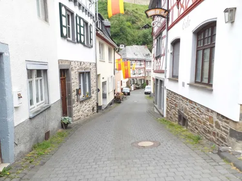

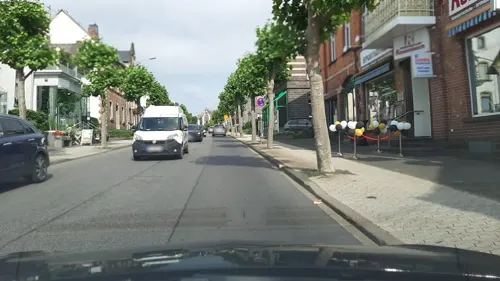
Pizzeria Adriano Vulcano
Restaurant · Noodle, Pizza, Cafe, Ice · 6.5 km
64 Bahnstraße, Mendig
Mo-Su 11:30-23:00
Roy’s Pizzeria
Restaurant · Pizza · 3.1 km
21 Hauptstraße, Ettringen
Su 12:00-21:00; Mo-Fr 11:00-14:30, 17:00-21:30; Sa 12:00-14:30, 17:00-21:30

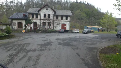
Stellwerk
Restaurant · German, Regional · 6.1 km
5 Am Bahnhof, Monreal
We-Sa 18:00-24:00; Su 12:00-14:00, 18:00-24:00
Wok Man
Restaurant · Asian, German
4 Neustraße, Mayen
Mo 11:00-15:00; Tu-Sa 11:00-15:00,16:00-22:00; Su 12:00-15:00,16:00-22:00
Bäckerei Hoefer
Cafe · 6.5 km
2 Robert-Koch-Straße, Polch
Mo-Fr 06:30-17:00; Sa 07:00-17:00; Su,PH 07:00-17:00
Bäckerei Hoefer
Bakery · 6.6 km
57 Bahnstraße, Mendig
Mo-Fr 07:00-17:30; Su 07:30-17:00; Sa 07:00-16:00


Dolci & Amor Italienische Desserts & Spezialitäten
Cafe · Italian · 6.6 km
55 Bahnstraße, Mendig
Mo off; Tu-Sa 10:00-17:30; Su 12:00-17:30
89 more on the map.
History
Even in Roman times, Mayen (Lat. Megina) was an important economic centre. From the end of the 3rd century up until the Middle Ages, potteries operated here, and their products were traded and sold across Central Europe. During prehistoric times, nearby quarries were the sources of basalt to make millstones and tuff used to make sarcophagi. These sarcophagi were found buried with significant glass artifacts as grave goods (both classes of items are displayed in the Genovevaburg Museum in Mayen).
The name Mayen probably comes from the name Megina. Records from as far back as 847 show this as a designation of the town; it was adapted by the Romans from the Celtic word magos, meaning field. In the 8th century the legend of Genoveva of Brabant, names Mayen as the seat of government of Duke Siegfried of the Pfalz.
Mayen received its first official recognition in 1041, and was granted Town Status in 1291 by Rudolf I von Habsburg, at the same time as Bernkastel, Welschbillig, Montabaur and Saarburg. Mayen is possibly linked to the town of Maifeld, which lies a short distant to the south-east, since Mayen was called the capital of the Meiengau in the Middle Ages.
From the History section of Mayen on Wikipedia, under CC BY-SA 4.0.
Where to stay15
Landhaus Kürrenberg
Motel and hotel · 4.9 km
9 Im Weiherhölzchen, Mayen-Kürrenberg
Churches and places of worship32
St. Nikolaus
Church · Roman Catholic · 3.3 km
1 Burgstraße, Kottenheim
Pfarrkirche Heiligste Dreifaltigkeit
Church · Roman Catholic · 5.5 km
Shopping33
Gas and EV charging14
Schools, colleges and libraries25
Bundesbildungszentrum des Deutschen Dachdeckerhandwerks
School · 0.7 km
43-59 Kelberger Straße, Mayen
Healthcare8
Map of Mayen
250 places. The map loads OpenStreetMap tiles when you open it.
Getting there and nearby towns
Hahn Airport (HHN) is the nearest airport with scheduled flights listed in OpenStreetMap, 43 km away.
- Neuwied 21 km northeast, about 21 min by car
- Sinzig 24 km north, about 24 min by car
- Koblenz 25 km east, about 25 min by car
- Remagen 28 km north, about 28 min by car
- Bad Honnef 35 km north, about 35 min by car
- Wachtberg 35 km north, about 35 min by car
- Meckenheim 36 km northwest, about 36 min by car
- Königswinter 39 km north, about 39 min by car
- Rheinbach 38 km northwest, about 38 min by car
- Bonn 46 km north, about 46 min by car
Drive times are estimates from straight-line distance, not routes.
Local news
Headlines from INDB.
Reviews, tips and questions
Loading what members have shared...
Sources and licences
- GeoNames (CC BY 4.0): population, coordinates, regions and time zone
- Mapillary (see each image): photos
- OpenStreetMap contributors (ODbL 1.0): places, airports, map data
- Wikidata (CC0 1.0): elevation, founding date, time zone, website, landmarks and historic places
- Wikimedia Commons (see each image): photos
- Wikipedia (CC BY-SA 4.0): overview and history text
Photo credits
- Mayen 001x, Wolkenkratzer, CC BY-SA 4.0
- 56727 Mayen, Germany - panoramio (5), AndreKeus, CC BY 3.0
- Mayen Herzjesukirche Marienaltar P1050702 20200717, Karlunun, CC BY-SA 4.0
- Mayen, Genovevaburg, 2012-08 CN-01, kaʁstn Disk / Cat, CC BY-SA 3.0 de
- Mayen-Koblenz - Mayen Scenery - geo.hlipp.de - 26904, Lewis Clarke on geo.hlipp.de, CC BY-SA 2.0
- Mayen-Koblenz - Mayen Scenery - geo.hlipp.de - 26905, Lewis Clarke on geo.hlipp.de, CC BY-SA 2.0
- Burgfestspiele Mayen, StolzCaroline, CC BY-SA 4.0
- Mayen, Herz-Jesu-Kirche, 2012-08 CN-01, kaʁstn Disk / Cat, CC BY-SA 3.0 de
- Mayen Genovevaburg Ostzugang Orsbeckwappen P1050713 20200717, Karlunun, CC BY-SA 4.0
- Mayen Marktstr 40 P1050705 20200717, Karlunun, CC BY-SA 4.0
- Mayen Stadtbefestigung SW Schieferdach 310 P1050711 20200717, Karlunun, CC BY-SA 4.0
- MayenStadtbefestigung, Sir Gawain, CC BY-SA 3.0
- Mayen Genovevaburg SW Halsgrabenbruecke 150 P1050703 20200717, Karlunun, CC BY-SA 4.0
- 56727 Mayen, Germany - panoramio, AndreKeus, CC BY 3.0
- Buerresheim 1, Klaus Graf, CC BY 2.0 de
- Welling Alte Kirche 46, Reinhardhauke, CC BY-SA 3.0
- Mayen, Heilig Hartkerk, RomkeHoekstra, CC BY-SA 4.0
- Pfarrkirche Monreal, Wo st 01 (There are 682 Pictures in my Category ) See also Toolserver, CC BY-SA 3.0 de
- Mendig, Sint-Cyriacuskerk, RomkeHoekstra, CC BY-SA 4.0
- Hochsimmerturm, J. Braukmann Milseburg, CC BY-SA 3.0
- LoewenburgSW, Marcus Budde, CC BY 3.0
- Sankt Clemens Mayen, Labradormix, Public domain
- Welling von SSW, Rs-foto, CC BY-SA 3.0
- Kottenheim St. Nikolaus367, GFreihalter, CC BY-SA 3.0
- Hausen(Mayen) St.Silvester355, GFreihalter, CC BY-SA 3.0
- Schloss Bürresheim 047x, Wolkenkratzer, CC BY-SA 4.0
- Mayen-altes-rathaus, A.Savin, CC BY-SA 3.0
- 2020 06 01 Wanderung Osteifelweg Nr5 (82), Buergerverein, CC BY-SA 4.0
- Hochstein (Eifel), J. Braukmann Milseburg, CC BY-SA 3.0
- Thürerweier15-2, Michelsphotography, CC BY-SA 4.0
- Mayen-Fachhochschule1-Bubo, Bubo, CC BY-SA 3.0
- Mayen, St. Clemens 016x, Wolkenkratzer, CC BY-SA 4.0
- Niedermendig Jüdischer Friedhof777, GFreihalter, CC BY-SA 3.0
- Niedermendig St. Cyriakus 974, GFreihalter, CC BY-SA 3.0
- Stirnseite Pfarrkirche Monreal, Wo st 01 (There are 682 Pictures in my Category ) See also Toolserver, CC BY-SA 3.0 de
- Welling St. Paulinus 27, Reinhardhauke, CC BY-SA 3.0
- Mayen, Herz-Jesu-Kirche 012x, Wolkenkratzer, CC BY-SA 4.0
- Mayener Grubenfeld - Steinbruch (7) cropped, Tetris L, CC BY-SA 3.0
- St. Nikolaus (Kottenheim) 03, Thomas Hummel, CC BY-SA 4.0
- Wehrmauer Römische Höhenbefestigung Katzenberg Mayen 2010, Holger Weinandt, CC BY-SA 3.0 de
- Informationstafel - Aussichts- und Rastplatz "Mühlenberg", LightSpirit888, CC0
- Informationstafel - Antike Treppe, LightSpirit888, CC0
- Informationstafel - Aussichts- und Rastplatz "Burgkopf", LightSpirit888, CC0
- Aussichts- und Rastplatz "Im Burgberg", LightSpirit888, CC0
- Informationstafel - Aussichts- und Rastplatz Nettehof, LightSpirit888, CC0
- Street-level photo, derEntwickler, CC BY-SA 4.0
- Street-level photo, Lowiekse, CC BY-SA 4.0
- Street-level photo, VIA_CH, CC BY-SA 4.0
- Street-level photo, slp_gho, CC BY-SA 4.0
- Street-level photo, VIA_CH, CC BY-SA 4.0
- Street-level photo, Lowiekse, CC BY-SA 4.0
- Street-level photo, derEntwickler, CC BY-SA 4.0
- Street-level photo, uwenr5, CC BY-SA 4.0
- Street-level photo, derEntwickler, CC BY-SA 4.0
- Street-level photo, VIA_CH, CC BY-SA 4.0
- Street-level photo, Lowiekse, CC BY-SA 4.0
- Street-level photo, Lowiekse, CC BY-SA 4.0
- Street-level photo, Lowiekse, CC BY-SA 4.0
- Street-level photo, joostjakob, CC BY-SA 4.0
- Street-level photo, VIA_CH, CC BY-SA 4.0
- Street-level photo, VIA_CH, CC BY-SA 4.0
- Street-level photo, soulcover, CC BY-SA 4.0
- Street-level photo, bct, CC BY-SA 4.0
- Street-level photo, bct, CC BY-SA 4.0
- Street-level photo, derEntwickler, CC BY-SA 4.0
- Street-level photo, uwenr5, CC BY-SA 4.0
- Street-level photo, derEntwickler, CC BY-SA 4.0


Page built November 8, 2026. Spotted a mistake? Tell us or suggest a place.