


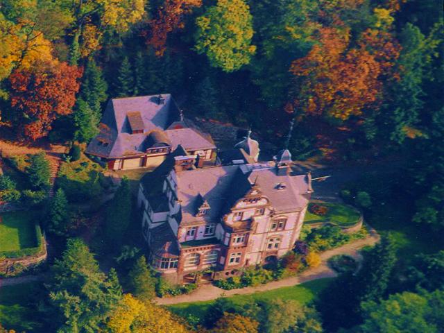

Mittenaar, Germany
Mittenaar is a town of 5,020 people in Hesse, Germany, founded in 1971.
Why visit Mittenaar
Townapedia lists 33 museums and landmarks, 8 parks and trails, 18 places to eat, 3 places to stay and 34 attractions in and around town.
Highlights include Alteburg, Hölzchen, Grube Ypsilanta and Altes Rathaus.
Weather in Mittenaar
Forecast from MET Norway (CC BY 4.0). Full forecast
About Mittenaar
Mittenaar (German pronunciation: [ˈmɪtn̩ˌʔaːɐ̯]) is a municipality in the Lahn-Dill-Kreis in Hesse, Germany.
From the Wikipedia article Mittenaar (this version), under CC BY-SA 4.0.
Things to do34


22 more on the map.
Museums and landmarks33


Altes Rathaus
Monument and historic site · 2.2 km
12 Kirchberg, Mittenaar


Goldkiste
Monument and historic site · 5.2 km
Stein, dessen Form an eine Kiste erinnert
21 more on the map.
Parks, trails and playgrounds8




Restaurants and cafes18

Gasthaus Decker
Restaurant · German · 4.6 km
16 Wetzlarer Straße, Mittenaar
We-Mo 11:30-14:00; We, Fr-Su 17:00-21:00
Schupp
Restaurant · Regional · 4.7 km
2 Wetzlarer Straße, Mittenaar
We-Fr 11:30-14:00; We-Sa 17:00-22:00; Su 11:00-14:00,17:00-21:00



Bäckerei Gabriel
Bakery · 3.0 km
31 Hohe Straße, Herborn
Mo,We-Fr 06:00-12:30,14:00-18:00; Tu 06:00-12:30; Sa 06:00-12:00


Licher Stübchen
Bar and pub · 4.6 km
10 Deuterbachstraße, Siegbach
Schorschs Bergschänke
Bar and pub · 2.9 km
4 Im Gäßchen, Herborn
6 more on the map.
Where to stay3
Churches and places of worship14
Evangelische Kirche
Church · Protestant · 2.1 km
Kirchberg, Mittenaar
Katholische Kirche - Roncallihaus
Church · Roman Catholic · 5.0 km
68 Schelde-Lahn-Straße, Dillenburg
Shopping8
Gas and EV charging4
Schools, colleges and libraries7
Archiv der Genealogischen Arbeitsgemeinschaft Lahn-Dill-Kreis
Library · 2.2 km
12 Kirchberg, Mittenaar
Healthcare2
Map of Mittenaar
131 places. The map loads OpenStreetMap tiles when you open it.
Getting there and nearby towns
Siegerlandflughafen (SGE) is the nearest airport with scheduled flights listed in OpenStreetMap, 21 km away.
- Herborn 6 km west, about 6 min by car
- Sinn 7 km southwest, about 7 min by car
- Dillenburg 8 km northwest, about 8 min by car
- Haiger 13 km west, about 13 min by car
- Aßlar 13 km southeast, about 13 min by car
- Gladenbach 16 km northeast, about 16 min by car
- Wetzlar 18 km southeast, about 18 min by car
- Solms 18 km south, about 18 min by car
- Braunfels 21 km south, about 21 min by car
- Burbach 22 km west, about 22 min by car
Drive times are estimates from straight-line distance, not routes.
Local news
Headlines from INDB.
Reviews, tips and questions
Loading what members have shared...
Sources and licences
- GeoNames (CC BY 4.0): population, coordinates, regions and time zone
- Mapillary (see each image): photos
- OpenStreetMap contributors (ODbL 1.0): places, airports, map data
- Wikidata (CC0 1.0): elevation, founding date, time zone, website, landmarks and historic places
- Wikimedia Commons (see each image): photos
- Wikipedia (CC BY-SA 4.0): overview and history text
Photo credits
- Wegweiser Schutzhütte Mittenaar MIT.035, Clisch, CC BY-SA 4.0
- Mittenaar Steinbruch Benner Offenbach, Otto Domes, CC BY-SA 4.0
- Mittenaar Steinbruch Benner Offenbach (2), Otto Domes, CC BY-SA 4.0
- Mittenaar Linde „Lennebemche“ Bicken, Otto Domes, CC BY-SA 4.0
- Villa Haas Luftbild, www.villahaas.com, CC BY 3.0
- Kirche Bicken, Hydro, CC BY-SA 4.0
- Kirche Bischoffen, Hydro, CC BY-SA 4.0
- Kirche Ballersbach, Hydro, CC BY-SA 4.0
- Alteburg Hörre, Santasantaxxx, CC BY-SA 4.0
- Evangelische Kirche Oberscheld, USeibert, CC BY-SA 3.0 de
- Kirche HBS, Marcel Georg, CC BY-SA 3.0
- Eisemroth - Ev. Kirche, Otto Domes, CC BY-SA 4.0
- Kirche Offenbach (Mittenaar), Hydro, CC BY-SA 4.0
- In der Bellersdorfer Tränk - 6, Otto Domes, CC BY-SA 4.0
- Oberscheld Ypsilanta, Useibert, CC BY-SA 4.0
- Offenbach-Altes Rathaus, Otto Domes, CC BY-SA 4.0
- Rastplatz Rudolfshain oberhalb von Bicken, Clisch, CC BY-SA 4.0
- Kleiner Weiher - geo.hlipp.de - 38451, Uwe Seibert on geo.hlipp.de, CC BY-SA 2.0
- Schutzhütte Hainberg, Clisch, CC BY-SA 4.0
- Infotafel Höhensiedlung Ställchen, Clisch, CC BY-SA 4.0
- Wegweiser MIT.037 Hütte Hainberg, Clisch, CC BY-SA 4.0
- Picknicktisch am Hainberg, Clisch, CC BY-SA 4.0
- Ortseingang von Bicken - geo.hlipp.de - 38452, Uwe Seibert on geo.hlipp.de, CC BY-SA 2.0
- Bicken Hindenburg 5, Otto Domes, CC BY-SA 4.0
- Bicken Haupt 26, Otto Domes, CC BY-SA 4.0
- Bicken Burggasse 5, Otto Domes, CC BY-SA 4.0
- Bicken Burggasse 4, Otto Domes, CC BY-SA 4.0
- Bicken Burggraben 17, Otto Domes, CC BY-SA 4.0
- Bicken Burggraben 4, Otto Domes, CC BY-SA 4.0
- Bicken Burggraben Scheune, Otto Domes, CC BY-SA 4.0
- Evangelische Kirche in Bicken - geo.hlipp.de - 35849, Uwe Seibert on geo.hlipp.de, CC BY-SA 2.0
- Bicken Burggraben 15, Otto Domes, CC BY-SA 4.0
- Bicken Haupt 14, Otto Domes, CC BY-SA 4.0
- Bicken Alte Schule, Otto Domes, CC BY-SA 4.0
- Bicken Leipziger 7, Otto Domes, CC BY-SA 4.0
- Wegkreuz oberhalb von Bicken, Clisch, CC BY-SA 4.0
- Bicken Wiesen 2, Otto Domes, CC BY-SA 4.0
- 2022-Grünlandkomplexe von Herbornseelbach bis Ballersbach und Aar-Aue-0386, Otto Domes, CC BY-SA 4.0
- Bicken Viadukt, Otto Domes, CC BY-SA 4.0
- ISS065-E-383950 - View of Earth, Earth Science and Remote Sensing Unit , Lyndon B. Johnson Space Center, Public domain
- Street-level photo, bct, CC BY-SA 4.0
- Street-level photo, tim3003, CC BY-SA 4.0
- Street-level photo, Lowiekse, CC BY-SA 4.0
- Street-level photo, thetornado76, CC BY-SA 4.0
- Street-level photo, thetornado76, CC BY-SA 4.0
- Street-level photo, thetornado76, CC BY-SA 4.0
- Street-level photo, Lowiekse, CC BY-SA 4.0
- Street-level photo, Lowiekse, CC BY-SA 4.0
- Street-level photo, thetornado76, CC BY-SA 4.0


Page built November 9, 2026. Spotted a mistake? Tell us or suggest a place.