


Why visit Dillenburg
Townapedia lists 127 museums and landmarks, 40 parks and trails, 162 places to eat, 13 places to stay and 50 attractions in and around town.
Highlights include Wildpark Donsbach, Aussichtsturm Dillblick, Villa Grün and Museum Erdbachium.
Weather in Dillenburg
Forecast from MET Norway (CC BY 4.0). Full forecast
About Dillenburg
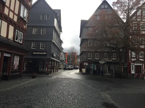
Dillenburg (German pronunciation: [ˈdɪlənbʊʁk] ), officially Oranienstadt Dillenburg, is a town in Hesse's Gießen region in Germany. The town was formerly the seat of the old Dillkreis district, which is now part of the Lahn-Dill-Kreis.
From the Wikipedia article Dillenburg (this version), under CC BY-SA 4.0.
Things to do50



Wendel
Farm and orchard · 5.2 km
16 Burger Hauptstraße, Herborn
Apr-Jun: Mo-Fr 08:30-12:30,13:30-17:30,Sa 08:30-17:00




38 more on the map.
Museums and landmarks127

Villa Grün
Museum
Wirtschaftsgeschichtliches Museum
3 Schloßberg, Dillenburg
Apr 01-Nov 01 Tu-Su,PH 10:00-12:00,13:00-17:00



Altes Bürgermeisteramt
Monument and historic site · 5.2 km
22 Alte Hauptstraße, Herborn


Herborn Castle
Monument and historic site · 6.7 km
11 Kirchberg, Herborn


Museum für Bergbau und Fernmeldetechnik
Museum · 6.2 km
Ehemalige Transformatorenturmstation
2 Am Berg, Eschenburg
"Nur an speziellen Museumstagen geöffnet, siehe opening_hours:url"
Museum für Heimat- und Industriegeschichte
Museum · 5.0 km
39 Burger Hauptstraße, Herborn
"nach Vereinbarung"


115 more on the map.
Parks, trails and playgrounds40


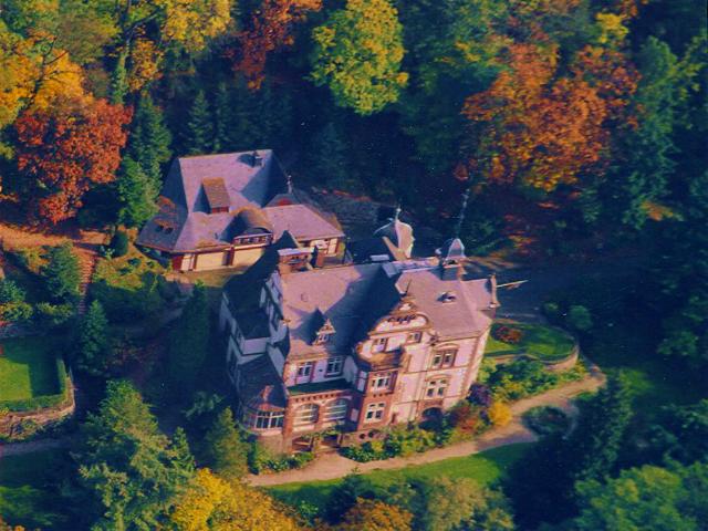

Weißehöll bei Niederscheld
Hiking and trails · 3.2 km
Relikt der historischen Nutzung unproduktiven Grünlandes als Weiden (Huten) für Schafe, Ziegen und Rinder.







28 more on the map.
Restaurants and cafes162

Seelbacher Hof
Restaurant · German · 5.9 km
88 Hohe Straße, Herborn
We-Fr 17:00-22:00, Sa,Su,PH 12:00-22:00
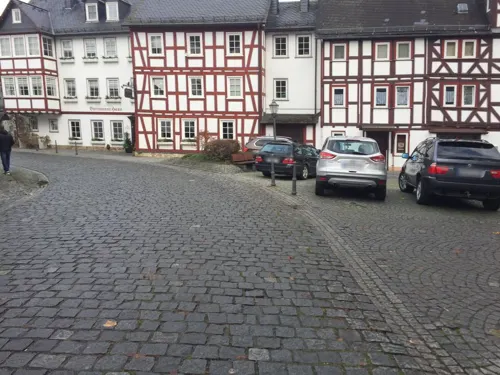
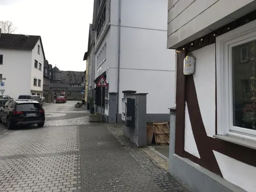
Bistro Franz Ferdinand
Bar and pub · Pizza, Tapas, Pasta · 6.5 km
21-23 Hauptstraße, Herborn
Su,Mo off; Tu-Th 17:00-23:00; Fr 12:00-14:30,17:00-24:00; Sa 18:00-24:00
China Restaurant Palace
Restaurant · Chinese, Buffet, Sushi, Teppanyaki · 4.9 km
10 Bahnhofstraße, Haiger
Mo-Fr 11:30-15:00,17:30-21:30; Sa 11:30-22:30; Su,PH 11:30-21:30
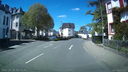
EzTenya Grillparadies
Restaurant · Steak House, Turkish · 5.5 km
61 Bahnhofstraße, Haiger
Mo,We,Th 10:00-14:00,17:00-23:00; Fr 10:00-14:00,17:00-24:00; Sa...
Gasthof Kanzelstein
Restaurant · German, Local · 2.0 km
2 Fasanenweg, Dillenburg
Fr,Sa 17:00-22:00; Su 11:00-14:00,17:00-21:00
Gusto e Fantasia
Restaurant · Italian · 6.6 km
4 Kornmarkt, Herborn
Mo-Th 11:00-18:00; Fr 11:00-20:00; Sa,Su,PH off
Indian Tandoori Kitchen
Restaurant · Indian · 6.5 km
24 Mühlgasse, Herborn
Mo-Fr 11:00-14:30, 17:00-21:30,Sa 16:00-21:30,Su,PH 12:00-21:30
Kaisergarten
Restaurant · Chinese, Mongolian · 7.4 km
13 Rehbergring, Herborn
Tu off; Mo,We-Sa 12:00-14:30,18:00-22:00, Sa,Su,PH 12:00-22:00,...
Karawanserei
Restaurant · Turkish · 6.6 km
17 Augustastraße, Herborn
Mo,Tu,Th-Sa 17:00-23:00; Su,PH 12:00-15:00,17:00-22:00


150 more on the map.
History
Dillenburg had its first documentary mention in 1254. Dillenburg was the ancestral seat of the Orange branch of the House of Nassau. Dillenburg Castle was built on top of the peak now called the Schlossberg in the late 13th or early 14th century. There are no pictures of this castle, however, as it was wooden, and was destroyed in the Dernbacher Feud.
From his stately home in exile, William I of Orange-Nassau, who was born in Dillenburg, organized the Dutch resistance against Spain (1567–1572), which still occasions regular Dutch royal visits to the town to this day. The land was administered by the presidents of the House of Nassau-Dillenburg. One of the last presidents was Georg Ernst Ludwig Freiherr von Preuschen von und zu Liebenstein (born 1727 in Diethardt; died 1794 in Bad Ems). In the Seven Years' War, the stately home was destroyed (1760), and Wilhelmstraße (a street) was built out of the remains.
In 1797, one of the earliest schools of forestry in Europe, founded a decade earlier at Hungen by Georg Ludwig Hartig, was moved to Dillenburg. It continued in Dillenburg until 1805, when Hartig lost his position as Inspector of Forests for the Prince of Orange-Nassau, when the principality was dissolved by Napoleon.
From the History section of Dillenburg on Wikipedia, under CC BY-SA 4.0.
Where to stay13
Churches and places of worship52
Evangelische Stadtkirche Herborn
Church · Protestant · 6.5 km
4a Kirchberg, Herborn
Evangelisch-Freikirchliche Brüdergemeinde Allendorf
Church · Brethren · 7.2 km
9 Auf der Hofstadt, Haiger
Evangelisch-Freikirchliche Gemeinde Schillerstraße
Church · Brethren · 5.6 km
23 Schillerstraße, Haiger
Shopping54
Gas and EV charging22
Schools, colleges and libraries35
Healthcare22
Map of Dillenburg
250 places. The map loads OpenStreetMap tiles when you open it.
Getting there and nearby towns
Siegerlandflughafen (SGE) is the nearest airport with scheduled flights listed in OpenStreetMap, 15 km away.
- Haiger 6 km west, about 6 min by car
- Herborn 7 km south, about 7 min by car
- Aßlar 21 km southeast, about 21 min by car
- Gladenbach 21 km east, about 21 min by car
- Siegen 24 km northwest, about 24 min by car
- Solms 24 km south, about 24 min by car
- Wetzlar 25 km southeast, about 25 min by car
- Biedenkopf 25 km northeast, about 25 min by car
- Braunfels 26 km south, about 26 min by car
- Weilburg 29 km south, about 29 min by car
Drive times are estimates from straight-line distance, not routes.
Local news
Headlines from INDB.
Reviews, tips and questions
Loading what members have shared...
Sources and licences
- GeoNames (CC BY 4.0): population, coordinates, regions and time zone
- Mapillary (see each image): photos
- OpenStreetMap contributors (ODbL 1.0): places, airports, map data
- Wikidata (CC0 1.0): elevation, founding date, time zone, website, landmarks and historic places
- Wikimedia Commons (see each image): photos
- Wikipedia (CC BY-SA 4.0): overview and history text
Photo credits
- Dillenburg01, Unknown author, CC BY-SA 3.0
- Dillenburg - Rathaus Rathausstraße 7 (1 08.2015), Oliver Abels, CC BY-SA 4.0
- Dill-Dillenburg-Dillturm, Otto Domes, CC BY-SA 4.0
- Dillenburg - Wehrturm Am Zwingel o. Nr. (KD.HE 132534 1 08.2015), Oliver Abels, CC BY-SA 4.0
- Dillenburg-Dill, Otto Domes, CC BY-SA 4.0
- Dill-Dillenburg-Rathaus, Otto Domes, CC BY-SA 4.0
- Dillenburg - Oranienstraße 10 (KD.HE 132587 1 08.2015), Oliver Abels, CC BY-SA 4.0
- Dillenburg - Oranienstraße 10 (KD.HE 132587 2 08.2015), Oliver Abels, CC BY-SA 4.0
- Dillenburg - Dillturm, Oliver Abels ( SBT ), CC BY 2.5
- Bismarckdenkmal Dillenburg 2024, Vespertilia, CC BY-SA 4.0
- Dillenburg Stadtkirche Wilhelmsturm 190 P1050731 20200719, Karlunun, CC BY-SA 4.0
- Bismarckdenkmal Dillenburg, Clisch, CC BY-SA 4.0
- Dillenburg - Hindenburgstraße 11 (KD.HE 132565 3 08.2015), Oliver Abels, CC BY-SA 4.0
- Dillenburg - Pressehaus Dillzeitung (1 08.2015), Oliver Abels, CC BY-SA 4.0
- Dillenburg - Hindenburgstraße 11 (KD.HE 132565 1 08.2015), Oliver Abels, CC BY-SA 4.0
- Dillenburg - Hindenburgstraße 11 (KD.HE 132565 2 08.2015), Oliver Abels, CC BY-SA 4.0
- Dill-Dillenburg-Wickbrücke, Otto Domes, CC BY-SA 4.0
- Dillenburg - Hauptstraße 66-68 Teil der Gesamtanlage (KD.HE 132524 1 08.2015), Oliver Abels, CC BY-SA 4.0
- Dillenburg Hauptstraße 53-57, Otto Domes, CC BY-SA 4.0
- Dillenburg - Hauptstraße 45 (KD.HE 132553 1 08.2015), Oliver Abels, CC BY-SA 4.0
- Dillenburg - Hauptstraße 100 Teil der Gesamtanlage (KD.HE 132524 1 08.2015), Oliver Abels, CC BY-SA 4.0
- Dillenburg - Hauptstraße 102 (KD.HE 132562 1 08.2015), Oliver Abels, CC BY-SA 4.0
- Dillenburg Hauptstraße 70, Otto Domes, CC BY-SA 4.0
- Dillenburg - Hauptstraße 75 (KD.HE 132559 1 08.2015), Oliver Abels, CC BY-SA 4.0
- Dillenburg - Hauptstraße 75 (KD.HE 132559 2 08.2015), Oliver Abels, CC BY-SA 4.0
- Dill-Dillenburg-Obertorbrücke, Otto Domes, CC BY-SA 4.0
- Dillenburg, Germany - panoramio (83), ngocchat1014, CC BY 3.0
- Dillenburg, Germany - panoramio (86), ngocchat1014, CC BY 3.0
- Dillenburg, Germany - panoramio (65), ngocchat1014, CC BY 3.0
- Dillenburg - Hauptstraße 31 (KD.HE 132548 1 08.2015), Oliver Abels, CC BY-SA 4.0
- Dillenburg, Germany - panoramio (92), ngocchat1014, CC BY 3.0
- Dillenburg, Germany - panoramio (84), ngocchat1014, CC BY 3.0
- Dillenburg - Evangelische Pfarrkirche Kirchberg 18 (KD.HE 132582 1 08.2015), Oliver Abels, CC BY-SA 4.0
- Dillenburg, Germany - panoramio (94), ngocchat1014, CC BY 3.0
- Dillenburg - Evangelische Pfarrkirche Kirchberg 18 (KD.HE 132582 3 08.2015), Oliver Abels, CC BY-SA 4.0
- Dillenburg - Evangelische Pfarrkirche Kirchberg 18 (KD.HE 132582 2 08.2015), Oliver Abels, CC BY-SA 4.0
- Dillenburg — Hauptstraße 83 — 2013-10-03, ngocchat1014, CC BY 3.0
- Dillenburg, Germany - panoramio (9), ngocchat1014, CC BY 3.0
- Dillenburg, Germany - panoramio (78), ngocchat1014, CC BY 3.0
- Dillenburg, Germany - panoramio (12), ngocchat1014, CC BY 3.0
- Villa Haas Luftbild, www.villahaas.com, CC BY 3.0
- Oktober 07-34, H2OMy at German Wikipedia, Public domain
- Herborn - Stadtkirche, Oliver Abels ( SBT ), CC BY 2.5
- Wilhelmsturm, No machine-readable author provided. Famulus~commonswiki assumed (based on copyright claims)., Public domain
- Herborn - Schloss Vorderseite 3, Kurt + Else Dietrich, CC BY-SA 3.0
- Dillenburg, Schloßberg 3, Grünsche Villa Eingang Museum, Stefan Didam - Schmallenberg, CC BY-SA 4.0
- Aussichtsturm Dillblick-01, Muck, CC BY-SA 4.0
- Frohnhausen Evangelische Kirche, Useibert, CC BY-SA 4.0
- Hof Feldbach, Useibert, CC BY-SA 4.0
- Kirchenruine Feldbach, USeibert, CC BY-SA 3.0 de
- Evangelische Kirche Haiger Allendorf, USeibert, CC BY-SA 3.0 de
- Haiger - Evangelische Pfarrkirche Kirchberg (KD.HE 132834 4 08.2015), Oliver Abels, CC BY-SA 4.0
- Betsaal Amdorf, Useibert, CC BY-SA 4.0
- Burg Eisenbahnbrücke, Otto Domes, CC BY-SA 4.0
- Herborn - Dillturm (KD.HE 132946 2 07.2015), Oliver Abels, CC BY-SA 4.0
- Herborn - Bürgerturm Schulberg o. Nr. (KD.HE 133061 1 07.2015), Oliver Abels, CC BY-SA 4.0
- Kirche HBS, Marcel Georg, CC BY-SA 3.0
- Amdorfer Viehweide - 2, Otto Domes, CC BY-SA 4.0
- Kanzelstein bei Eibach - 13, Otto Domes, CC BY-SA 4.0
- Alteberg und Sauernberg 2, Otto Domes, CC BY-SA 4.0
- An der alten Rheinstraße - 5, Otto Domes, CC BY-SA 4.0
- Hasel bei Donsbach - 3, Otto Domes, CC BY-SA 4.0
- Tringensteiner Schelde 8, Otto Domes, CC BY-SA 4.0
- Weißehöll bei Niederscheld 14, Otto Domes, CC BY-SA 4.0
- Mühlberg und Kramberg bei Erdbach 4, Otto Domes, CC BY-SA 4.0
- Wilhelm-von-Oranien-Schule, WIlhelm-von-Oranien-Schule, CC BY-SA 4.0
- Herborn St. Petrus, Wikiwal, CC BY-SA 4.0
- Dillbrücke, Useibert, CC BY-SA 4.0
- Gleichenhäuschen, Clisch, CC BY-SA 4.0
- Oberscheld Ypsilanta, Useibert, CC BY-SA 4.0
- Altes Bürgermeisteramt Uckersdorf, Useibert, CC BY-SA 4.0
- Museum für Bergbau und Fernmeldetechnik in Wissenbach, Otto Domes, CC BY-SA 4.0
- Dillenburg Kastanien bei Hof Feldbach, Otto Domes, CC BY-SA 4.0
- Evangelische Kirche Uckersdorf, Useibert, CC BY-SA 4.0
- Papageienfütterung 02.04.2016, Britta L, CC BY-SA 4.0
- Wildpark Donsbach 2017 Damwild, Otto Domes, CC BY-SA 4.0
- Street-level photo, troher15, CC BY-SA 4.0
- Street-level photo, rab, CC BY-SA 4.0
- Street-level photo, thetornado76, CC BY-SA 4.0
- Street-level photo, akinogermany, CC BY-SA 4.0
- Street-level photo, rab, CC BY-SA 4.0
- Street-level photo, akinogermany, CC BY-SA 4.0
- Street-level photo, troher15, CC BY-SA 4.0
- Street-level photo, troher15, CC BY-SA 4.0
- Street-level photo, troher15, CC BY-SA 4.0
- Street-level photo, troher15, CC BY-SA 4.0
- Street-level photo, troher15, CC BY-SA 4.0
- Street-level photo, troher15, CC BY-SA 4.0
- Street-level photo, troher15, CC BY-SA 4.0
- Street-level photo, troher15, CC BY-SA 4.0
- Street-level photo, troher15, CC BY-SA 4.0
- Street-level photo, grinninghamster, CC BY-SA 4.0
- Street-level photo, bitnapper, CC BY-SA 4.0
- Street-level photo, lllooommm, CC BY-SA 4.0
- Street-level photo, troher15, CC BY-SA 4.0


Page built November 8, 2026. Spotted a mistake? Tell us or suggest a place.