


Monschau, Germany
Monschau is a town of 12,945 people in North Rhine-Westphalia, Germany.
Why visit Monschau
Townapedia lists 164 museums and landmarks, 44 parks and trails, 95 places to eat, 39 places to stay and 26 attractions in and around town.
Highlights include Alpakahof, Ehrensteinsley, Rotes Haus and Reichenstein Monastery.
Weather in Monschau
Forecast from MET Norway (CC BY 4.0). Full forecast
About Monschau
Monschau (German pronunciation: [ˈmɔnʃaʊ] ; French: Montjoie, pronounced [mɔ̃ʒwa]; Walloon: Mondjoye) is a small resort town in the Eifel region of western Germany, located in the Aachen district of North Rhine-Westphalia.
From the Wikipedia article Monschau (this version), under CC BY-SA 4.0.
Travel tips from other travellers: Monschau on Wikivoyage (CC BY-SA 4.0).
Things to do26






14 more on the map.
Museums and landmarks164

Rotes Haus
Museum
Haus des Tuchmachers Johann Heinrich Scheibler, erbaut um 1760
8, 10 Laufenstraße, Monschau
Tu-Su 10:00-13:00, 14:00-17:00

Reichenstein Monastery
Monument and historic site · Catholic Fsspx (Benediktiner) · 3.2 km
340 Reichensteiner Straße, Monschau


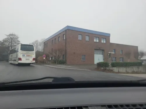


Troistorff House
Monument and historic site
18 Laufenstraße, Monschau



Erlebnisstation 1 Belgischer Zöllner in Kalterherberg
Monument and historic site · 3.9 km
Silhouette: Belgischer Zöllner Ausstattung: Fahrradabstellanlagen Hörstation Informationsstele Tisch-Bank-Kombination
„Am alten Badetümpel“, Monschau
152 more on the map.
Parks, trails and playgrounds44


Belgenbachtal mit Seilfertsief, Drossel- und Holzbachtal
Hiking and trails · 4.2 km



Brombachtal und Brommersbachtal mit Nebenbach
Hiking and trails · 6.9 km


32 more on the map.
Restaurants and cafes95

Altes Eifelhaus
Restaurant · German · 2.7 km
Bäckerei, Café, Restaurant
96 Hauptstraße, Monschau
Th-Su 09:30-12:00+

Felsenkeller Brauerei
Bar and pub
2, 4, 6 Sankt-Vither-Straße, Monschau
Tu-Su 11:00+; Mo off
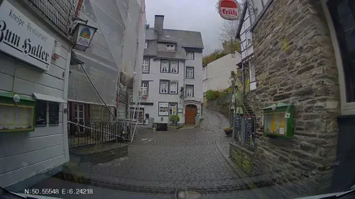

Schnabuleum
Restaurant · German, Mustard · 0.9 km
118 Laufenstraße, Monschau
Tu-Su 11:30-14:30, 17:30-22:00
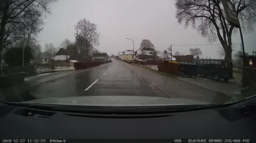
Alte Molkerei
Restaurant · German · 2.5 km
72-74 Hauptstraße, Monschau
Su, Tu-Th 10:00-20:30; Fr-Sa 10:00-21:00
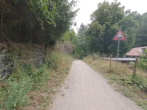
Café-Bistro Grünental
Restaurant · Regional, Sandwich, Coffee Shop · 3.9 km
1 Grünental, Monschau
Jul-Aug: We 11:30-17:00, Th 11:30-17:00, Fr-Su 11:30-22:00
Hotel Haus Vennblick
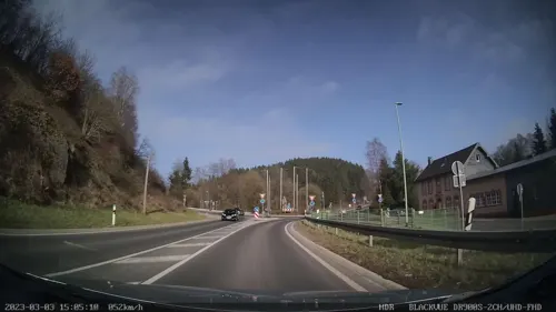
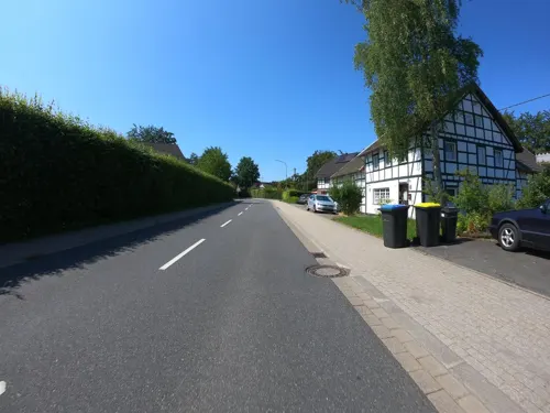
Restaurant · Regional, German · 1.9 km
24 Hauptstraße, Monschau
Th,Fr 17:00-21:00; Sa,Su 12:00-14:00,17:00-21:00

Moss
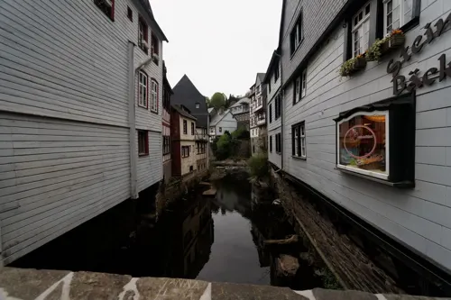
Bakery · 2.9 km
Unser Café bereichert seit Herbst 2016 das Angebot am "Baumarkt an der Linde" in Imgenbroich. Seitlich des Haupteingangs finden Sie uns...
201 Trierer Straße, Monschau
Mo-Fr 06:00-18:00; Sa 06:00-15:00; Su 07:30-13:00

Am Nassenhof
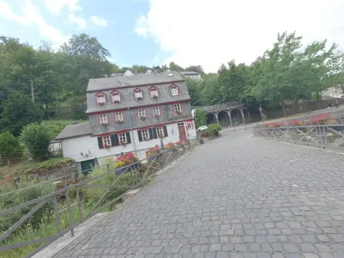
Restaurant · Regional · 2.1 km
80 Eupener Straße, Monschau
"der Saal ist buchbar"


83 more on the map.
History
On the heights above the city is Monschau castle, which dates back to the 13th century — the first mention of Monschau was made in 1198. Beginning in 1433, the castle was used as a seat of the dukes of Jülich. In 1543, Emperor Charles V besieged it as part of the Guelders Wars, captured it and plundered the town. However, the castle stayed with Jülich until 1609, when it became part of Palatinate-Neuburg.
In 1795, the French captured the area and, under the name Montjoie, made it the capital of a canton of the Roer département. After the area became part of the Kingdom of Prussia in 1815, Monschau became the district capital of the Kreis Montjoie.
During World War I, some people argued that Monschau (or "Montjoie" as it was then still called) should be annexed to Belgium since they believed it historically to be a Walloon area that had been Germanized by the Prussians.
In 1918, William II, German Emperor, changed the name to Monschau. In 1972, the town was enlarged with the previously independent municipalities of Höfen, Imgenbroich, Kalterherberg, Konzen, Mützenich and Rohren. Mützenich, to the west of the town center, is an exclave of German territory surrounded by Belgium. It is separated from Germany by the Vennbahn railway line, which was assigned to Belgium by the Treaty of Versailles in 1919.
From the History section of Monschau on Wikipedia, under CC BY-SA 4.0.
Where to stay39
Churches and places of worship39
St. Bartholomäus
Church · Roman Catholic · 6.1 km
15 Dedenborner Straße, Simmerath
St. Johann Baptist
Church · Roman Catholic · 7.2 km
Kirchplatz, Simmerath
Shopping27
Gas and EV charging10
Schools, colleges and libraries13
Healthcare8
Allgemeinpsychiatrische Tagesklinik Simmerath
Clinic and pharmacy · 7.1 km
8 Kammerbruchstraße, Simmerath
Map of Monschau
250 places. The map loads OpenStreetMap tiles when you open it.
Getting there and nearby towns
Flugplatz Würselen-Aachen (AAH) is the nearest airport with scheduled flights listed in OpenStreetMap, 30 km away.
- Schleiden 17 km east, about 17 min by car
- Nideggen 23 km northeast, about 23 min by car
- Stolberg 24 km north, about 24 min by car
- Aachen 27 km northwest, about 27 min by car
- Würselen 30 km north, about 30 min by car
- Zülpich 33 km northeast, about 33 min by car
- Niederzier 40 km northeast, about 40 min by car
- Nörvenich 40 km northeast, about 40 min by car
- Übach-Palenberg 41 km north, about 41 min by car
- Weilerswist 48 km northeast, about 48 min by car
Drive times are estimates from straight-line distance, not routes.
Local news
Headlines from INDB.
Reviews, tips and questions
Loading what members have shared...
Sources and licences
- GeoNames (CC BY 4.0): population, coordinates, regions and time zone
- Mapillary (see each image): photos
- OpenStreetMap contributors (ODbL 1.0): places, airports, map data
- Wikidata (CC0 1.0): elevation, founding date, time zone, website, landmarks and historic places
- Wikimedia Commons (see each image): photos
- Wikipedia (CC BY-SA 4.0): overview and history text
Photo credits
- Burg Monschau 2, Steffen Heinz Caronna, CC BY 3.0
- 0 Monschau - Holzmarkt, 12, Jean-Pol GRANDMONT, CC BY-SA 3.0
- 0 Monschau - Holzmarkt, 8-10-12, Jean-Pol GRANDMONT, CC BY-SA 3.0
- Laufenstraße - Holzmarkt - Monschau 01, H. Zell, CC BY-SA 3.0
- Monschau, Nordeifel - geo.hlipp.de - 1617, Colin Smith on geo.hlipp.de, CC BY-SA 2.0
- Laufenstraße 7 - Monschau, H. Zell, CC BY-SA 3.0
- Stadtkirche Monschau Innenraum 2017, JPBentzin, CC BY-SA 4.0
- Stadtkirche Monschau Emporen 001, JPBentzin, CC BY-SA 4.0
- 52156 Monschau, Germany - panoramio (17), Ben Bender, CC BY-SA 3.0
- Looking down the Laufenbach in central Monschau, 2025 (2), DimiTalen, CC0
- Stadtkirche Monschau, Bestuhlung auf der Ersten Empore, JPBentzin, CC BY-SA 4.0
- Evangelische Kirche Monschau 04, Helmlechner, CC0
- Stadtkirche Monschau Kanzelkorb, JPBentzin, CC BY-SA 4.0
- 0 Monschau - Rotes Haus ou maison Scheibler (1), Jean-Pol GRANDMONT, CC BY-SA 3.0
- Monschau - Das Rote Haus - Rur - Nordrhein-Westfalen - Deutschland (21324461563), Frans Berkelaar, CC BY-SA 2.0
- Stadtkirche Monschau Weimbs-Orgel, JPBentzin, CC BY-SA 4.0
- Stadtkirche Monschau, Bestuhlung, JPBentzin, CC BY-SA 4.0
- 0 Monschau - Holzmarkt, 5 - (1), Jean-Pol GRANDMONT, CC BY 3.0
- 0 Monschau - Rur (3), Jean-Pol GRANDMONT, CC BY-SA 3.0
- 52156 Monschau, Germany - panoramio (13), Ben Bender, CC BY-SA 3.0
- Stadtkirche Monschau Prinzipalwand, JPBentzin, CC BY-SA 4.0
- 0 Monschau - Geländer des Hauses Troistorff, Jean-Pol GRANDMONT, CC BY-SA 3.0
- 0 Monschau - Haus Troistorff, Jean-Pol GRANDMONT, CC BY-SA 3.0
- Stadtkirche Monschau, Detail Kruzifix, JPBentzin, CC BY-SA 4.0
- Stadtkirche Monschau - Altar, JPBentzin, CC BY-SA 4.0
- Stadtkirche Monschau Kronleuchter aus den 1950er Jahren, JPBentzin, CC BY-SA 4.0
- Empore Stadtkirche Monschau, Helmlechner, CC0
- Evangelische Stadtkirche - Monschau 01, H. Zell, CC BY-SA 3.0
- Looking down the Laufenbach in central Monschau, 2025 (1), DimiTalen, CC0
- Stadtkirche Monschau Emporen 003, JPBentzin, CC BY-SA 4.0
- Laufenstraße 8–10 - Monschau - Rotes Haus 03, H. Zell, CC BY-SA 3.0
- Laufenstraße 8–10 - Monschau - Rotes Haus 04, H. Zell, CC BY-SA 3.0
- Laufenstraße 8–10 - Monschau - Rotes Haus 02, H. Zell, CC BY-SA 3.0
- Laufenstraße 8–10 - Monschau - Rotes Haus - Wappen, H. Zell, CC BY-SA 3.0
- Laufenstraße 8–10 - Monschau - Rotes Haus 05, H. Zell, CC BY-SA 3.0
- Laufenstraße 8–10 - Monschau - Rotes Haus 01, H. Zell, CC BY-SA 3.0
- Laufenstraße - Stehlings - Rurstraße - Monschau 01, H. Zell, CC BY-SA 3.0
- Freitragende Wendeltreppe über 3 Etagen im Roten Haus in Monschau, ThomasLendt, CC BY-SA 4.0
- Prinzipalwand Stadtkirche Monschau, Helmlechner, CC0
- Monschau, Kalterherberg, St. Lambertus, 2011-09 CN-01, kaʁstn Disk / Cat, CC BY-SA 3.0 de
- Laufenstraße 18 - Monschau - Haus Troistorff 02, H. Zell, CC BY-SA 3.0
- Reichenstein Innenhof Panorama, Steffen Heinz Caronna, CC BY 3.0
- Rotes Haus, Monschau (2025), ArthurMcGill, CC BY-SA 4.0
- Steling Eifelberg, Steffen Heinz (Caronna), CC BY-SA 2.0 de
- Monschau Laufenstraße 116 - 124 Gebäude 1, Caronna, CC BY-SA 3.0
- NSG Buchenwald am Letgenbruch, Monschau (7), ArthurMcGill, CC BY-SA 4.0
- Monschau-Kleiner Laufenbach Blick Richtung NSG Kleiner Laufenbach, Assenmacher, CC BY-SA 4.0
- Standort Simmerath, BetreutesInternet, CC BY-SA 4.0
- Gipfelkreuz Monschau-Ehrensteinsley, Assenmacher, CC BY-SA 4.0
- Muetzenich - Ringstrasse 4, Caronna, CC BY-SA 4.0
- Monschau, CN-019, 2011-08-31, kaʁstn Disk / Cat, CC BY-SA 3.0 de
- Haller Monschau, Sneecs Roland Struwe, CC BY 3.0
- Weltkriegsbunker 121a, Höfen-Alzen, ArthurMcGill, CC BY 3.0
- NSG Belgenbach, Xjvolker, CC BY-SA 4.0
- Belgenbacher Mühle (5), ArthurMcGill, CC BY 3.0
- NSG Brettner Hof (1), ArthurMcGill, CC BY-SA 4.0
- NSG Brom- und Brommersbachtal (2), ArthurMcGill, CC BY-SA 4.0
- NSG Brückborn-Kranzbruch (3), ArthurMcGill, CC BY-SA 4.0
- NSG Ermesbachtal, ArthurMcGill, CC BY-SA 4.0
- Brücke über die Kall, Ahoerstemeier, CC BY-SA 4.0
- Monschau-Höfen Hauptstrasse 96, Caronna, CC BY-SA 3.0
- St. Vither Straße 6-8, Monschau, ArthurMcGill, CC BY-SA 4.0
- Senfmühle Monschau (1), ArthurMcGill, CC BY-SA 4.0
- Muetzenich - Eupener Strasse 80, Caronna, CC BY-SA 4.0
- Monschau, Burg Monschau-jeugdherberg Dm12 foto4 2015-04-16 09.46, Michielverbeek, CC BY-SA 4.0
- Tuchfabrik Troistorff, Monschau, ArthurMcGill, CC BY-SA 4.0
- Monschau, kerk op plein foto4 2011-03-23 13.29, Michielverbeek, CC BY-SA 3.0
- Evangelische Stadtkirche in Monschau Bild 2, Alf van Beem, Public domain
- Konzen Pankratius Kapelle, Caronna, CC BY-SA 4.0
- St. Cornelius (Rohren) 01, Thomas Hummel, CC BY-SA 4.0
- St. Bartholomäus (Hammer) 04, Thomas Hummel, CC BY-SA 4.0
- Simmerath, kerk foto7 2011-03-23 144.33, Michielverbeek, CC BY-SA 3.0
- St. Mariä Geburt, Monschau (3), ArthurMcGill, CC BY-SA 4.0
- St. Michael (Höfen) 07, Thomas Hummel, CC BY-SA 4.0
- Norbertuskapelle, Kalterherberg (2), ArthurMcGill, CC BY 3.0
- St. Bartholomäus (Mützenich) 01, Thomas Hummel, CC BY-SA 4.0
- St. Lucia (Eicherscheid) 01, Thomas Hummel, CC BY-SA 4.0
- NSG Feuerbach-Laufenbach, Nordabschnitt (1), ArthurMcGill, CC BY-SA 4.0
- Naturteich Dürhölderbach, Monschau-Höfen (2), ArthurMcGill, CC BY-SA 4.0
- Erlebnisstation 1 Belgischer Zöllner in Kalterherberg, Clisch, CC BY-SA 4.0
- Street-level photo, Hightower-, CC BY-SA 4.0
- Street-level photo, Hightower-, CC BY-SA 4.0
- Street-level photo, txllxt, CC BY-SA 4.0
- Street-level photo, madel, CC BY-SA 4.0
- Street-level photo, joostjakob, CC BY-SA 4.0
- Street-level photo, madel, CC BY-SA 4.0
- Street-level photo, hektor1989, CC BY-SA 4.0
- Street-level photo, hektor1989, CC BY-SA 4.0
- Street-level photo, hektor1989, CC BY-SA 4.0
- Street-level photo, mprins, CC BY-SA 4.0
- Street-level photo, Hightower-, CC BY-SA 4.0
- Street-level photo, hektor1989, CC BY-SA 4.0
- Street-level photo, tobiasreg, CC BY-SA 4.0
- Street-level photo, jeroenrozema74, CC BY-SA 4.0
- Street-level photo, walldi222, CC BY-SA 4.0
- Street-level photo, Nicolas1030, CC BY-SA 4.0
- Street-level photo, map_dav, CC BY-SA 4.0
- Street-level photo, noel, CC BY-SA 4.0
- Street-level photo, noel, CC BY-SA 4.0
- Street-level photo, hektor1989, CC BY-SA 4.0
- Street-level photo, Hightower-, CC BY-SA 4.0
- Street-level photo, mprins, CC BY-SA 4.0
- Street-level photo, joostjakob, CC BY-SA 4.0
- Street-level photo, tobiasreg, CC BY-SA 4.0
- Street-level photo, noel, CC BY-SA 4.0


Page built November 8, 2026. Spotted a mistake? Tell us or suggest a place.