


Stolberg, Germany
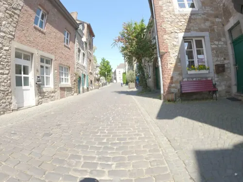
Stolberg is a town of 57,684 people in North Rhine-Westphalia, Germany.
Why visit Stolberg
Townapedia lists 157 museums and landmarks, 66 parks and trails, 161 places to eat, 9 places to stay and 18 attractions in and around town.
Highlights include Aachen, Aachener Thermalquellen, Varnenum and Zinkhütter Hof.
Weather in Stolberg
Forecast from MET Norway (CC BY 4.0). Full forecast
About Stolberg
Stolberg (German pronunciation: [ˈʃtɔlbɛʁk] , Ripuarian: Stolbersch) is a town in North Rhine-Westphalia, Germany. It has a long history as an industrial town and belongs to the district Aachen and the lower district court of Eschweiler.
From the Wikipedia article Stolberg (Rhineland) (this version), under CC BY-SA 4.0.
Photos of Stolberg


Things to do18

Aachen
Monument and historic site · 10.0 km
City in North Rhine-Westphalia, Germany


Bismarck Tower (Aachen)
Monument and historic site · 8.9 km
Bismarck tower in Aachen, Germany

Öcher Schängche
Cinema and theater · 10.3 km
Theatre in Aachen, Germany

Theater Aachen
Cinema and theater · 9.8 km
Theatre and opera house in Aachen, Germany


Schwarzenburger Hofladen
Farm and orchard · 4.5 km
5 Gut Schwarzenburg, Stolberg (Rhld.)
Fr-Sa 09:30-16:00; PH closed


Wolfsberg
Scenic view · 3.9 km
Der Wolfsberg: Eilendorfer nennen ihn auch „Knopp“ oder „Gottes Segen“
6 more on the map.
Museums and landmarks157

Varnenum
Monument and historic site · 5.4 km
Gallorömische Umgangstempel
24/7


Burg Röthgen
Monument and historic site · 4.8 km
71 Burgstraße, Eschweiler

Jüdischer Friedhof Eschweiler
Cemetery · 5.3 km
52249 Eschweiler; Talstraße Ecke Grachtstraße



145 more on the map.
Parks, trails and playgrounds66

Schlangenberg
Park · 4.2 km
Nature reserve in Stolberg, North Rhine-Westphalia, Germany


54 more on the map.
Restaurants and cafes161
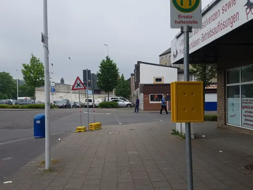
Imbiss-Stube Le
Restaurant · Chinese, Asian
Chinesische und asiatische Küche.
1 Blaustraße, Stolberg (Rhld.)
Su-Fr 11:30-20:00
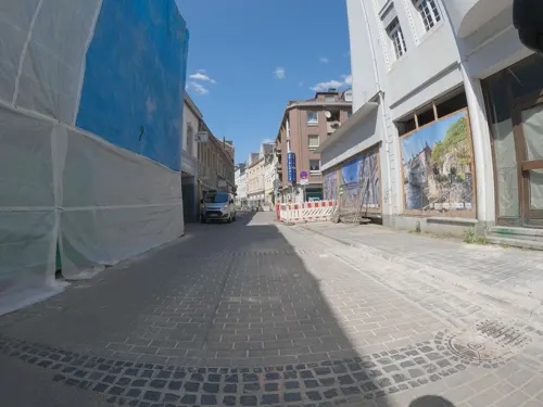
Nicole's Dinner | Bistro & Catering
Cafe · Coffee Shop, Sandwich, French, Hamb, Burger · 0.8 km
Fingerfood & Catering | Auch Mietköchin https://www.nicoles-dinner.de/mietkoch.html | Vegane Speisen im Angebot
Steinweg, Stolberg (Rhld.)
Mo off; Tu off; We-Fr 10:00-17:00; Sa off; Su off
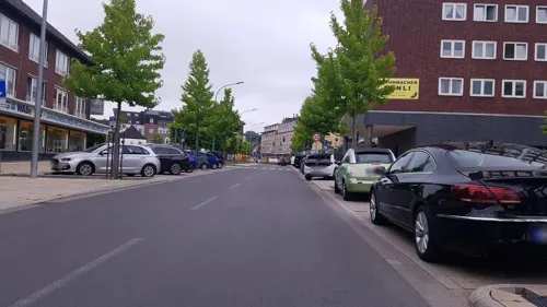
Artemis
Restaurant · Greek
94 Rathausstraße, Stolberg
Mo off; Tu-Fr 12:00-14:30,18:00-23:00; Sa 18:00-23:00; Su...
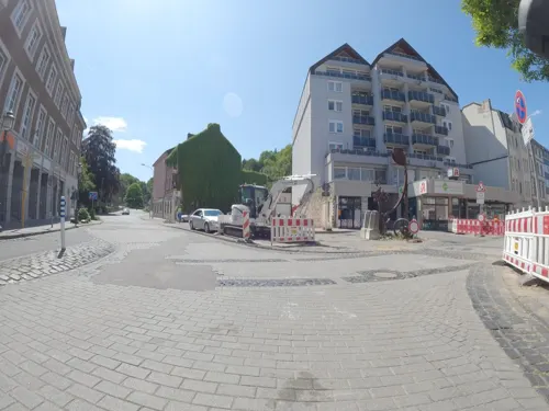
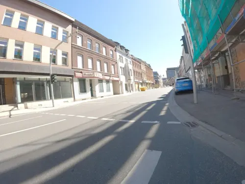
Bäckerei und Café Prishtina
Bakery
Kosovarische Bäckerei Prishtina Stolberg.
45 Rathausstraße, Stolberg (Rhld.)
Mo-Su 06:00-21:00, Su 08:00-21:00
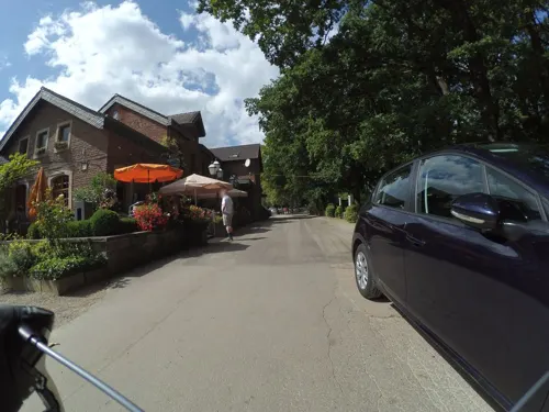
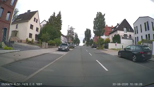
Mila
Restaurant · Mediterranean · 5.0 km
844 Trierer Straße, Aachen
Tu-We 17:00-23:00; Th 11:00-23:00; Fr-Sa 11:30-24:00; Su 11:30-23:00
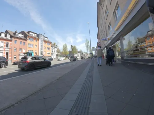
Murphy's White Horse
Restaurant · Irish · 1.0 km
35 Burgstraße, Stolberg (Rhld.)
Mo off; Tu off; We 17:00-23:00; Th 17:00-23:00; Fr 17:00-00:00; Sa...

Brander Bahnhof
Restaurant · Burger, Friture, Steak, International · 5.3 km
1 Karl-Kuck-Straße, Aachen
We-Sa 12:00-23:00; Su,PH 12:00-22:00
Berlin Kebap
Restaurant · Turkish, Pizza
1 Rathausstraße, Stolberg (Rhld.)
Mo-Sa 11:00-22:20; Su 11:30-22:30

Café Steinbachshochwald
Cafe · Regional · 3.5 km
3 Steinbachshochwald, Stolberg
Sa 14:00-sunset; Su,PH 10:00-sunset
149 more on the map.
History
Stolberg is first mentioned in documents from the 12th century. It became an important centre of brass production when Protestant brass producers resettled to Stolberg from Aachen around 1600 to escape religious persecution and economic restrictions. The nickname of Stolberg, Die Kupferstadt (the Copper City), thus derives not from copper but from brass, "yellow copper". The Kupferhöfe (copper yards) where brass was originally produced and the brass manufacturers built their mansions remain as reminders of the brass manufacturers that dominated Stolberg and its economy.
Stolberg lost its importance as a brass producer when pure zinc became available in the middle of the 19th century. Many brass producers moved into other industries, especially the glass and textile industries, or specialized in the mass production of haberdashery.
Stolberg belonged to the Duchy of Jülich until 1794, when it became occupied by France and part of the Canton of Eschweiler in the Département de la Roer. After the Congress of Vienna in 1815, Stolberg became part of the Kingdom of Prussia.
Stolberg acquired notoriety in the 1960s as the residence of Contergan producer Grünenthal. Because of its heavy industry, Stolberg has become associated with diseases of metal poisoning, literally "Gressenich cadmium cattle-dying" disease and "Stolberg lead children" disease.
Read more of the history
Stolberg has a significant ultra-right history, e.g., as the headquarters of the Wiking-Jugend from 1967 to 1991 and as a place of NPD activities.
Large parts of the central axis of the valley and the villages of Zweifall, Vicht and Atsch were severely affected by the 2021 European floods. One of the buildings affected by the destruction was the town hall, which is getting demolished and will replaced by a new building.
From the History section of Stolberg (Rhineland) on Wikipedia, under CC BY-SA 4.0.
More about Stolberg
Geography
Stolberg is located approximately 5 km east of Aachen in a valley at the fringes of the Eifel which begins in the East with the Hürtgenwald and in the South in the municipality of Monschau. It borders Eschweiler in the north and the Aachen city district of Eilendorf in the west.
The core of Stolberg is commonly divided into Unterstolberg (Lower Stolberg) and Oberstolberg (Upper Stolberg) which includes most of the old parts of Stolberg. Other parts of Stolberg are Atsch, Büsbach, Donnerberg, Münsterbusch. In addition the villages of Breinig, Dorff, Gressenich, Mausbach, Schevenhütte, Venwegen, Vicht, Werth, and Zweifall.
From the Wikipedia article Stolberg (Rhineland), under CC BY-SA 4.0.
Notable people from Stolberg
 Juliana of StolbergGerman countess (1506–1580)Photo: Anonymous Unknown author, Public domain
 Heinrich GrüberGerman politician and theologian (1891-1975)Photo: Levin Holtkamp, CC BY-SA 4.0
 Marcel MeisenGerman cyclistPhoto: Kai Winter, CC BY-SA 4.0
 Abdulkadir ÖzgenTurkish association football player (born 1986)Photo: Ultraslansi, CC BY-SA 3.0
 Walter HilgersGerman musicianPhoto: WilhelmWalter59, CC BY-SA 4.0
 Eric PetersGerman painterPhoto: User:Jenli, CC BY-SA 3.0
 Otto PeltzerGerman American politicianPhoto: Unknown photographer, Public domain
- LaFeeGerman singer
- Ronny Claescyclist
- Ernst LandsbergGerman jurist (1860–1927)
- Viktor HoltzGerman educator (1846-1919)
- Arndt KohnGerman politician
Born in Stolberg, according to Wikidata (CC0). Each name links to its Wikipedia article.
Where to stay9
Romantik Parkhotel Am Hammerberg
Motel and hotel · 1.1 km
11 Hammerberg, Stolberg (Rhld.)
Churches and places of worship52
St. Mariä Himmelfahrt
Church · Roman Catholic
8 Salmstraße, Stolberg (Rhld.)
Mariä Empfängnis
Church · Catholic · 4.2 km
6 Pfarrer-Gau-Straße, Stolberg (Rhld.)
St. Antonius
Church · Roman Catholic · 5.0 km
8 Pfarrer-Kleinermanns-Straße, Eschweiler
St. Barbara
Church · Roman Catholic · 4.9 km
42 Alt Breinig, Stolberg (Rhld.)
St. Hubertus
Church · Catholic · 2.7 km
2 Konrad-Adenauer-Straße, Stolberg (Rhld.)
St. Lucia
Church · Roman Catholic · 0.9 km
3 Luciaweg, Stolberg (Rhld.)
Shopping62
Gas and EV charging20
Schools, colleges and libraries39
Healthcare21
Map of Stolberg
250 places. The map loads OpenStreetMap tiles when you open it.
Getting there and nearby towns
Flugplatz Würselen-Aachen (AAH) is the nearest airport with scheduled flights listed in OpenStreetMap, 6 km away.
- Eschweiler 6 km northeast, about 6 min by car
- Würselen 8 km northwest, about 8 min by car
- Aachen 10 km west, about 10 min by car
- Langerwehe 10 km northeast, about 10 min by car
- Jüngersdorf 11 km east, about 11 min by car
- Alsdorf 12 km north, about 12 min by car
- Inden 12 km northeast, about 12 min by car
- Niedermerz 12 km north, about 12 min by car
- Herzogenrath 14 km northwest, about 14 min by car
- Roetgen 14 km south, about 14 min by car
Drive times are estimates from straight-line distance, not routes.
Towns near Stolberg


Keep exploring
Local news
Headlines from INDB.
Reviews, tips and questions
Loading what members have shared...
Sources and licences
- GeoNames (CC BY 4.0): population, coordinates, regions and time zone
- Mapillary (see each image): photos
- OpenStreetMap contributors (ODbL 1.0): places, airports, map data
- Wikidata (CC0 1.0): elevation, founding date, time zone, website, landmarks and historic places
- Wikimedia Commons (see each image): photos
- Wikipedia (CC BY-SA 4.0): overview and history text
Photo credits
- Luftaufnahme Betlehem Gesundheitszentrum Stolberg 2025-08-09 (cropped), NDG, CC BY-SA 4.0
- Bethlehem Gesundheitszentrum Stolberg (Bethlehem Health Centre) - geo.hlipp.de - 26376, Tiger on geo.hlipp.de, CC BY-SA 2.0
- Stolberg (7513282112), Tekniska museet, CC BY 2.0
- Bücherschrank Sayette-Park, Stolberg, ArthurMcGill, CC BY-SA 4.0
- Stolberg - Kupferhof Steinfeld - 20200916164649, Sterafix, CC BY-SA 4.0
- Stolberg - Kupferhof Steinfeld - 20200916164658, Sterafix, CC BY-SA 4.0
- Stolberg (7513282546), Tekniska museet, CC BY 2.0
- Stolberg (7513281950), Tekniska museet, CC BY 2.0
- Stolberg (7513282692), Sigurd Curman, CC BY 2.0
- Stolberg - Kupferhof Steinfeld - 20200916164801, Sterafix, CC BY-SA 4.0
- Stolberg - Kupferhof Steinfeld - 20200916164532, Sterafix, CC BY-SA 4.0
- Stolberg - Kupferhof Steinfeld - 20200916164213, Sterafix, CC BY-SA 4.0
- Stolberg - Kupferhof Steinfeld - 20200916164459, Sterafix, CC BY-SA 4.0
- Stolberg - Kupferhof Steinfeld - 20200916164202, Sterafix, CC BY-SA 4.0
- Stolberg - Kupferhof Steinfeld - 20200916164450, Sterafix, CC BY-SA 4.0
- Stolberg - Kupferhof Steinfeld - 20200916164105, Sterafix, CC BY-SA 4.0
- Luftaufnahme altes Goethe-Gymnasium Stolberg 2025-08-09-01, NDG, CC BY-SA 4.0
- Luftaufnahme altes Goethe-Gymnasium Stolberg 2025-08-09-01 (cropped), NDG, CC BY-SA 4.0
- Luftaufnahme altes Goethe-Gymnasium Stolberg 2025-08-09-02, NDG, CC BY-SA 4.0
- Luftaufnahme Betlehem Gesundheitszentrum Stolberg 2025-08-09, NDG, CC BY-SA 4.0
- Luftaufnahme altes Goethe-Gymnasium Stolberg 2025-08-09-03, NDG, CC BY-SA 4.0
- Luftaufnahme Rathaus Stolberg 2025-06-20-8, NDG, CC BY-SA 4.0
- Luftaufnahme Rathaus Stolberg 2025-06-20-9, NDG, CC BY-SA 4.0
- Luftaufnahme Rathaus Stolberg 2025-06-20-10, NDG, CC BY-SA 4.0
- Luftaufnahme Rathaus Stolberg 2025-06-20-11, NDG, CC BY-SA 4.0
- Luftaufnahme Rathaus Stolberg 2025-06-20-12, NDG, CC BY-SA 4.0
- Luftaufnahme Rathaus Stolberg 2025-06-20-2, NDG, CC BY-SA 4.0
- Luftaufnahme Rathaus Stolberg 2025-06-20-5, NDG, CC BY-SA 4.0
- Luftaufnahme Rathaus Stolberg 2025-06-20-6, NDG, CC BY-SA 4.0
- Luftaufnahme Rathaus Stolberg 2025-06-20-3, NDG, CC BY-SA 4.0
- Luftaufnahme Rathaus Stolberg 2025-06-20-4, NDG, CC BY-SA 4.0
- Luftaufnahme Rathaus Stolberg 2025-06-20-7, NDG, CC BY-SA 4.0
- Luftaufnahme Kaiserplatz Stolberg 2025-08-09-02, NDG, CC BY-SA 4.0
- Luftaufnahme Kaiserplatz Stolberg 2025-08-09-01, NDG, CC BY-SA 4.0
- Luftaufnahme Rathaus Stolberg 2025-08-09-02, NDG, CC BY-SA 4.0
- Luftaufnahme Rathaus Stolberg 2025-08-09-01, NDG, CC BY-SA 4.0
- Aachen Germany Imperial-Cathedral-01, CEphoto, Uwe Aranas, CC BY-SA 3.0
- CarolusThermen04, Wi1234, CC BY-SA 3.0
- Aachen Bismarckturm h fern, Norbert Schnitzler, CC BY-SA 3.0
- Aachen BW 2016-07-09 17-24-02, Berthold Werner, CC BY-SA 3.0
- Aachen BW 2016-07-09 16-46-40, Berthold Werner, CC BY-SA 3.0
- Aachen Couvenmuseum, Norbert Schnitzler, CC BY-SA 3.0
- Schlangenberg im Monat Juni, BBKurt, Public domain
- AC BD Boxgraben 98–100, Grunpfnul, CC BY-SA 4.0
- 1196-18-rwth-aachen-hg-von-hendrik-brixius, Hendrik Brixius, CC BY-SA 3.0
- Varnenum Kornelimünster, Ladislaus Hoffner, CC BY-SA 4.0
- Stolberg Germany Castle-Stolberg-01, CEphoto, Uwe Aranas, CC BY-SA 3.0
- StolbergFinkenbergkirche, Unknown author, CC BY-SA 2.0 de
- Maria Empfängnis Dorff, BBKurt, CC BY-SA 3.0
- St. Lucia, Stolberg (6), ArthurMcGill, CC BY 3.0
- Jüdischer Friedhof Eschweiler 02, Papa1234, CC BY 3.0
- Vogelsangkirche Stolberg-Oberstadt (2), ArthurMcGill, CC BY 3.0
- Zinkhütter Hof, Stolberg (8), ArthurMcGill, CC BY 3.0
- Ritzefeld-Gymnasium, UBettscheider, CC BY-SA 4.0
- NSG Heidegebiet Steinfurt (6), ArthurMcGill, CC BY-SA 4.0
- Stolperstein Fam. Heumann-Borkowski -Aachen (2), ArthurMcGill, CC BY 3.0
- Stolpersteine Fam. Mathes - Aachen (2), ArthurMcGill, CC BY 3.0
- Schwarzer Berg, AC-Eschweiler (2), ArthurMcGill, CC BY-SA 4.0
- BurgRoethgen01, Unknown author, CC BY-SA 2.0 de
- NSG Auf der Rüst-1, BBKurt, Public domain
- Eschweiler Stadtwald 4, Ahoerstemeier, CC BY-SA 4.0
- NSG Brander Wald Kiefern, Ahoerstemeier, CC BY-SA 4.0
- Naturschutzgebiet Derichsheck 1, Ahoerstemeier, CC BY-SA 4.0
- NSG Grosser und Kleiner Kranzberg, Stolberg-Vicht (2), ArthurMcGill, CC BY-SA 4.0
- NSG Hammerberg, Stolberg (3), ArthurMcGill, CC BY-SA 4.0
- NSG Hastenrather Kalksteinbrüche - Albertsgrube (3), ArthurMcGill, CC BY-SA 4.0
- NSG Horstbend 4, Ahoerstemeier, CC BY-SA 4.0
- NSG Indetal 1, BBKurt, CC BY-SA 3.0
- Kluckensteine Stolberg-Vicht (7), ArthurMcGill, CC BY-SA 4.0
- St. Johannes, Stolberg-Vicht (3), ArthurMcGill, CC BY 3.0
- Stolberg Franziskuskirche 1, Norbert Schnitzler, CC BY-SA 3.0
- Mariae Himmelfahrt, Stolberg, ArthurMcGill, CC BY 3.0
- Johanneskapalle, Stolberg-Vicht, ArthurMcGill, CC BY 3.0
- Eschweiler Antoniuskirche, Norbert Schnitzler, CC BY-SA 3.0
- Roehe-kirche, Eschweiler, CC BY-SA 3.0
- St. Barbara (Breinig) 01, Thomas Hummel, CC BY-SA 4.0
- St. Hubertus, Stolberg-Büsbach, ArthurMcGill, CC BY 3.0
- Öcher Schängchen, Euku : ⇄, CC BY-SA 3.0
- Street-level photo, trockennasenaffe, CC BY-SA 4.0
- Street-level photo, FahrradstadtAachen, CC BY-SA 4.0
- Street-level photo, changchun1, CC BY-SA 4.0
- Street-level photo, FahrradstadtAachen, CC BY-SA 4.0
- Street-level photo, FahrradstadtAachen, CC BY-SA 4.0
- Street-level photo, FahrradstadtAachen, CC BY-SA 4.0
- Street-level photo, FahrradstadtAachen, CC BY-SA 4.0
- Street-level photo, FahrradstadtAachen, CC BY-SA 4.0
- Street-level photo, heetENkoel, CC BY-SA 4.0
- Street-level photo, FahrradstadtAachen, CC BY-SA 4.0
- Street-level photo, peewee32, CC BY-SA 4.0
- Street-level photo, FahrradstadtAachen, CC BY-SA 4.0
- Street-level photo, FahrradstadtAachen, CC BY-SA 4.0
- Street-level photo, FahrradstadtAachen, CC BY-SA 4.0
- Street-level photo, FahrradstadtAachen, CC BY-SA 4.0
- Street-level photo, trockennasenaffe, CC BY-SA 4.0
- Street-level photo, noel, CC BY-SA 4.0
- Street-level photo, noel, CC BY-SA 4.0
- Street-level photo, trockennasenaffe, CC BY-SA 4.0
- Street-level photo, FahrradstadtAachen, CC BY-SA 4.0
- Street-level photo, heetENkoel, CC BY-SA 4.0
- Street-level photo, trockennasenaffe, CC BY-SA 4.0


Page built November 9, 2026. Spotted a mistake? Tell us or suggest a place.