


Neckarsulm, Germany
Neckarsulm is a town of 26,431 people in Baden-Wurttemberg, Germany.
Why visit Neckarsulm
Townapedia lists 41 museums and landmarks, 43 parks and trails, 239 places to eat, 24 places to stay and 32 attractions in and around town.
Highlights include Cineplex, Bad Friedrichshall, Deutsches Zweirad-Museum Neckarsulm and Stadtmuseum.
Weather in Neckarsulm
Forecast from MET Norway (CC BY 4.0). Full forecast
About Neckarsulm
Neckarsulm (German pronunciation: [nɛkaʁˈzʊlm] ) is a city in northern Baden-Württemberg, Germany, near Heilbronn, and part of the district of Heilbronn. As of 2016, Neckarsulm had 26,800 inhabitants. The name Neckarsulm derives from the city's location where the Neckar and Sulm rivers meet.
From the Wikipedia article Neckarsulm (this version), under CC BY-SA 4.0.
Things to do32


Bad Friedrichshall
Monument and historic site · 5.0 km
Municipality in Germany

Bad Wimpfen
Monument and historic site · 6.5 km
Town in Heilbronn District, Stuttgart Government Region, Baden-Württemberg (Kraichgau), Germany


Stadttheater Heilbronn
Cinema and theater · 4.8 km
Former theatre in Heilbronn, Germany, destroyed in World War II

Theater Heilbronn
Cinema and theater · 4.8 km
Theatre in Heilbronn, Germany
Kreatief Probenzentrum
Cinema and theater · 1.7 km
Hier entstehen aus kreativen Ideen "kreatiefe" Shows für den legendäre OPEN-AIR-SOMMER beim Schützenhaus Neckarsulm
39 Neckargartacher Straße, Neckarsulm

Sommerers Hofladen
Farm and orchard · 3.0 km
24 Herzog-Magnus-Straße, Untereisesheim
Mo,Tu,Th 09:00-12:30,16:00-18:00; We off; Fr...
20 more on the map.
Museums and landmarks41

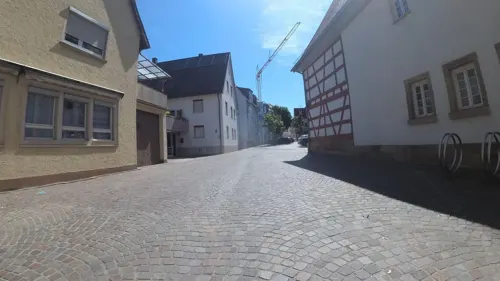


Greckenschloss
Monument and historic site · 3.9 km
2 Lindenweg, Bad Friedrichshall

Mesnerhaus
Monument and historic site · 3.0 km
6 Kirchbergstraße, Heilbronn

Schloss Lehen
Monument and historic site · 4.1 km
2 Hauptstraße, Bad Friedrichshall

St.Andresches Schlösschen
Monument and historic site · 4.1 km
1 Hauptstraße, Bad Friedrichshall

Widmann’sche Papiermaschinenfabrik
Museum · 4.1 km
1 Widmannstal, Heilbronn

29 more on the map.
Parks, trails and playgrounds43

Weinausschank am Wartberg
Park · 3.4 km
Wein-Panoramaweg, Heilbronn
Apr-Oct Sa,Su 14:00-21:00




31 more on the map.
Restaurants and cafes239

KEIO Gourmet
Restaurant · Chinese · 4.4 km
Https://www.echo24.de/heilbronn/keio-gourmet-lebensmittel-heilbronn-kontrolle-kakerlaken-schimmel-ekel-alarm-sushi-asia-restaurant-91786173.html
6 Fügerstraße, Heilbronn
Mo-Sa 11:30-15:00,17:30-23:00; Su,PH 11:30-23:00

An der Linde
Restaurant · German · 1.3 km
11 Stuttgarter Straße, Neckarsulm
Mo-Fr 12:00-13:30, 18:00-21:30
Arte Bianca Pizzaservice Neckarsulm
Restaurant · Italian · 1.6 km
38 Kochendorfer Straße
Th-Su 17:30-22:00
Bella Capri
Restaurant · Italian · 1.2 km
7 Stuttgarter Straße, Neckarsulm
Tu-Su 11:30-14:30,17:00-23:30
Capriccio
Restaurant · Italian
11 Rathausstraße, Neckarsulm
Tu-Fr 11:30-14:30,17:30-23:00; Sa 18:00-23:00; Su,Mo off
Ciao Ciao
Restaurant · Italian · 0.9 km
15 Hezenbergstraße, Neckarsulm
Tu-Th 11:30-14:00,17:30-21:00; Fr 11:30-14:00,17:30-22:00; Sa...
Eiscafé & Pizzeria Laguna
Restaurant · Pizza · 4.5 km
2 Hagenbacher Straße, Bad Friedrichshall
Mo-Fr 11:00-23:00; Sa 15:00-23:00; Su 11:00-23:00
Ewiges Glück
Restaurant · Chinese
3 Felix-Wankel-Straße, Neckarsulm
Su-Fr 11:30-14:30; We-Mo 17:30-22:00
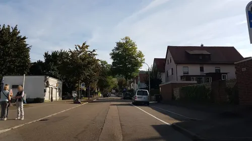
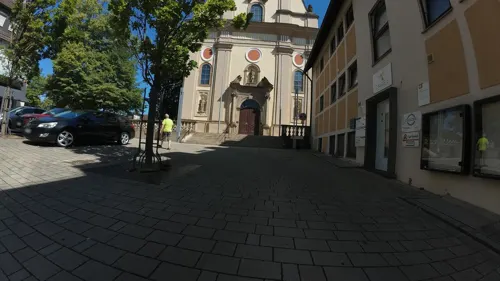


Gnadenstäffele Karl Traub Restaurant & Erlebnisgastronomie
Bar and pub · German
3 Pfarrgasse, Neckarsulm
Tu-Th 17:00-01:00, Fr,Sa 17:00-02:00
227 more on the map.
History
Archaeological finds such as vessel shards indicate human activity in the greater Neckarsulm region as early as the middle of the 6th millennium B.C. (Neolithic period). In 2001, archaeologists found a Late Bronze Age burial ground in Trendpark-Süd (roughly on the modern day site of the German IT company "Bechtle"), which was dated to around 1100 BC on the basis of metal and ceramic finds. Graves found south of the old city wall indicate a Frankish settlement dating to the 7th century AD.
The town, formerly called "Sulmana" or "Sulmgau", is dated to the year 771 in a deed of donation to Lorsch Abbey. Sulmana is mentioned in the Lorsch Codex. The area became known as Neckarsulm in the 16th century.
From the History section of Neckarsulm on Wikipedia, under CC BY-SA 4.0.
Where to stay24
Wohnmobilstellplatz Bad Friedrichshall
Campground · 4.4 km
Fahräcker, Bad Friedrichshall
Churches and places of worship33
Russisch-Orthodoxe Gemeinde des Hl. Johannes von Shanghai
Church · Russian Orthodox · 1.8 km
2 Brahmsweg, Neckarsulm
Augustinuskirche
Church · Roman Catholic · 4.7 km
16 Paul-Göbel-Straße, Heilbronn
Shopping45
Gas and EV charging17
Schools, colleges and libraries42
Healthcare15
Salinen Apotheke + Reformhaus
Clinic and pharmacy · 4.5 km
15 Friedrichshaller Straße, Bad Friedrichshall
Map of Neckarsulm
250 places. The map loads OpenStreetMap tiles when you open it.
Getting there and nearby towns
Manfred Rommel Airport Stuttgart (STR) is the nearest airport with scheduled flights listed in OpenStreetMap, 56 km away.
- Bad Friedrichshall 5 km north, about 5 min by car
- Heilbronn 5 km south, about 5 min by car
- Weinsberg 6 km southeast, about 6 min by car
- Schwaigern 13 km west, about 13 min by car
- Öhringen 21 km east, about 21 min by car
- Steinheim an der Murr 25 km south, about 25 min by car
- Sinsheim 26 km west, about 26 min by car
- Tamm 31 km south, about 31 min by car
- Vaihingen an der Enz 34 km southwest, about 34 min by car
- Oberderdingen 34 km southwest, about 34 min by car
Drive times are estimates from straight-line distance, not routes.
Local news
Headlines from INDB.
Reviews, tips and questions
Loading what members have shared...
Sources and licences
- GeoNames (CC BY 4.0): population, coordinates, regions and time zone
- Mapillary (see each image): photos
- OpenStreetMap contributors (ODbL 1.0): places, airports, map data
- Wikidata (CC0 1.0): elevation, founding date, time zone, website, landmarks and historic places
- Wikimedia Commons (see each image): photos
- Wikipedia (CC BY-SA 4.0): overview and history text
Photo credits
- Neckarsulm Rathaus01, Joachim Köhler, CC BY-SA 3.0
- Neckarsulm an der Klostergasse, 5R-MFT, CC BY-SA 4.0
- Marktstraße mit Modehaus Diemer in Neckarsulm - panoramio, qwesy qwesy, CC BY 3.0
- Neckarsulm - Marktstraße - panoramio, Baden de, CC BY 3.0
- Neckarsulm - panoramio (3), Baden de, CC BY 3.0
- Marktstraße - Neckarsulm - panoramio, Baden de, CC BY 3.0
- Neckarsulm - Altstadt - Marktplatz - Platane mit Weihnachtsbeleuchtung (1), Roman Eisele, CC BY-SA 4.0
- Neckarsulm - panoramio (2), Baden de, CC BY 3.0
- Neckarsulm - Altstadt - Marktstraße - Blick zu St. Dionys mit Weihnachtsbeleuchtung in blauer Stunde, Roman Eisele, CC BY-SA 4.0
- Neckarsulm - Altstadt - Marktplatz - Löwenbrunnen - Ansicht von SO mit Weihnachtsbeleuchtung (1), Roman Eisele, CC BY-SA 4.0
- Neckarsulm mit Tauzieher von Karl-Henning Seemann, 1985, gestiftet von der EVS - panoramio, qwesy qwesy, CC BY 3.0
- Neckarsulm - Altstadt - Marktplatz - Ansicht von Osten mit Weihnachtsbeleuchtung (1), Roman Eisele, CC BY-SA 4.0
- Neckarsulm - Altstadt - Marktplatz - Löwenbrunnen - Ansicht von NW mit rotem Imbisswagen (1), Roman Eisele, CC BY-SA 4.0
- Neckarsulm - Altstadt - Marktstraße und Marktplatz - Weihnachtsbeleuchtung in blauer Stunde, Roman Eisele, CC BY-SA 4.0
- Stolperstein Amalie Bodenheimer Neckarsulm 20190904 121011, rolf_acker, CC BY-SA 4.0
- Neckarsulm - Altstadt - Marktplatz - Weihnachtsbaum defokussiert (1.4), Roman Eisele, CC BY-SA 4.0
- Neckarsulm - Altstadt - Marktplatz - Weihnachtsbaum defokussiert (1.1), Roman Eisele, CC BY-SA 4.0
- Neckarsulm - Marktplatz - panoramio, Baden de, CC BY 3.0
- Deutsches Zweirad- und NSU-Museum Neckarsulm Parkseite, Zweiradmuseum Neckarsulm, CC BY-SA 4.0
- Bahnhofplatz Neckarsulm, HeilbronninWürttemberg, CC BY-SA 4.0
- Katholische Stadtpfarrkirche in Neckarsulm - panoramio, qwesy qwesy, CC BY 3.0
- Zweirad - Museum - Neckarsulm - panoramio (7), Baden de, CC BY 3.0
- Zweirad - Museum - Neckarsulm - panoramio (6), Baden de, CC BY 3.0
- Zweirad - Museum - Neckarsulm - panoramio (8), Baden de, CC BY 3.0
- NSU Museum Neckarsulm - panoramio, Baden de, CC BY 3.0
- Zweirad - Museum - Neckarsulm - panoramio (5), Baden de, CC BY 3.0
- Zweirad - Museum - Neckarsulm - panoramio (10), Baden de, CC BY 3.0
- Zweirad - Museum - Neckarsulm - panoramio (3), Baden de, CC BY 3.0
- Neckarsulm - NSU - Museum - panoramio (5), Baden de, CC BY 3.0
- Neckarsulm - NSU - Museum - panoramio (3), Baden de, CC BY 3.0
- Neckarsulm - NSU - Museum - panoramio (2), Baden de, CC BY 3.0
- Neckarsulm - NSU - Museum - panoramio (6), Baden de, CC BY 3.0
- Deutsches Zweiradmuseum Neckarsulm - panoramio, Baden de, CC BY 3.0
- Deutsches - Zweirad - Museum - Neckarsulm - panoramio, Baden de, CC BY 3.0
- Bad Wimpfen - Altstadt - 2017-09-17 18-22-59, Photographs by Radosław Drożdżewski (User:Zwiadowca21), CC BY-SA 4.0
- Hochschule Heilbronn mit Know Cube, Wolfgang Wehl, Public domain
- Kochendorf-greckenschloss, p.schmelzle, CC BY-SA 2.5
- Neckarsulm-ZweiradMuseum-Innenhof, Joachim Köhler, CC BY-SA 3.0
- Neckarsulm-AudiForum-vonSueden-061118, Joachim Köhler, CC BY-SA 3.0
- Hn-aukirche-web, p.schmelzle, CC BY-SA 2.5
- Kochendorf-andresches-schloesschen, p.schmelzle, CC BY-SA 2.5
- Widmannsche Papiermaschinenfabrik Neckargartach, Carl Theodor Rausche, Public domain
- Hn-dammrealschule, p.schmelzle, CC BY-SA 3.0
- Neckarsulm-Evangelische-Stadtkirche, Joachim Köhler, CC BY-SA 3.0
- Neckarsulm-Frauenkirche-AussenAnsicht, Joachim Köhler, CC BY-SA 3.0
- Nsu-klosterkirche-2011, Peter Schmelzle, CC BY-SA 3.0
- Hn-ngartach-mesnerhaus, p.schmelzle, CC BY-SA 3.0
- Obereisesheim Mauritiuskirche01, Joachim Köhler, CC BY-SA 3.0
- Badfriedrichshall-szene2008, Peter Schmelzle, CC BY-SA 3.0
- BFH Mennonite churchE, sarang, Public domain
- NSU-Amorbach-EvangelKirche, Joachim Köhler, CC BY-SA 3.0
- Europlex NSU, Joachim Köhler, CC BY-SA 3.0
- Heilbronn-lindenparkschule, Peter Schmelzle, CC BY-SA 3.0
- Untereisesheim-kath-kirche, p.schmelzle, CC BY-SA 2.5
- Neckarsulm-Obereisesheim-Christuskirche, Joachim Köhler, CC BY-SA 3.0
- Erlenbach Christuskirche 20120202, User:Rosenzweig, CC BY-SA 3.0
- Scheuerberg Aussichtspunkt, RolfRoemmele, CC BY-SA 3.0
- Heilbronn, Altes Theater, Gesamtansicht von Osten, Entwurf Theodor Fischer (1862-1938). Quelle - Hugo Licht, Das Stadttheater in Heilbronn, (Der Profanbau), Verlag J. J. Arnd, Leipzig 1913, Unknown author Unknown author, Public domain
- Ngartach-kriegerdenk3, p.schmelzle, CC BY-SA 3.0
- Street-level photo, fx7, CC BY-SA 4.0
- Street-level photo, teddy73, CC BY-SA 4.0
- Street-level photo, teddy73, CC BY-SA 4.0
- Street-level photo, teddy73, CC BY-SA 4.0
- Street-level photo, teddy73, CC BY-SA 4.0
- Street-level photo, teddy73, CC BY-SA 4.0
- Street-level photo, teddy73, CC BY-SA 4.0
- Street-level photo, changchun1, CC BY-SA 4.0
- Street-level photo, teddy73, CC BY-SA 4.0
- Street-level photo, teddy73, CC BY-SA 4.0
- Street-level photo, teddy73, CC BY-SA 4.0
- Street-level photo, teddy73, CC BY-SA 4.0
- Street-level photo, teddy73, CC BY-SA 4.0
- Street-level photo, teddy73, CC BY-SA 4.0
- Street-level photo, changchun1, CC BY-SA 4.0
- Street-level photo, teddy73, CC BY-SA 4.0
- Street-level photo, fx7, CC BY-SA 4.0


Page built November 8, 2026. Spotted a mistake? Tell us or suggest a place.