


Neuenkirchen, Germany
Neuenkirchen is a town of 13,953 people in North Rhine-Westphalia, Germany.
Why visit Neuenkirchen
Townapedia lists 88 museums and landmarks, 31 parks and trails, 122 places to eat, 6 places to stay and 10 attractions in and around town.
Highlights include Warenautomat, Hypothalamus, Falkenhof and Falkenhof-Museum.
Weather in Neuenkirchen
Forecast from MET Norway (CC BY 4.0). Full forecast
About Neuenkirchen
Neuenkirchen (German pronunciation: [ˈnɔʏənˌkɪʁçn̩] ; Low German: Nienkiärken) is a municipality in the district of Steinfurt, in North Rhine-Westphalia, Germany. Neuenkirchen is the biggest village in the district of Steinfurt and noted for its stately homes. It is situated approximately 7 km south-west of Rheine and 35 km north-west of Münster.
From the Wikipedia article Neuenkirchen, Westphalia (this version), under CC BY-SA 4.0.
Things to do10
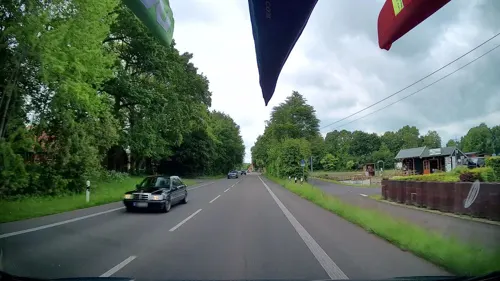
Warenautomat
Farm and orchard · 3.9 km
Tiefgekühltes Fleisch von unseren Bentheimer Landschweinen, frische Freilandeier, Eierlikör, Eiernudeln, Saisonware (siehe Website)
4 Dorfbauerschaft, Neuenkirchen
24/7



Gärtnerei Weßling
Farm and orchard · 0.9 km
Tu,Sa 09:00-12:00; Th 09:00 - 12:00, 15:00 - 18:00; PH off

Museums and landmarks88


Falkenhof-Museum
Museum · 6.0 km
22 Tiefe Straße, Rheine
Tu-Sa 14:00-18:00; Su 10:00-18:00

Heimatverein Hauenhorst/Catenhorn e.V.
Monument and historic site · 5.4 km
Direkt am Dorfplatz in Hauenhorst finden Sie die historische münsterländische Hofanlage.
1 Bauerschaftsstraße, Rheine



Ältester Jüdischer Friedhof
Monument and historic site · 6.1 km
Friedhof liegt nördl. der Mühlensilos
Hünenburg
Monument and historic site · 4.8 km
Monumentales Kriegerdenkmal aus 12 hohen Sandsteinpfeilern, angelehnt an vorgeschichtliche Steinsetzungen wie Stonehenge
76 more on the map.
Parks, trails and playgrounds31







19 more on the map.
Restaurants and cafes122

Cafe Extrablatt
Cafe · Coffee Shop · 5.8 km
14 Herrenschreiberstraße, Rheine
Mo-Sa 08:30-24:00; Su,PH 09:30-24:00
Gaststätte Bertling
Restaurant · German, Regional · 5.9 km
1 Münsterstraße, Rheine
Mo-Fr 17:00-24:00; Sa 18:00-24:00; PH,Su off
ICHIMI Sushi & Grill
Restaurant · Japanese · 5.9 km
16 Emsstraße, Rheine
Tu-Sa 11:30-22:00; Su,PH 14:00-21:00
Kreimer's GartenCafé
Cafe · Waffle, Breakfast, Lunch, Coffee Shop, Tea · 2.0 km
2 Erlenstraße, Neuenkirchen
Mo-Sa 09:00-17:00; Su off; Mar-May Su 14:00-17:00

Lohner Landbäcker - Bäckerei & Café
Cafe · 5.7 km
4 Kardinal-Galen-Ring, Rheine
Mo-Sa 08:00-19:00; PH off
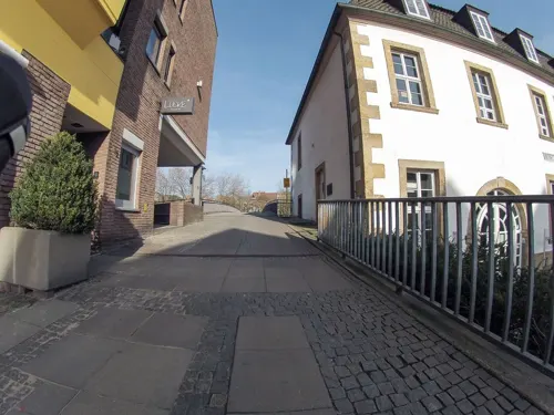
Mongolei City
Restaurant · Chinese · 5.6 km
42 Kardinal-Galen-Ring, Rheine
Mo-Sa 12:00-15:00, 17:30-23:00; Su 12:00-23:00
Restaurant Beesten
Restaurant · German · 5.7 km
3 Eichenstraße, Rheine
Mo-We 18:00-24:00; Th off; Fr-Sa 18:00-24:00; Su 11:30-14:00, 18:00-24:00
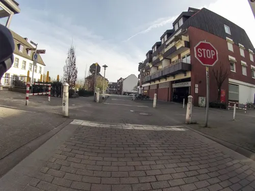
Sundays
Restaurant · German · 6.0 km
1a Heiliggeistplatz, Rheine
Mo,Tu 16:00-23:00; We,Th 12:00-23:00; Sa,Su 10:00-24:00


Viet Delight
Restaurant · Vietnamese · 5.9 km
18-22 Münsterstraße, Rheine
Mo-Su 11:30-22:00; PH closed
110 more on the map.
Where to stay6
Churches and places of worship21
Sankt Elisabeth
Church · Roman Catholic · 5.0 km
25 Windthorststraße, Rheine
St. Dionysius
Church · Roman Catholic · 5.9 km
6 An der Stadtkirche, Rheine
Shopping40
Gas and EV charging17
Schools, colleges and libraries26
Healthcare12
Map of Neuenkirchen
250 places. The map loads OpenStreetMap tiles when you open it.
Getting there and nearby towns
Münster Osnabrück Airport (FMO) is the nearest airport with scheduled flights listed in OpenStreetMap, 25 km away.
- Rheine 6 km northeast, about 6 min by car
- Steinfurt 11 km south, about 11 min by car
- Ochtrup 13 km west, about 13 min by car
- Schüttorf 13 km northwest, about 13 min by car
- Recke 27 km northeast, about 27 min by car
- Nordhorn 29 km northwest, about 29 min by car
- Wietmarschen 34 km northwest, about 34 min by car
- Münster 36 km southeast, about 36 min by car
- Nottuln 35 km south, about 35 min by car
- Westerkappeln 35 km east, about 35 min by car
Drive times are estimates from straight-line distance, not routes.
Local news
Headlines from INDB.
Reviews, tips and questions
Loading what members have shared...
Sources and licences
- GeoNames (CC BY 4.0): population, coordinates, regions and time zone
- Mapillary (see each image): photos
- OpenStreetMap contributors (ODbL 1.0): places, airports, map data
- Wikidata (CC0 1.0): elevation, founding date, time zone, website, landmarks and historic places
- Wikimedia Commons (see each image): photos
- Wikipedia (CC BY-SA 4.0): overview and history text
Photo credits
- Neuenkirchen, katholische Pfarrkirche Sankt Anna Dm12 foto4 2013-09-28, Michielverbeek, CC BY-SA 3.0
- Neuenkirchen bei Rheine - geo.hlipp.de - 10188, Udo und Joan Fugel on geo.hlipp.de, CC BY-SA 2.0
- In Offlum bei Neuenkirchen - geo.hlipp.de - 10711, Udo und Joan Fugel on geo.hlipp.de, CC BY-SA 2.0
- Der Offlumer See bei Neuenkirchen - geo.hlipp.de - 10709, Udo und Joan Fugel on geo.hlipp.de, CC BY-SA 2.0
- St.-Antonius-Basilika (Rheine), Sharps at German Wikipedia, CC BY-SA 2.0 de
- Arnold-Janssen-Gymnasium-2008, Zumthie, CC BY-SA 3.0
- Dionys Außen Markt, Drooker, CC BY-SA 3.0
- Neuenkirchen-SwR, Zumthie, Public domain
- Gymnasium Dionysianum Rheine, Portal, quapan, CC BY 2.0
- Rheine Falkenhof 01, J.-H. Janßen, CC BY-SA 4.0
- Neuenkirchen-St-Anna-sued, Zumthie, Public domain
- Wettringen, Kirche St. Petronilla, Nordseite, Rauenstein, CC BY-SA 2.5
- Hauenhorst-Kirche, Zumthie, Public domain
- St. Elisabeth Rheine - Westgiebel mit Turm, Westerdam, CC BY-SA 4.0
- Kath. Gymnasialkirche St. Peter, Drusenthal, CC BY-SA 4.0
- Bilk-St-Michael, Zumthie, Public domain
- Emsmühle-Rheine, Ramsch, CC BY-SA 3.0
- Ehem. Redeptoristenkloster, Manuel Wolbeck, CC BY-SA 3.0 de
- Alte Synagoge Rheine, Manuel Wolbeck, CC BY-SA 3.0 de
- Ältester jüd. Friedhof, Manuel Wolbeck, CC BY-SA 3.0 de
- NRW Rheine Naturschutzgebiet Waldhügel Kalksee, IfSoGirl88, CC BY-SA 4.0
- Großes Unland, LoMo600, CC0
- Falkenhof Rheine, Holgerpo, CC BY-SA 1.0
- Gym dionysianum hauptportal, Saragossa, CC BY-SA 3.0
- Sankt Anna Neuenkirchen Kreis Steinfurt Germany, Johannes Kerstiens ( unland ), CC BY 3.0
- St. Elisabeth Rheine - Westgiebel neu, Westerdam, CC BY-SA 4.0
- Waldhügel Rheine 01, Jabalive, CC BY-SA 4.0
- Neue Freizeitanlage am Offlumer See - geo.hlipp.de - 10710, Udo und Joan Fugel on geo.hlipp.de, CC BY-SA 2.0
- In Landersum bei Rheine (Ems) - geo.hlipp.de - 10128, Udo und Joan Fugel on geo.hlipp.de, CC BY-SA 2.0
- Rheine Emswehr 05, J.-H. Janßen, CC BY-SA 4.0
- Street-level photo, hkelc, CC BY-SA 4.0
- Street-level photo, hkelc, CC BY-SA 4.0
- Street-level photo, VIA_KK, CC BY-SA 4.0
- Street-level photo, polyglot, CC BY-SA 4.0
- Street-level photo, changchun1, CC BY-SA 4.0
- Street-level photo, GlitchHunter, CC BY-SA 4.0
- Street-level photo, snowdiver, CC BY-SA 4.0
- Street-level photo, GlitchHunter, CC BY-SA 4.0
- Street-level photo, GlitchHunter, CC BY-SA 4.0
- Street-level photo, GlitchHunter, CC BY-SA 4.0
- Street-level photo, kalcaaro, CC BY-SA 4.0
- Street-level photo, hknk1, CC BY-SA 4.0
- Street-level photo, snowdiver, CC BY-SA 4.0
- Street-level photo, bct, CC BY-SA 4.0
- Street-level photo, VIA_KK, CC BY-SA 4.0
- Street-level photo, VIA_KK, CC BY-SA 4.0
- Street-level photo, VIA_KK, CC BY-SA 4.0
- Street-level photo, kalla, CC BY-SA 4.0
- Street-level photo, GlitchHunter, CC BY-SA 4.0
- Street-level photo, GlitchHunter, CC BY-SA 4.0
- Street-level photo, GlitchHunter, CC BY-SA 4.0
- Street-level photo, hkelc, CC BY-SA 4.0


Page built November 8, 2026. Spotted a mistake? Tell us or suggest a place.