


Why visit Rheine
Townapedia lists 126 museums and landmarks, 47 parks and trails, 186 places to eat, 16 places to stay and 14 attractions in and around town.
Highlights include Hypothalamus, Thieberg, Europäische Märchengesellschaft and Falkenhof.
Weather in Rheine
Forecast from MET Norway (CC BY 4.0). Full forecast
About Rheine
Rheine (German: [ˈʁaɪnə] ) is a city in the district of Steinfurt in Westphalia, Germany. It is the largest city in the district and the location of Rheine Air Base.
From the Wikipedia article Rheine (this version), under CC BY-SA 4.0.
Travel tips from other travellers: Rheine on Wikivoyage (CC BY-SA 4.0).
Photos of Rheine


Things to do14




Gärtnerei Weßling
Farm and orchard · 6.1 km
Tu,Sa 09:00-12:00; Th 09:00 - 12:00, 15:00 - 18:00; PH off
2 more on the map.
Museums and landmarks126
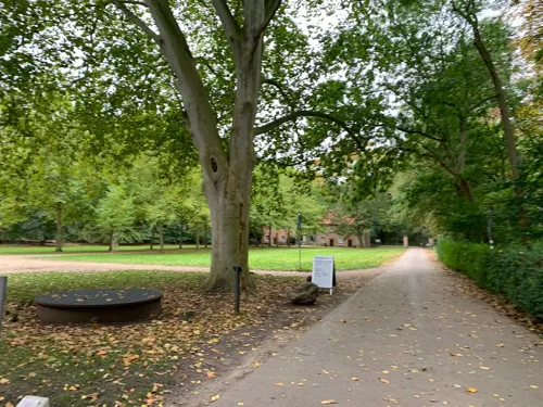
Europäische Märchengesellschaft
Museum · 2.4 km
130 Bentlager Weg
Mo 09:00-12:00; Tu-Th 09:00-16:00; Fr 09:00-12:00


Falkenhof-Museum
Museum
22 Tiefe Straße, Rheine
Tu-Sa 14:00-18:00; Su 10:00-18:00



Heimatverein Hauenhorst/Catenhorn e.V.
Monument and historic site · 5.1 km
Direkt am Dorfplatz in Hauenhorst finden Sie die historische münsterländische Hofanlage.
1 Bauerschaftsstraße, Rheine

114 more on the map.
Parks, trails and playgrounds47



Hallenbad Mesum
Sports field and stadium · 6.8 km
55 Hassenbrockweg, Rheine
Mo-Fr 09:00-18:00; Sa 09:00-12:00

35 more on the map.
Restaurants and cafes186

Naturzoo Rheine
Restaurant · 2.1 km
150 Salinenstraße, Rheine
Mar 15-Oct 26 Mo-Sa 09:00-18:00, Su,PH 09:00-19:00; Oct 27-Mar 14...
Altes Gasthaus Delsen
Restaurant · Regional · 1.5 km
39 Bentlager Weg, Rheine
Mo,We off; Tu,Fr,Sa 14:00+; Th 17:00+; Su 11:00+
Asia Wok Sushi Rheine
Restaurant · Asian · 7.1 km
130 Burgsteinfurter Damm, Rheine
Mo 17:00-21:00; We-Sa 17:00-21:00; Su 15:00-21:00
Gaststätte Bertling
Restaurant · German, Regional
1 Münsterstraße, Rheine
Mo-Fr 17:00-24:00; Sa 18:00-24:00; PH,Su off
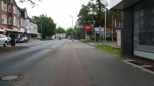
Istanbul Grill
Restaurant · Turkish · 0.6 km
81 Osnabrücker Straße, Rheine
Mo-Th 11:30-22:00; Fr 10:30-23:00; Sa 11:30-22:00; Su 13:00-22:00
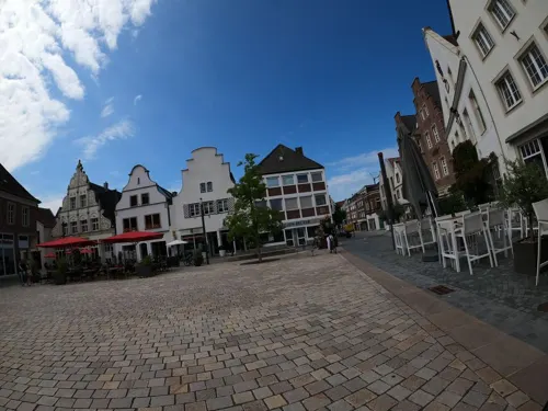
Lohner Landbäcker - Bäckerei & Café
Cafe
7 Marktplatz, Rheine
Mo-Fr 08:00-18:00; Sa 08:00-17:00; PH off

Cafe Extrablatt
Cafe · Coffee Shop
14 Herrenschreiberstraße, Rheine
Mo-Sa 08:30-24:00; Su,PH 09:30-24:00

Das Emskind
Restaurant · Steak House · 3.1 km
375 Salzbergener Straße, Rheine
Mo-Th 17:00-23:00; Fr-Sa 17:00-24:00; Su 11:00-23:00
174 more on the map.
History
Although the region around the city has been populated since prehistoric times, Rheine was first mentioned in a document signed by Louis the Pious in 838. On 15 August 1327, it received its town charter from Louis II, Bishop of Münster.
The settlement was near to the crossing of two old merchant roads and a ford over the river Ems. Frankish soldiers initially secured this strategic point with a barrack yard. Later a church and more buildings were added to this outpost.
At the end of the Thirty Years' War the city was burned down almost completely. Swedish and Hessian troops besieged imperial soldiers who had entrenched themselves in Rheine. On 20/21 September and 19 October 1647 glowing cannonballs set fire to the city and 365 houses were destroyed. In 1803 the city became the capital of the Sovereign Principality of Rheina-Wolbeck (556 square kilometers) of the House of Looz-Corswarem, later annexed by the Grand Duchy of Berg and the Kingdom of Prussia.
During the Industrial Revolution the textile industry prospered. It remained an important economic factor until the second half of the 20th century. Today engineering industries and services form the largest part of economy in Rheine.
On 1 April 1927 about 10,000 inhabitants of the Office Rheine (Bentlage, Wadelheim, Dutum, etc.) were incorporated into the city, the population increased to 29,598, the city area was thus tripled.
Read more of the history
During Nazi rule of Germany, Jewish citizens were deported from Rheine, as elsewhere in Germany. In the Second World War, Allied forces bombarded the city repeatedly, especially the railway line and the Dortmund-Ems Canal, which represented tactical goals. Large-scale bombing raids occurred on 5 October 1944 and 21 March 1945, each leaving more than 200 dead and causing extensive damage to the city area. The conquest of Rheine took place on 2 April 1945 after some fierce fighting by units of the 157th British Infantry Brigade (5th Battalion of the King's Own Scottish Borderers Regiment, 7th Battalion of the Cameronians (Scottish Rifles) Regiment).
After 1945, Rheine was in the British occupation zone and 1946 was politically assigned to the newly founded Land (state) of North Rhine-Westphalia. In 1949 it joined with the other states in the Western Zone to form the Federal Republic of Germany.
On 10 February 1946 Rheine was affected by the highest ever Emshochwasser. Large parts of the city were flooded.
On 15 August 2002 the city celebrated the 675th anniversary of the granting of municipal law.
From the History section of Rheine on Wikipedia, under CC BY-SA 4.0.
More about Rheine
Geography
Rheine is on the river Ems, about 40 kilometres (25 mi) north of Münster, 45 kilometres (28 mi) west of Osnabrück and 45 kilometres (28 mi) east of Hengelo (Netherlands).
From the Wikipedia article Rheine, under CC BY-SA 4.0.
Notable people from Rheine
 Lisa PausGerman politicianPhoto: Gam9bit, CC BY-SA 4.0
 Jonas Reckermannprofessional beach volleyball playerPhoto: Raimond Spekking, CC BY-SA 4.0
 Bettina HoyequestrianPhoto: Henry Bucklow/Lazy Photography ( Sffubs ), CC BY-SA 3.0
 Frank RipplohGerman actor and director (1949–2002)Photo: Michael Lucan, CC BY-SA 3.0 de
 Carlo MenseGerman artist (1886–1965)Photo: Tohma ( talk ), CC BY-SA 4.0
 Heinrich MeyringGerman artistPhoto: Didier Descouens, CC BY-SA 4.0
 Hildegard MüllerGerman lobbyist and former politicianPhoto: Vadim Motov, CC BY-SA 4.0
 Josef WincklerGerman writer (1881–1966)Photo: Paul Holländer (verst.), CC BY-SA 3.0
 Josef H. NeumannGerman photographerPhoto: Josef H. Neumann, CC BY-SA 4.0
 Georg PelsterGerman politician (1897-1963)Photo: CDU, CC BY-SA 3.0 de
 Moritz DobschutzGerman noble and American merchant (1831-1913)Photo: Unknown author Unknown author, Public domain
- Paul MebusGerman footballer (1920–1993)
Born in Rheine, according to Wikidata (CC0). Each name links to its Wikipedia article.
Where to stay16
Churches and places of worship27
St. Antonius-Basilika
Church · Roman Catholic
60 Osnabrücker Straße, Rheine
Sankt Anna
Church · Roman Catholic · 6.4 km
1 Kirchplatz, Neuenkirchen
Sankt Elisabeth
Church · Roman Catholic · 1.5 km
25 Windthorststraße, Rheine
Shopping73
Gas and EV charging24
Schools, colleges and libraries44
Healthcare18
Augentagesklinik Rheine
Clinic and pharmacy · 1.7 km
233-235 Osnabrücker Straße, Rheine
Map of Rheine
250 places. The map loads OpenStreetMap tiles when you open it.
Getting there and nearby towns
Münster Osnabrück Airport (FMO) is the nearest airport with scheduled flights listed in OpenStreetMap, 23 km away.
- Neuenkirchen 6 km southwest, about 6 min by car
- Salzbergen 8 km northwest, about 8 min by car
- Spelle 9 km north, about 9 min by car
- Hörstel 10 km east, about 10 min by car
- Wettringen 12 km southwest, about 12 min by car
- Emsdetten 13 km southeast, about 13 min by car
- Birgte 15 km east, about 15 min by car
- Steinfurt 16 km southwest, about 16 min by car
- Schüttorf 15 km west, about 15 min by car
- Emsbüren 16 km northwest, about 16 min by car
Drive times are estimates from straight-line distance, not routes.
Towns near Rheine


Keep exploring
Local news
Headlines from INDB.
Reviews, tips and questions
Loading what members have shared...
Sources and licences
- GeoNames (CC BY 4.0): population, coordinates, regions and time zone
- Mapillary (see each image): photos
- OpenStreetMap contributors (ODbL 1.0): places, airports, map data
- Wikidata (CC0 1.0): elevation, founding date, time zone, website, landmarks and historic places
- Wikimedia Commons (see each image): photos
- Wikipedia (CC BY-SA 4.0): overview and history text
Photo credits
- Stadtkirche Sankt Dionysus Rheine, Tubantia, CC BY-SA 3.0
- Rheine Falkenhof 01, J.-H. Janßen, CC BY-SA 4.0
- Rheine Emswehr Stadtkirche Timmermmanufer 190 IMG 20200628 1157, Karlunun, CC BY-SA 4.0
- Rheine Emswehr Oberschleuse Timmermanufer 330 IMG 20200628 1154, Karlunun, CC BY-SA 4.0
- Rheine Emsmuehle 13, J.-H. Janßen, CC BY-SA 4.0
- Rheine Straetersches Haus 06, J.-H. Janßen, CC BY-SA 4.0
- Rheine Emsmuehle Silo 04, J.-H. Janßen, CC BY-SA 4.0
- Rheine Timmermanufer 170 01, J.-H. Janßen, CC BY-SA 4.0
- Rheine Emsmuehle 04, J.-H. Janßen, CC0
- Rheine Emsmuehle 12, J.-H. Janßen, CC BY-SA 4.0
- Ems Rheine, Tubantia, CC BY-SA 3.0
- Ems River at Rheine (Germany, NRW), Dennis Lamczak, CC BY-SA 2.0
- Rheine Emsmuehle 06, J.-H. Janßen, CC BY-SA 4.0
- Rheine Emsmuehle 05, J.-H. Janßen, CC BY-SA 4.0
- Ems, 2, Rheine, Landkreis Steinfurt, GeorgDerReisende, CC BY-SA 4.0
- Rheine Emsmuehle 03, J.-H. Janßen, CC BY-SA 4.0
- Ems, 1, Rheine, Landkreis Steinfurt, GeorgDerReisende, CC BY-SA 4.0
- Rheine Emsmuehle 02, J.-H. Janßen, CC BY-SA 4.0
- Rheine Timmermanufer 170 02, J.-H. Janßen, CC BY-SA 4.0
- Rheine 07, J.-H. Janßen, CC BY-SA 4.0
- Rheine Straetersches Haus 05, J.-H. Janßen, CC0
- Rheine Straetersches Haus 03, J.-H. Janßen, CC BY-SA 4.0
- Rheine Emsmuehle Silo 05, J.-H. Janßen, CC BY-SA 4.0
- St. Dionysius (Rheine) - Blick von Nord-Osten, Westerdam, CC BY-SA 4.0
- Rheine Straetersches Haus 04, J.-H. Janßen, CC0
- Rheine Emsmuehle 01, J.-H. Janßen, CC BY-SA 4.0
- Rheine Straetersches Haus 01, J.-H. Janßen, CC BY-SA 4.0
- Fenster 2 - WG-Kapelle - St. Dionysius, Rheine, Westerdam, CC BY-SA 4.0
- Fenster 3 - WG-Kapelle - St. Dionysius, Rheine, Westerdam, CC BY-SA 4.0
- Fenster 1 - WG-Kapelle - St. Dionysius, Rheine, Westerdam, CC BY-SA 4.0
- Rheine Falkenhof 08, J.-H. Janßen, CC BY-SA 4.0
- Rheine Straetersches Haus 02, J.-H. Janßen, CC BY-SA 4.0
- Rheine Emsmuehle 07, J.-H. Janßen, CC BY-SA 4.0
- Heiliggeistplatz 7, 1, Rheine, Landkreis Steinfurt, GeorgDerReisende, CC BY-SA 4.0
- Rheine Falkenhof 03, J.-H. Janßen, CC BY-SA 4.0
- Zeichnung Burg Bevergern, H.P-Marquard, CC BY-SA 3.0 de
- St.-Antonius-Basilika (Rheine), Sharps at German Wikipedia, CC BY-SA 2.0 de
- Rheine Tierpark Stoerche, Corradox, CC BY-SA 3.0
- Dionys Außen Markt, Drooker, CC BY-SA 3.0
- Neuenkirchen-SwR, Zumthie, Public domain
- Gymnasium Dionysianum Rheine, Portal, quapan, CC BY 2.0
- Megalithgrab, Rheine-Schotthock 3158, Uniesert, CC BY-SA 3.0
- Kloster Bentlage, Sharps, CC BY-SA 2.0 de
- Saline Gottesgabe, Rheine, Sharps, CC BY-SA 2.0 de
- Neuenkirchen-St-Anna-sued, Zumthie, Public domain
- Rheine StLudgerus 1109, Rüdiger Wölk This photo was taken by Rüdiger Wölk . Please credit this photo Rüdiger Wölk, Münster . View all photos (large page) of Rüdiger Wölk I would also appreciate an email to..., CC BY-SA 2.5
- Turm St. Johannes, Mesum, Westerdam, CC BY-SA 4.0
- Hauenhorst-Kirche, Zumthie, Public domain
- St. Elisabeth Rheine - Westgiebel mit Turm, Westerdam, CC BY-SA 4.0
- Kath. Gymnasialkirche St. Peter, Drusenthal, CC BY-SA 4.0
- Kath.Pfarrkirche Herz-Jesu, Drusenthal, CC BY-SA 4.0
- Emsmühle-Rheine, Ramsch, CC BY-SA 3.0
- Ehem. Redeptoristenkloster, Manuel Wolbeck, CC BY-SA 3.0 de
- NRW Rheine Naturschutzgebiet Waldhügel Kalksee, IfSoGirl88, CC BY-SA 4.0
- Über der Ems schwebent, Jabalive, CC BY-SA 3.0
- Großes Unland, LoMo600, CC0
- Falkenhof Rheine, Holgerpo, CC BY-SA 1.0
- Rheine Emswehr 05, J.-H. Janßen, CC BY-SA 4.0
- Street-level photo, wolfgangfey, CC BY-SA 4.0
- Street-level photo, GlitchHunter, CC BY-SA 4.0
- Street-level photo, GlitchHunter, CC BY-SA 4.0
- Street-level photo, hkelc, CC BY-SA 4.0
- Street-level photo, GlitchHunter, CC BY-SA 4.0
- Street-level photo, snowdiver, CC BY-SA 4.0
- Street-level photo, GlitchHunter, CC BY-SA 4.0
- Street-level photo, snowdiver, CC BY-SA 4.0
- Street-level photo, polyglot, CC BY-SA 4.0
- Street-level photo, regentkoerper, CC BY-SA 4.0
- Street-level photo, changchun1, CC BY-SA 4.0
- Street-level photo, peterossege, CC BY-SA 4.0
- Street-level photo, GlitchHunter, CC BY-SA 4.0
- Street-level photo, regentkoerper, CC BY-SA 4.0
- Street-level photo, ramap, CC BY-SA 4.0
- Street-level photo, bct, CC BY-SA 4.0
- Street-level photo, hkelc, CC BY-SA 4.0
- Street-level photo, bct, CC BY-SA 4.0
- Street-level photo, peterossege, CC BY-SA 4.0
- Street-level photo, bct, CC BY-SA 4.0
- Street-level photo, bct, CC BY-SA 4.0
- Street-level photo, peterossege, CC BY-SA 4.0
- Street-level photo, peterossege, CC BY-SA 4.0
- Street-level photo, VIA_KK, CC BY-SA 4.0
- Street-level photo, VIA_KK, CC BY-SA 4.0
- Street-level photo, GlitchHunter, CC BY-SA 4.0
- Street-level photo, snowdiver, CC BY-SA 4.0


Page built November 9, 2026. Spotted a mistake? Tell us or suggest a place.