


Why visit Nordhorn
Townapedia lists 77 museums and landmarks, 25 parks and trails, 138 places to eat, 15 places to stay and 3 attractions in and around town.
Highlights include Konzert- und Theatersaal, Schiffahrts-Museum Nordhorn, Poaschebarg - Historische Stätte and Tierpark Nordhorn.
Weather in Nordhorn
Forecast from MET Norway (CC BY 4.0). Full forecast
About Nordhorn
Nordhorn (German pronunciation: [ˈnɔʁtˌhɔʁn] ; Northern Low Saxon: Nothoorn, or Notthoarn, Netthoarn, and Dutch: Noordhoorn), is a town in Lower Saxony, Germany. It is the district seat of Grafschaft Bentheim, in the southwest corner of the state, near the border of the Netherlands and North Rhine-Westphalia.
From the Wikipedia article Nordhorn (this version), under CC BY-SA 4.0.
Travel tips from other travellers: Nordhorn on Wikivoyage (CC BY-SA 4.0).
Photos of Nordhorn


Things to do3

Konzert- und Theatersaal
Cinema and theater · 0.7 km
14 Ootmarsumer Weg, Nordhorn


Museums and landmarks77

Poaschebarg - Historische Stätte
Monument and historic site · 8.6 km
Https://www.neuenhaus.de/magazin/artikel.php?menuid=104&topmenu=253&artikel=411
wanderweg, Neuenhaus


Kloster Frenswegen
Monument and historic site · 3.3 km
9 Klosterstraße, Nordhorn



65 more on the map.
Parks, trails and playgrounds25


Bergvennen & Brecklenkampse Veld
Hiking and trails · 4.1 km
Habitatrichtlijn





13 more on the map.
Restaurants and cafes138
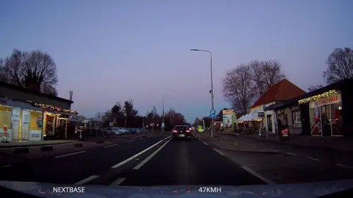
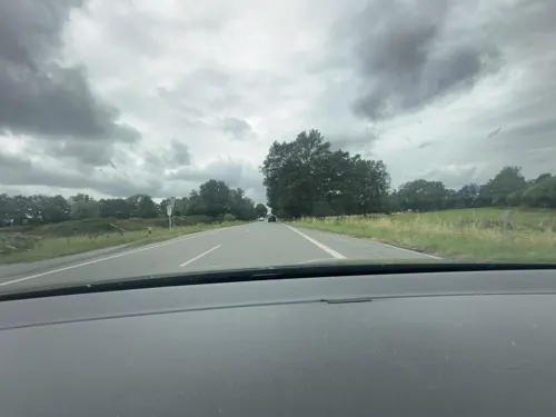
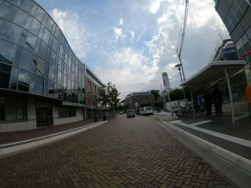
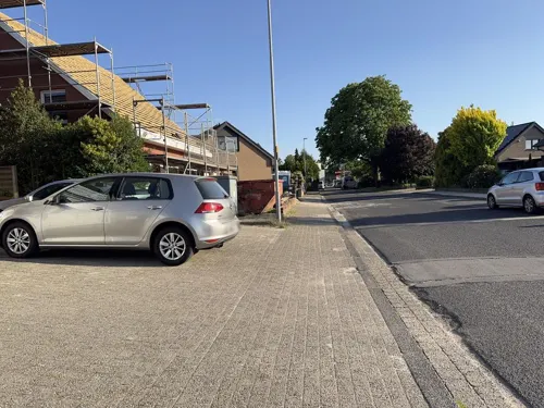
Kleines Sandhookhaus
Restaurant · International · 1.8 km
34 Sandhook, Nordhorn
We-Sa 17:30-24:00; Su 12:00-14:00, 17:00-24:00
Lohner Landbäcker
Bakery
2 Friedrich-Ebert-Straße, Nordhorn
Mo-Fr 07:00-20:00; Sa 07:00-19:00; Su 08:00-12:00

Wintering Biener Landbäckerei
Cafe · Cake · 2.4 km
23 Immenweg, Nordhorn
Mo-Fr 06:00-18:00; Sa 06:00-17:00; Su 06:00-17:00

burgerme
Restaurant · Burger · 1.0 km
46 Neuenhauser Straße, Nordhorn
Mo-Th 11:00-22:00; Fr 11:00-22:30; Sa-Su 12:00-22:30

Biener Landbäckerei Wintering
Bakery · 1.2 km
3 Molkereistraße, Nordhorn
Mo-Fr 06:30-19:00; Sa 06:30-17:00; PH off
Biener Landbäckerei Wintering
Bakery · 1.5 km
21 Deegfelder Weg, Nordhorn
Mo-Fr 06:30-18:00; Sa 06:30-13:00; Su 07:00-11:00
126 more on the map.
History
Human settlement in the Nordhorn area dates back more than 6,000 years, as evidenced by archaeological findings from the Old Stone Age and the subsequent Bronze Age. During the Ice Age, early peoples settled on the elevated, dry riverbanks of the Vechte. Traces of Iron Age settlements have been discovered across the region, forming the basis for later farming communities such as Frensdorf, Bookholt, Altendorf, Hesepe, and Bakelde.
From 12 BCE to 10 CE, Roman commanders including Drusus, Tiberius, Germanicus, and Varus led campaigns into what is now northern Germany. Operating from camps in Xanten, they are believed to have advanced into the lands of the Chamavi and Tubanti, who inhabited the Nordhorn region. The Romans likely used ancient riverbanks and sandy moorland paths as military roads—routes that would later evolve into significant trade roads linking cities such as Brussels, Amsterdam, Bremen, and Hamburg.
By the late 4th century, during the Migration Period, Saxons began pressing westward, displacing the Tubanti into present-day Twente. Following Charlemagne's conquest of the Saxons, a new internal border formed between the Frankish Empire and Saxony—an early version of today's German-Dutch border.
Read more of the history
Christianization began in 687, when Bishop Wilfrid of York sent missionaries to the region. Willibrord established the Bishopric of Utrecht, and Werenfried spread Christianity throughout the Vechte Valley. Around 800, Nordhorn was assigned to the Bishopric of Münster, and Bishop Ludger is said to have built a wooden church in the river's floodplain. The earliest recorded mention of Nordhorn appears around 900 as Northhornon in the Heberegister of Werden Monastery.
In about 1180, the Counts of Bentheim took control of the Nordhorn Gogericht (regional court) and built a castle on an island in the Vechte. Though the castle was largely dismantled by 1912, its location is now occupied by the Catholic St.-Augustinus-Kirche. A dam and mills enabled control over the river's flow, and waterways—possibly built under Dutch influence—divided the island into six sections. The fortified settlement grew into a trading hub, with merchants and shipowners establishing themselves. The name Nordhorn was adopted for this newer, fortified area, while the earlier village around the market church became known as Altendorf (Old Village).
Nordhorn soon gained importance along the Flemish Road (today's Bundesstraße 213 and 403), linking it to wider European trade networks. The Vechte was navigable as far as Schüttorf, and goods flowed from Scandinavia and the Hanseatic League through Nordhorn to destinations as distant as Paris.
In the Middle Ages, the Vechte—roughly 167 km (104 mi) long—flowed directly into the sea via the Zuider Zee, a key node in Dutch sea trade. Today, after land reclamation projects, it empties into the Zwarte Water north of Zwolle, eventually flowing into the IJsselmeer.
By 1160, Bentheim sandstone was being shipped from Nordhorn to the Netherlands. The Steinmaate market became a hub of stone trade, supplying materials for notable buildings such as the Royal Palace in Amsterdam, along with churches, locks, and mills. Returning ships brought spices, textiles, paper, coffee, tea, cacao, and tobacco. Until the mid-19th century, the local economy was based on trade, crafts, and agriculture.
On the ninth day after Whitsunday in 1379, Count Bernhard I granted Nordhorn town rights, followed by municipal privileges in 1416. The Augustinian canons established the Marienwolde Monastery in Frenswegen in 1394, which later gained renown as "Westphalia's Paradise." After secularization in 1806, monastic lands passed to the Bentheim Counts.
In the 13th century, churches built from Bentheim sandstone mirrored Romanesque styles from nearby Westphalia. The oldest preserved artifact from this period is a baptismal font in Brandlecht. The 15th-century Alte Kirche ("Old Church"), built in Late Gothic style, was dedicated to Saint Ludger. Its original 102-meter tower served as a firewatch and lookout, but was destroyed in a storm. The shorter replacement tower was designed to allow wind to pass through. During 20th-century restorations, wall paintings of the Twelve Apostles—the Nordhorner Apostelbilder—were uncovered and preserved with washi paper due to their religious and artistic significance.
War and epidemics marked the 17th and 18th centuries. During the Eighty Years' War, Spanish troops used Nordhorn as a waypoint. In the Thirty Years' War, various forces—Swedish, Hessian, Lüneburg, and Imperial—passed through the town. Shortly afterward, Bishop Christoph Bernhard von Galen waged war against the Dutch near Nordhorn, ending with the Peace of Nordhorn in 1666.
In Napoleonic times, Nordhorn became a center for smuggling due to the continental blockade. After the Congress of Vienna (1814–1815), the town's trade with the west declined due to new customs borders and the silting up of the Vechte. Many residents turned to small-scale farming or emigrated, while home weaving offered modest income.
In 1839, the textile era began when Willem Stroink from Enschede founded the first mechanized weaving mill. Subsequent mills followed in 1851 and 1864, revitalizing the economy. Mayor Ernst Firnhaber (1843–1872), a pharmacist and chemist, also established Germany's first quinine plant in Nordhorn, processing over 16 tons of cinchona in 1843.
Between 1872 and 1897, more textile firms were founded—some of which still operated into the 21st century. The 1890s saw the expansion of canal and rail networks. Canals such as the Ems-Vechte and Nordhorn-Almelo connected the town to Dutch waterways, while the Bentheim Railway (since 1896) linked it to the broader rail network. Around 1,500 workers were employed in the textile industry.
The economic boom attracted migrants during the Great Depression, and by 1939, Nordhorn's population had reached 23,457. The town's dynamic growth earned it the nickname Klein Amerika ("Little America").
From the History section of Nordhorn on Wikipedia, under CC BY-SA 4.0.
More about Nordhorn
Geography
The town lies in southwestern Lower Saxony, near the Netherlands border and the boundary with North Rhine-Westphalia, on the river Vechte. The nearest major city is Hengelo in the Netherlands, some 20 kilometres (12 miles) southwest of Nordhorn. The nearest German cities are Münster, about 75 km (47 mi) to the southeast, and Osnabrück, about 85 km (53 mi) to the east.
The landscape in and around Nordhorn is marked by the Vechte, the Vechtesee (English: Vechte Lake), through which the Vechte flows, and three canals: the Süd-Nord-Kanal, the Nordhorn-Almelo-Kanal and the Ems-Vechte-Kanal.
Nordhorn is located in the Central European Temperate Zone. The average annual temperature is 8.5 °C (47 °F), the mean air pressure is 30 in Hg (1016 mbar). The average yearly precipitation ranges between 700 and 800 mm (28 and 31 in). The climate is sub-Atlantic with mild winters and fairly warm summers.
As a result of several amalgamations, the town now covers 14,959 hectares, making it only marginally smaller than the Principality of Liechtenstein.
North of Nordhorn lies the town and joint community (Samtgemeinde) both called Neuenhaus, while the communities of Engden and Isterberg lie to the south. The town's western limit is also part of Germany's border with the Netherlands.
As of today, Nordhorn is divided into seven local subdistricts (Gemarkungen) an further quarters ("Stadtteile").
Economy
Industrialization brought about a rise in population from 2,540 in 1903 to 18,104 in 1930, rising to 50,000 in the textile industry's heyday from the 1950s to 1970s.
Today, Nordhorn has roughly 57,700 inhabitants, and the trend is upward.
Once Nordhorn's biggest textile firm with up to 6,000 employees, NINO was until the 1980s one of Europe's leading textile producers. This stands out not least of all in coöperative efforts with renowned fashion photographers like Karl Lagerfeld and Helmut Newton. The only clothing manufacturer still in business in Nordhorn is Erfo Bekleidungswerk GmbH & Co. KG. The three formerly biggest companies, NINO, Povel, and Rawe, are all gone.
Since the textile industry waned, mostly midsize businesses from various service and production areas have settled in town, albeit without quite managing to offset job losses due to the textile industry's virtual death. Even though Citibank's temporary presence, with 550 jobs, eventually folded – despite massive local subsidies – the location is still quite attractive for service businesses. This can be seen in the latest firm to be located in town, Bertelsmann, which will soon have 250 jobs. ETF EUROPEAN TRUCK FACTORY GmbH is located in this town.
Arts and culture
The Town Museum (Stadtmuseum) in the Povelturm was opened in October 1996. Within, one can inform oneself about Nordhorn's history. On the upper floor of the Povelturm is the museum café, which offers a view over Nordhorn from a height of 26 m.
Nordhorn has mostly kept itself from being spoiled by the few individual building styles of the postwar years. The town's appearance has kept the appealing red brickwork that has long been a tradition in northern Germany and in the neighbouring Netherlands. It is even seen in modern buildings. The new district building, for instance, combines the local building materials of brick and sandstone with glass, concrete and copper.
A fine example of restored architecture formerly overgrown by plant life is the Frenswegen Monastery from the 14th century in the town's northwest. A lightning strike in 1881 destroyed the church consecrated in 1445. The monastery buildings, however, were mostly preserved, even the square, two-floored cloister, the little wellhouse, the bridge over the moat, and the impressive cellar vaulting. On the east wing's outer façade, a "Madonna and Child" made of Bentheim sandstone attracts the beholder's attention. After cautious renovations, the building now houses an ecumenical educational and meeting place whose origin and basis the unusually broad mix of faiths in Nordhorn and its environs is.
From the Wikipedia article Nordhorn, under CC BY-SA 4.0.
Notable people from Nordhorn
 Anna-Lena GrönefeldGerman tennis playerPhoto: si.robi, CC BY-SA 2.0
 Jennifer JaniskaGerman volleyball playerPhoto: Sandro Halank , Wikimedia Commons, CC BY-SA 3.0
 Sarah PappGerman chess playerPhoto: Coenja, CC BY-SA 4.0
 Bernhard BrinkGerman schlager singerPhoto: Olaf Kosinsky, CC BY-SA 3.0 de
 Albert StegemannGerman politicianPhoto: Rafael P. D. Suppmann, CC BY-SA 4.0
 Christina Haferkamphuman rights activistPhoto: Yanomami2015, CC BY-SA 4.0
 Tommy StrootGerman football manager (born 1988)Photo: Steffen Prößdorf, CC BY-SA 4.0
 Timon DzienusGerman politicianPhoto: Kasa Fue, CC BY-SA 4.0
 Klaus WienerGerman politicianPhoto: Texttalker, CC BY-SA 4.0
 Sven TeuberGerman politician (born 1982)Photo: Wothius, CC0
- Silke PielenGerman swimmer
- Marie-Luise DöttGerman politician
Born in Nordhorn, according to Wikidata (CC0). Each name links to its Wikipedia article.
Where to stay15
Churches and places of worship24
Michaeliskirche Klausheide
Church · Lutheran, Catholic, Reformed · 6.9 km
11c Klausheider Weg, Nordhorn
Shopping49
Gas and EV charging15
Schools, colleges and libraries28
Healthcare14
Map of Nordhorn
250 places. The map loads OpenStreetMap tiles when you open it.
Getting there and nearby towns
Münster Osnabrück Airport (FMO) is the nearest airport with scheduled flights listed in OpenStreetMap, 53 km away.
- Neuenhaus 10 km northwest, about 10 min by car
- Wietmarschen 11 km northeast, about 11 min by car
- Uelsen 14 km northwest, about 14 min by car
- Bad Bentheim 16 km southeast, about 16 min by car
- Schüttorf 16 km southeast, about 16 min by car
- Emsbüren 16 km east, about 16 min by car
- Lingen 20 km northeast, about 20 min by car
- Salzbergen 22 km southeast, about 22 min by car
- Geeste 23 km northeast, about 23 min by car
- Gronau 25 km south, about 25 min by car
Drive times are estimates from straight-line distance, not routes.
Towns near Nordhorn


Keep exploring
Local news
Headlines from INDB.
Reviews, tips and questions
Loading what members have shared...
Sources and licences
- GeoNames (CC BY 4.0): population, coordinates, regions and time zone
- Mapillary (see each image): photos
- OpenStreetMap contributors (ODbL 1.0): places, airports, map data
- Wikidata (CC0 1.0): elevation, founding date, time zone, website
- Wikimedia Commons (see each image): photos
- Wikipedia (CC BY-SA 4.0): overview and history text
Photo credits
- Nordhorn Ev.ref.Kirche Am Markt, Heribert Duling (Famduling), CC BY-SA 3.0
- Nordhorn - Kirche am Markt, Heribert Duling (Famduling) Famduling 11:51, 20. Jun. 2010 (CEST), CC BY-SA 3.0
- Tillenberge, MaFüEms, CC BY-SA 4.0
- Klausheide Schule Altbau 2048px, Jüppken, CC BY 3.0
- Stadtbilbiothek Nordhorn, Nordhörnchen, CC BY-SA 3.0
- Kloster Frenswegen ehem Kreuzgang, Heribert Duling, GFDL
- Nordhorn Kreuzkirche, Rabanus Flavus, Public domain
- Augustinus Nordhorn, Rabanus Flavus, CC0
- Burg Lage, Unknown author Unknown author, Public domain
- Nordhorn, Gut Brandlecht, Prinzipalhaus (2), Nordhörnchen, CC BY-SA 3.0
- Konzert- und Theatersaal Nordhorn, Nordhörnchen, CC BY-SA 3.0
- KriegerdenkmalHeseperWeg, Roger Harazim, CC BY-SA 3.0
- Spinnerei Hochbau2, Nordhörnchen, CC BY-SA 3.0
- Schwarzer Garten 15, JuLei, CC BY-SA 3.0
- Michaeliskirche Klausheide, Heribert Duling (Famduling), CC BY-SA 3.0 de
- Nordhorn, Brandlecht-Hestrup, Evangelisch-reformierte Kirche, Seitenansicht, Nordhörnchen, CC BY-SA 3.0
- Neuenhaus - kath. Kirche Mariä Himmelfahrt, Heribert Duling (Famduling), CC BY-SA 4.0
- Die Motte Grasdorf oder Osterberg, Castritus, CC BY-SA 4.0
- Reformierte Kirche Lage 2010 S, Knightriderfan, CC BY-SA 4.0
- Engden - Abt St.Antonius Kirche, Heribert Duling (Famduling), CC BY-SA 4.0
- Nordhorn, Kirche von Gut Brandlecht, Totale, Nordhörnchen, CC BY-SA 3.0
- 42109282 Nordhorn altreformierte Kirche, Dennis Wubs, CC BY-SA 3.0
- Nordhorn, Gut Brandlecht, Prinzipalhaus, Nordhörnchen, CC BY-SA 3.0
- WassermuehleLage, Stefan Kunzmann, CC BY-SA 3.0
- Burgruine Lage Dinkel Westen 2006, Knightriderfan, CC BY-SA 3.0
- Ferdinand Kobitzki, Heribert Duling (Famduling), CC BY-SA 3.0 de
- Stiftung Kloster Frenswegen, Heribert Duling, CC BY-SA 3.0 de
- Eingangsbereich Tierpark Nordhorn, Heribert Duling, CC BY-SA 3.0 de
- Klukkerthafen, Heribert Duling, CC BY-SA 3.0 de
- Kreuzkirche Nordhorn, Heribert Duling, CC BY-SA 3.0 de
- Nordhorn, Gut Brandlecht, Wehrgraben (1), Nordhörnchen, CC BY-SA 3.0
- Franzosenfriedhof - Frenswegen, Heribert Duling, CC BY-SA 3.0 de
- Schwarzer Garten 3, JuLei, CC BY-SA 3.0
- Natura2000 - Bergvennen & Brecklenkampse Veld, Map data (c) OpenStreetMap contributors, CC-BY-SA • Shape files infrastructure and nature (railway, roads, water, forest): all originally by OpenStreetMap contributors. Status december 2011 •..., CC BY 2.0
- Street-level photo, robinvdlinde, CC BY-SA 4.0
- Street-level photo, VIA_KK, CC BY-SA 4.0
- Street-level photo, StadtNOH, CC BY-SA 4.0
- Street-level photo, cAble_Guy, CC BY-SA 4.0
- Street-level photo, brunsben, CC BY-SA 4.0
- Street-level photo, Lowiekse, CC BY-SA 4.0
- Street-level photo, StadtNOH, CC BY-SA 4.0
- Street-level photo, brunsben, CC BY-SA 4.0
- Street-level photo, VIA_KK, CC BY-SA 4.0
- Street-level photo, Lowiekse, CC BY-SA 4.0
- Street-level photo, janmathys, CC BY-SA 4.0
- Street-level photo, Lowiekse, CC BY-SA 4.0
- Street-level photo, robinvdlinde, CC BY-SA 4.0
- Street-level photo, robinvdlinde, CC BY-SA 4.0
- Street-level photo, Lowiekse, CC BY-SA 4.0
- Street-level photo, Schmarvis, CC BY-SA 4.0
- Street-level photo, micmin1972, CC BY-SA 4.0
- Street-level photo, geogast, CC BY-SA 4.0
- Street-level photo, brunsben, CC BY-SA 4.0
- Street-level photo, brunsben, CC BY-SA 4.0
- Street-level photo, VIA_KK, CC BY-SA 4.0


Page built November 9, 2026. Spotted a mistake? Tell us or suggest a place.