


Why visit Nohfelden
Townapedia lists 129 museums and landmarks, 41 parks and trails, 117 places to eat, 16 places to stay and 69 attractions in and around town.
Highlights include Bergfried Liebenburg, Dankenberg, Burg Birkenfeld and Landesmuseum Birkenfeld.
Weather in Nohfelden
Forecast from MET Norway (CC BY 4.0). Full forecast
About Nohfelden
Nohfelden is a municipality in the district of Sankt Wendel, in Saarland, Germany. It is situated approximately 15 kilometres (9.3 mi) north of Sankt Wendel, and 20 kilometres (12 mi) southwest of Idar-Oberstein. It was formed during administrative reform in January 1974 from the merger of 13 previously independent municipalities.
From the Wikipedia article Nohfelden (this version), under CC BY-SA 4.0.
Things to do69

Bergfried Liebenburg
Scenic view · 8.3 km
1170 erbaut, 1677 zerstört, 1976 auf Resten wieder aufgebaut

57 more on the map.
Museums and landmarks129

Burg Birkenfeld
Monument and historic site · 6.1 km
Von der mittelalterlichen Burg erhalten ein runder Turmstumpf; von der Renaissanceanlage das Torhaus (Nr. 17); ehemaliges „Gasthaus zum...
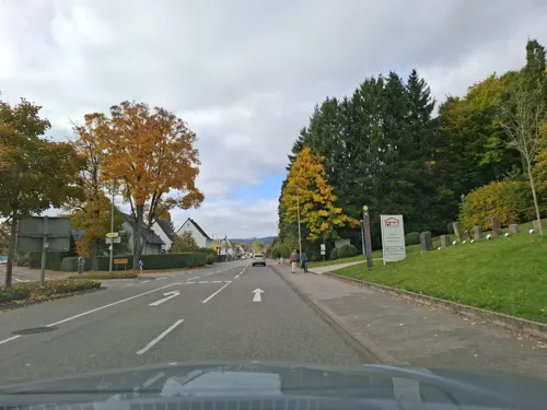
Landesmuseum Birkenfeld
Museum · 7.0 km
Museum; in Formen eines römischen Landhauses, 1910, Architekt Julius Groeschel, München
17 Friedrich-August-Straße, Birkenfeld

Jüdischer Friedhof Birkenfeld
Cemetery · 5.7 km
Denkmalzone Jüdischer Friedhof (südwestlich der Stadt, an der Straße nach Dambach): 34 Grabstellen in situ, ab 1898



Celtic circular wall of Otzenhausen
Monument and historic site · 10.9 km
Ancient Celtic fortification


Altes Stadthaus
Monument and historic site · 7.0 km
Sogenanntes Stadthaus; aufwändiger historistischer Eckbau auf Terrasse, um 1900
9 Hauptstraße, Birkenfeld
Hugo-Zang-Haus
Monument and historic site · 7.0 km
Maler-Hugo-Zang-Haus; neuklassizistisches Wohnhaus, 1883
15 Friedrich-August-Straße, Birkenfeld
Kußlersches Haus
Monument and historic site · 7.0 km
Eckwohnhaus, bezeichnet 1590, teilweise mit Veränderungen des 19. Jahrhunderts; ortsbildprägend
9 Auf dem Römer, Birkenfeld
117 more on the map.
Parks, trails and playgrounds41








29 more on the map.
Restaurants and cafes117
Landgasthof Römerhof
Restaurant · Regional · 6.1 km
T.A.P.P.'s Römerhof Restaurant-Café-Biergarten
1 Römerhof
We-Su 11:00-23:00
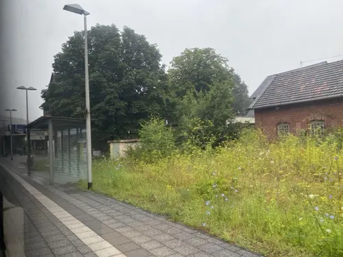
Gleis 4
Restaurant · Fish, Burger · 3.1 km
19 Saarstraße, Hoppstädten-Weiersbach
Mo-Fr 11:00-20:00; Sa-Su 10:00-21:00
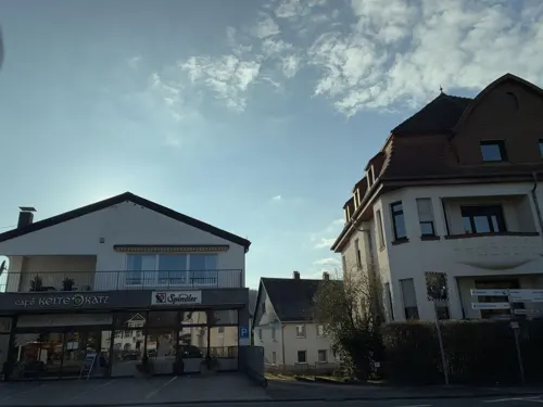

KostBar Am See
Restaurant · Regional · 6.2 km
2 Am Seehafen, Nohfelden
Mo-Sa 10:30-22:00; Su 10:00-21:00
Pizzeria Romantica
Restaurant · Italian · 7.8 km
Mo 17:30-23:00; We-Sa 17:30-23:00; Su,PH 11:30-14:00,17:30-23:00

Café Vazzola
Cafe · Coffee Shop, Regional, Sandwich · 6.9 km
26 Hauptstraße, Birkenfeld
Mo-Sa 09:00-13:30; Su,PH 09:00-17:00
Römerstube da Giovanni
Restaurant · Italian, German · 7.2 km
1 Am Stadion
Mo off; Tu-Sa 17:00-21:00; Su 11:30-14:30,17:00-21:00



105 more on the map.
History
Surface finds from the Celtic and Roman times were discovered or excavated in Bosen, Eisen, Eiweiler, Mosberg-Richweiler, Neunkirchen (Nahe), Nohfelden, Selbach, Sötern, Türkismühle, Walhausen and Wolfersweiler. The Nohfelden castle was first mentioned in 1286 and a Nohfelden magistracy in 1372.
Since the early Middle Ages (around 1200) until July 1879 and in the years 1946/47, when Nohfelden was moved from Rhineland-Palatinate to Saarland, the historical development of the 13 districts has differed. Around 1790, lordship was divided among the following four areas:
The Duchy of Palatine Zweibrücken, which evolved from the County of Veldenz in the 15th century, containing Eckelhausen, Eisen, Mosberg-Richweiler, Nohfelden, (Türkismühle), Walhausen, and Wolfersweiler,
The Imperial Lordship of Eberswald with associated towns of Bosen and Sötern,
The Imperial Lordship of Dagstuhl with the associated village of Eiweiler,
The High Court of Neunkirchen including Gonnesweiler, Neunkirchen, and Selbach.
The French Revolution and the following occupation of the entire left bank of the Rhine in 1794 abolished the four lordships. New administrative divisions were created under French rule. The 13 districts of the municipality Nohfelden belonged to the Saar Department and were assigned to five Mairien (mayoralties):
From the History section of Nohfelden on Wikipedia, under CC BY-SA 4.0.
Where to stay16
Landgasthof Alt Birkenfeld
Motel and hotel · 7.2 km
16 Wasserschiederstraße, Birkenfeld
Churches and places of worship32
Evangelische Pfarrkirche
Church · Protestant · 7.1 km
6 Am Kirchplatz, Birkenfeld
Evangelische Kirche
Church · Lutheran · 6.6 km
Willibrordstraße, Bosen
Queen of the Rosary
Church · Catholic · 6.1 km
80 Hauptstraße, Nohfelden
Shopping26
Fissler Outlet
Hardware store · 3.1 km
12 Harald-Fissler-Straße, Hoppstädten-Weiersbach
Gas and EV charging13
Schools, colleges and libraries18
Neubrücke Elementary School
School · 2.8 km
9900 Zum Kindergarten, Hoppstädten-Weiersbach
Healthcare9
Map of Nohfelden
250 places. The map loads OpenStreetMap tiles when you open it.
Getting there and nearby towns
Ramstein Air Base (RMS) is the nearest airport with scheduled flights listed in OpenStreetMap, 37 km away.
- Tholey 14 km southwest, about 14 min by car
- Wadern 19 km west, about 19 min by car
- Ottweiler 21 km south, about 21 min by car
- Schiffweiler 25 km south, about 25 min by car
- Schmelz 27 km southwest, about 27 min by car
- Spiesen-Elversberg 30 km south, about 30 min by car
- Quierschied 31 km south, about 31 min by car
- Sulzbach 33 km south, about 33 min by car
- Riegelsberg 35 km southwest, about 35 min by car
- Saarbrücken 41 km south, about 41 min by car
Drive times are estimates from straight-line distance, not routes.
Local news
Headlines from INDB.
Reviews, tips and questions
Loading what members have shared...
Sources and licences
- GeoNames (CC BY 4.0): population, coordinates, regions and time zone
- Mapillary (see each image): photos
- OpenStreetMap contributors (ODbL 1.0): places, airports, map data
- Wikidata (CC0 1.0): elevation, founding date, time zone, website, landmarks and historic places
- Wikimedia Commons (see each image): photos
- Wikipedia (CC BY-SA 4.0): overview and history text
Photo credits
- Burg Veldenz Nohfelden, Fjrei, CC BY-SA 3.0
- Nohfelden – Burg Nohfelden- Burg Veldenz - panoramio, giggel, CC BY 3.0
- Nohfelden – Burg Nohfelden- Burg Veldenz - panoramio (1), Edgar El, CC BY 3.0
- Hunsrück Nahe Burg Nohfelden., L.Sieht, CC BY-SA 3.0
- Mauern Burg Nohfelden, L.Sieht, CC BY-SA 3.0
- Blick von der Burg über den Ort Nohfelden, L.Sieht, CC BY-SA 3.0
- Innenhof Burg Nohfelden, L.Sieht, CC BY-SA 3.0
- Fahrstuhl Hunsrück Nahe Burg Nohfelden., L.Sieht, CC BY-SA 3.0
- Ringwall Otzenhausen 01, Cayambe, CC BY-SA 3.0
- Gebäude 9011 des Umwelt-Campus Birkenfeld, Nordseite, Claus Ableiter, CC BY-SA 3.0
- Burg Veldenz 01, MacElch (Rainer Kunze), CC BY-SA 3.0
- Gonnesweiler jüdischer Friedhof, L.Sieht, CC BY-SA 3.0
- Jüdischer Friedhof bei Sötern, Pascal Dihé, CC BY-SA 4.0
- Bosen, Evangelische Kirche (2), Cmcmcm1, CC BY-SA 3.0
- Türkismühle Evangelische Kirche 01, atreyu, CC BY-SA 4.0
- Sötern Evangelische Kirche 04, atreyu, CC BY-SA 4.0
- Nohfelden, Evangelische Kirche (20), Cmcmcm1, CC BY-SA 4.0
- 55765 Denkmalzone Jüdischer Friedhof Birkenfeld, Astloch, CC BY-SA 3.0
- Birkenfeld-nahe-torhaus, Blueduck4711, CC BY-SA 3.0
- 20250504 Burgstall Nohfels 003, Commander-pirx, CC BY-SA 4.0
- 20150524 Blick ins NSG Bostalsee IMG 4685 by sebaso, Sebaso, CC0
- Schutzengelkirche Heimbach (Nahe), FriedrichFrisch, CC BY-SA 4.0
- Blick auf das verschneite Berglangenbach, FriedrichFrisch, CC BY-SA 4.0
- Hirstein, Evangelische Kirche (1), Cmcmcm1, CC BY-SA 3.0
- Walhausen, Evangelische Kirche (01), Cmcmcm1, CC BY-SA 4.0
- Gehweiler (Namborn), St. Michael (2), Cmcmcm1, CC BY-SA 4.0
- Sötern Rosenkranzkönigin 01, atreyu, CC BY-SA 4.0
- Birkenfeld – Ev. Kirche - panoramio, Edgar El, CC BY 3.0
- Hofeld-Schlossberg-20091019-08, Speifensender, CC BY-SA 3.0
- Weiher am Anfang des Naturschutzgebietes, LIBELLI, CC BY-SA 4.0
- Freisen, der Naturwildpark, Alpakas, Dguendel, CC BY 4.0
- Nohfelden, Evangelische Kirche (25), Cmcmcm1, CC BY-SA 4.0
- Bergfried Burg Veldenz-03-Zugang, Muck, CC BY-SA 4.0
- Bergfried Burg Veldenz-01, Muck, CC BY-SA 4.0
- Bergfried Burg Veldenz-05-Dach, Muck, CC BY-SA 4.0
- Bergfried Burg Veldenz-04-Plattform, Muck, CC BY-SA 4.0
- Bergfried Burg Veldenz-06-Aussicht, Muck, CC BY-SA 4.0
- Bergfried Burg Veldenz-02, Muck, CC BY-SA 4.0
- Street-level photo, changchun1, CC BY-SA 4.0
- Street-level photo, troher15, CC BY-SA 4.0
- Street-level photo, masterofnoroad, CC BY-SA 4.0
- Street-level photo, teddy73, CC BY-SA 4.0
- Street-level photo, teddy73, CC BY-SA 4.0
- Street-level photo, VIA_CH, CC BY-SA 4.0
- Street-level photo, teddy73, CC BY-SA 4.0
- Street-level photo, teddy73, CC BY-SA 4.0
- Street-level photo, teddy73, CC BY-SA 4.0
- Street-level photo, teddy73, CC BY-SA 4.0
- Street-level photo, teddy73, CC BY-SA 4.0
- Street-level photo, teddy73, CC BY-SA 4.0
- Street-level photo, chuck, CC BY-SA 4.0
- Street-level photo, teddy73, CC BY-SA 4.0
- Street-level photo, VIA_CH, CC BY-SA 4.0
- Street-level photo, teddy73, CC BY-SA 4.0
- Street-level photo, teddy73, CC BY-SA 4.0
- Street-level photo, VIA_CH, CC BY-SA 4.0
- Street-level photo, teddy73, CC BY-SA 4.0
- Street-level photo, teddy73, CC BY-SA 4.0
- Street-level photo, ramap, CC BY-SA 4.0


Page built November 8, 2026. Spotted a mistake? Tell us or suggest a place.