


Why visit Norderney
Townapedia lists 35 museums and landmarks, 16 parks and trails, 116 places to eat, 74 places to stay and 10 attractions in and around town.
Highlights include Kurtheater, Kap Norderney, bade~museum norderney and Fischerhaus-Museum.
Weather in Norderney
Forecast from MET Norway (CC BY 4.0). Full forecast
About Norderney
Norderney (German pronunciation: [ˌnɔʁdɐˈnaɪ] ; Low German: Nördernee) is one of the seven populated East Frisian Islands off the North Sea coast of Germany.
From the Wikipedia article Norderney (this version), under CC BY-SA 4.0.
Travel tips from other travellers: Norderney on Wikivoyage (CC BY-SA 4.0).
Things to do10




Leuchtturm Norderney
Lighthouse · 4.8 km
Achteckiger Ziegelturm (54 m)
Museums and landmarks35

bade~museum norderney
Museum · 1.1 km
3b Poppe-Folkerts-Weg, Norderney
Tu-Fr 11:00-17:00; Sa,Su 14:00-17:00



Bahnhof Stelldichein
Monument and historic site · 0.9 km
Karl-Rieger-Weg, Norderney

Museumskreuzer Otto Schülke
Museum · 0.8 km
Restaurierter und fahrbereiter Museumskreuzer mit Tochterboot Johann-Fidi, der von Juni 1969 bis April 1997 als Seenotrettungskreuzer...
56 Nordhelmstraße, Norderney




Deutsche Gesellschaft zur Rettung Schiffbrüchiger
Museum · 1.2 km
Ehemalige Rettungsbootsschuppen der Weststation von 1892
5 Am Weststrand, Norderney
23 more on the map.
Parks, trails and playgrounds16



Trampolinanlage am Weststrand
Sports field and stadium · 1.2 km
Mo-Su,PH 11:00-18:00


4 more on the map.
Restaurants and cafes116


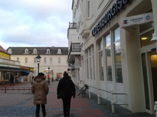

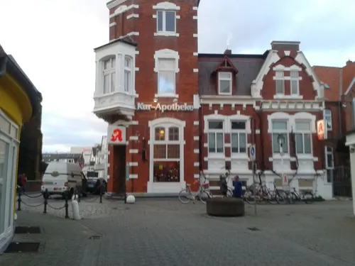
Cafe Denissimo
Restaurant · Mediterranean · 1.0 km
26 Kirchstraße, Norderney
Tu-Su,PH 09:00-21:00; Mo off

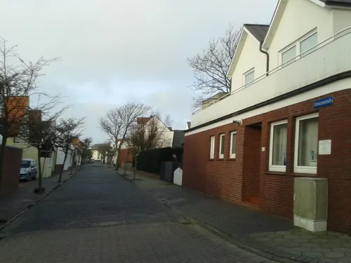
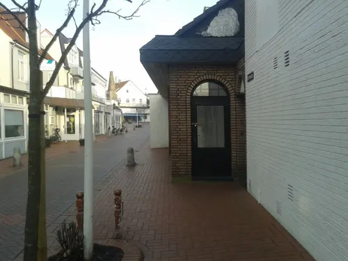
Pasta & Pizza Manufactura
Restaurant · Italian Pizza · 0.8 km
20 Herrenpfad, Norderney
Tu-Su 15:00-22:00
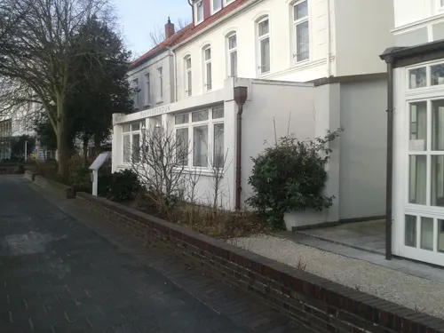


Bambus-Garten
Restaurant · Chinese · 0.7 km
2 Bülowallee, Norderney
Tu-Su 11:30-15:00,17:30-22:30; PH open
104 more on the map.
History
Of the seven East Frisian islands, Norderney is the youngest. The island has existed in its present form only since the middle of the 16th century, being the eastern remnant of the larger island Buise. The original Buise was split into two parts during the Grote Mandrenke flood of 1362, the eastern remnant at first being called Ostrende. What was left of Buise (the western part) shrank in size over the years and finally disappeared into the North Sea during the St. Peter's Flood of 1651. Ostrende, on the other hand, grew in size, and is noted in a 1550 census as "Norder neys Oog" (Northern New Island), and having a church and 18 houses. The inhabitants at this time worked principally as fishermen. In the second half of the 18th century the sea trade industry grew in importance. Next to fishing, tourism became important to the island economy. In 1797, Norderney became the first German resort on the North Sea.
From the History section of Norderney on Wikipedia, under CC BY-SA 4.0.
Where to stay74
Churches and places of worship7
Stella Maris
Church · Roman Catholic · 0.8 km
1a Goebenstraße, Norderney
Shopping25
Gas and EV charging2
Schools, colleges and libraries3
Healthcare7
Map of Norderney
250 places. The map loads OpenStreetMap tiles when you open it.
Getting there and nearby towns
Flugplatz Norderney (NRD) is the nearest airport with scheduled flights listed in OpenStreetMap, 5 km away.
- Norden 13 km south, about 13 min by car
- Pewsum 31 km south, about 31 min by car
- Aurich 34 km southeast, about 34 min by car
- Emden 38 km south, about 38 min by car
- Wittmund 43 km east, about 43 min by car
- Wiesmoor 50 km southeast, about 50 min by car
- Jever 51 km east, about 51 min by car
- Friedeburg 53 km southeast, about 53 min by car
- Schortens 55 km east, about 55 min by car
- Leer 57 km south, about 57 min by car
Drive times are estimates from straight-line distance, not routes.
Local news
Headlines from INDB.
Reviews, tips and questions
Loading what members have shared...
Sources and licences
- GeoNames (CC BY 4.0): population, coordinates, regions and time zone
- Mapillary (see each image): photos
- OpenStreetMap contributors (ODbL 1.0): places, airports, map data
- Wikidata (CC0 1.0): elevation, founding date, time zone, website
- Wikimedia Commons (see each image): photos
- Wikipedia (CC BY-SA 4.0): overview and history text
Photo credits
- Aerial image of Norderney (view from the west), Carsten Steger, CC BY-SA 4.0
- Norderney Cumberland-Denkmal, Elvaube This file was uploaded with Commonist ., CC BY-SA 3.0 de
- Norderney kurtheater 5, Elvaube This file was uploaded with Commonist ., CC BY 3.0
- Norderney ev Kirche02, Unknown author, CC BY-SA 3.0
- Norderney St. Ludgerus Ost, Norderney_St._Ludgerus.JPG : de:Benutzer:Elvaube derivative work: Rabanus Flavus ( talk ), CC BY 3.0
- Norderney Stella Maris, Norderney_stella_maris_2.JPG : de:Benutzer:Elvaube derivative work: Rabanus Flavus ( talk ), CC BY 3.0
- Norderney bademuseum, Elvaube This file was uploaded with Commonist ., CC BY-SA 3.0
- Marienhöhe NOR, Nordenfan, CC BY-SA 4.0
- Kaiser Wilhelm Denkmal NOR, Nordenfan, CC BY-SA 4.0
- Milchbar - panoramio (1), Foto Fitti, CC BY-SA 3.0
- Norderney, Weststrand, Hotel -- 2018 -- 1050, Dietmar Rabich, CC BY-SA 4.0
- Norderney, Bahnhof Stelldichein -- 2018 -- 0957, Dietmar Rabich, CC BY-SA 4.0
- Norderney Kap 2014, Oberlausitzerin64, CC BY-SA 4.0
- Norderney Leuchtturm, Oberlausitzerin64, CC BY-SA 4.0
- Norderney Denkmal01, by Produnis, CC BY-SA 3.0
- Norderney Wasserturm, Oberlausitzerin64, CC BY-SA 4.0
- Norderney DGzRS Rettungsschuppen Seenotrettungsstation, Oberlausitzerin64, CC BY-SA 4.0
- SRKOSchülke-02, Chris Hartmann, CC BY-SA 3.0
- Lt norderney 2007 ArM, Original: elvaube Bearbeitungen: ArtMechanic . ArtMechanic at de.wikipedia, Public domain
- Kurtheater-Norderney-msu-0123, User:Matthias Süßen, CC BY-SA 4.0
- Norderney - St. Ludgerus - Außenansicht, Westerdam, CC BY-SA 4.0
- Norderney, Hafen, Nationalparkhaus -- 2016 -- 5371, Dietmar Rabich, CC BY-SA 4.0
- Norderney, Inselkirche, Lutherdenkmal -- 2025 -- 2729, Dietmar Rabich, CC BY-SA 4.0
- Street-level photo, thomas, CC BY-SA 4.0
- Street-level photo, thomas, CC BY-SA 4.0
- Street-level photo, thomas, CC BY-SA 4.0
- Street-level photo, thomas, CC BY-SA 4.0
- Street-level photo, thomas, CC BY-SA 4.0
- Street-level photo, thomas, CC BY-SA 4.0
- Street-level photo, thomas, CC BY-SA 4.0
- Street-level photo, thomas, CC BY-SA 4.0
- Street-level photo, 5rmft, CC BY-SA 4.0
- Street-level photo, thomas, CC BY-SA 4.0
- Street-level photo, 5rmft, CC BY-SA 4.0
- Street-level photo, thomas, CC BY-SA 4.0
- Street-level photo, thomas, CC BY-SA 4.0
- Street-level photo, thomas, CC BY-SA 4.0
- Street-level photo, thomas, CC BY-SA 4.0
- Street-level photo, thomas, CC BY-SA 4.0


Page built November 9, 2026. Spotted a mistake? Tell us or suggest a place.