


Why visit Cham
Townapedia lists 25 museums and landmarks, 24 parks and trails, 89 places to eat, 8 places to stay and 62 attractions in and around town.
Highlights include Cine-World Cham, Dachsberg, Wasserschloss Loifling and Rundfunkmuseum Cham.
Weather in Cham
Forecast from MET Norway (CC BY 4.0). Full forecast
About Cham
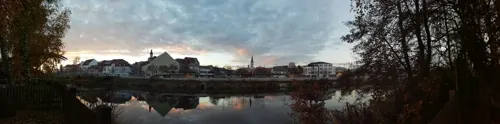
Cham (German pronunciation: [kaːm] ; Czech: Kouba) is the capital of the district of Cham in the Upper Palatinate in Bavaria in Germany.
From the Wikipedia article Cham, Germany (this version), under CC BY-SA 4.0.
Travel tips from other travellers: Cham on Wikivoyage (CC BY-SA 4.0).
Things to do62
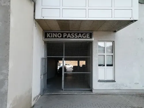



Rotes Höhenvieh aus der Regentalaue - Fuchs
Farm and orchard · 5.7 km
63 Untertraubenbach, Cham
"nach Bestellung"
50 more on the map.
Museums and landmarks25

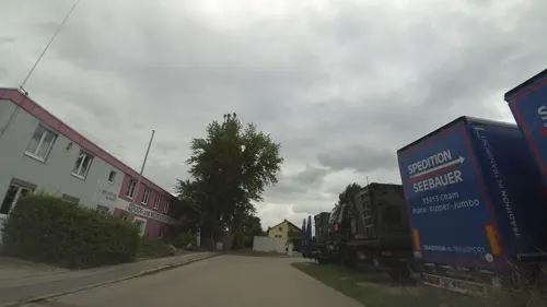

Spur Museum
Museum · 0.9 km
7 Schützenstraße, Cham
We,Sa,Su 14:00-17:00



13 more on the map.
Parks, trails and playgrounds24




12 more on the map.
Restaurants and cafes89

Caorle
Restaurant · Italian · 0.9 km
9 Steinmarkt, Cham
Mo-Su 11:00-14:00,17:30-23:00; Tu off; Sa 17:30-23:00

Hana's Sushi
Restaurant · Sushi · 1.3 km
4 Schmidstraße, Cham
Mo-Sa 11:00-14:30,16:30-21:00; Su,PH 14:00-21:00
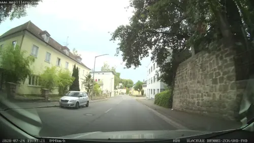
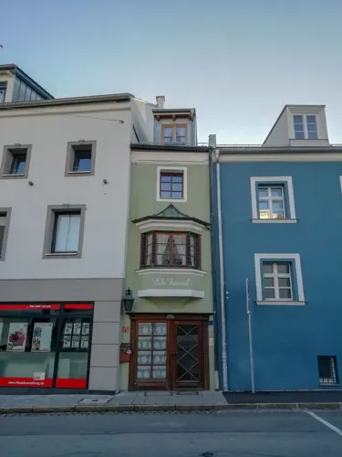
La Esquina
Restaurant · Spanish · 1.3 km
11 Lucknerstraße, Cham
Tu-Su 11:30-14:30, Tu-Sa 16:30-22:30; Mo,PH off
Trattoria al Gallo Nero
Restaurant · Italian · 1.2 km
10 Spitalplatz, Cham
Th-Tu 11:30-14:00,17:30-23:00
Wirtshaus Lamberg
Restaurant · Bavarian · 5.5 km
1 Lamberg, Cham
We-Sa 14:00-22:00; Su, PH 11:00-22:00; Mo, Tu off


.jpg)




Vitaleria
Restaurant · 1.3 km
19 Further Straße, Cham
Mo-Fr 09:00-18:00; Sa 09:00-13:00; Su 09:00-14:00; PH off
77 more on the map.
History
Monks from Regensburg founded the Marienmünster, the first and oldest church in the Bavarian forest, at Chammünster in the 8th century. The first reference to Cham as a city appears in 976. An imperial castle of the Holy Roman Empire stood on the Galgenberg (German: "gallows hill"), providing protection for the trade route into Bohemia. Cham was granted its own currency in around 1000, the Cham Denar. The 12th century saw the town's location shifted to its current place. The Hussite Wars of the 15th century inflicted great hardships on the townspeople. In 1742, the Pandur troops of Franz Freiherr von der Trenck overran and destroyed the city.
Cham's first railway connection came in 1861. On April 18, 1945, a British air raid on the western part of Cham caused 63 deaths. The arrival of numerous German war refugees from Silesia and the Sudetenland swelled Cham's population from 5,860 to over 10,000.
The father of the French resistance fighter Jeannette Guyot, Jean-Marie Guyot, who likewise was a member of the resistance, was arrested in early 1944 and transported to Cham, where he died.
From the History section of Cham, Germany on Wikipedia, under CC BY-SA 4.0.
Where to stay8
Churches and places of worship30
Shopping26
Gas and EV charging15
Schools, colleges and libraries17
Healthcare12
Map of Cham
250 places. The map loads OpenStreetMap tiles when you open it.
Getting there and nearby towns
Flugplatz Straubing-Wallmühle (RBM) is the nearest airport with scheduled flights listed in OpenStreetMap, 37 km away.
- Roding 10 km west, about 10 min by car
- Straubing 39 km south, about 39 min by car
- Regenstauf 40 km west, about 40 min by car
- Maxhütte-Haidhof 41 km west, about 41 min by car
- Neutraubling 42 km southwest, about 42 min by car
- Regen 45 km southeast, about 45 min by car
- Lappersdorf 46 km southwest, about 46 min by car
- Regensburg 47 km southwest, about 47 min by car
- Zwiesel 48 km southeast, about 48 min by car
- Plattling 52 km south, about 52 min by car
Drive times are estimates from straight-line distance, not routes.
Local news
Headlines from INDB.
Reviews, tips and questions
Loading what members have shared...
Sources and licences
- GeoNames (CC BY 4.0): population, coordinates, regions and time zone
- Mapillary (see each image): photos
- OpenStreetMap contributors (ODbL 1.0): places, airports, map data
- Wikidata (CC0 1.0): elevation, founding date, time zone, website
- Wikimedia Commons (see each image): photos
- Wikipedia (CC BY-SA 4.0): overview and history text
Photo credits
- Aerial image of Cham (view from the southeast), Carsten Steger, CC BY-SA 4.0
- Cham - panoramio (8), Hans100, CC BY 3.0
- Cham - panoramio (6), Hans100, CC BY 3.0
- Cham (Oberpfalz), Hotel am Regenbogen, Manfred Schröter, Berga, CC BY-SA 4.0
- Katzberg Cham St. Ägidius Orgel), Regerman, CC BY-SA 4.0
- Sendeturm Luitpoldhoehe Cham18052025 1, Zonk43, CC BY-SA 3.0
- Cham - panoramio (7), Hans100, CC BY 3.0
- Cham - panoramio (11), Hans100, CC BY 3.0
- Cham - das Biertor (The 'Beer Gate' in Cham) - geo.hlipp.de - 3784, Udo und Joan Fugel on geo.hlipp.de, CC BY-SA 2.0
- Cham - panoramio (1), Hans100, CC BY 3.0
- Cham - panoramio (10), Hans100, CC BY 3.0
- Cham - panoramio (9), Hans100, CC BY 3.0
- Robert-Schuman-Gymnasium Cham, Chai003, CC BY-SA 4.0
- Sendeturm Luitpoldhoehe Cham18052025 2, Zonk43, CC BY-SA 3.0
- Luitpoldturm Cham18052025, Zonk43, CC BY-SA 3.0
- Cham - panoramio (4), Hans100, CC BY 3.0
- Cham - panoramio (2), Hans100, CC BY 3.0
- Cham Stadtpfarrkirche St. Jakob - Altar im südlichen Langhaus, Elcom.stadler, CC BY-SA 4.0
- Cham Stadtpfarrkirche St. Jakob - Altar im nördlichen Langhaus, Elcom.stadler, CC BY-SA 4.0
- Joseph-von-Fraunhofer-Gymnasium Cham, Romanist~dewiki, CC BY-SA 4.0
- Waffenbrunn-Schlosskapelle-02, Asurnipal, CC BY-SA 4.0
- Regen-regentalaue-nach-loibling, Mboesch, CC BY-SA 4.0
- Cham Katholische Kirche St. Jakob 1, Schulerst, CC BY-SA 3.0
- Cham-Ev-Erlöserkirche-02, Asurnipal, CC BY-SA 4.0
- Cham - Steinmarkt Nr 9 v S, Flodur63, CC BY-SA 4.0
- Regen-regentalaue-untertraubenbach-kirche, Mboesch, CC BY-SA 4.0
- Cham - Katholische Expositurkirche St. Laurentius - 20220904115434, MarkusFl76, CC BY-SA 4.0
- Waffenbrunn-Kirche-06a, Asurnipal, CC BY-SA 4.0
- Pemfling Kalvarienbergkapelle, Pelot, CC BY-SA 4.0
- PfarrkirchePemfling, Schmid Marco, Thanried - Stamsried, CC BY-SA 3.0 de
- Fluss "Regen" bei Untertraubenbach, Rosa-Maria Rinkl, CC BY-SA 4.0
- Schloss Loifling, Raoul & Carlos, CC BY-SA 4.0
- Regentalaue Poesing, Pedro ximenez, CC BY-SA 3.0
- Hotel Randsbergerhof Skypool, Randsberger, CC BY-SA 4.0
- Biertor in Cham, 3, Rainer Lippert, CC BY-SA 3.0
- Street-level photo, ryhk, CC BY-SA 4.0
- Street-level photo, mapcreator, CC BY-SA 4.0
- Street-level photo, ryhk, CC BY-SA 4.0
- Street-level photo, ryhk, CC BY-SA 4.0
- Street-level photo, ryhk, CC BY-SA 4.0
- Street-level photo, mapcreator, CC BY-SA 4.0
- Street-level photo, ryhk, CC BY-SA 4.0
- Street-level photo, mapcreator, CC BY-SA 4.0
- Street-level photo, mapcreator, CC BY-SA 4.0
- Street-level photo, dirk18, CC BY-SA 4.0
- Street-level photo, foxconn11, CC BY-SA 4.0
- Street-level photo, aceini, CC BY-SA 4.0
- Street-level photo, Jubisser, CC BY-SA 4.0
- Street-level photo, Jubisser, CC BY-SA 4.0
- Street-level photo, mapcreator, CC BY-SA 4.0
- Street-level photo, ryhk, CC BY-SA 4.0
- Street-level photo, renade, CC BY-SA 4.0
- Street-level photo, mapcreator, CC BY-SA 4.0
- Street-level photo, soulcover, CC BY-SA 4.0


Page built November 8, 2026. Spotted a mistake? Tell us or suggest a place.