


Why visit Pirmasens
Townapedia lists 149 museums and landmarks, 23 parks and trails, 144 places to eat, 15 places to stay and 42 attractions in and around town.
Highlights include Walhalla-Kinocenter, Festhalle, Dynamikum and Westwallmuseum.
Weather in Pirmasens
Forecast from MET Norway (CC BY 4.0). Full forecast
About Pirmasens
Pirmasens (German pronunciation: [ˈpɪʁmazɛns] ; Palatine German: Bärmesens (also Bermesens or Bärmasens)) is an independent town in Rhineland-Palatinate, Germany, near the border with France. It was famous for the manufacture of shoes. The surrounding rural district was called Landkreis Pirmasens from 1818 until 1997, when it was renamed to Südwestpfalz.
From the Wikipedia article Pirmasens (this version), under CC BY-SA 4.0.
Travel tips from other travellers: Pirmasens on Wikivoyage (CC BY-SA 4.0).
Photos of Pirmasens


Things to do42
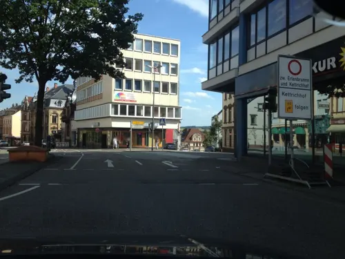



30 more on the map.
Museums and landmarks149

Dynamikum
Museum
8 Fröhnstraße, Pirmasens
Mo-Fr 09:00-18:00; Sa-Su 10:00-18:00; PH 10:00-18:00; Jan 01,Dec...

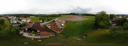
Karl-Sieber-Halle
Museum · 5.0 km
Die Chorgemeinschaft Windsberg ist ein überaus aktiver Verein. Mit dem Gemischten Chor, dem Frauenchor, dem Männerchor und dem Jungen...
5 Römerstraße, Pirmasens
Mo 19:00-23:30; Fr 20:00-24:00; Su 11:00-13:00, 20:00-23:00


Heidelsburg
Monument and historic site · 9.7 km
Former castle in Germany


Ritterstein 209 "Rodalb Ursprung"
Monument and historic site · 6.3 km
Quelle der Rodalb bei Erlenbrunn (Pirmasens). Südwestlich vom Rodalberhof, am Hang im hinteren Talabschnitt.

Ritterstein 223 "Starkenbrunnen"
Monument and historic site · 3.9 km
Nördlich von Pirmasens-Ruhbank zwischen Großem Arius und Sengelsberg. Mit Buntsandsteinen gefasste Quelle mit starker Schüttung.

Ritterstein 298 "Am alten Glastaler Hof"
Monument and historic site · 3.3 km
Östlich Pirmasens, im Glastal, zwischen Glasberg und Kleinem Arius. Hinweis auf den ehemaligen Hof bei Pirmasens, der von 1765 bis 1877 bestand.



137 more on the map.
Parks, trails and playgrounds23

Freizeitbad Plub
Sports field and stadium · 1.4 km
41 Lemberger Straße, Pirmasens
Mo 12:00-22:00; Tu-Sa 09:00-22:00; Su 08:00-20:00; PH 08:00-20:00

Rolandseck
Park · 5.8 km
Picknickplatz und Aussichtspunkt mit Aussicht bis zum Trifels

11 more on the map.
Restaurants and cafes144


Waldhaus Starkenbrunnen
Restaurant · Regional · 3.9 km
Tu 10:30-22:00,We-Su 10:30-20:00; PH 10:30-20:00
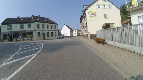
Bold's Hotel Restaurant Zum Grünen Kranz
Restaurant · Regional · 4.8 km
2 Pirmasenser Straße, Rodalben
Mo,We,Fr,Sa,Su 11:00-14:00,17:00+; Tu 17:00+; Th off
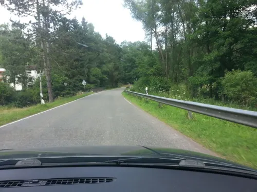
Eichelsbacher Mühle
Restaurant · German · 5.2 km
1 Eichelsbacher Mühle, Pirmasens
Mo 16:00-00:00; Tu-Fr 11:00-00:00; Sa, Su 10:00-00:00
Kuchems Brauhaus
Restaurant · Regional
13-15 Hauptstraße, Pirmasens
Mo-Th 10:30-24:00, Fr-Sa 10:30-01:00, Su 10:00-23:00
Novello
Restaurant · Italian · 1.2 km
56 Arnulfstraße, Pirmasens
We-Fr,Su,PH 11:30-14:30,17:30-23:30; Sa 17:00-23:30; Mo,Tu off

Landgasthaus Ständenhof
Restaurant · German · 6.6 km
An der B10, Münchweiler
Mo-Tu off; We-Su 09:00-22:00
Udo‘s Gasthaus
Restaurant · Cake, Friture, German, Ice Cream, Pizza, Regional, Sausage · 5.7 km
28 Erlenring
We-Sa 11:30+; Su 09:00+
132 more on the map.
History
The first mention of "Pirminiseusna", a colony of Hornbach Abbey, dates from 860. The name derives from St. Pirminius, the founder of the monastery. During the period it was under rule of the Bishopric of Metz. It was passed to the Diocese of Speyer in last the quarter of the 11th century, then captured by the County of Saarbrücken in 1100.
In 1182, the County of Saarbrücken was divided by Simon II and Henry I, who were sons of Simon I. Pirmasens was given to Henry I and his dominion was named as County of Zweibrücken. He built Lemberg Castle to protect his dominion in 1198. During this period Pirmasens was under the formal jurisdiction of the bishop of Metz, but the parish administration of Pirmasens was passed to the monastery of Hornbach after confirmation by John, Bishop of Metz, in 1225.
In 1297, the County of Zweibrücken was divided and Pirmasens was passed to the County of Zweibrücken-Bitsch, Eberhard I's dominion. He traded some localities with Duke Frederick III of Lorraine and took lordship of Bitsch in the same year.
Read more of the history
In 1525, during the German Peasants' War, Pirmasens was looted by peasants from Bitsch. In 1560, Ludowika Margaretha of Zweibrücken-Bitsch, daughter of Count James of Zweibrücken-Bitsch (1510–1570), the last male member of the House of Zweibrücken, was married to Philip V, Count of Hanau-Lichtenberg. In 1570, Count James of Zweibrücken-Bitsch died without male heir and Ludowika Margaretha inherited the County of Bitsch, the Lordship of Ochsenstein and half the Lordship of Lichtenberg (Philip's father had already held the other half). James's older brother, Simon V Wecker, had already died in 1540, also without a male heir. A dispute about the inheritance erupted between the husbands of Ludowika Margaretha and of her cousin Amalie, Philip V of Hanau-Lichtenberg and Philip I of Leiningen-Westerburg, respectively. Formally, the County of Bitsch and the district of Lemberg were fiefs of the Duchy of Lorraine and such fiefs could only be inherited in the male line.
Philip V was initially successful in the dispute with Philip I about Zweibrücken-Bitsch. However, he introduced the Lutheran confession in his newly gained territories in 1572. This upset his powerful Catholic neighbour and liege lord, Duke Charles III of Lorraine. The Duke terminated the fief and in July 1572 Lorraine troops occupied the county. Since Philip V's army was no match for Lorraine, he took his case to the Imperial Chamber Court in Speyer. During the trial, Lorraine argued that, firstly, a significant part of the territory of Zweibrücken-Bitsch had been obtained in an exchange with Lorraine in 1302 and, secondly, the Counts of Leiningen had sold their hereditary claims to Lorraine in 1573. In 1604, Hanau-Lichtenberg and Lorraine decided to settle out of court. In a treaty signed in 1606, it was agreed that Bitsch would revert to Lorraine and Hanau-Lichtenberg would retain Lemberg. This corresponded approximately to the religious realities of the territories. Since then, Pirmasens was part of the Amt Lemberg in the County of Hanau-Lichtenberg.
Before the Thirty Years War, Pirmasens had 59 families and about 235 inhabitants resident, whereas in Lemberg were counted 54 families (about 215 people). When counting it was assumed at that time that a family consisted of four to five people. In 1622, Pirmasens and Lemberg were ravaged by Spaniards and Croatian horsemen of the Imperial troops. The imperial army set fire to the village. Even the church was destroyed in a fire. After the withdrawal of the troops, the Pirmasens inhabitants began to rebuild it. It was again ravaged by imperial troops under Matthias Gallas. They also looted Lemberg Castle, which was burned in 1636. Then the headquarters of the Lutheran parish of Lemberg was moved to Pirmasens. But Pirmasens was heavily damaged in the war. In 1657, only 9 families (about 40 people) lived there. The population then slowly increased through immigration of Reformed Swiss, Catholic Tyrolean as well as Franconian and Württembergian families, so that in 1661, 21 families (about 87 people) were counted in Pirmasens. During the Franco-Dutch War in 1677, the town was burned down again, this time by French troops. During the Nine Years' War, it was sacked by French troops under General de Ezéchiel Mélac, who devastated the Palatinate in 1689. In 1691, only 16 people lived in Pirmasens. At the same time, the part of Lemberg Castle that was still habitable after the Thirty Years' War, was completely destroyed. Thus, the administrative centre of Amt Lemberg was moved to Pirmasens in 1697. This made Pirmasens the most important locality of the region.
In 1736, Johann Reinhard III, the last count of Hanau-Lichtenberg, died without male heir and the duchy passed to his grandson, Landgrave Ludwig IX of Hesse-Darmstadt, the son of Countess Charlotte of Hanau-Lichtenberg, sole heir of the county of Hanau Lichtenberg, and Ludwig VIII, Landgrave of Hesse-Darmstadt.
Landgrave Ludwig IX took residence in his grandfather's hunting lodge in Pirmasens, Schloss Pirmasens, and established a garrison. In 1763, Pirmasens was granted city rights by Ludwig IX, who stayed in his small residence even after taking office in Hesse-Darmstadt after his father's death in 1768. The garrison was continuously expanded, and a town hall, two churches and a large exercise hall were erected. Residence and garrison abruptly ended with the landgrave's death in 1790.
In 1793, Pirmasens was the location of the Battle of Pirmasens between Prussia and the French Corps of the Vosges. The French lost the battle, but their opponents' internal divisions nevertheless enabled them to return and occupy Pirmasens by the end of the year: between 1798 and 1814, the town was included in the French département of Mont-Tonnerre ("Donnersberg-Département" in German). After the French defeat, it was made part of Bavaria together with the Rhenish Palatinate.
From the History section of Pirmasens on Wikipedia, under CC BY-SA 4.0.
More about Pirmasens
Arts and culture
The "Landgrafen-Tage" (days of the landgraves) - every second weekend in April
Open-Air Highlights at the parade-ground (e.g. musicals, opera)
"Schlabbeflicker-Fest", a parade of uniformed musicians - every first weekend in August
Euroclassic festival (Festival of the cities: Pirmasens, Bitche, Zweibrücken, Blieskastel and of the Verbandsgemeinde Zweibrücken-Land)
"Novembermarkt" - last weekend of October or first weekend of November
From the Wikipedia article Pirmasens, under CC BY-SA 4.0.
Notable people from Pirmasens
 Erik DurmGerman footballer (born 1992)Photo: Sven Mandel, CC BY-SA 4.0
 Betty AmannGerman actress (1905-1990)Photo: Hugo Engel Filmges, Public domain
 Safy BoutellaAlgerian musicianPhoto: Dzkouslavia, CC BY-SA 3.0
 Fritz SchäferOlympic medalist in wrestling (1912-1973)Photo: Unknown author Unknown author, Public domain
 Heinrich BürkelGerman artist (1802-1869)Photo: Franz Hanfstaengl, Public domain
 MassivGerman rapperPhoto: Asfand Saeed, CC BY-SA 2.0
 Karl Theodor FahrGerman pathologist (1877–1945)Photo: Unknown author Unknown author, Public domain
- Hugo BallGerman author, poet and one of the leading Dada artists (1886–1927)
- Wolfgang UnzickerGerman chess grandmaster (1925-2006)
- Hermann BreithGerman general (1892-1964)
- Heinrich SchrothGerman actor (1871–1945)
- Marta HoepffnerGerman artist and photographer (1912–2000)
Born in Pirmasens, according to Wikidata (CC0). Each name links to its Wikipedia article.
Where to stay15
Churches and places of worship36
Katholische Kirche St. Josef
Church · Catholic · 3.7 km
14 Forststraße, Pirmasens
Protestantische Friedenskirche Ruhbank
Church · Protestant · 2.9 km
2 Kirchstraße, Pirmasens
Protestantische Friedenskirchengemeinde
Church · Protestant · 3.6 km
9 Forststraße, Pirmasens
Shopping35
Gas and EV charging15
Schools, colleges and libraries25
University of Applied Sciences, Kaiserslautern, Campus Pirmasens
School · 1.1 km
10-16 Carl-Schurz-Straße, Pirmasens
Healthcare15
Tagesklinik für Kinder- und Jugendpsychiatrie
Clinic and pharmacy
1a Klosterstraße, Pirmasens
Map of Pirmasens
250 places. The map loads OpenStreetMap tiles when you open it.
Getting there and nearby towns
Zweibruecken Airport (ZQW) is the nearest airport with scheduled flights listed in OpenStreetMap, 15 km away.
- Rodalben 5 km northeast, about 5 min by car
- Waldfischbach-Burgalben 10 km northeast, about 10 min by car
- Contwig 14 km northwest, about 14 min by car
- Zweibrücken 18 km west, about 18 min by car
- Homburg 24 km northwest, about 24 min by car
- Landstuhl 24 km north, about 24 min by car
- Bruchmühlbach-Miesau 24 km northwest, about 24 min by car
- Blieskastel 26 km west, about 26 min by car
- Annweiler am Trifels 27 km east, about 27 min by car
- Kaiserslautern 29 km northeast, about 29 min by car
Drive times are estimates from straight-line distance, not routes.
Towns near Pirmasens


Keep exploring
Local news
Headlines from INDB.
Reviews, tips and questions
Loading what members have shared...
Sources and licences
- GeoNames (CC BY 4.0): population, coordinates, regions and time zone
- Mapillary (see each image): photos
- OpenStreetMap contributors (ODbL 1.0): places, airports, map data
- Wikidata (CC0 1.0): elevation, founding date, time zone, website, landmarks and historic places
- Wikimedia Commons (see each image): photos
- Wikipedia (CC BY-SA 4.0): overview and history text
Photo credits
- Pirmasens, Altes Rathaus 2, Bearbeitung: Achim Lammerts (Syntaxys) , Original: Juergen Kappenberg (KA PS), CC BY-SA 3.0
- Pirmasens-Ecksteinsau-Stadttorpfeiler-Johanneskirche, Sonnenstar, CC BY-SA 3.0
- Pirmasens-Ecksteinsau-Stadttorpfeiler, Sonnenstar, CC BY-SA 3.0
- Pirmasens, die Hauptstraße, Dguendel, CC BY 4.0
- Pirmasens, die Schloßstraße, Dguendel, CC BY 4.0
- Pirmasens-Bayerische Staatsbank-03-gje, Gerd Eichmann, CC BY-SA 3.0
- Pirmasens-Bayerische Staatsbank-01-gje, Gerd Eichmann, CC BY-SA 3.0
- Pirmasens-Bayerische Staatsbank-02-gje, Gerd Eichmann, CC BY-SA 3.0
- Pirmasens, das Bismarckdenkmal, Dguendel, CC BY 4.0
- Pirmasens, die Kirche St. Pirminius, Dguendel, CC BY 4.0
- Pirmasens, Bankgebäude, Dguendel, CC BY 4.0
- Pirmasens-Caramba-Bar-02-2021-gje, Gerd Eichmann, CC BY-SA 4.0
- Pirmasens-Hauptstr.-Loewenskulptur-01-gje, Gerd Eichmann, CC BY-SA 3.0
- Pirmasens-Hauptstr.-Loewenskulptur-02-gje, Gerd Eichmann, CC BY-SA 3.0
- Pirmasens, Blick zum Alten Rathaus, Dguendel, CC BY 4.0
- Schloßplatz - PIRMASENS - panoramio, geo pixel, CC BY 3.0
- Pirmasens, Stierskulptur, Dguendel, CC BY 4.0
- Pirmasens-Altes Rathaus Schlossplatz-16-gje, Gerd Eichmann, CC BY-SA 3.0
- Pirmasens-Altes Rathaus Schlossplatz-11-gje, Gerd Eichmann, CC BY-SA 3.0
- Pirmasens-Altes Rathaus Schlossplatz-10-gje, Gerd Eichmann, CC BY-SA 3.0
- Pirmasens-Altes Rathaus Schlossplatz-20-gje, Gerd Eichmann, CC BY-SA 3.0
- Pirmasens-Altes Rathaus Schlossplatz-12-gje, Gerd Eichmann, CC BY-SA 3.0
- Pirmasens-Altes Rathaus Schlossplatz-01-gje, Gerd Eichmann, CC BY-SA 3.0
- Pirmasens-Altes Rathaus Schlossplatz-22-gje, Gerd Eichmann, CC BY-SA 3.0
- Pirmasens-Altes Rathaus Schlossplatz-18-gje, Gerd Eichmann, CC BY-SA 3.0
- Pirmasens-Altes Rathaus Schlossplatz-21-gje, Gerd Eichmann, CC BY-SA 3.0
- Pirmasens, Schlosstreppe und Kirche Sankt Pirminius, Dguendel, CC BY 4.0
- Pirmasens, bull sculpture, Dguendel, CC BY 4.0
- Pirmasens, das Nardinihaus, Dguendel, CC BY 4.0
- Pirmasens, der Schlossplatz, Dguendel, CC BY 4.0
- Pirmasens, Blick zur Kirche Sankt Anton, Dguendel, CC BY 4.0
- Pirmasens, Kuchems Brauhaus, Dguendel, CC BY 4.0
- Pirmasens, das Alte Rathaus, Dguendel, CC BY 4.0
- Pirmasens, die Johanneskirche, Dguendel, CC BY 4.0
- Pirmasens-Schuhfabrik Kopp-02-Grenadierhaeuschen-gje, Gerd Eichmann, CC BY-SA 3.0
- Heidelsburg, Gabriele Delhey, CC BY-SA 3.0
- Pirmasens-Niedersimten-Westwall-Museum-08-2019-gje, Gerd Eichmann, CC BY-SA 4.0
- Pirmasens Dynamikum pano, LoKiLeCh, CC BY-SA 3.0
- Johanneskirche Pirmasens front farbig1, Akinom, Public domain
- Vinningen-SWP, Juergen Kappenberg, Pirmasens, Germany, CC BY 2.5
- Pirmasens, Turm Lutherkirche, Juergen Kappenberg, Pirmasens, Germany, CC BY-SA 2.5
- Pirmasens-Niedersimten-Herz-Jesu-Kirche-06-2019-gje, Gerd Eichmann, CC BY-SA 4.0
- Vinningen-Alte Kirche-02-2019-gje, Gerd Eichmann, CC BY-SA 4.0
- Vinningen-St Sebastian-10-2019-gje, Gerd Eichmann, CC BY-SA 4.0
- Rodalben-Josefskirche-02-gje, Gerd Eichmann, CC BY-SA 3.0
- Rodalben-Marienkirche-20-Winter-gje, Gerd Eichmann, CC BY-SA 3.0
- Pirmasens-Festhalle-01-gje, Gerd Eichmann, CC BY-SA 3.0
- 2020 Südwestpfalz 0103 Hilschberghaus ji lmnr1, Steffen 962, CC BY-SA 4.0
- 2020 Südwestpfalz 0226 Felsenwald Waldhaus Starkenbrunnen, Steffen 962, CC BY-SA 4.0
- Pirmasens-Ruhbank-evangelische Friedenskirche-04-gje, Gerd Eichmann, CC BY-SA 4.0
- Pirmasens-Zionskirche-01-gje, Gerd Eichmann, CC BY-SA 3.0
- Ruppertsweiler Evangelische Kirche Bergstraße 4, Alexander Nicolay, CC BY-SA 4.0
- Pirmasens-Erlenbrunn Evangelische Kirche, Palastwache, CC BY-SA 4.0
- Pirmasens-Erlenbrunn Katholische Kirche St. Joseph, Palastwache, CC BY-SA 4.0
- Lemberg 0047, myself, CC BY-SA 3.0
- Ritterstein 209 Rodalb-Ursprung, Pfalz39, CC BY-SA 3.0
- Ritterstein 223 Starkenbrunnen, pfalz39, CC BY-SA 3.0
- Ritterstein 298 Am alten Glastaler Hof, pfalz39, CC BY-SA 3.0
- Waldhaus Drei Buchen5, Tara2, CC BY 3.0
- Ruppertstein 0051, myself, CC BY-SA 3.0
- Pirmasens-Altes Rathaus Schlossplatz-02-gje, Gerd Eichmann, CC BY-SA 3.0
- Rodalben, Felsenwanderweg Nr.1, an der Bärenhöhle, Dguendel, CC BY 4.0
- Street-level photo, teddy73, CC BY-SA 4.0
- Street-level photo, teddy73, CC BY-SA 4.0
- Street-level photo, teddy73, CC BY-SA 4.0
- Street-level photo, mfa, CC BY-SA 4.0
- Street-level photo, mfa, CC BY-SA 4.0
- Street-level photo, teddy73, CC BY-SA 4.0
- Street-level photo, teddy73, CC BY-SA 4.0
- Street-level photo, teddy73, CC BY-SA 4.0
- Street-level photo, zweigelb, CC BY-SA 4.0
- Street-level photo, zors1843, CC BY-SA 4.0
- Street-level photo, teddy73, CC BY-SA 4.0
- Street-level photo, teddy73, CC BY-SA 4.0
- Street-level photo, teddy73, CC BY-SA 4.0
- Street-level photo, teddy73, CC BY-SA 4.0
- Street-level photo, teddy73, CC BY-SA 4.0
- Street-level photo, hahn112, CC BY-SA 4.0
- Street-level photo, teddy73, CC BY-SA 4.0
- Street-level photo, teddy73, CC BY-SA 4.0
- Street-level photo, teddy73, CC BY-SA 4.0
- Street-level photo, teddy73, CC BY-SA 4.0
- Street-level photo, zors1843, CC BY-SA 4.0
- Street-level photo, heetENkoel, CC BY-SA 4.0
- Street-level photo, teddy73, CC BY-SA 4.0


Page built November 9, 2026. Spotted a mistake? Tell us or suggest a place.