


Why visit Raubling
Townapedia lists 49 museums and landmarks, 14 parks and trails, 93 places to eat, 15 places to stay and 21 attractions in and around town.
Highlights include Hofladen Paul, Hubers Hühnernest, Bauernhausmuseum and Urweltmuseum.
Weather in Raubling
Forecast from MET Norway (CC BY 4.0). Full forecast
About Raubling
Raubling (German pronunciation: [ˈʁaʊblɪŋ]) is a municipality in the district of Rosenheim, Bavaria, Germany. It is situated on the western bank of the river Inn, 7 km south of Rosenheim.
From the Wikipedia article Raubling (this version), under CC BY-SA 4.0.
Things to do21

Hofladen Paul
Farm and orchard · 3.1 km
Freiland-Eier, Käse, Teigwaren, Geflügel und Milchprodukte. Im Advent auch Christbäume.
In der Huben, Raubling
Mo-Su 06:00-20:00
Hubers Hühnernest
Farm and orchard · 4.0 km
Selbstbedienung, Frische Bio-Eier aus Freilandhaltung & regional, Eiernudeln, Milch, Joghurt, Käse von Bauernhof-Kooperation,...
31 Am Wasen, Rosenheim
24/7
Hofladen Huberhof
Farm and orchard · 4.0 km
Käse, Fleisch, Wurst, Geräuchertes
25a Mitterfeldweg, Raubling
Brotverkauf Albert-Link-Hütte Schliersee
Farm and orchard · 3.9 km
Brotverkaufsstand der Albert-Link-Hütte Schliersee
Tu 10:00-18:00; Th-Sa 10:00-18:00; Su 09:00-17:00

Freiland Eier vom Mayr
Farm and orchard · 4.0 km
Frische Eier aus Freilandhaltung, Eiernudeln, Suppenhühner, Kartoffeln, Mehl, Marmeladen, Äpfel.
15 Am Wasen, Rosenheim
Freiland Eier
Farm and orchard · 3.4 km
Frische Eier aus Freilandhaltung, Eierlikör, Eiernudeln, Suppenhühner.
2 Esterfeld, Rosenheim
Panger Eierladen
Farm and orchard · 4.0 km
Frische Eier aus Freilandhaltung, Eierlikör, Eiernudeln, Suppenhühner.
1 Dorfstraße, Rosenheim
9 more on the map.
Museums and landmarks49


Inn Maritime Museum
Museum · 2.7 km
4 Marktplatz, Neubeuern
Apr-Sep: Tu-Th 10:00-14:00, Sa 09:00-12:00, Oct-Mar: Tu,Th 10:00-14:00

Alter Pfarrhof
Monument and historic site · 1.3 km
83 Kufsteiner Straße, Raubling

Geotop Mühlsteinbruch Hinterhör
Monument and historic site · 3.7 km
Im ehemaligen Steinbruch sind steilstehende Sandsteine des Helvetikums aufgeschlossen, die im 16. - 19.Jhdt. per Hand als Mühlsteine...
Hinterhörer Straße, Neubeuern


37 more on the map.
Parks, trails and playgrounds14


City Golf Rosenheim
Golf course · 5.2 km
Mehr als 30 Abschlagplätze (7 davon beleuchtet und überdacht) großzügiger Kurzspielbereich 9 LOCH Kurzplatz (Längen zwischen 60 und 140...
1 Moosbachstraße, Rosenheim






2 more on the map.
Restaurants and cafes93

Gasthaus Schwarzlack
Restaurant · Regional · 5.2 km
2 Schwarzlack, Brannenburg
We 17:00-22:00; Th-Su 10:00-22:00; PH 10:00-22:00
Hofwirt
Restaurant · Burger, International, Regional, Steak House · 2.8 km
5 Marktplatz, Neubeuern
Nov-Apr: We-Fr 17:00+; Sa,Su 12:00+; May-Oct: We-Su 12:00+
Berggasthof Kogl
Restaurant · Regional · 5.7 km
20 Sulzbergstraße, Brannenburg
Mo,Th 11:00-17:00; Tu,We,Sa,Su 11:00-21:00; PH 11:00-21:00; 2023...
Berggasthof Schweinsteig
Restaurant · Regional · 5.6 km
30 Sulzbergstraße, Brannenburg
We,Fr,Sa,Su 10:00+; PH 10:00+

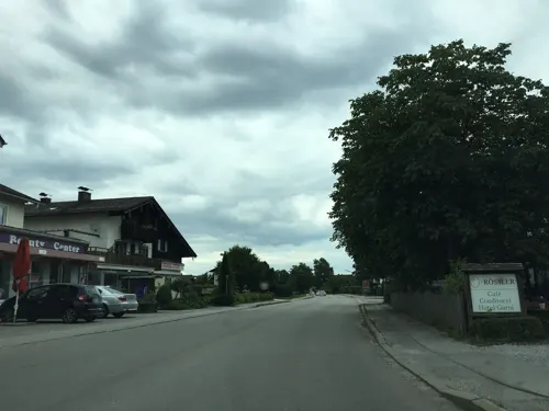
Da Mario
Restaurant · Pizza · 5.9 km
60 Rosenheimer Straße, Brannenburg
Mo off; Tu-Fr,Su 11:30-14:00,17:00-22:00; Sa 17:00-22:00
Dinzler am Hochstraß
Cafe · 2.8 km
Das Romanicum hat sei 31.1.2018 geschlossen.
2 Hochstraß, Raubling
Tu-Fr 08:00-18:00; Sa,Su 08:00-18:00
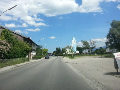
Kirchenwirt Pang
Restaurant · Regional · 4.0 km
25 Panger Straße, Rosenheim
Tu-Th 11:00-23:00, Fr-Su,PH 10:00-23:00; Mo off
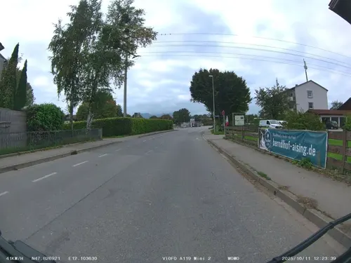
Landgasthof zum Erdinger Weißbräu
Restaurant · German, Bavarian · 4.1 km
101 Aisinger Straße, Rosenheim
Mo-Su 10:00-23:00; We off
Mulligan - City Golf Bistro
Restaurant · International · 5.1 km
1 Moosbachstraße, Rosenheim
Mo-Su 09:00-sunset


Restaurant & Café Christl
Restaurant · Bavarian · 4.1 km
45 Untere Dorfstraße, Rohrdorf
Mo-Th 11:00-22:00; Fr-Sa 16:00-22:00; Su 10:00-22:00
81 more on the map.
Where to stay15
Churches and places of worship36
St. Michael
Church · Roman Catholic · 5.5 km
29 Aiblinger Straße, Bad Feilnbach
Dreifaltigkeitskirche
Church · Roman Catholic · 3.2 km
11 Am Bürgl, Neubeuern
Mariä Himmelfahrt
Church · Roman Catholic · 4.0 km
1 Grünthalweg, Rosenheim
Mariä Unbefleckte Empfängnis
Church · Roman Catholic · 2.8 km
14 Marktplatz, Neubeuern
St. Georg
Church · Roman Catholic · 3.7 km
4 Tegernseer Straße, Raubling
St. Johann Baptist - Heilig Kreuz
Church · Roman Catholic · 4.3 km
70 Am Wasen, Rosenheim
St. Johannes Baptist
Church · Roman Catholic · 4.3 km
9 Litzldorfer Straße, Raubling
St. Martin
Church · Roman Catholic · 4.5 km
16 Inntalstraße, Rosenheim
Shopping28
Gas and EV charging16
Schools, colleges and libraries32
Healthcare10
Panorama Gesundheitszentrum
Clinic and pharmacy · 5.6 km
98 Happinger Straße, Rosenheim
Map of Raubling
250 places. The map loads OpenStreetMap tiles when you open it.
Getting there and nearby towns
Munich International Airport (MUC) is the nearest airport with scheduled flights listed in OpenStreetMap, 67 km away.
- Rosenheim 7 km north, about 7 min by car
- Wasserburg am Inn 30 km north, about 30 min by car
- Traunreut 41 km northeast, about 41 min by car
- Traunstein 41 km east, about 41 min by car
- Vaterstetten 43 km northwest, about 43 min by car
- Taufkirchen 47 km northwest, about 47 min by car
- Unterhaching 48 km northwest, about 48 min by car
- Waldkraiburg 51 km northeast, about 51 min by car
- Wolfratshausen 53 km west, about 53 min by car
- Munich 55 km northwest, about 55 min by car
Drive times are estimates from straight-line distance, not routes.
Local news
Headlines from INDB.
Reviews, tips and questions
Loading what members have shared...
Sources and licences
- GeoNames (CC BY 4.0): population, coordinates, regions and time zone
- Mapillary (see each image): photos
- OpenStreetMap contributors (ODbL 1.0): places, airports, map data
- Wikidata (CC0 1.0): elevation, founding date, time zone, website, landmarks and historic places
- Wikimedia Commons (see each image): photos
- Wikipedia (CC BY-SA 4.0): overview and history text
Photo credits
- Nicklheimer Str. Kapelle Raubling-3, Rufus46, CC BY-SA 3.0
- Raubling, Bahnunterführung Bahnhofstr, 1, Renardo la vulpo, CC0
- Raubling, Rathaus v NO, 1, Renardo la vulpo, CC BY-SA 4.0
- Raubling, Rathaus v N, Seiteneingang, 1, Renardo la vulpo, CC BY-SA 4.0
- Raubling, Rathaus v O, 1, Renardo la vulpo, CC BY-SA 4.0
- Raubling, Bahnhofstr 29, 1, Renardo la vulpo, CC0
- Raubling, Bahnhof v SO, 1, Renardo la vulpo, CC0
- Raubling, Bahnhof v SW, 1, Renardo la vulpo, CC0
- Kapelle an der Nicklheimer Straße (Raubling), Ricardalovesmonuments, CC BY-SA 4.0
- Raubling, Rosenheimer Straße 31 a-g (3), JoeGue, CC BY-SA 4.0
- Raubling, Rosenheimer Straße 31 a-g (1), JoeGue, CC BY-SA 4.0
- Raubling, Auf dem Bichl 3 a-g, JoeGue, CC BY-SA 4.0
- Raubling, Rosenheimer Straße 31 a-g (2), JoeGue, CC BY-SA 4.0
- Kirchbach, Brücke bei Raubling, 3, Renardo la vulpo, CC0
- 1 Walfahrtskirche in Westerndorf-Rosenheim, W. Bulach, CC BY-SA 4.0
- Schloss Neubeuern 01a, Helmlechner, CC BY-SA 3.0
- Bad Feilnbach Litzldorf-3, Rufus46, CC BY-SA 3.0
- Gymnasium Raubling-5, Rufus46, CC BY-SA 3.0
- Brannenburg Schloss-1, Rufus46, CC BY-SA 3.0
- St. Georg Grossholzhausen Raubling-1, Rufus46, CC BY-SA 3.0
- Ehem. Pfarrhof Kirchdorf Raubling-1, Rufus46, CC BY-SA 3.0
- St. Johannes Baptist Kleinholzhausen Raubling-2, Rufus46, CC BY-SA 3.0
- Kirche Altenbeuern-1, Rufus46, CC BY-SA 3.0
- Kirche Mariae Empfängnis Neubeuern-1, Rufus46, CC BY-SA 3.0
- St. Martin Happing Rosenheim-2, Rufus46, CC BY-SA 3.0
- Happinger Straße 85 Kaltenmuehle Aising Rosenheim-3, Rufus46, CC BY-SA 3.0
- Mariae Himmelfahrt Pang Rosenheim-1, Rufus46, CC BY-SA 3.0
- Rohrdorf KathPfarrkirche HlJakob, Leitzsche, CC0
- Aerial image of the SAC Moore um Raubling (view from the southeast), Carsten Steger, CC BY-SA 4.0
- Hl. Familie Thansau Rohrdorf-1, Rufus46, CC BY-SA 3.0
- Versoehnungskirche Severinstr. Rosenheim-4, Rufus46, CC BY-SA 3.0
- Untere Dorfstr. 16 Rohrdorf-1, Rufus46, CC BY-SA 3.0
- Stolperstein für Erich Spiegelberg (Pinswang), BariumFiasko, CC BY 4.0
- Stolperstein für Heinz Kerb (Pinswang), BariumFiasko, CC BY 4.0
- NSG Kalten Kolbermoor-1, Rufus46, CC BY-SA 3.0
- Westerndorf, Gerhard Piezinger, CC BY-SA 3.0
- Schloss Brannenburg 5, Aisano, CC BY-SA 4.0
- St. Johannes Baptist Kleinholzhausen Raubling-2 (bearb Sp), Rufus46, CC BY-SA 3.0
- Neubeuern, Marienkirche, 6, Renardo la vulpo, CC BY-SA 4.0
- Mariae Himmelfahrt Pang Rosenheim-5, Rufus46, CC BY-SA 4.0
- Street-level photo, omba, CC BY-SA 4.0
- Street-level photo, wegavision, CC BY-SA 4.0
- Street-level photo, soulcover, CC BY-SA 4.0
- Street-level photo, maleo, CC BY-SA 4.0
- Street-level photo, springer55, CC BY-SA 4.0
- Street-level photo, chuck, CC BY-SA 4.0
- Street-level photo, xlayer, CC BY-SA 4.0
- Street-level photo, maleo, CC BY-SA 4.0
- Street-level photo, springer55, CC BY-SA 4.0
- Street-level photo, chiedeguchi, CC BY-SA 4.0
- Street-level photo, chuck, CC BY-SA 4.0
- Street-level photo, chiedeguchi, CC BY-SA 4.0
- Street-level photo, xlayer, CC BY-SA 4.0
- Street-level photo, chuck, CC BY-SA 4.0
- Street-level photo, omba, CC BY-SA 4.0
- Street-level photo, omba, CC BY-SA 4.0
- Street-level photo, stefanro74, CC BY-SA 4.0
- Street-level photo, soulcover, CC BY-SA 4.0
- Street-level photo, stefanro74, CC BY-SA 4.0
- Street-level photo, stefanro74, CC BY-SA 4.0


Page built November 8, 2026. Spotted a mistake? Tell us or suggest a place.