


Schmallenberg, Germany
Schmallenberg is a town of 26,132 people in North Rhine-Westphalia, Germany.
Why visit Schmallenberg
Townapedia lists 177 museums and landmarks, 45 parks and trails, 82 places to eat, 43 places to stay and 118 attractions in and around town.
Highlights include Wisent-Wildnis am Rothaarsteig, Skiliftkarussell Winterberg, Burg Fredeburg and Modellbahn am Rothaarsteig.
Weather in Schmallenberg
Forecast from MET Norway (CC BY 4.0). Full forecast
About Schmallenberg
Schmallenberg (German pronunciation: [ˈʃmalənbɛʁk] ; Westphalian: Smalmereg) is a town and a climatic health resort in the High Sauerland District, Germany. By area, it is the third biggest of all cities and towns of the state of North Rhine-Westphalia and the second biggest of the region of Westphalia.
From the Wikipedia article Schmallenberg (this version), under CC BY-SA 4.0.
Travel tips from other travellers: Schmallenberg on Wikivoyage (CC BY-SA 4.0).
Things to do118

Wisent-Wildnis am Rothaarsteig
Zoo and aquarium · 7.6 km
100 Weidiger Weg, Bad Berleburg
Fr-Su 11:00-16:00

Skiliftkarussell Winterberg
Ski area · 16.5 km
Ski resort in North Rhine-Westphalia, Germany



106 more on the map.
Museums and landmarks177

Burg Fredeburg
Monument and historic site · 4.3 km
Burgrest (Mauerrest)
4 Auf der Burg, Schmallenberg
24/7
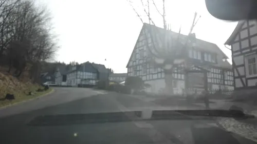
Modellbahn am Rothaarsteig
Monument and historic site · 3.1 km
4a Am Stünzel, Schmallenberg
Su 13:00-16:00
Bahnstrecke Altenhundem–Wenholthausen
Monument and historic site · 7.7 km
Ehemalige Bahntrasse

Kunsthaus alte Mühle
Museum · 1.0 km
4 Unter der Stadtmauer, Schmallenberg

Frühmittelalterliche Wallburg Wilzenberg
Monument and historic site · 3.2 km

165 more on the map.
Parks, trails and playgrounds45




33 more on the map.
Restaurants and cafes82

Fuji Restaurant
Restaurant · Asian
2 Oststraße, Schmallenberg
Tu-Fr 11:00-15:00, 17:00-22:00; Sa-Su 12:00-15:00, 17:00-22:00
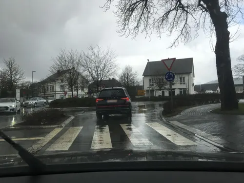

Landcafé Birkenhof
Cafe · Regional · 4.3 km
19 Heustraße, Schmallenberg
Fr 14:00-17:00; Sa 14:30-18:30
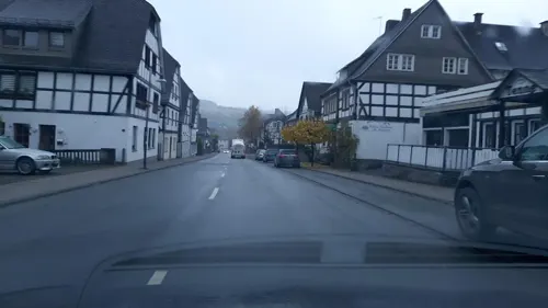
Pizza Treff Burger Haus 3
Restaurant · Pizza · 4.2 km
23 Im Ohle, Schmallenberg
Mo 11:00-21:00; Tu off; We-Fr 11:00-21:00; Sa-Su 12:00-21:00
Wüllner's Landgasthof
Restaurant · Regional · 8.8 km
13 Hennetalstraße, Schmallenberg
We-Mo 12:00-14:00,17:30-20:30; Tu off

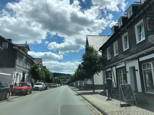
Café Zeit am Wasserrad
Cafe · 1.3 km
1 Unterm Huckelberg, Schmallenberg
Th-Su 13:00-18:00, PH 13:00-18:00


Hotel Rameil - Flurschütz
Restaurant · 9.2 km
11 Auf der Jenseite, Lennestadt
12:00-14:00; 17:30-22:00; We off; Su 12:00-14:00
70 more on the map.
History
In 1072, a Benedictine monastery of Grafschaft was founded near the Wilzenberg mountain by St. Anno II, Archbishop of Cologne.
The oldest available documents speaking of a “town of Schmallenberg” are the archbishop's and the town council's deeds from 1243. There were several causes which let the place of “Smalenburg” (old German, “narrow castle”) receive town rights.
Before Schmallenberg received town rights, there had been a castle of Schmallenberg which must have been destroyed around 1240. It was owned by the Archbishop of Cologne Conrad of Hochstadt and the Grafschaft Abbey. The Knight Johann Kolve had the order to protect this castle. At this time, there already must have been some kind of settlement around. The archbishop did not consider the destroyed castle as useful any more. Furthermore, the local settlement was unprotected and in a risky situation because of the castle. That is why the archbishop and the Grafschaft Abbey wanted to fortify the place, leaving the old castle outside the town wall.
From the History section of Schmallenberg on Wikipedia, under CC BY-SA 4.0.
Where to stay43
Churches and places of worship60
Pfarrkirche St. Peter und Paul
Church · Roman Catholic · 2.4 km
2 Alt Wormbach, Schmallenberg
Kapelle Heilige Drei Könige
Church · Roman Catholic · 8.9 km
2b Oberlandenbeck, Eslohe (Sauerland)
St. Alexander
Church · Roman Catholic · 0.8 km
7 Alter Kirchplatz, Schmallenberg
St. Hubertus
Church · Catholic · 8.1 km
1 An der Kirche, Schmallenberg
St. Vinzentius
Church · Catholic · 5.1 km
6 Uentropstraße, Schmallenberg
Herz-Jesu-Kirche
Church · Catholic · 2.3 km
4 Zur Dorfmitte, Schmallenberg
Mariä Heimsuchung
Church · Roman Catholic · 9.3 km
2 Niederlandenbeck, Eslohe (Sauerland)
Shopping26
Gas and EV charging5
Schools, colleges and libraries9
Healthcare5
Map of Schmallenberg
250 places. The map loads OpenStreetMap tiles when you open it.
Getting there and nearby towns
Siegerlandflughafen (SGE) is the nearest airport with scheduled flights listed in OpenStreetMap, 52 km away.
- Winterberg 18 km east, about 18 min by car
- Warstein 33 km north, about 33 min by car
- Biedenkopf 32 km southeast, about 32 min by car
- Siegen 36 km southwest, about 36 min by car
- Frankenberg 38 km east, about 38 min by car
- Werdohl 38 km west, about 38 min by car
- Wilnsdorf 40 km south, about 40 min by car
- Korbach 43 km east, about 43 min by car
- Dillenburg 46 km south, about 46 min by car
- Soest 48 km north, about 48 min by car
Drive times are estimates from straight-line distance, not routes.
Local news
Headlines from INDB.
Reviews, tips and questions
Loading what members have shared...
Sources and licences
- GeoNames (CC BY 4.0): population, coordinates, regions and time zone
- Mapillary (see each image): photos
- OpenStreetMap contributors (ODbL 1.0): places, airports, map data
- Wikidata (CC0 1.0): elevation, founding date, time zone, website, landmarks and historic places
- Wikimedia Commons (see each image): photos
- Wikipedia (CC BY-SA 4.0): overview and history text
Photo credits
- Schmallenberg, stadhuis foto2 2010-08-12 11.51, Michielverbeek, CC BY-SA 3.0
- Schmallenberg St. Alexander Sauerland-Ost 022, Michael Kramer, CC BY-SA 3.0
- Linie R 69, 1, Schmallenberg, Hochsauerlandkreis, GeorgDerReisende, CC BY-SA 4.0
- De Schmallmersken Breybälge, 3, Schmallenberg, Hochsauerlandkreis, GeorgDerReisende, CC BY-SA 4.0
- Bushaltestelle Habbel, 1, Schmallenberg, Hochsauerlandkreis, GeorgDerReisende, CC BY-SA 4.0
- Obringhauser Straße, 1, Schmallenberg, Hochsauerlandkreis, GeorgDerReisende, CC BY-SA 4.0
- Linie 463, 1, Schmallenberg, Hochsauerlandkreis, GeorgDerReisende, CC BY-SA 4.0
- Bushaltestelle Habbel, 2, Schmallenberg, Hochsauerlandkreis, GeorgDerReisende, CC BY-SA 4.0
- Linie 467, 1, Schmallenberg, Hochsauerlandkreis, GeorgDerReisende, CC BY-SA 4.0
- Bücherschrank, 1, Schmallenberg, Hochsauerlandkreis, GeorgDerReisende, CC BY-SA 4.0
- Bushaltestelle Schützenplatz, 2, Schmallenberg, Hochsauerlandkreis, GeorgDerReisende, CC BY-SA 4.0
- Feuerwehr, 1, Schmallenberg, Hochsauerlandkreis, GeorgDerReisende, CC BY-SA 4.0
- Bushaltestelle Schützenplatz, 1, Schmallenberg, Hochsauerlandkreis, GeorgDerReisende, CC BY-SA 4.0
- Schmallenberg von oben, Mich.kramer, CC BY-SA 3.0
- Schmallenberg Sauerland-Ost 021, Michael Kramer, CC BY-SA 3.0
- Paul-Falke-Platz, 1, Schmallenberg, Hochsauerlandkreis, GeorgDerReisende, CC BY-SA 4.0
- De Schmallmersken Breybälge, 2, Schmallenberg, Hochsauerlandkreis, GeorgDerReisende, CC BY-SA 4.0
- Gehäkeltes Tipi Auf Dem Schützenplatz Schmallenberg, Thomas Vogt, CC BY-SA 3.0
- Oststraße 18, 1, Schmallenberg, Hochsauerlandkreis, GeorgDerReisende, CC BY-SA 4.0
- Stolperstein Alfred Funke, 1, Oststraße 18, Schmallenberg, Hochsauerlandkreis, GeorgDerReisende, CC BY-SA 4.0
- Mahnmal, 1, Schmallenberg, Hochsauerlandkreis, GeorgDerReisende, CC BY-SA 4.0
- Aerial image of the Schmallenberg-Rennefeld airfield, Carsten Steger, CC BY-SA 4.0
- Weststraße 30, 1, Schmallenberg, Hochsauerlandkreis, GeorgDerReisende, CC BY-SA 4.0
- Synagogenstraße, 1, Schmallenberg, Hochsauerlandkreis, GeorgDerReisende, CC BY-SA 4.0
- Oberer Hagen, 2, Schmallenberg, Hochsauerlandkreis, GeorgDerReisende, CC BY-SA 4.0
- Oststraße 22, 1, Schmallenberg, Hochsauerlandkreis, GeorgDerReisende, CC BY-SA 4.0
- Oststraße, 1, Schmallenberg, Hochsauerlandkreis, GeorgDerReisende, CC BY-SA 4.0
- Stolperstein Betty Gonsenhäuser, 1, Weststraße 30, Schmallenberg, Hochsauerlandkreis, GeorgDerReisende, CC BY-SA 4.0
- Stolperstein Samuel Paul Albert Herz, 1, Weststraße 30, Schmallenberg, Hochsauerlandkreis, GeorgDerReisende, CC BY-SA 4.0
- Stolperstein Ursula Emma Hermine Herz, 1, Weststraße 30, Schmallenberg, Hochsauerlandkreis, GeorgDerReisende, CC BY-SA 4.0
- Stolperstein Edith Gonsenhäuser, 1, Weststraße 30, Schmallenberg, Hochsauerlandkreis, GeorgDerReisende, CC BY-SA 4.0
- Stolperstein Otto Herz, 1, Weststraße 30, Schmallenberg, Hochsauerlandkreis, GeorgDerReisende, CC BY-SA 4.0
- Stolperstein Hannelore Gonsenhäuser, 1, Weststraße 30, Schmallenberg, Hochsauerlandkreis, GeorgDerReisende, CC BY-SA 4.0
- Stolperstein Renate Jenny Regine Herz, 1, Weststraße 30, Schmallenberg, Hochsauerlandkreis, GeorgDerReisende, CC BY-SA 4.0
- Stolperstein Max Gonsenhäuser, 1, Weststraße 30, Schmallenberg, Hochsauerlandkreis, GeorgDerReisende, CC BY-SA 4.0
- Stolperstein Helmut Herz, 1, Weststraße 30, Schmallenberg, Hochsauerlandkreis, GeorgDerReisende, CC BY-SA 4.0
- Stolperstein Paula Herz, 1, Weststraße 30, Schmallenberg, Hochsauerlandkreis, GeorgDerReisende, CC BY-SA 4.0
- Linie SB 9, 1, Schmallenberg, Hochsauerlandkreis, GeorgDerReisende, CC BY-SA 4.0
- Skiliftkarussell Winterberg, Nichter85, CC0
- Kloster Grafschaft 2011, Stefan Didam - Schmallenberg, CC BY-SA 3.0
- Schmallenberg Beerenberg Sauerland Ost 022 pk, Teta, CC BY-SA 3.0
- Kirche Berghausen, -- Wolfgang Poguntke 14:38, 10. Okt. 2007 (CEST), CC BY-SA 2.0 de
- Wilzenberg 2012, Jörg Braukmann, CC BY-SA 3.0
- Kirche Wormbach, Wolfgang Poguntke at German Wikipedia, CC BY-SA 2.0 de
- Kirche St. Hubertus, Schmallenberg-Dorlar, Stefan Didam - Schmallenberg, CC BY-SA 3.0
- Kapelle Oberlandenbeck, Stefan Didam - Schmallenberg, CC BY-SA 3.0
- St.-Gertrud-Kirche(Oberkirchen), Rmbonn, CC BY-SA 3.0
- Kirche Lenne-2, No machine-readable author provided. Wolfgang Poguntke assumed (based on copyright claims)., CC BY-SA 3.0
- Fachkrankenhaus Kloster Grafschaft, Stefan Didam - Schmallenberg, CC BY 3.0
- Niederlandenbeck Kirche, Stefan Didam - Schmallenberg, CC BY-SA 3.0
- Herz Jesu Schmallenberg, Teta; cropped & recoloured by Rabanus Flavus, CC BY-SA 3.0
- Saalhauser Berge, J. Braukmann Milseburg, CC BY-SA 3.0
- Gleidorf, kapel 2010-08-12 11.14, Michielverbeek, CC BY-SA 3.0
- Schmallenberg - Evangelische Christuskirche, Felix Löwe, CC BY-SA 4.0
- Fredeb.fd, Friedhelm Dröge, CC BY-SA 4.0
- Wilzenberg from above, El Grafo, CC BY-SA 3.0
- NSG Sommerseite 8, Martin lindner, CC BY-SA 4.0
- Naturschutzgebiet Feuchtgrünland am Hengsbecker Bach 3, Martin Lindner, CC BY-SA 4.0
- Hohlweg Hengstberg, KlausDa, CC BY-SA 4.0
- Albrechtsberg von B480, Mollseifer, CC BY 4.0
- Härdler von Norden, Jörg Braukmann, CC BY-SA 4.0
- Street-level photo, heetENkoel, CC BY-SA 4.0
- Street-level photo, flugyflay, CC BY-SA 4.0
- Street-level photo, Lowiekse, CC BY-SA 4.0
- Street-level photo, flugyflay, CC BY-SA 4.0
- Street-level photo, heetENkoel, CC BY-SA 4.0
- Street-level photo, chuck, CC BY-SA 4.0
- Street-level photo, chuck, CC BY-SA 4.0
- Street-level photo, chuck, CC BY-SA 4.0
- Street-level photo, flugyflay, CC BY-SA 4.0
- Street-level photo, flugyflay, CC BY-SA 4.0
- Street-level photo, chuck, CC BY-SA 4.0
- Street-level photo, Lowiekse, CC BY-SA 4.0


Page built November 8, 2026. Spotted a mistake? Tell us or suggest a place.