


Why visit Werdohl
Townapedia lists 36 museums and landmarks, 18 parks and trails, 47 places to eat, 4 places to stay and 43 attractions in and around town.
Highlights include Biesenberg, Ennest, Schloss Brüninghausen and Ahehammer.
Weather in Werdohl
Forecast from MET Norway (CC BY 4.0). Full forecast
About Werdohl
Werdohl (German pronunciation: [vɛʁˈdoːl] ) is a town in the district Märkischer Kreis, in North Rhine-Westphalia, Germany.
From the Wikipedia article Werdohl (this version), under CC BY-SA 4.0.
Things to do43



31 more on the map.
Museums and landmarks36

Schloss Brüninghausen
Monument and historic site · 4.2 km
1 Brüninghausen, Plettenberg






24 more on the map.
Parks, trails and playgrounds18



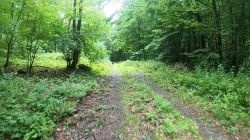

Reitanlage RFZV Neuenrade-Küntrop
Sports field and stadium · 5.0 km
30 Gevener Weg, Neuenrade
RFZV Neuenrade-Küntrop
Sports field and stadium · 4.9 km
30 Gevener Weg, Neuenrade


6 more on the map.
Restaurants and cafes47
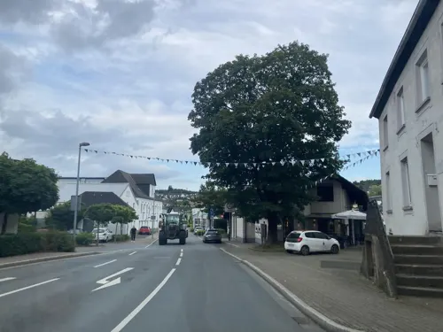
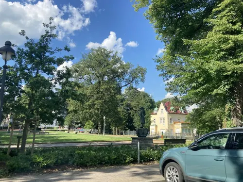
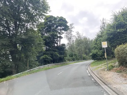
Tiroler Stub'n
Restaurant · Austrian · 3.6 km
4 Kohlberg, Neuenrade
We-Mo 12:00-23:00

Dorfkrug - Thuns
Restaurant · Fine Dining · 2.6 km
7 Brauck, Werdohl
Tu-Sa 18:00-23:00
Jade
Restaurant · Chinese
2 Freiheitstraße, Werdohl
Tu-Sa 12:00-15:00, 17:00-22:00; Su,PH 12:00-22:00
La Rosa
Restaurant · Pizza, Pasta, Salad
11 Bahnhofstraße, Werdohl
Mo-Fr,Su 11:00-14:00, Mo-Sa,PH 17:30-22:00; Tu off; 2019 Aug...
Trattoria Da Gianni
Restaurant · 2.8 km
3 Rentrop, Werdohl
Mo,Th-Su 17:00-22:00

Alt Werdohl
Bar and pub · 0.6 km
56 Freiheitstraße, Werdohl
We-Sa 18:00+; Su,Mo,Tu off


Bäckerei Zihn
Bakery · 4.6 km
25 Hauptstraße, Altena
Mo 08:00-12:30, 14:30-18:00; Tu, Th, Fr 05:00-12:30,14:30-18:00;...
35 more on the map.
History
The first document which mentions Werdohl dates to the year 1101. Bishop Heinrich II. from Paderborn mentions the church of Werdohl, which was donated by count Erpo of Padberg to the monastery Boke/Flechtdorf. In 1220 the Priorat Berentrop took over the ownership, which in 1300 was bought by count Everhard II. of the Mark.
Werdohl was long administered in the Amt Neuenrade, however at the end of the 19th century the population of Werdohl was higher than those of the other municipalities in the Amt together. On June 1, 1891 Werdohl left the Amt and became self-administered, after it failed to get the seat of the Amt administration to be moved to Werdohl. On April 19, 1936 the municipality received city rights.
From the History section of Werdohl on Wikipedia, under CC BY-SA 4.0.
Where to stay4
Churches and places of worship12
Shopping14
Gas and EV charging5
Schools, colleges and libraries10
Healthcare7
Map of Werdohl
196 places. The map loads OpenStreetMap tiles when you open it.
Getting there and nearby towns
Dortmund Airport (DTM) is the nearest airport with scheduled flights listed in OpenStreetMap, 30 km away.
- Hagen 23 km northwest, about 23 min by car
- Wickede 27 km north, about 27 min by car
- Wetter 30 km northwest, about 30 min by car
- Wipperfürth 30 km southwest, about 30 min by car
- Wickede 32 km north, about 32 min by car
- Werl 34 km north, about 34 min by car
- Dortmund 35 km northwest, about 35 min by car
- Witten 35 km northwest, about 35 min by car
- Remscheid 41 km west, about 41 min by car
- Wuppertal 43 km west, about 43 min by car
Drive times are estimates from straight-line distance, not routes.
Local news
Headlines from INDB.
Reviews, tips and questions
Loading what members have shared...
Sources and licences
- GeoNames (CC BY 4.0): population, coordinates, regions and time zone
- Mapillary (see each image): photos
- OpenStreetMap contributors (ODbL 1.0): places, airports, map data
- Wikidata (CC0 1.0): elevation, founding date, time zone, website
- Wikimedia Commons (see each image): photos
- Wikipedia (CC BY-SA 4.0): overview and history text
Photo credits
- Werdohl-Kleinhammer FFSN-5690, Michael Kramer, CC BY-SA 3.0
- Werdohl Neustadtstraße 34 W, Arnoldius, CC BY-SA 3.0
- Werdohl Schulstraße 1 Gitter 01, Arnoldius, CC BY-SA 3.0
- Werdohl Schulstraße 1, Arnoldius, CC BY-SA 3.0
- Werdohl Schulstraße 1 Gitter 02, Arnoldius, CC BY-SA 3.0
- Werdohl Neustadtstraße 34 S, Arnoldius, CC BY-SA 3.0
- Werdohl Neustadtstraße 34 NW, Arnoldius, CC BY-SA 3.0
- Bushaltestelle Brüderstraße, 1, Werdohl, Märkischer Kreis, GeorgDerReisende, CC BY-SA 4.0
- Bushaltestelle Katholische Kirche, 1, Werdohl, Märkischer Kreis, GeorgDerReisende, CC BY-SA 4.0
- Werdohl Michaelskirche, Arnoldius, CC BY-SA 3.0
- Werdohl Neustadtstraße 5, Arnoldius, CC BY-SA 3.0
- Werdohl Neustadtstraße 6, Arnoldius, CC BY-SA 3.0
- Bushaltestelle Eggenpfad, 1, Werdohl, Märkischer Kreis, GeorgDerReisende, CC BY-SA 4.0
- Bushaltestelle Eggenpfad, 2, Werdohl, Märkischer Kreis, GeorgDerReisende, CC BY-SA 4.0
- Werdohl Eggenpfad 22, Arnoldius, CC BY-SA 3.0
- Werdohl Eggenpfad 22 Detail, Arnoldius, CC BY-SA 3.0
- Bahnhofstraße 25, 1, Werdohl, Märkischer Kreis, GeorgDerReisende, CC BY-SA 4.0
- Werdohl Freiheitsstraße, Arnoldius, CC BY-SA 3.0
- Neuenrader Straße 1b, 1, Werdohl, Märkischer Kreis, GeorgDerReisende, CC BY-SA 4.0
- Bahnhofstraße 24, 1, Werdohl, Märkischer Kreis, GeorgDerReisende, CC BY-SA 4.0
- Werdohl Busenhof Schweinegruppe, Arnoldius, CC BY-SA 3.0
- Werdohl Busenhof Tür, Arnoldius, CC BY-SA 3.0
- Bushaltestelle Friedrich-Keßler-Platz, 1, Werdohl, Märkischer Kreis, GeorgDerReisende, CC BY-SA 4.0
- Bushaltestelle Friedrich-Keßler-Platz, 2, Werdohl, Märkischer Kreis, GeorgDerReisende, CC BY-SA 4.0
- Busenhof in Werdohl, Rückseite, Morty, CC BY-SA 4.0
- Linie 60, 1, Werdohl, Märkischer Kreis, GeorgDerReisende, CC BY-SA 4.0
- Linie 61, 1, Werdohl, Märkischer Kreis, GeorgDerReisende, CC BY-SA 4.0
- Linie 65, 1, Werdohl, Märkischer Kreis, GeorgDerReisende, CC BY-SA 4.0
- Bahnhofstraße 24, 7, Werdohl, Märkischer Kreis, GeorgDerReisende, CC BY-SA 4.0
- Werdohl Busenhof SW, Arnoldius, CC BY-SA 3.0
- Bushaltestelle Brücke zur Vorth, 1, Werdohl, Märkischer Kreis, GeorgDerReisende, CC BY-SA 4.0
- Bushaltestelle An der Vorthbrücke, 2, Werdohl, Märkischer Kreis, GeorgDerReisende, CC BY-SA 4.0
- Werdohl Rathaus FFSW-0252, Michael Kramer, CC BY-SA 3.0
- Plettenberger Straße 9, 1, Werdohl, Märkischer Kreis, GeorgDerReisende, CC BY-SA 4.0
- Bushaltestelle Brücke zur Vorth, 2, Werdohl, Märkischer Kreis, GeorgDerReisende, CC BY-SA 4.0
- Plettenberger Straße, 3, Werdohl, Märkischer Kreis, GeorgDerReisende, CC BY-SA 4.0
- Plettenberger Straße 10, 1, Werdohl, Märkischer Kreis, GeorgDerReisende, CC BY-SA 4.0
- Plettenberger Straße, 1, Werdohl, Märkischer Kreis, GeorgDerReisende, CC BY-SA 4.0
- Plettenberger Straße, 2, Werdohl, Märkischer Kreis, GeorgDerReisende, CC BY-SA 4.0
- Neuenrade-Kirche1-Bubo, Bubo, CC BY-SA 3.0
- Grimminghausen, Benutzer: Stammbaum03, Lars Womelsdorf, CC BY-SA 3.0
- Kohlberg, J. Braukmann Milseburg, CC BY-SA 3.0 de
- Plettenberg-SchlossBrüninghausen1-Asio, Asio otus, CC BY-SA 3.0
- Plettenberg-LennebrückeHilfringhausen2-Bubo, Bubo, CC BY-SA 3.0
- Neuenrade-Quitmannsturm1-Bubo, Bubo, CC BY-SA 3.0
- Neuenrade Berentrop - Rennofen 04 ies, Frank Vincentz, CC BY-SA 3.0
- Werdohl-StMichael1-Asio, Asio otus, CC BY-SA 3.0
- Werdohl Stadtmuseum, Arnoldius, CC BY-SA 3.0
- Herscheid-SchwarzeAheHammer1-Bubo, Bubo, CC BY-SA 3.0
- Neuenrade Küntrop - Wasserburg Gevern 06 ies, Frank Vincentz, CC BY-SA 3.0
- NSG MK-008 Eschmecke-Hückenstein in Werdohl, René Kirchhoff, CC BY-SA 4.0
- Neuenrade - Niederheide - Stadtbücherei 01 ies, Frank Vincentz, CC BY-SA 3.0
- Werdohl-Deitenbecke1-Asio, Asio otus, CC BY-SA 3.0
- Werdohl-Christuskirche1-Asio, Asio otus, CC BY-SA 3.0
- Plettenberg-AmSchlehenNSG1-Asio, Asio otus, CC BY-SA 3.0
- Street-level photo, tasmaniadevil, CC BY-SA 4.0
- Street-level photo, tasmaniadevil, CC BY-SA 4.0
- Street-level photo, dilara2001, CC BY-SA 4.0
- Street-level photo, dilara2001, CC BY-SA 4.0
- Street-level photo, tasmaniadevil, CC BY-SA 4.0
- Street-level photo, uwekoch, CC BY-SA 4.0
- Street-level photo, uwekoch, CC BY-SA 4.0
- Street-level photo, VIA_DT, CC BY-SA 4.0
- Street-level photo, VIA_DT, CC BY-SA 4.0
- Street-level photo, uwekoch, CC BY-SA 4.0
- Street-level photo, VIA_DT, CC BY-SA 4.0
- Street-level photo, tasmaniadevil, CC BY-SA 4.0
- Street-level photo, dilara2001, CC BY-SA 4.0
- Street-level photo, dilara2001, CC BY-SA 4.0
- Street-level photo, VIA_DT, CC BY-SA 4.0
- Street-level photo, uwekoch, CC BY-SA 4.0


Page built November 8, 2026. Spotted a mistake? Tell us or suggest a place.