


Soest, Germany
Soest is a town of 48,037 people in North Rhine-Westphalia, Germany, founded in 1449.
Why visit Soest
Townapedia lists 128 museums and landmarks, 72 parks and trails, 155 places to eat, 23 places to stay and 8 attractions in and around town.
Highlights include Universum Soest, Freiherr-von-Wintzingerode-Park, Brunsteinkapelle and Burghofmuseum.
Weather in Soest
Forecast from MET Norway (CC BY 4.0). Full forecast
About Soest
Soest (German pronunciation: [ˈzoːst] , as if it were 'Sohst'; Westphalian: Saust) is a city in North Rhine-Westphalia, in western Germany. It is the capital of the Soest district.
From the Wikipedia article Soest, Germany (this version), under CC BY-SA 4.0.
Travel tips from other travellers: Soest on Wikivoyage (CC BY-SA 4.0).
Photos of Soest


Things to do8

Universum Soest
Cinema and theater · 0.9 km
44 Grandweg, Soest
"Täglich immer 20-30 Minuten vor der ersten Vorstellung"


Mosterei Gerhards
Farm and orchard · 7.3 km
1 Klosterstraße, Welver
Oevel's Milchtankstelle
Farm and orchard · 6.8 km
Milchtankstelle und Automat für Grillfleisch usw.
66 Lindweg, Soest
Museums and landmarks128


Burghofmuseum
Museum · 0.8 km
22 Burghofstraße, Soest
Tu-Sa 10:00-12:00,15:00-17:00; Su 11:00-13:00

Kleinbahnhof RLE
Monument and historic site
Die Gaststätte und Café diente ursprünglich als Wartemöglichkeit für den ehemaligen Kleinbahnhof. Das nierenförmige Gebäude ist typisch...
2 Am Bahnhof, Soest

Haus Nehlen
Monument and historic site · 7.8 km
1 Haus Nehlen, Welver

Haus zum Spiegel
Monument and historic site · 0.6 km
13 Jakobistraße, Soest

Kunstmuseum Wilhelm-Morgner-Haus
Museum
1 Thomästraße, Soest
Tu,We,Fr 13:00-17:00; Th 13:00-19:00; Sa,Su 11:00-17:00


Westfälische Salzwelten
Museum · 4.2 km
2 An der Rosenau, Bad Sassendorf
Tu-Fr 10:00-17:00; Sa,Su 10:00-18:00

Osthofentor
Monument and historic site · 0.7 km
72 Osthofenstraße, Soest

Villa Plange
Monument and historic site · 1.0 km
20 Sigefridwall, Soest

Ehem. Kloster Paradiese
Monument and historic site · 3.9 km
Ehemaliges Dominikanerinnenkloster
1 Im Stiftsfeld, Soest
von Dolffscher Hof
Monument and historic site
Der ehemalige Patrizierhof steht auf einem weitläufigen Wohnplatz. Die Anlage besteht aus dem Wohnhaus, einem Gartenhaus und einer...
29 Nöttenstraße, Soest
116 more on the map.
Parks, trails and playgrounds72


Ehemalige Klärteiche an der Zuckerfabrik Soest
Hiking and trails · 1.8 km



Aqua Fun Spaßbad
Sports field and stadium · 2.0 km
35 Ardeyweg, Soest
Mo-Th 06:00-21:00; Fr 06:00-22:00; Sa 09:00-22:00; Su 09:00-21:00


60 more on the map.
Restaurants and cafes155

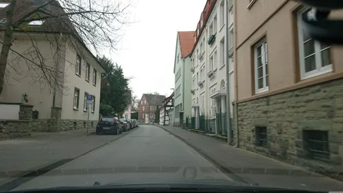
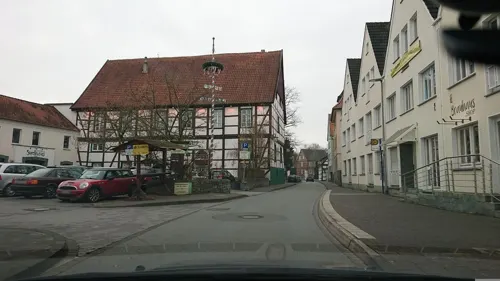
Brauhaus Zwiebel
Restaurant · German · 0.8 km
24 Ulricherstraße, Soest
Su-Th 11:30-21:00+; Fr,Sa 11:00-22:00+

Im Osterkamp
Restaurant · German
10 Walburgerstraße, Soest
Mo-Th 11:00-15:00,17:00-23:00; Tu off; Fr 11:00-15:00,17:00-24:00;...
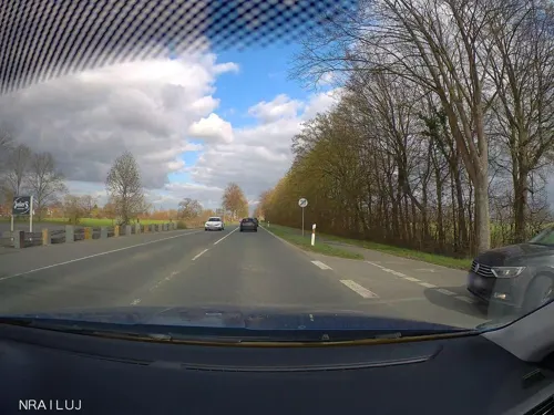
Junker's Restaurant
Restaurant · Italian, German · 5.5 km
15 Bundesstraße, Bad Sassendorf
Mo 17:00-22:00; We-Sa 17:00-22:00; Su 12:00-14:00,17:00-21:00
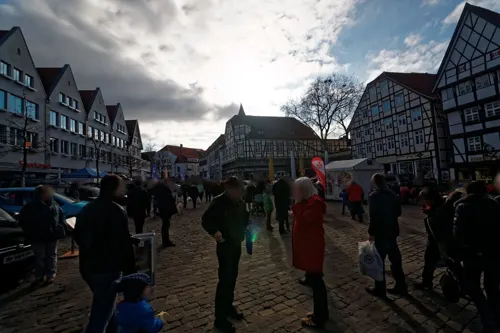
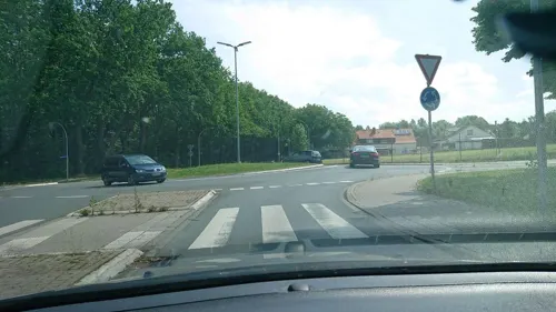
Ghebah
Restaurant · Indian · 2.4 km
1 Herzog-Adolf-Weg, Soest
Mo-Sa 11:00-14:00, 17:00-21:45, Su 11:00-21:00
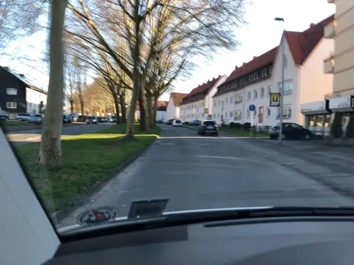
Harry
Restaurant · Regional · 1.3 km
71 Kölner Ring, Soest
Tu-Fr 11:00-14:30,17:00-21:00; Sa 12:00-14:30,17:00-21:00; PH,Su...

Restaurant FachWerk
Restaurant · Regional, International
5 Am Seel, Soest
Tu-Fr 17:00-24:00; Sa,Su 12:00-14:00,17:00-24:00

143 more on the map.
History
Owing to its fertile soil (predominantly brown silty clay loam), the area around Soest is believed to have been settled well before the village is first mentioned in the Dagobertsche Schenkung in 836. Excavations in recent decades have uncovered signs of habitation stretching back more than 4000 years. During the 11th and 12th centuries, Soest grew considerably, making it one of the largest towns in Westphalia with some 10,000 citizens. It was also, until 1609, an important member of the Hanseatic League.
An increasingly confident and powerful Soest liberated itself, between 1444 and 1449, from the Bishop of Cologne, who controlled Westphalia (the so-called Soest Feud). No longer a capital of Westphalia, Soest aligned itself instead with the Duke of Cleves. This proved to be mostly a Pyrrhic victory, however. Though it had shown itself strong enough to defy the powerful Archbishop of Cologne, the town lost much of its trade as a consequence, with a "liberated" Soest surrounded by territories with other allegiances. When the last Duke of Cleves died in 1609, his dukedom was inherited by Brandenburg and, after a short siege, Soest was incorporated into it.
The painter Peter Lely, later to win fame in England, was born in 1618 in Soest to Dutch parents, where his father was an officer serving in the armed forces of Elector Johann Sigismund of Brandenburg.
Read more of the history
During and after the Thirty Years' War, Soest suffered a tremendous loss of both population and influence; at its lowest point, in 1756, having merely 3,600 citizens. In the 1690s, a small commune of French Huguenots was founded in the town.
With the creation of the Soest district in 1817, its influence again began to rise. However, the industrialization of the Ruhr area throughout the 19th century did not reach Soest, which remained a small town.
Under the re-drawing of political borders within the Reich by the Nazi Party Soest was placed in Gau Westphalia-South. During World War II,
the Stalag VI-E prisoner-of-war camp for Polish, French, Belgian and British POWs was operated in the town. In 1945, an SS construction brigade was dispatched to the town, and its prisoners were mostly Poles and Soviets, but also Danes, French, Belgians and Dutch. Soest was the target of several allied bomber raids targeting the marshalling yard, one of the biggest in the Reich, and the important battery factory Akku Hagen. In early April 1945, Soest suffered from major fighting as Allied forces captured the town. Though retaken by a German counterattack shortly thereafter, destructive front-line combat continued to rage in Soest and its environs at the eastern edge of the Ruhr Pocket until the Allies, spearheaded by the U.S. Ninth Army, gained permanent control on April 7.
From 1953 to 1971, a sizable garrison of Canadian soldiers and their families was stationed at Soest (with the Canadian camps located just east of the town in Bad Sassendorf), as well as at Werl and Hemer-Iserlohn and Deilinghofen to the southwest. In addition, an American Nike Battery (66th Battalion) was situated just south of the town, and was subsequently turned over to the German military.
From 1971 to 1993, the former Canadian properties, including the Married Quarters along Hiddingser Weg, south of the B-1, were used and occupied by British military personnel and their families. With the eventual closure of the Belgian and British army facilities, many of these properties were re-purposed for civilian use, abandoned, or demolished. The former Married Quarters area was converted to civilian housing. The former CANEX (the Canadian Army's food and clothing store for NATO families) was converted to a NAAFI under the British and finally demolished in 2006.
From the History section of Soest, Germany on Wikipedia, under CC BY-SA 4.0.
More about Soest
Geography
Soest is located along the Hellweg road, approximately 23 kilometres (14 miles) south-west of Lippstadt, roughly 50 km (31 mi) east of Dortmund and roughly 50 km (31 mi) west of Paderborn.
Education
The city is home to a major branch of the South Westphalia University of Applied Sciences (also: Fachhochschule Südwestfalen (FH SWF)) which offers various engineering, and Business Administration programmes.
From the Wikipedia article Soest, Germany, under CC BY-SA 4.0.
Notable people from Soest
 Peter Lely17th-century Dutch painter (1618–1680)Photo: Peter Lely, Public domain
 Oliver KirchGerman footballerPhoto: Thomas Rodenbücher, CC BY 2.0
 Gina LückenkemperGerman athletics competitorPhoto: Martin Rulsch , Wikimedia Commons, CC BY-SA 4.0
 Ralf KönigGerman comic book creatorPhoto: C.Stadler/Bwag, CC BY-SA 4.0
 Arnold Adolph BertholdGerman physiologist and zoologist (1803–1861)Photo: Unknown author Unknown author, Public domain
 Gaëtan BilleBelgian cyclistPhoto: Jérémy-Günther-Heinz Jähnick, CC BY-SA 3.0
 SashaGerman singerPhoto: Elena Ternovaja, CC BY-SA 3.0
- Tielman SusatoGerman printer and musician (fl. 1541-1561)
- Otto ModersohnGerman painter (1865-1943)
- Wilhelm MorgnerGerman painter (1891-1917)
- Johann GropperCatholic cardinal
- Augustus MeinekeGerman classical philologist (1790–1870)
Born in Soest, according to Wikidata (CC0). Each name links to its Wikipedia article.
Where to stay23
Churches and places of worship38
Shopping53
Gas and EV charging19
Schools, colleges and libraries33
von-Vincke-Schule Bildungszentrum für Blinde und Sehbehinderte
School · 1.2 km
70 Hattroper Weg, Soest
Healthcare23
Map of Soest
250 places. The map loads OpenStreetMap tiles when you open it.
Getting there and nearby towns
Dortmund Airport (DTM) is the nearest airport with scheduled flights listed in OpenStreetMap, 35 km away.
- Bad Sassendorf 4 km east, about 4 min by car
- Möhnesee 9 km south, about 9 min by car
- Welver 11 km northwest, about 11 min by car
- Werl 13 km west, about 13 min by car
- Anröchte 16 km east, about 16 min by car
- Erwitte 17 km east, about 17 min by car
- Lippstadt 20 km northeast, about 20 min by car
- Wickede 19 km southwest, about 19 min by car
- Beckum 21 km north, about 21 min by car
- Arnsberg 21 km south, about 21 min by car
Drive times are estimates from straight-line distance, not routes.
Towns near Soest


Keep exploring
Local news
Headlines from INDB.
Reviews, tips and questions
Loading what members have shared...
Sources and licences
- GeoNames (CC BY 4.0): population, coordinates, regions and time zone
- Mapillary (see each image): photos
- OpenStreetMap contributors (ODbL 1.0): places, airports, map data
- Wikidata (CC0 1.0): elevation, founding date, time zone, website, landmarks and historic places
- Wikimedia Commons (see each image): photos
- Wikipedia (CC BY-SA 4.0): overview and history text
Photo credits
- Soest-Grosser-Teich-IMG 0711, Mbdortmund, CC BY-SA 3.0
- Stolpersteinlage Soest Waisenhausstr 4, Gmbo 2013, CC0
- Stiftstraße 43, 1, Soest, Landkreis Soest, GeorgDerReisende, CC BY-SA 4.0
- IMG Kirmes Soest, Mitumial, CC BY-SA 4.0
- Armesündergasse, 1, Soest, Landkreis Soest, GeorgDerReisende, CC BY-SA 4.0
- Stolpersteinlage Soest Brüderstr 36, Gmbo 2013, CC0
- Stolpersteine in Soest Bruederstraße 36 Marianne Eichwald, Gmbo 2013, CC0
- Stolpersteine in Soest Bruederstraße 36, Gmbo 2013, CC0
- Stolpersteine in Soest Bruederstraße 36 Julie Mueller, Gmbo 2013, CC0
- Stolpersteinlage in Soest Bruederstraße 36, Gmbo 2013, CC0
- Armesündergasse 1, 1, Soest, Landkreis Soest, GeorgDerReisende, CC BY-SA 4.0
- Stiftstraße 45, 1, Soest, Landkreis Soest, GeorgDerReisende, CC BY-SA 4.0
- Stolpersteinlage in Soest Bruederstraße 32, Gmbo 2013, CC0
- Stolpersteine in Soest Bruederstraße 32 Jakob Rosenberg, Gmbo 2013, CC0
- Stolpersteine in Soest Bruederstraße 32 Emma Rosenberg, Gmbo 2013, CC0
- Stolpersteine in Soest Bruederstraße 32, Gmbo 2013, CC0
- Allerheiligenkirmes Soest, 09.11.2013 - panoramio (3), Sebastian “sebrem” B…, CC BY-SA 3.0
- Soest Fachwerkhäuser 04, Ad Meskens You are free to use this picture for any purpose as long as you credit its author, Ad Meskens . Example: © Ad Meskens / Wikimedia Commons If you use this work outside of the Wikimedia..., CC BY-SA 4.0
- Soest Fachwerkhäuser 03, Ad Meskens You are free to use this picture for any purpose as long as you credit its author, Ad Meskens . Example: © Ad Meskens / Wikimedia Commons If you use this work outside of the Wikimedia..., CC BY-SA 4.0
- Soest Fachwerkhäuser 02, Ad Meskens You are free to use this picture for any purpose as long as you credit its author, Ad Meskens . Example: © Ad Meskens / Wikimedia Commons If you use this work outside of the Wikimedia..., CC BY-SA 4.0
- Soest Am Loerbach 09, Jan-Herm Janßen, CC BY-SA 4.0
- Allerheiligenkirmes Soest, 09.11.2013 - panoramio (4), Sebastian “sebrem” B…, CC BY-SA 3.0
- Bauhütte Soest mit dem Grünsandsteinmuseum, StagiaireMGIMO, CC BY-SA 4.0
- Brüderstraße 46, 1, Soest, Landkreis Soest, GeorgDerReisende, CC BY-SA 4.0
- Brüderstraße 42, 1, Soest, Landkreis Soest, GeorgDerReisende, CC BY-SA 4.0
- Bauhütte Soest, StagiaireMGIMO, CC BY-SA 4.0
- Stolpersteinlage Soest Kohlbrink 7, Gmbo 2013, CC0
- Soest (16096604972), photobeppus, CC BY-SA 2.0
- Soest-090816-9929-Wiesenkirche-Turmportal, Mbdortmund, GFDL 1.2
- Soest-090816-9930-Wiesenkirche-Westportal, Mbdortmund, GFDL 1.2
- Soest-13770-Wiesenkirche, Mbdortmund, GFDL 1.2
- Soest-13772-Wiesenkirche, Mbdortmund, GFDL 1.2
- Soest-13773-Wiesenkirche, Mbdortmund, GFDL 1.2
- Bauzaun an der Wiesenkirche, Wiesenstraße 28, 59494 Soest, Germany 02, KaiKemmann, CC BY-SA 4.0
- Bauzaun an der Wiesenkirche, Wiesenstraße 28, 59494 Soest, Germany 01, KaiKemmann, CC BY-SA 4.0
- Alt-St.Thomae Mai 2008 6, Benutzer Stephan Hense, CC BY-SA 3.0
- Archigymnasium Soest, Sebastian Kirsch, Segroove, CC BY-SA 3.0
- Brunsteinkapelle., Kühlungsborn, CC BY-SA 3.0
- BurghofMuseumSoest Mai 2008 1, Stephan Hense, CC BY-SA 3.0
- Soest-090816-9960-Kirche, Mbdortmund, GFDL 1.2
- 20140601 131813 St. Maria zur Wiese, Soest (DSC02285), Günter Seggebäing, Coesfeld, CC BY-SA 3.0
- Borgeln Kirche1, AlterWolf49, CC BY-SA 3.0
- Franzkapellesoest gesamtansicht, Juchhoff, CC0
- Soest Hansa-Realschule FFSN-1652, Petra Klawikowski, CC BY-SA 3.0
- Soest Aldegrever-Gymnasium FFSN-1549, Petra Klawikowski, CC BY-SA 3.0
- Kleinbahnhof, K.bierkaemper, CC BY-SA 3.0
- Welver, Berwicke, Haus Nehlen -- 2014 -- 8771 -- Ausschnitt, Dietmar Rabich, CC BY-SA 4.0
- Museum Wilhelm Morgner mit dem Raum Schroth hell geschnitten©Gero Sliwa KLEIN, Fotograf Gero Sliwa, © Stiftung Konzeptuelle Kunst, CC BY-SA 3.0 de
- Schwefe, Turm von St. Severin, Stephan Hense, CC BY-SA 3.0
- Pilgrimhaus, K.bierkaemper, CC BY-SA 3.0
- Nikolaikapelle Soest, outer view, K.bierkaemper, CC BY-SA 3.0
- Osthofentor, Parmigianino, CC BY-SA 3.0
- St. Antonius Stocklarn, Kühlungsborn, CC BY-SA 3.0
- Paulikirche soest, Schonekind, Public domain
- Von-Vincke-Schule, 1, Soest, Landkreis Soest, GeorgDerReisende, CC BY-SA 4.0
- St. Pantaleon zu Lohne, View from the South, Stephan Hense, CC BY-SA 4.0
- A 207 Bruno Paul Villa Plange (34), Stephan Hense, CC BY-SA 4.0
- Soest-Severinstr10-1-Bubo, Bubo, CC BY-SA 3.0
- Bruno Paul Villa Sternberg Mai 2008 1, Stephan Hense, CC BY-SA 3.0
- Schwefe - NSG Salzbrink - 01, Ath, CC0
- NSG Ahse nördlich Lohne, Falkmart, CC BY-SA 4.0
- Oestinghausen - NSG Ahseniederung Oestinghausen - 01, Ath, CC0
- Welver - NSG Ahsewiesen (VO) - 01, Ath, CC0
- Soest - NSG Ehemalige Klärteiche an der Zuckerfabrik Soest - 01, Ath, CC0
- Hattrop - NSG Ehemalige Klärteiche bei Hattrop - 02, Ath, CC0
- SO-80 an der Rosenau, Friedhelm Dröge, CC BY-SA 3.0
- Möhnesee - NSG Standortübungsplatz bei Büecke - 02, Ath, CC0
- Naturschutzgebiet Steinbruch Lohner Klei 4, Falkmart, CC BY-SA 4.0
- Soest st petri, Unknown author, CC BY-SA 3.0
- Haus zum Spiegel, 1, Soest, Landkreis Soest, GeorgDerReisende, CC BY-SA 4.0
- Bad Sassendorf-Erlebnismuseum Westfälische Salzwelten, Dat doris, CC BY 4.0
- Soest Im Osterkamp, Arnoldius, CC BY-SA 3.0
- Street-level photo, analuisa, CC BY-SA 4.0
- Street-level photo, analuisa, CC BY-SA 4.0
- Street-level photo, nrailuj, CC BY-SA 4.0
- Street-level photo, nrailuj, CC BY-SA 4.0
- Street-level photo, txllxt, CC BY-SA 4.0
- Street-level photo, hotteliene, CC BY-SA 4.0
- Street-level photo, lord92, CC BY-SA 4.0
- Street-level photo, analuisa, CC BY-SA 4.0
- Street-level photo, analuisa, CC BY-SA 4.0
- Street-level photo, hotteliene, CC BY-SA 4.0
- Street-level photo, analuisa, CC BY-SA 4.0
- Street-level photo, analuisa, CC BY-SA 4.0
- Street-level photo, nrailuj, CC BY-SA 4.0
- Street-level photo, analuisa, CC BY-SA 4.0
- Street-level photo, nrailuj, CC BY-SA 4.0
- Street-level photo, nrailuj, CC BY-SA 4.0
- Street-level photo, pharris0n, CC BY-SA 4.0
- Street-level photo, lord92, CC BY-SA 4.0
- Street-level photo, nrailuj, CC BY-SA 4.0
- Street-level photo, analuisa, CC BY-SA 4.0
- Street-level photo, nicolaus1977, CC BY-SA 4.0
- Street-level photo, analuisa, CC BY-SA 4.0
- Street-level photo, saschahaberkorn, CC BY-SA 4.0


Page built November 9, 2026. Spotted a mistake? Tell us or suggest a place.