


Schopfheim, Germany
Schopfheim is a town of 19,386 people in Baden-Wurttemberg, Germany.
Why visit Schopfheim
Townapedia lists 33 museums and landmarks, 29 parks and trails, 127 places to eat, 13 places to stay and 29 attractions in and around town.
Highlights include Scala Kino, Grethermühle, Heimat-Museum der Stadt Schopfheim and Wiesentäler Textilmuseum.
Weather in Schopfheim
Forecast from MET Norway (CC BY 4.0). Full forecast
About Schopfheim
Schopfheim (German pronunciation: [ˈʃɔpfhaɪm] ) is a town in the district of Lörrach in Baden-Württemberg, Germany. It is situated on the river Wiese, 10 km north of Rheinfelden, and 13 km east of Lörrach.
From the Wikipedia article Schopfheim (this version), under CC BY-SA 4.0.
Things to do29
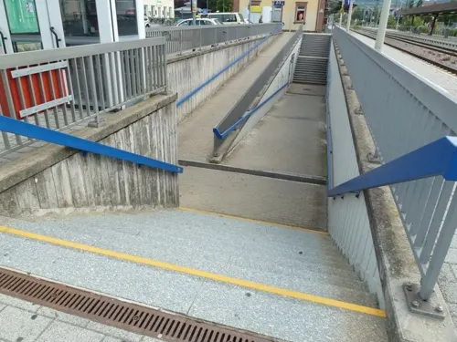
Scala Kino
Cinema and theater
10a Bahnhofstraße, Schopfheim
"Je nach Wochentag und Film; siehe Homepage"

Grethermühle
Farm and orchard · 4.1 km
20 Mühleweg, Maulburg
Mo-Fr 10:00-12:00, 17:00-19:00; Sa 10:00-12:00


Connys Hofladen
Farm and orchard · 2.2 km
57 Dinkelbergstraße, Schopfheim
Mo 10:00-13:00; Th, Fr 10:00-18:00; Sa 08:30-13:00

17 more on the map.
Museums and landmarks33
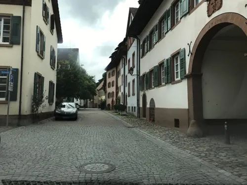

Wiesentäler Textilmuseum
Museum · 6.7 km
4 Teichstraße, Zell im Wiesental
Sa,Su 10:00-12:00, Mar 01-Nov 30: Tu 14:00-17:00; "sowie nach Anmeldung"


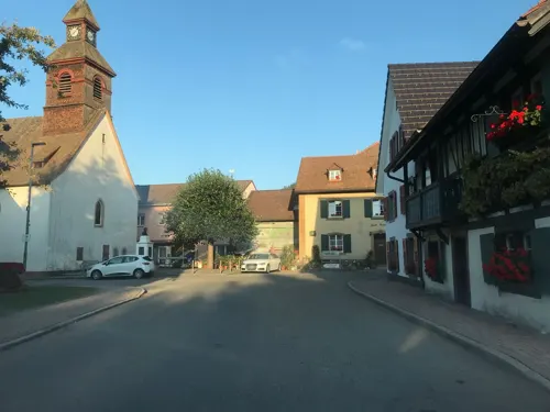
Literaturmuseum Hebelhaus
Museum · 3.7 km
1 Bahnhofstraße, Hausen im Wiesental
We,Sa,Su 13:30-17:00; Jan off


Schloss Ehner-Fahrnau
Monument and historic site · 1.8 km
8 Ehner-Fahrnau, Schopfheim

Steineck
Monument and historic site · 5.6 km
Wenige Mauerreste auf Höhenrückem


21 more on the map.
Parks, trails and playgrounds29

Park des Wohnquartiers "Am Eisweiher"
Park · 0.7 km
7-9 Am Eisweiher, Schopfheim
24/7



17 more on the map.
Restaurants and cafes127

Scheiblerei
Cafe · Cake, Ice Cream
Mittagstisch,_Brunch,_Kaffee,_Kuchen,_Eis
21 Pflughof, Schopfheim
We-Su 09:00-17:00
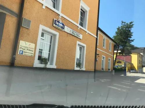
Barsaat indisches Restaurant
Restaurant · Indian · 6.8 km
52 Hauptstraße, Wehr
Tu-Sa 11:30-14:00,17:00-22:00; Su 12:00-21:30; Mo off
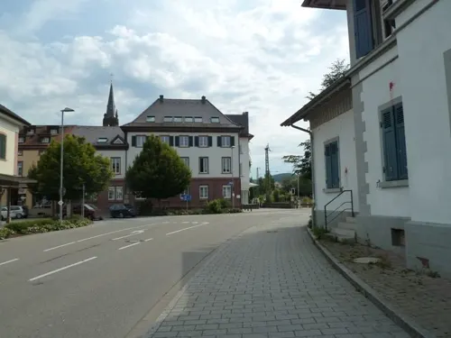
Cafe Irrlicht
Bar and pub
Das Café Irrlicht versteht sich als selbstverwaltetes linkes Zentrum, in dem Kultur von unten, gegen den herrschenden Mainstream...
3 Bahnhofstraße, Schopfheim
Mo-Th 21:00-01:00, Fr,Sa 21:00-05:00


Gasthaus Dorfstübli
Restaurant · Regional · 5.4 km
27 Scheideckstraße, Steinen
Tu-Sa 14:00-23:00; Su 10:00-23:00
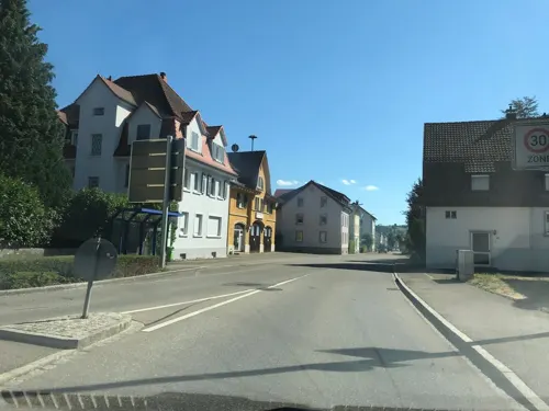
Gasthaus Hirschen
Restaurant · German · 1.7 km
270 Hauptstraße, Schopfheim
Tu off; Su,Mo,We,Th 10:00-01:00, Fr,Sa 10:00-02:00
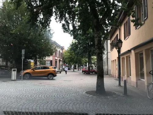
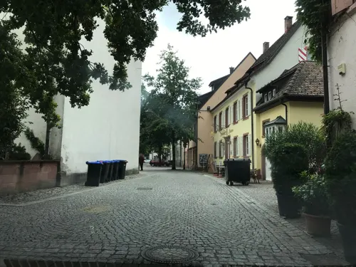


Griechisches Restaurant Hermes
Restaurant · Greek
7 Torstraße, Schopfheim
Mo,Tu,Th-Sa 17:00-22:00, Sa 11:30-14:30, Su 11:30-14:30,17:00-21:00; We off
Hotel-Restaurant Löwen
Restaurant · German · 1.4 km
16 Gündenhausen, Schopfheim
Mo-Sa 11:45-14:00,17:00-22:00; Su 11:45-14:30; We,Th off
In's kleine Eck
Restaurant · German
9 Feldbergstraße, Schopfheim
Tu-Fr 11:30-14:00, 17:00-23:00; Sa 17:00-23:00
115 more on the map.
Where to stay13
Churches and places of worship42
Alte Stadtkirche St. Michael
Church · Protestant
4 Wallstraße, Schopfheim
Evangelische Kirche Maulburg
Church · Protestant · 3.6 km
2 Karl-Friedrich-Straße, Maulburg
Evangelische Kirche Schlächtenhaus / Hofen / Weitenau
Church · Protestant · 6.8 km
50 Hofener Straße, Steinen
Evangelische Kirche Wieslet
Church · Protestant · 4.6 km
1 Kirchstraße, Kleines Wiesental
Evangelische Kirche Zell
Church · Protestant · 6.5 km
2 Carl-Maria-von-Weber-Straße, Zell im Wiesental
Evangelische Matthäuskirche
Church · Protestant · 1.6 km
4 Gerberstraße, Schopfheim
Evangelische Nikolauskirche
Church · Protestant · 6.9 km
20 Gresgen, Zell im Wiesental
Evangelische Petruskirche Steinen
Church · Protestant · 6.1 km
12 Kirchstraße, Steinen
Evangelische Stadtkirche
Church · Protestant
1 Roggenbachstraße, Schopfheim
Katholische Kirche St. Martin
Church · Roman Catholic · 6.5 km
5 Kirchplatz, Wehr
Shopping47
Gas and EV charging8
Schools, colleges and libraries21
Healthcare12
Map of Schopfheim
250 places. The map loads OpenStreetMap tiles when you open it.
Getting there and nearby towns
Lahr Airport (LHA) is the nearest airport with scheduled flights listed in OpenStreetMap, 80 km away.
- Steinen 6 km west, about 6 min by car
- Wehr 7 km east, about 7 min by car
- Weil am Rhein 16 km southwest, about 16 min by car
- Waldshut-Tiengen 30 km east, about 30 min by car
- Titisee-Neustadt 41 km northeast, about 41 min by car
- Waldkirch 51 km north, about 51 min by car
- Teningen 53 km north, about 53 min by car
- Villingen-Schwenningen 68 km northeast, about 1 h 15 min by car
- Schramberg 76 km northeast, about 1 h 15 min by car
- Singen 77 km east, about 1 h 15 min by car
Drive times are estimates from straight-line distance, not routes.
Local news
Headlines from INDB.
Reviews, tips and questions
Loading what members have shared...
Sources and licences
- GeoNames (CC BY 4.0): population, coordinates, regions and time zone
- Mapillary (see each image): photos
- OpenStreetMap contributors (ODbL 1.0): places, airports, map data
- Wikidata (CC0 1.0): elevation, founding date, time zone, website, landmarks and historic places
- Wikimedia Commons (see each image): photos
- Wikipedia (CC BY-SA 4.0): overview and history text
Photo credits
- Schopfheim-Die Lenkplastik - panoramio, Pierre Likissas, CC BY 3.0
- Schopfheim - panoramio (1), Pierre Likissas, CC BY 3.0
- Schopfheim - panoramio (2), Pierre Likissas, CC BY 3.0
- Schopfheim - Impressions... - panoramio, Pierre Likissas, CC BY 3.0
- Schopfheim - 5 Open Air Konzert - panoramio, Pierre Likissas, CC BY 3.0
- Schopfheim - panoramio, Pierre Likissas, CC BY 3.0
- Schopfheim-Weihnachtsbäckerei. - panoramio, Pierre Likissas, CC BY 3.0
- Schopfheim Stadthalle, Zieglhar, CC BY-SA 4.0
- Schopfheim - Bahnhofstraße - panoramio, Pierre Likissas, CC BY 3.0
- DB.Schopfheim... - panoramio, Pierre Likissas, CC BY 3.0
- FWS Schopfheim Schulgarten, Louis Bafrance, CC BY 3.0
- FWS Schopfheim, Louis Bafrance, CC BY 3.0
- Hasel Erdmannshöhle 1, Zieglhar, CC BY-SA 4.0
- Altes Schloss Wehr 2012 1, zieglhar, CC BY 3.0
- Aussichtsturm Hohe Möhr, Mike Schulz Gossel, CC0
- Burg Alt-Waldeck 9, Zieglhar, CC BY-SA 4.0
- Bürgle 2, Zieglhar, CC BY-SA 4.0
- Wieslet - Dorfkirche, Taxiarchos228, CC BY 3.0
- Wiesentäler Textilmuseum, SEM, CC BY 3.0
- Tschamberhöhle 01, Latschari, CC BY-SA 3.0
- THG Schopfheim, SEM, CC BY 3.0
- Schloss Ehner-Fahrnau 2, Zieglhar, CC BY-SA 3.0
- Menhir Dossenbach 1, Zieglhar, CC BY-SA 4.0
- Wehr, Kirche St. Martin 1, Rauenstein, CC BY-SA 3.0
- Schlossgut Ehner-Fahrnau, Gustav Wilhelm Friesenegger, Public domain
- Lenk Bad Revolution 3, Zieglhar, CC BY-SA 4.0
- Peter Lenk "Badische Revolution 1848" - panoramio, Pierre Likissas, CC BY 3.0
- Lenk Bad Revolution 1, Zieglhar, CC BY-SA 4.0
- Hidden Spider Waiting For The Sun, Jo Kehm, CC0
- Nica and Joe 1080069, Flominator ( talk ), CC BY-SA 4.0
- Orgel St Bernhard - Spieltisch, Alexander79650, CC BY-SA 4.0
- Orgel St Bernhard, Alexander79650, CC BY-SA 4.0
- Orgel St. Bernhard - Spieltisch, Alexander79650, CC BY-SA 4.0
- Innenansicht St. Bernhard - Blick zur Orgel, Alexander79650, CC BY-SA 4.0
- Park.01... - panoramio, Pierre Likissas, CC BY 3.0
- EisLiebe... - panoramio, Pierre Likissas, CC BY 3.0
- Park.02... - panoramio, Pierre Likissas, CC BY 3.0
- Evang.Kirche - panoramio, Pierre Likissas, CC BY 3.0
- Olympus CH2 microscope 4, Amada44, CC BY-SA 3.0
- Gallus gallus domesticus - Vogelpark Steinen 03, H. Zell, CC BY-SA 3.0
- Street-level photo, tbkrtz, CC BY-SA 4.0
- Street-level photo, tbkrtz, CC BY-SA 4.0
- Street-level photo, nvbwseifert, CC BY-SA 4.0
- Street-level photo, tbkrtz, CC BY-SA 4.0
- Street-level photo, tbkrtz, CC BY-SA 4.0
- Street-level photo, tbkrtz, CC BY-SA 4.0
- Street-level photo, tbkrtz, CC BY-SA 4.0
- Street-level photo, tbkrtz, CC BY-SA 4.0
- Street-level photo, tbkrtz, CC BY-SA 4.0
- Street-level photo, tbkrtz, CC BY-SA 4.0
- Street-level photo, nvbwseifert, CC BY-SA 4.0
- Street-level photo, tbkrtz, CC BY-SA 4.0
- Street-level photo, tbkrtz, CC BY-SA 4.0
- Street-level photo, tbkrtz, CC BY-SA 4.0
- Street-level photo, tbkrtz, CC BY-SA 4.0
- Street-level photo, tbkrtz, CC BY-SA 4.0
- Street-level photo, tbkrtz, CC BY-SA 4.0
- Street-level photo, nvbwseifert, CC BY-SA 4.0
- Street-level photo, tbkrtz, CC BY-SA 4.0
- Street-level photo, tbkrtz, CC BY-SA 4.0
- Street-level photo, tbkrtz, CC BY-SA 4.0
- Street-level photo, tbkrtz, CC BY-SA 4.0
- Street-level photo, tbkrtz, CC BY-SA 4.0
- Street-level photo, tbkrtz, CC BY-SA 4.0
- Street-level photo, tbkrtz, CC BY-SA 4.0


Page built November 8, 2026. Spotted a mistake? Tell us or suggest a place.