


Schöppenstedt, Germany
Schöppenstedt is a town of 5,961 people in Lower Saxony, Germany.
Why visit Schöppenstedt
Townapedia lists 12 museums and landmarks, 7 parks and trails, 17 places to eat, 2 places to stay and 5 attractions in and around town.
Highlights include Hofladen Lindenhof, Galgenberg, Till Eulenspiegel Museum and Bahnstrecke Helmstedt–Börßum.
Weather in Schöppenstedt
Forecast from MET Norway (CC BY 4.0). Full forecast
About Schöppenstedt
Schöppenstedt (German pronunciation: [ˈʃœpn̩ˌʃtɛt] ; Eastphalian: Schöppenstidde) is a small town in the district of Wolfenbüttel, in Lower Saxony, Germany. It is the administrative seat of the Samtgemeinde ("collective municipality") of Elm-Asse.
From the Wikipedia article Schöppenstedt (this version), under CC BY-SA 4.0.
Things to do5

Hofladen Lindenhof
Farm and orchard · 3.8 km
Im Hofladen bieten wir an Lindenhof-Produkten neben den Vollkornbackwaren aus unserer Backstube, Getreide, Kartoffeln, Wurst und Gemüse...
6 Presseweg, Kneitlingen
Mo-Tu,Th-Fr 09:00-13:00,15:00-18:00; Sa 09:00-13:00; We,Su,PH off



Museums and landmarks12




Parks, trails and playgrounds7





Restaurants and cafes17
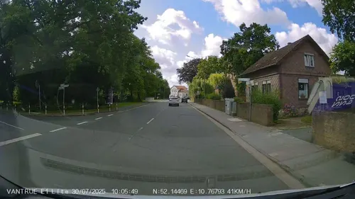
Katané
Restaurant · Italian
36 Stobenstraße, Schöppenstedt
Tu-Sa 17:00-22:30; Su,PH 11:30-14:30, 17:30-22:00; Mo off; "nach...

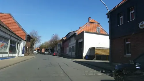
Gaststätte Zum Zoll
Bar and pub
13 Braunschweiger Straße, Schöppenstedt
Mo-Tu,Th-Sa 17:00+; We off; Su 11:30-13:30,17:00+

Akropolis
Restaurant
8 Stobenstraße, Schöppenstedt
Mo,We-Su 11:30-14:00,17:00-23:00; Tu off

Sportheim Schöppenstedt
Bar and pub · 0.6 km
1a Elm-Asse-Platz, Schöppenstedt
Mo-We,Fr-Sa 17:00+; Th off; Su 10:00+
Landbäckerei Isensee
Bakery
Tu-Fr 05:30-13:00,14:00-17:30; Sa 06:00-12:00; Su 07:30-10:30; Mo off


5 more on the map.
History
The settlement of Sciphinstete in the Derlingau region of Saxony, located on the trade route from Brunswick to the Königspfalz at Schöningen, was first mentioned in a 1051 deed. A church at the site probably existed in the days of the missionary bishop Hildegrim of Châlons before 827 AD; Schöppenstedt later became the seat of a Halberstadt archdeacon. From 1267 to 1269, the surrounding estates were held by the Welf dukes of Brunswick-Wolfenbüttel. In 1542, the citizens turned Protestant.
A main landmark is the St. Stephen's Church with its famous leaning tower of the 12th century. The interior contains remarkable stone pillars with depictions of animal figures and human heads, including Wotan and his ravens, the Fenrir Wolf, the Midgard Serpent and the Ash Yggdrasil (black and white illustration). These ornate pillars have been constructed with the introduction of Christianity as a monument to the ancient gods of faith - the ornaments could date from the first documented mention of Schöppenstedt.
From the History section of Schöppenstedt on Wikipedia, under CC BY-SA 4.0.
Where to stay2
Churches and places of worship16
Shopping5
Gas and EV charging2
Schools, colleges and libraries2
Healthcare1
Map of Schöppenstedt
69 places. The map loads OpenStreetMap tiles when you open it.
Getting there and nearby towns
Forschungsflughafen Braunschweig-Wolfsburg (BWE) is the nearest airport with scheduled flights listed in OpenStreetMap, 24 km away.
- Königslutter am Elm 12 km north, about 12 min by car
- Schöningen 13 km east, about 13 min by car
- Cremlingen 14 km northwest, about 14 min by car
- Wolfenbüttel 16 km west, about 16 min by car
- Helmstedt 19 km northeast, about 19 min by car
- Braunschweig 22 km northwest, about 22 min by car
- Lehre 22 km north, about 22 min by car
- Salzgitter 25 km west, about 25 min by car
- Vienenburg 26 km southwest, about 26 min by car
- Wolfsburg 31 km north, about 31 min by car
Drive times are estimates from straight-line distance, not routes.
Local news
Headlines from INDB.
Reviews, tips and questions
Loading what members have shared...
Sources and licences
- GeoNames (CC BY 4.0): population, coordinates, regions and time zone
- Mapillary (see each image): photos
- OpenStreetMap contributors (ODbL 1.0): places, airports, map data
- Wikidata (CC0 1.0): elevation, founding date, time zone, website
- Wikimedia Commons (see each image): photos
- Wikipedia (CC BY-SA 4.0): overview and history text
Photo credits
- Schoeppenstedt-fachwerk-1, Elmschrat, CC BY-SA 3.0
- Rathaus Schöppenstedt, Gerd Fahrenhorst, CC BY 4.0
- Till Eulenspiegel, Schöppenstedt, FrankBothe, CC BY-SA 4.0
- Bahnhof Schöppenstedt - Ende Gleis 2, 11. März 2022, Till-André Diegeler, CC BY-SA 4.0
- Bahnhof Schöppenstedt (21607213838), Linus Follert, CC BY-SA 2.0
- Bahnhof Schöppenstedt - Gleisanlagen, März 2022, Till-André Diegeler, CC BY-SA 4.0
- Handwerker, Statue Neue Straße in Schöppenstedt 1, Gerd Fahrenhorst, CC BY 4.0
- Handwerker, Statue Neue Straße in Schöppenstedt 2, Gerd Fahrenhorst, CC BY 4.0
- Die Wächter der Salzwiese, Kongo Mueller, CC BY-SA 3.0
- Till-Eulenspiegel-Museum, Thomas Binder, CC BY-SA 4.0
- Watzum (2), Lotus7, CC BY-SA 4.0
- Galgenberg Vahlberg Elm, Axel Hindemith, CC BY-SA 3.0
- St.-Stephanus-Kirche Schöppenstedt, Thomas Binder, CC BY-SA 4.0
- Gross Dahlum St Marien, TeWeBs, CC BY-SA 3.0
- Berklingen-Kirche, Roll-Stone, CC BY 3.0
- Kirche Bansleben, Carnie31, CC BY-SA 4.0
- KircheKneitlingenVonOsten, Utausb, CC BY-SA 3.0
- 20171001 Kirche Watzum Niedersachsen DSC06303-2 PtrQs, PtrQs, CC BY-SA 4.0
- Groß Vahlberg Am Kirchberg NLD 34107133, Günter Jung, CC BY-SA 4.0
- Schöppenstedt Kirche kath, Kirchenfan, CC0
- Bahnstrecke Helmstedt–Börßum Karte, Joeb07, CC BY-SA 3.0
- Blick über die Wiese, Kongo Mueller, CC BY-SA 3.0
- Töpferfrau (Stephan Suttka) Infotafel, Gerd Fahrenhorst, CC BY 4.0
- Töpferfrau (Stephan Suttka) 1, Gerd Fahrenhorst, CC BY 4.0
- Töpferfrau (Stephan Suttka) 3, Gerd Fahrenhorst, CC BY 4.0
- Töpferfrau (Stephan Suttka) 2, Gerd Fahrenhorst, CC BY 4.0
- SchoeppenstedtKircheStStephanusOrgel, Utausb, CC BY-SA 3.0
- DB Regio BR 648 LINT in Shöppenstedt (21607211618), Linus Follert, CC BY-SA 2.0
- Schoeppenstedt BHf, TeWeBs, CC BY-SA 3.0
- Till Eulenspiegel (Erich Schmidtbochum) 2, Gerd Fahrenhorst, CC BY 4.0
- Till Eulenspiegel (Erich Schmidtbochum) 1, Gerd Fahrenhorst, CC BY 4.0
- Till Eulenspiegel (Erich Schmidtbochum) 3, Gerd Fahrenhorst, CC BY 4.0
- Till Eulenspiegel (Erich Schmidtbochum) 6, Gerd Fahrenhorst, CC BY 4.0
- Till Eulenspiegel (Erich Schmidtbochum) 4, Gerd Fahrenhorst, CC BY 4.0
- Till Eulenspiegel (Erich Schmidtbochum) 5, Gerd Fahrenhorst, CC BY 4.0
- Kueblingen Kirche 3, Kirchenfan, CC0
- Kueblingen Kirche 1, Kirchenfan, CC0
- Kueblingen Kirche 2, Kirchenfan, CC0
- Aufgehts -) - panoramio, ThorstenE, CC BY-SA 3.0
- Skulptur Biene in Schöppenstedt, Gerd Fahrenhorst, CC BY 4.0
- Steinkreuz Ollaberg (Ampleben) (1), Lutz Lange ( talk ), CC BY-SA 4.0
- Street-level photo, Hightower-, CC BY-SA 4.0
- Street-level photo, Hightower-, CC BY-SA 4.0
- Street-level photo, tian, CC BY-SA 4.0
- Street-level photo, tian, CC BY-SA 4.0
- Street-level photo, Hightower-, CC BY-SA 4.0
- Street-level photo, tian, CC BY-SA 4.0
- Street-level photo, tian, CC BY-SA 4.0
- Street-level photo, Hightower-, CC BY-SA 4.0
- Street-level photo, digital0533, CC BY-SA 4.0
- Street-level photo, tian, CC BY-SA 4.0
- Street-level photo, digital0533, CC BY-SA 4.0


_-_panoramio.jpg)
Page built November 9, 2026. Spotted a mistake? Tell us or suggest a place.