


Why visit Tarforst
Townapedia lists 38 museums and landmarks, 10 parks and trails, 35 places to eat, 5 places to stay and 7 attractions in and around town.
Highlights include Roman Bridge, Theater Trier, Irscher Burg and Augusta Treverorum.
Weather in Tarforst
Forecast from MET Norway (CC BY 4.0). Full forecast
About Tarforst
Tarforst is a suburban part of the city Trier in Germany with about 7,000 inhabitants. The University of Trier is situated in the suburb.
From the Wikipedia article Tarforst (this version), under CC BY-SA 4.0.
Things to do7


Theater Trier
Cinema and theater · 4.3 km
Theatre and opera house in Trier, Germany



Museums and landmarks38


Augusta Treverorum
Monument and historic site · 4.0 km
Roman site, in modern-day Trier, Germany

Barbara Baths
Monument and historic site · 4.5 km
Roman baths in Trier, Germany

Forum baths
Monument and historic site · 4.1 km
Roman baths in Trier, Germany

Karl Marx statue in Trier
Monument and historic site · 4.1 km
Statue in Trier, Germany


Rheinisches Landesmuseum Trier
Museum · 3.6 km
German archaeological museum

Trier
Monument and historic site · 4.1 km
City in Rhineland-Palatinate, Germany

Trier Cathedral Treasury
Museum · 3.8 km
Museum of christian art, museum of medieval art in Cathedral of Trier, Mustorstraße

Trier Imperial Baths
Monument and historic site · 3.7 km
UNESCO World Heritage Site in Rhineland-Palatinate, Germany


26 more on the map.
Parks, trails and playgrounds10


Restaurants and cafes35

Blesius Garten
Restaurant · German · 2.3 km
135 Olewiger Straße, Trier
Mo-Th 15:00-24:00; Fr-Su 12:00-24:00


Gasthaus Wollscheid
Restaurant · Local · 0.6 km
43 Tarforster Straße, Trier
Tu-Sa 16:00+; Su 14:00+; Mo off


Sushi Petrisberg
Restaurant · Japanese, Sushi · 1.4 km
16-18 Robert-Schuman-Allee, Trier
Mo,We,Th 12:00-15:00,17:30-21:30; Fr-Su,PH 12:00-16:00,17:00-21:30; Tu off
Weinstube Gehlen
Restaurant · Local · 0.6 km
3 Am Hötzberg, Trier
Tu-Th 16:00-23:00, Fr 16:00-24:00, Sa 12:00-24:00; Su,Mo off
23 more on the map.
Where to stay5
Churches and places of worship15
Shopping7
Gas and EV charging1
Schools, colleges and libraries13
Healthcare4
Map of Tarforst
135 places. The map loads OpenStreetMap tiles when you open it.
Getting there and nearby towns
Flugplatz Bitburg (BBJ) is the nearest airport with scheduled flights listed in OpenStreetMap, 25 km away.
- Trier 4 km northwest, about 4 min by car
- Konz 9 km southwest, about 9 min by car
- Weiskirchen 23 km southeast, about 23 min by car
- Wadern 26 km southeast, about 26 min by car
- Bitburg 28 km northwest, about 28 min by car
- Wittlich 31 km northeast, about 31 min by car
- Morbach 32 km east, about 32 min by car
- Merzig 33 km south, about 33 min by car
- Schmelz 36 km south, about 36 min by car
- Nohfelden 37 km southeast, about 37 min by car
Drive times are estimates from straight-line distance, not routes.
Local news
Headlines from INDB.
Reviews, tips and questions
Loading what members have shared...
Sources and licences
- GeoNames (CC BY 4.0): population, coordinates, regions and time zone
- Mapillary (see each image): photos
- OpenStreetMap contributors (ODbL 1.0): places, airports, map data
- Wikidata (CC0 1.0): elevation, founding date, time zone, website, landmarks and historic places
- Wikimedia Commons (see each image): photos
- Wikipedia (CC BY-SA 4.0): overview and history text
Photo credits
- Tarforst-Bildstock, Thomas Holbach, CC BY-SA 3.0
- Trier-Tarforst, Stadtteilzentrum Tarforster Höhe 20121120, P170, CC BY-SA 4.0
- Trier-Tarforst, Maximiner Hof und Kirche St. Andreas 20121122, P170, CC BY-SA 4.0
- Tarforst-Maximiner Zehnt- und Gerichtshof, Thomas Holbach, CC BY-SA 3.0
- Tarforst-St.Andreas, Thomas Holbach, CC BY-SA 3.0
- Tarforst-Kreuzweg 02, Thomas Holbach, CC BY-SA 3.0
- Trier-Tarforst, Am Trimmelter Hof 20121120, P170, CC BY-SA 4.0
- Tarforst-Kreuzweg 03, Thomas Holbach, CC BY-SA 3.0
- Tarforst-Kreuzweg 04, Thomas Holbach, CC BY-SA 3.0
- Trier-Tarforst, Friedhof mit Friedhofskapelle 20121122, P170, CC BY-SA 4.0
- Tarforst-Kreuzweg 05, Thomas Holbach, CC BY-SA 3.0
- Tarforst-Kreuzweg 06, Thomas Holbach, CC BY-SA 3.0
- Trier-Tarforst, Friedhof 20121122, P170, CC BY-SA 4.0
- Tarforst-Kreuzweg 07, Thomas Holbach, CC BY-SA 3.0
- Roemerbruecke Trier, Stefan Kühn, CC BY-SA 3.0
- Theater Trier Germany, Stefan Kühn, CC BY-SA 3.0
- Augusta Treverorum, Stefan Kühn, CC BY-SA 3.0
- Trier Barbarathermen, Stefan Kühn, CC BY-SA 3.0
- Trier BW 2012-04-06 16-24-40, Berthold Werner, CC BY-SA 3.0
- Karl-Marx-Statue Trier, Thomas Wolf , www.foto-tw.de, CC BY-SA 3.0 de
- Trier BW 2014-06-21 11-11-49, Berthold Werner, CC BY-SA 3.0
- Trier Landesmuseum BW 1, Berthold Werner, Public domain
- Trier 126x, Wolkenkratzer, CC BY-SA 4.0
- 2018 Trier, Domschatzkammer 1, Kleon3, CC BY-SA 4.0
- Trier Kaiserthermen BW 1, Berthold Werner, Public domain
- 00 0099 Trier - Konstantinbasilika, W. Bulach, CC BY-SA 4.0
- Dom und Liebfrauen Trier, Berthold Werner, CC BY-SA 3.0
- Liebfrauen Trier aussen BW 1, Berthold Werner, Public domain
- Trier St. Paulin BW 2018-04-07 15-09-21, Berthold Werner, CC BY-SA 3.0
- Trier BW 2013-09-30 11-19-47, Berthold Werner, CC BY-SA 3.0
- 00 0064 Trier - Hauptmarkt, W. Bulach, CC BY-SA 4.0
- Trier Sankt Matthias BW 1, Berthold Werner, Public domain
- Uni Trier Campus 1, Stefan Kühn, CC BY 3.0
- Trier Irsch St. Georg und St. Wendelinus BW 2018-09-09 12-55-29, Berthold Werner, CC BY-SA 4.0
- Trier Irsch Burg BW 2018-09-09 11-37-46, Berthold Werner, CC BY-SA 4.0
- Trier St. Andreas BW 2019-05-01 13-25-47 stitch, Berthold Werner, CC BY-SA 4.0
- GER — Rheinland-Pfalz — Trier — Olewig — Olewiger Str. 135 (Hotel Restaurant Hausbrauerei „Blesius Garten“ · Rückseite) — 2025-05-23 Mattes, User:Mattes, CC BY-SA 2.0
- Trier-Filsch, Kirche St. Luzia 20121122, P170, CC BY-SA 4.0
- Benninger Kreuz memorial, Trier-Tarforst, Germany, 21 January 2018 (back side), Cobatfor, CC BY-SA 3.0
- Schellberg bei trier, Gete1, CC BY-SA 4.0
- Trier BW 2013-12-15 15-57-10, Berthold Werner, CC BY-SA 3.0
- University of Trier St Augustinus, Panek, CC BY-SA 3.0
- Pestkreuz Trier Irsch, Andy Dufresne & Red, CC BY-SA 4.0
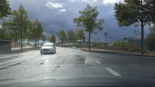
- Street-level photo, Lowiekse, CC BY-SA 4.0
- Street-level photo, Lowiekse, CC BY-SA 4.0
- Street-level photo, Lowiekse, CC BY-SA 4.0
- Street-level photo, Lowiekse, CC BY-SA 4.0
- Street-level photo, raymond, CC BY-SA 4.0
- Street-level photo, ma_rt_in, CC BY-SA 4.0
- Street-level photo, ma_rt_in, CC BY-SA 4.0
- Street-level photo, ma_rt_in, CC BY-SA 4.0
- Street-level photo, ma_rt_in, CC BY-SA 4.0
- Street-level photo, igdb, CC BY-SA 4.0


Page built November 9, 2026. Spotted a mistake? Tell us or suggest a place.